

List of micropolitan areas in Mississippi
Encyclopedia
United States Census Bureau
The United States Census Bureau is the government agency that is responsible for the United States Census. It also gathers other national demographic and economic data...
as micropolitan. As of the 2000 Census
United States Census, 2000
The Twenty-second United States Census, known as Census 2000 and conducted by the Census Bureau, determined the resident population of the United States on April 1, 2000, to be 281,421,906, an increase of 13.2% over the 248,709,873 persons enumerated during the 1990 Census...
, these counties had a combined population of 1,001,735 (35.2% of the state's total population). Based on a July 1, 2008 population estimate, that figure had declined to 998,992 (33.8% of the state's total population).
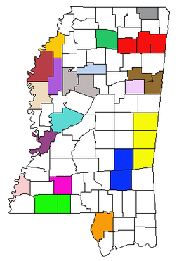
Micropolitan areas
|
Meridian micropolitan area The Meridian Micropolitan Statistical Area is a micropolitan area in east central Mississippi that covers three counties - Clarke, Kemper, and Lauderdale...
Natchez micropolitan area The Natchez Micropolitan Statistical Area is a micropolitan area that consists of Adams County, Mississippi and Concordia Parish, Louisiana. As of the 2000 census, the μSA had a population of 54,587 .-Incorporated places:*Clayton, Louisiana*Ferriday, Louisiana*Natchez, Mississippi *Ridgecrest,...
Tupelo micropolitan area The Tupelo Micropolitan Statistical Area is a micropolitan area in northeastern Mississippi that covers three counties - Itawamba, Lee and Pontotoc...
Vicksburg Micropolitan area The Vicksburg Micropolitan Statistical Area, as defined by the United States Census Bureau, is an area consisting of one county – Warren – in Mississippi, anchored by the city of Vicksburg...
|
1 - part of the Columbus-West Point combined statistical area
Columbus-West Point combined statistical area
The Columbus-West Point Combined Statistical Area is made up of two counties in northeastern Mississippi. The statistical area consists of the Columbus Micropolitan Statistical Area and the West Point Micropolitan Statistical Area...
2 - part of the Jackson-Yazoo City combined statistical area
Jackson-Yazoo City combined statistical area
The Jackson-Yazoo City Combined Statistical Area is made up of six counties in central Mississippi. The statistical area consists of the Jackson Metropolitan Statistical Area and the Yazoo City Micropolitan Statistical Area. As of the 2000 census, the CSA had a population of 525,346...
Population statistics
| Micropolitan Statistical Area | July 1, 2009 Estimate |
2000 Census |
Growth Rate (2000–2009) |
|---|---|---|---|
| Brookhaven Lincoln County, Mississippi -Demographics:As of the census of 2000, there were 33,166 people, 12,538 households, and 9,190 families residing in the county. The population density was 57 people per square mile . There were 14,052 housing units at an average density of 24 per square mile... |
34,830 | 33,166 | 5.02% |
| Clarksdale Coahoma County, Mississippi -Demographics:As of the census of 2000, there were 30,622 people, 10,553 households, and 7,482 families residing in the county. The population density was 55 people per square mile . There were 11,490 housing units at an average density of 21 per square mile... |
26,936 | 30,622 | -12.04% |
| Cleveland Bolivar County, Mississippi -Demographics:As of the census of 2000, there were 40,633 people, 13,776 households, and 9,725 families residing in the county. The population density was 46 people per square mile . There were 14,939 housing units at an average density of 17 per square mile... |
36,766 | 40,633 | -9.52% |
| Columbus Lowndes County, Mississippi As of the census of 2000, there were 61,586 people, 22,849 households, and 16,405 families residing in the county. The population density was 123 people per square mile . There were 25,104 housing units at an average density of 50 per square mile... |
59,658 | 61,586 | -3.13% |
| Corinth Alcorn County, Mississippi There were 14,224 households out of which 30.90% had children under the age of 18 living with them, 54.50% were married couples living together, 11.50% had a female householder with no husband present, and 30.30% were non-families. 27.60% of all households were made up of individuals and 11.90% had... |
35,822 | 34,558 | 3.66% |
| Greenville Washington County, Mississippi -National protected areas:*Holt Collier National Wildlife Refuge*Theodore Roosevelt National Wildlife Refuge *Yazoo National Wildlife Refuge-Demographics:... |
54,616 | 62,977 | -13.28% |
| Greenwood Greenwood, Mississippi micropolitan area The Greenwood Micropolitan Statistical Area is a micropolitan area in the northwestern Delta region of Mississippi that covers two counties - Leflore and Carroll... |
44,841 | 48,716 | -7.95% |
| Grenada Grenada County, Mississippi -Demographics:As of the census of 2000, there were 23,263 people, 8,820 households, and 6,297 families residing in the county. The population density was 55 people per square mile . There were 9,973 housing units at an average density of 24 per square mile... |
23,046 | 23,263 | -0.93% |
| Indianola Sunflower County, Mississippi -Demographics:As of the census of 2000, there were 34,369 people, 9,637 households, and 7,314 families residing in the county. The population density was 50 people per square mile . There were 10,338 housing units at an average density of 15 per square mile... |
29,610 | 34,369 | -13.85% |
| Laurel Laurel micropolitan area The Laurel Micropolitan Statistical Area is a micropolitan area in the southeastern Mississippi that covers two counties - Jasper and Jones. As of the 2000 census, the μSA had a population of 83,107 .-Incorporated places:*Bay Springs*Ellisville*Heidelberg*Laurel The Laurel Micropolitan Statistical... |
85,716 | 83,107 | 3.14% |
| McComb McComb micropolitan area The McComb Micropolitan Statistical Area is a micropolitan area in the southwestern Mississippi that covers two counties – Amite and Pike... |
52,872 | 52,539 | 0.63% |
| Meridian Meridian micropolitan area The Meridian Micropolitan Statistical Area is a micropolitan area in east central Mississippi that covers three counties - Clarke, Kemper, and Lauderdale... |
106,139 | 106,569 | -0.40% |
| Natchez Natchez micropolitan area The Natchez Micropolitan Statistical Area is a micropolitan area that consists of Adams County, Mississippi and Concordia Parish, Louisiana. As of the 2000 census, the μSA had a population of 54,587 .-Incorporated places:*Clayton, Louisiana*Ferriday, Louisiana*Natchez, Mississippi *Ridgecrest,... |
49,711 | 54,587 | -8.93% |
| Oxford Lafayette County, Mississippi -Demographics:As of the census of 2000, there were 38,744 people, 14,373 households, and 8,321 families residing in the county. The population density was 61 people per square mile . There were 16,587 housing units at an average density of 26 per square mile... |
43,975 | 38,744 | 13.50% |
| Picayune Pearl River County, Mississippi -National protected areas:*Bogue Chitto National Wildlife Refuge *De Soto National Forest -Demographics:The census estimates of 2006 place the county population over 57,000 and place it among the 10 fastest growing counties in the U.S. As of the census of 2000, there were 48,621 people, 18,078... |
57,860 | 48,621 | 19.00% |
| Starkville Oktibbeha County, Mississippi -National protected areas:*Noxubee National Wildlife Refuge *Tombigbee National Forest -Demographics:As of the census of 2000, there were 42,902 people, 15,945 households, and 9,264 families residing in the county. The population density was 94 people per square mile . There were 17,344 housing... |
44,544 | 42,902 | 3.83% |
| Tupelo Tupelo micropolitan area The Tupelo Micropolitan Statistical Area is a micropolitan area in northeastern Mississippi that covers three counties - Itawamba, Lee and Pontotoc... |
134,161 | 125,251 | 7.11% |
| Vicksburg Vicksburg Micropolitan area The Vicksburg Micropolitan Statistical Area, as defined by the United States Census Bureau, is an area consisting of one county – Warren – in Mississippi, anchored by the city of Vicksburg... |
48,175 | 49,644 | -2.96% |
| West Point Clay County, Mississippi As of the census of 2000, there were 21,979 people, 8,152 households, and 5,885 families residing in the county. The population density was 54 people per square mile . There were 8,810 housing units at an average density of 22 per square mile... |
20,722 | 21,979 | -5.72% |
| Yazoo City Yazoo County, Mississippi -National protected area:*Hillside National Wildlife Refuge *Panther Swamp National Wildlife Refuge-History:The area which is now Yazoo County was acquired by the State of Mississippi from the Choctaw Indians in 1820. Yazoo County was established on January 21, 1823. It was the 19th county... |
27,981 | 28,149 | -0.60% |
See also
- List of metropolitan areas in Mississippi
- List of cities in Mississippi
- List of towns and villages in Mississippi
- Mississippi census statistical areasMississippi census statistical areasThe United States Census Bureau has defined 3 Combined Statistical Areas , 5 Metropolitan Statistical Areas , and 20 Micropolitan Statistical Areas in the State of Mississippi. The following table describes these areas with the following information:*The name of the Combined Statistical Area , if...
- Table of United States primary census statistical areas (PCSA)
- Table of United States Combined Statistical AreasTable of United States Combined Statistical Areasthumb|An enlargeable map of the 125 [[Combined Statistical Area]]s of the [[United States]]The United States Office of Management and Budget has defined 125 Combined Statistical Areas for the United States of America...
(CSA) - Table of United States Metropolitan Statistical AreasTable of United States Metropolitan Statistical Areasthumb|An enlargeable map of the 942 [[Core Based Statistical Area]]s of the [[United States]]. The 367 [[Metropolitan Statistical Area]]s are shown in red....
(MSA) - Table of United States Micropolitan Statistical AreasTable of United States Micropolitan Statistical Areasthumb|An enlargeable map of the 942 [[Core Based Statistical Area]]s of the [[United States]]. The 576 [[Micropolitan Statistical Area]]s are shown in blue....
(μSA)