

List of county routes in Dutchess County, New York
Encyclopedia
Dutchess County, New York
maintains a system of signed county routes primarily to serve local traffic between the various communities in the county. Route numbers generally increase progressively based on the alphabetical order of the towns where they are primarily located (with several exceptions). The newer routes numbered 100 and up do not follow this pattern. County routes never enter cities and only a few routes enter villages.
Dutchess County, New York
Dutchess County is a county located in the U.S. state of New York, in the state's Mid-Hudson Region of the Hudson Valley. The 2010 census lists the population as 297,488...
maintains a system of signed county routes primarily to serve local traffic between the various communities in the county. Route numbers generally increase progressively based on the alphabetical order of the towns where they are primarily located (with several exceptions). The newer routes numbered 100 and up do not follow this pattern. County routes never enter cities and only a few routes enter villages.
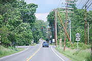
Amenia
| # | Road Name(s) | Length (mi) | Direction and Termini | Hamlets/villages served | Notes | ||
|---|---|---|---|---|---|---|---|
| CR 1 | Sharon Station Road | 1.89 | E/W | US 44/NY 22 New York State Route 22 New York State Route 22 is a north–south state highway in eastern New York in the United States. It runs parallel to the state's eastern edge from the outskirts of New York City to a short distance south of the Canadian border. At , it is the state's longest north–south route and... in Amenia Amenia (town), New York Amenia is a town in Dutchess County, United States. New York, United States. The population was 4,048 at the 2000 census. The name is derived from the Latin word, amoena, which means "pleasant to the eye."... |
Connecticut Connecticut Connecticut is a state in the New England region of the northeastern United States. It is bordered by Rhode Island to the east, Massachusetts to the north, and the state of New York to the west and the south .Connecticut is named for the Connecticut River, the major U.S. river that approximately... state line in North East North East, New York North East is a town in Dutchess County, New York, United States. The population was 3,002 at the 2000 census.The Town of North East is in the northeastern part of the county... (continues as local road) |
Sharon Station | |
| CR 2 | South Amenia Road, Amenia Union Road, Leedsville Road | 5.15 | N/S | CR 3 in South Amenia | NY 343 New York State Route 343 New York State Route 343 is a state highway located entirely within central Dutchess County, in the Hudson Valley region of the U.S. state of New York. It runs east–west from the intersection of NY 82 in the village of Millbrook to the Connecticut state line in the town of Amenia, where... in Amenia Amenia (town), New York Amenia is a town in Dutchess County, United States. New York, United States. The population was 4,048 at the 2000 census. The name is derived from the Latin word, amoena, which means "pleasant to the eye."... |
South Amenia, Amenia Union, Leedsville | Junction with Connecticut Route 41 at state line in Amenia Union |
| CR 3 County Route 3 (Dutchess County, New York) New York State Route 341 was an east–west state highway located in Dutchess County, New York, in the United States. It extended for from an intersection with NY 22 and NY 55 in the village of Pawling to the Connecticut state line in the town of Pawling... |
South Amenia Road, Kent Road, Bog Hollow Road | 5.16 | E/W | CR 81 in Amenia Amenia (town), New York Amenia is a town in Dutchess County, United States. New York, United States. The population was 4,048 at the 2000 census. The name is derived from the Latin word, amoena, which means "pleasant to the eye."... |
Connecticut Route 341 at state line in Dover Dover, New York Dover is a town in Dutchess County, New York, United States. The population was 8,565 at the 2000 census. The town was named after Dover in England, the home town of an early settler.... |
South Amenia, Wassaic | Former NY 341 |
| CR 4 | Poplar Hill Road, Benton Road, Sinpatch Road | 4.23 | N/S | Maple Lane & Lime Kiln Road (local) in Dover Dover, New York Dover is a town in Dutchess County, New York, United States. The population was 8,565 at the 2000 census. The town was named after Dover in England, the home town of an early settler.... |
CR 3 in Amenia Amenia (town), New York Amenia is a town in Dutchess County, United States. New York, United States. The population was 4,048 at the 2000 census. The name is derived from the Latin word, amoena, which means "pleasant to the eye."... |
Dover Plains | |
| CR 5/5S | Smithfield Road, Old Route 22 | 5.74 | E/W | CR 83 in Amenia Amenia (town), New York Amenia is a town in Dutchess County, United States. New York, United States. The population was 4,048 at the 2000 census. The name is derived from the Latin word, amoena, which means "pleasant to the eye."... |
US 44/NY 22 in North East North East, New York North East is a town in Dutchess County, New York, United States. The population was 3,002 at the 2000 census.The Town of North East is in the northeastern part of the county... |
Smithfield | CR 5S splits off and heads south near the east end while CR 5 heads north. Mileage of CR 5S is included in listed length. |
| CR 81 | Old Route 22 | 4.11 | N/S | NY 22/NY 343 in Amenia Amenia (town), New York Amenia is a town in Dutchess County, United States. New York, United States. The population was 4,048 at the 2000 census. The name is derived from the Latin word, amoena, which means "pleasant to the eye."... |
NY 22/NY 343 in Amenia | Wassaic, Amenia | Old alignment of NY 22 |
| CR 83 | CR-83 | 12.25 | N/S | US 44 in Amenia Amenia (town), New York Amenia is a town in Dutchess County, United States. New York, United States. The population was 4,048 at the 2000 census. The name is derived from the Latin word, amoena, which means "pleasant to the eye."... |
NY 82 in Pine Plains Pine Plains (town), New York Pine Plains is a town in Dutchess County, New York, USA. The population was 2,569 at the 2000 census. The name is derived from the geographic character of the region.The Hamlet of Pine Plains is on the north border of the county.-History:... |
Amenia, Pine Plains | Old alignment of NY 82 |
Beekman
| # | Road Name(s) | Length (mi) | Direction and Termini | Hamlets/villages served | Notes | ||
|---|---|---|---|---|---|---|---|
| CR 7 | Beekman-Poughquag Road | 2.11 | E/W | CR 9 in Beekman Beekman, New York Beekman is a town in Dutchess County, New York, United States. It is part of the Poughkeepsie–Newburgh–Middletown, NY Metropolitan Statistical Area as well as the larger New York–Newark–Bridgeport, NY-NJ-CT-PA Combined Statistical Area. The population was 11,452 at the 2000... |
NY 216 in Beekman | Beekman, Poughquag | |
| CR 8 | South Greenhaven Road, Greenhaven Road | 2.64 | N/S | Greenhaven train station in Beekman | CR 9 in Beekman Beekman, New York Beekman is a town in Dutchess County, New York, United States. It is part of the Poughkeepsie–Newburgh–Middletown, NY Metropolitan Statistical Area as well as the larger New York–Newark–Bridgeport, NY-NJ-CT-PA Combined Statistical Area. The population was 11,452 at the 2000... |
Greenhaven, Sylvan Lake | Intersects with NY 216 |
| CR 9 | Beekman Road, Clove Valley Road, Clove Road, North Clove Road | 16.51 | N/S | NY 82 in East Fishkill East Fishkill, New York East Fishkill is a town on the southern border of Dutchess County, New York, United States. The population was 25,589 at the 2000 census. The town name is derived from its formation from Fishkill, NY.... |
NY 82 in Union Vale Union Vale, New York Union Vale is a residential town in Dutchess County, New York, United States. The population was 4,546 at the 2000 census.The Town of Union Vale is in the south-central part of the county. It is part of the Poughkeepsie–Newburgh–Middletown, NY Metropolitan Statistical Area as well as the larger... |
Hopewell Junction, Beekman, Verbank | Major thoroughfare |
| CR 10 | Sylvan Lake Road | 3.06 | E/W | NY 82 in La Grange | CR 9 in Beekman Beekman, New York Beekman is a town in Dutchess County, New York, United States. It is part of the Poughkeepsie–Newburgh–Middletown, NY Metropolitan Statistical Area as well as the larger New York–Newark–Bridgeport, NY-NJ-CT-PA Combined Statistical Area. The population was 11,452 at the 2000... |
Sylvan Lake, Arthursburg | |
| CR 32 | Pleasant Ridge Road | 3.74 | N/S | NY 55 in Beekman Beekman, New York Beekman is a town in Dutchess County, New York, United States. It is part of the Poughkeepsie–Newburgh–Middletown, NY Metropolitan Statistical Area as well as the larger New York–Newark–Bridgeport, NY-NJ-CT-PA Combined Statistical Area. The population was 11,452 at the 2000... |
CR 21 in Union Vale Union Vale, New York Union Vale is a residential town in Dutchess County, New York, United States. The population was 4,546 at the 2000 census.The Town of Union Vale is in the south-central part of the county. It is part of the Poughkeepsie–Newburgh–Middletown, NY Metropolitan Statistical Area as well as the larger... |
Poughquag, Pleasant Ridge | |
Clinton
| # | Road Name(s) | Length (mi) | Direction and Termini | Hamlets/villages served | Notes | ||
|---|---|---|---|---|---|---|---|
| CR 12 | Schultzville Road | 0.90 | E/W | West junction with Harpers Road (local) in Clinton Clinton, Dutchess County, New York Clinton is a town in Dutchess County, New York, United States. The population was 4,010 at the 2000 census. The town is named after George Clinton, an early governor of New York.... |
Germond Road (local) in Clinton | Schultzville | Schultzville Road extends from CR 18 to CR 17 but is mostly town-maintained. |
| CR 13 | Clinton Corners Road | 2.22 | N/S | NY 82 in Pleasant Valley Pleasant Valley (town), New York Pleasant Valley is a town in Dutchess County, New York, United States. The population was 9,066 at the 2000 census. The town is centrally located in the county, northeast of the City of Poughkeepsie. US Route 44 passes through the town.-History:... |
CR 17 in Clinton Clinton, Dutchess County, New York Clinton is a town in Dutchess County, New York, United States. The population was 4,010 at the 2000 census. The town is named after George Clinton, an early governor of New York.... |
Clinton Corners | |
| CR 14 | Hollow Road | 8.28 | E/W | NY 9G in Clinton Clinton, Dutchess County, New York Clinton is a town in Dutchess County, New York, United States. The population was 4,010 at the 2000 census. The town is named after George Clinton, an early governor of New York.... |
CR 13 in Clinton | Pleasant Plains, Clinton Hollow, Hibernia | Intersects with NY 115. Split into two segments by the Taconic Taconic State Parkway The Taconic State Parkway , is a divided highway between Kensico Dam and Chatham, the longest parkway in the U.S. state of New York. It follows a generally northward route midway between the Hudson River and the Connecticut and Massachusetts state lines... . |
| CR 15 | Milan Hollow Road | 4.36 | N/S | CR 19 in Clinton Clinton, Dutchess County, New York Clinton is a town in Dutchess County, New York, United States. The population was 4,010 at the 2000 census. The town is named after George Clinton, an early governor of New York.... |
NY 199 in Milan Milan, New York Milan is a town in Dutchess County, New York, United States. The Town of Milan is in the northern part of the county.-History:The area that comprises Milan today was the western part of the Little Nine Partners Patent of 1706. Milan was largely a farming and mill town and remains a very rural... |
Milan Hollow | |
| CR 16 | South Quaker Lane, North Quaker Lane | 6.99 | N/S | NY 115 in Hyde Park Hyde Park, New York Hyde Park is a town located in the northwest part of Dutchess County, New York, United States, just north of the city of Poughkeepsie. The town is most famous for being the hometown of U.S. President Franklin D. Roosevelt.... |
CR 14 in Clinton Clinton, Dutchess County, New York Clinton is a town in Dutchess County, New York, United States. The population was 4,010 at the 2000 census. The town is named after George Clinton, an early governor of New York.... |
Pleasant Plains | |
| CR 17 | Salt Point Turnpike | 4.68 | N/S | Taconic Pkwy Taconic State Parkway The Taconic State Parkway , is a divided highway between Kensico Dam and Chatham, the longest parkway in the U.S. state of New York. It follows a generally northward route midway between the Hudson River and the Connecticut and Massachusetts state lines... and NY 115 in Clinton Clinton, Dutchess County, New York Clinton is a town in Dutchess County, New York, United States. The population was 4,010 at the 2000 census. The town is named after George Clinton, an early governor of New York.... |
NY 82 in Stanford Stanford, New York Stanford is a town in Dutchess County, New York, United States. The population was 3,544 at the 2000 census.The Town of Stanford is in the north-central part of the county.-History:Stanford was first settled around 1750... |
Clinton Corners, Stanfordville | |
| CR 18 | Clinton Hollow Road, Centre Road | 7.99 | N/S | NY 115 in Pleasant Valley Pleasant Valley (town), New York Pleasant Valley is a town in Dutchess County, New York, United States. The population was 9,066 at the 2000 census. The town is centrally located in the county, northeast of the City of Poughkeepsie. US Route 44 passes through the town.-History:... |
CR 19 in Clinton Clinton, Dutchess County, New York Clinton is a town in Dutchess County, New York, United States. The population was 4,010 at the 2000 census. The town is named after George Clinton, an early governor of New York.... |
Salt Point, Clinton Hollow, Silver Lake | |
| CR 19 | State Quarry Road, Bulls Head Road | 11.27 | E/W | NY 9G in Rhinebeck | NY 82 in Stanford Stanford, New York Stanford is a town in Dutchess County, New York, United States. The population was 3,544 at the 2000 census.The Town of Stanford is in the north-central part of the county.-History:Stanford was first settled around 1750... |
Silver Lake, Stanfordville | Interchange with the Taconic Pkwy Taconic State Parkway The Taconic State Parkway , is a divided highway between Kensico Dam and Chatham, the longest parkway in the U.S. state of New York. It follows a generally northward route midway between the Hudson River and the Connecticut and Massachusetts state lines... |
Dover
| # | Road Name(s) | Length (mi) | Direction and Termini | Hamlets/villages served | Notes | ||
|---|---|---|---|---|---|---|---|
| CR 6 | Old Route 22 | 5.66 | N/S | NY 55 in Dover Dover, New York Dover is a town in Dutchess County, New York, United States. The population was 8,565 at the 2000 census. The town was named after Dover in England, the home town of an early settler.... |
NY 22 in Dover | Webatuck, Dover Plains | Old alignment of NY 22 |
| CR 20 | West Dover Road, Hoags Corners Road | 5.80 | N/S | Pawling Pawling (village), New York Pawling is a village in Dutchess County, New York, USA. The population was 2,233 at the 2000 census. It is part of the Poughkeepsie–Newburgh–Middletown, NY Metropolitan Statistical Area as well as the larger New York–Newark–Bridgeport, NY-NJ-CT-PA Combined Statistical Area... village line |
CR 21 in Dover Dover, New York Dover is a town in Dutchess County, New York, United States. The population was 8,565 at the 2000 census. The town was named after Dover in England, the home town of an early settler.... |
Pawling, Wingdale | |
| CR 21 | Noxon Rd, East Noxon Rd, Bruzgul Rd, Wingdale Mountain Rd, Pleasant Ridge Rd | 18.52 | E/W | NY 55 in La Grange | NY 55 in Dover Dover, New York Dover is a town in Dutchess County, New York, United States. The population was 8,565 at the 2000 census. The town was named after Dover in England, the home town of an early settler.... |
Manchester Bridge, LaGrangeville, Wingdale | Intermediate intersections with NY 82 and NY 55. |
| CR 22 | Dog Tail Corners Road | 2.07 | N/S | NY 55 in Dover Dover, New York Dover is a town in Dutchess County, New York, United States. The population was 8,565 at the 2000 census. The town was named after Dover in England, the home town of an early settler.... |
Connecticut state line in Dover | Webatuck | Runs along shore of Tenmile River. Connects with Bulls Bridge Road (local) in Connecticut. |
| CR 23 | Little Rest Road | 3.13 | N/S | CR 24 in Dover Dover, New York Dover is a town in Dutchess County, New York, United States. The population was 8,565 at the 2000 census. The town was named after Dover in England, the home town of an early settler.... |
NY 343 in Washington Washington, New York Washington is a town in Dutchess County, New York, United States. The population was 4,742 at the 2000 census. The town is named after George Washington, who passed through the town during the Revolution.... |
Chestnut Ridge, Little Rest | |
| CR 24 | Chestnut Ridge Road, Halls Corners Road | 6.75 | E/W | CR 9 in Union Vale Union Vale, New York Union Vale is a residential town in Dutchess County, New York, United States. The population was 4,546 at the 2000 census.The Town of Union Vale is in the south-central part of the county. It is part of the Poughkeepsie–Newburgh–Middletown, NY Metropolitan Statistical Area as well as the larger... |
NY 343 in Washington Washington, New York Washington is a town in Dutchess County, New York, United States. The population was 4,742 at the 2000 census. The town is named after George Washington, who passed through the town during the Revolution.... |
Chestnut Ridge | |
| CR 26 | Crickett Hill Road, Dover Furnace Road | 4.07 | N/S | CR 6 in Dover Dover, New York Dover is a town in Dutchess County, New York, United States. The population was 8,565 at the 2000 census. The town was named after Dover in England, the home town of an early settler.... |
NY 22 in Dover | South Dover | Short overlap with NY 22. |
East Fishkill
| # | Road Name(s) | Length (mi) | Direction and Termini | Hamlets/villages served | Notes | ||
|---|---|---|---|---|---|---|---|
| CR 27 | Lime Kiln Road | 1.27 | N/S | I-84 in East Fishkill East Fishkill, New York East Fishkill is a town on the southern border of Dutchess County, New York, United States. The population was 25,589 at the 2000 census. The town name is derived from its formation from Fishkill, NY.... |
NY 52 in East Fishkill | Four lane highway. Truck connector between I-84 and NY 52. | |
| CR 28 | New Hamburg Road, Old Hopewell Road | 6.09 | E/W | Main Street (local) in Wappingers Falls Wappingers Falls, New York Wappingers Falls is a village in Dutchess County, New York, United States. The name is derived from the local Wappinger Indians. One half of the village is in the town of Wappinger and the other half is in the town of Poughkeepsie, with Wappinger Creek forming the dividing line between the... |
NY 82 in East Fishkill East Fishkill, New York East Fishkill is a town on the southern border of Dutchess County, New York, United States. The population was 25,589 at the 2000 census. The town name is derived from its formation from Fishkill, NY.... |
New Hamburg, Hughsonville, Hopewell Junction | |
| CR 29 | Hillside Lake Road, Clove Branch Road, Carpenter Road | 4.88 | N/S | NY 52 in East Fishkill East Fishkill, New York East Fishkill is a town on the southern border of Dutchess County, New York, United States. The population was 25,589 at the 2000 census. The town name is derived from its formation from Fishkill, NY.... |
NY 376 in East Fishkill | Fishkill Plains | Intersects with NY 82. |
| CR 30 | Milltown Road, Holmes Road | 4.04 | E/W | White Pond Rd & Ressique Rd (local) in East Fishkill East Fishkill, New York East Fishkill is a town on the southern border of Dutchess County, New York, United States. The population was 25,589 at the 2000 census. The town name is derived from its formation from Fishkill, NY.... |
NY 292 in Pawling Pawling (town), New York Pawling is a town in Dutchess County, New York, United States. The population was 7,521 at the 2000 census. The town is named after Catherine Pauling, the daughter of Henry Beekman, who held the second largest land patent in the county. A misprint caused the U to change to a W and the name... |
Holmes | |
| CR 31 | Palen Road | 2.29 | N/S | NY 52 in East Fishkill East Fishkill, New York East Fishkill is a town on the southern border of Dutchess County, New York, United States. The population was 25,589 at the 2000 census. The town name is derived from its formation from Fishkill, NY.... |
NY 82 in East Fishkill | Wiccopee, Hopewell Junction | |
| CR 33 | Hillside Lake Road, Arthursburg Road | 3.00 | N/S | CR 29 in East Fishkill East Fishkill, New York East Fishkill is a town on the southern border of Dutchess County, New York, United States. The population was 25,589 at the 2000 census. The town name is derived from its formation from Fishkill, NY.... |
CR 42 in La Grange | Fishkill Plains, Hillside Lake, LaGrangeville | |
Fishkill
| # | Road Name(s) | Length (mi) | Direction and Termini | Hamlets/villages served | Notes | ||
|---|---|---|---|---|---|---|---|
| CR 34 | Backstertown Road, Jackson Street | 2.96 | E/W | NY 9D at the Wappinger Wappinger, New York Wappinger is a town of in Dutchess County, New York in the United States. The population was 26,274 at the 2000 census. The name is derived from the Wappani Indians that inhabited the area... -Fishkill Fishkill (town), New York Fishkill is an affluent suburban town in the southwest part of Dutchess County, New York, USA. The population was 20,258 at the 2000 census, however, current estimates put the town's population at over 22,100. Fishkill partly surrounds the city of Beacon.... line |
NY 52 in Fishkill | Castle Point, Fishkill | CR 34S splits off to the southwest near western end. |
| CR 35 | Osborne Hill Road | 2.11 | N/S | CR 34 in Fishkill Fishkill (town), New York Fishkill is an affluent suburban town in the southwest part of Dutchess County, New York, USA. The population was 20,258 at the 2000 census, however, current estimates put the town's population at over 22,100. Fishkill partly surrounds the city of Beacon.... |
US 9 in Wappinger Wappinger, New York Wappinger is a town of in Dutchess County, New York in the United States. The population was 26,274 at the 2000 census. The name is derived from the Wappani Indians that inhabited the area... |
Fishkill, Hughsonville | |
| CR 36 | Red School House Road | 1.58 | N/S | NY 52 BUS in Fishkill Fishkill (town), New York Fishkill is an affluent suburban town in the southwest part of Dutchess County, New York, USA. The population was 20,258 at the 2000 census, however, current estimates put the town's population at over 22,100. Fishkill partly surrounds the city of Beacon.... |
NY 9D New York State Route 9D New York State Route 9D , also known as the Bear Mountain – Beacon Highway, is a north–south state highway that runs along the eastern shore of the Hudson River in New York in the United States. It starts at the eastern end of the Bear Mountain Bridge at U.S... in Fishkill |
Glenham | |
Hyde Park
| # | Road Name(s) | Length (mi) | Direction and Termini | Hamlets/villages served | Notes | ||
|---|---|---|---|---|---|---|---|
| CR 37 | North Cross Road | 1.38 | E/W | US 9 in Hyde Park Hyde Park, New York Hyde Park is a town located in the northwest part of Dutchess County, New York, United States, just north of the city of Poughkeepsie. The town is most famous for being the hometown of U.S. President Franklin D. Roosevelt.... |
NY 9G in Hyde Park | Staatsburg | |
| CR 39 | Cream Street | 3.41 | N/S | NY 115 in Hyde Park Hyde Park, New York Hyde Park is a town located in the northwest part of Dutchess County, New York, United States, just north of the city of Poughkeepsie. The town is most famous for being the hometown of U.S. President Franklin D. Roosevelt.... |
CR 41 in Hyde Park | East Park | |
| CR 40 | East Dorsey Lane, Dutchess Hill Road | 2.40 | E/W | NY 9G in Hyde Park Hyde Park, New York Hyde Park is a town located in the northwest part of Dutchess County, New York, United States, just north of the city of Poughkeepsie. The town is most famous for being the hometown of U.S. President Franklin D. Roosevelt.... |
CR 39 in Hyde Park | Fairview | |
| CR 40A | St. Andrews Road | 1.17 | E/W | US 9 in Hyde Park Hyde Park, New York Hyde Park is a town located in the northwest part of Dutchess County, New York, United States, just north of the city of Poughkeepsie. The town is most famous for being the hometown of U.S. President Franklin D. Roosevelt.... |
NY 9G in Hyde Park | Hyde Park | |
| CR 41 | River Rd, West Market St, East Market St, Crum Elbow Rd, Netherwood Rd | 8.49 | E/W | River Road (park entrance) in Hyde Park Hyde Park, New York Hyde Park is a town located in the northwest part of Dutchess County, New York, United States, just north of the city of Poughkeepsie. The town is most famous for being the hometown of U.S. President Franklin D. Roosevelt.... |
NY 115 in Pleasant Valley Pleasant Valley (town), New York Pleasant Valley is a town in Dutchess County, New York, United States. The population was 9,066 at the 2000 census. The town is centrally located in the county, northeast of the City of Poughkeepsie. US Route 44 passes through the town.-History:... |
Hyde Park, East Park, Netehrwood, Salt Point | Intersects with US 9 and NY 9G. |
La Grange
| # | Road Name(s) | Length (mi) | Direction and Termini | Hamlets/villages served | Notes | ||
|---|---|---|---|---|---|---|---|
| CR 42 | Arthursburg Road | 0.51 | E/W | Taconic Pkwy Taconic State Parkway The Taconic State Parkway , is a divided highway between Kensico Dam and Chatham, the longest parkway in the U.S. state of New York. It follows a generally northward route midway between the Hudson River and the Connecticut and Massachusetts state lines... in La Grange |
CR 33 in La Grange | Arthursburg | |
| CR 43 | DeGarmo Road | 0.82 | N/S | CR 46 in La Grange | US 44 in Poughkeepsie Poughkeepsie (town), New York Poughkeepsie is a town in Dutchess County, New York, United States. The population was 42,777 at the 2000 census. The name is derived from the native term, "Uppu-qui-ipis-in," which means "reed-covered hut by the water."... |
Manchester Bridge, Arlington | |
| CR 44 | Red Oaks Mill Road, Walker Road | 0.90 | N/S | NY 376 in La Grange | CR 49 in La Grange | Red Oaks Mill | CR 44S splits off to the south at the southern end while mainline heads southwest. |
| CR 46 | Overlook Road | 4.04 | E/W | NY 55 in La Grange | East junction with CR 47 in La Grange | Manchester Bridge | Overlaps with CR 47 at east end. |
| CR 47 | Freedom Road, South Avenue | 5.42 | N/S | NY 55 in La Grange | US 44 in Pleasant Valley Pleasant Valley (town), New York Pleasant Valley is a town in Dutchess County, New York, United States. The population was 9,066 at the 2000 census. The town is centrally located in the county, northeast of the City of Poughkeepsie. US Route 44 passes through the town.-History:... |
Freedom Plains, Pleasant Valley | |
| CR 49 | Old Manchester Road, Titusville Road | 4.14 | E/W | NY 55 in Poughkeepsie Poughkeepsie (town), New York Poughkeepsie is a town in Dutchess County, New York, United States. The population was 42,777 at the 2000 census. The name is derived from the native term, "Uppu-qui-ipis-in," which means "reed-covered hut by the water."... |
NY 55 in La Grange | Manchester Bridge, Titusville | CR 49S heads northwest at western end while mainline heads northeast. |
Milan
| # | Road Name(s) | Length (mi) | Direction and Termini | Hamlets/villages served | Notes | ||
|---|---|---|---|---|---|---|---|
| CR 50 | Jackson Corners Road, Mount Ross Road | 2.52 | E/W | Columbia County line in Milan Milan, New York Milan is a town in Dutchess County, New York, United States. The Town of Milan is in the northern part of the county.-History:The area that comprises Milan today was the western part of the Little Nine Partners Patent of 1706. Milan was largely a farming and mill town and remains a very rural... (continues as western segment of Columbia CR 2) |
Taconic Pkwy Taconic State Parkway The Taconic State Parkway , is a divided highway between Kensico Dam and Chatham, the longest parkway in the U.S. state of New York. It follows a generally northward route midway between the Hudson River and the Connecticut and Massachusetts state lines... in Milan |
Jackson Corners | Two segments connected via eastern segment of Columbia CR 2. Length figure is total length within Dutchess County. |
| Columbia County line in Pine Plains | NY 199 in Pine Plains | ||||||
| CR 51 | Academy Hill Road | 5.24 | N/S | NY 199 in Milan Milan, New York Milan is a town in Dutchess County, New York, United States. The Town of Milan is in the northern part of the county.-History:The area that comprises Milan today was the western part of the Little Nine Partners Patent of 1706. Milan was largely a farming and mill town and remains a very rural... |
CR 50 in Milan | Jackson Corners | |
| CR 52 | Salisbury Turnpike, Round Lake Road | 3.76 | E/W | NY 308 in Rhinebeck | CR 15 in Milan Milan, New York Milan is a town in Dutchess County, New York, United States. The Town of Milan is in the northern part of the county.-History:The area that comprises Milan today was the western part of the Little Nine Partners Patent of 1706. Milan was largely a farming and mill town and remains a very rural... |
Eighmyville | |
| CR 53 | Cold Spring Road, South Road | 6.04 | N/S | NY 82 in Stanford Stanford, New York Stanford is a town in Dutchess County, New York, United States. The population was 3,544 at the 2000 census.The Town of Stanford is in the north-central part of the county.-History:Stanford was first settled around 1750... |
NY 199 in Milan Milan, New York Milan is a town in Dutchess County, New York, United States. The Town of Milan is in the northern part of the county.-History:The area that comprises Milan today was the western part of the Little Nine Partners Patent of 1706. Milan was largely a farming and mill town and remains a very rural... |
Bangall, Lafayetteville | |
| CR 54 | Milan Hill Road | 4.18 | N/S | NY 199 in Milan Milan, New York Milan is a town in Dutchess County, New York, United States. The Town of Milan is in the northern part of the county.-History:The area that comprises Milan today was the western part of the Little Nine Partners Patent of 1706. Milan was largely a farming and mill town and remains a very rural... |
CR 56 in Milan | Rock City | |
| CR 55 | Spring Lake Road | 2.18 | N/S | CR 56 in Red Hook Red Hook, New York Red Hook is a town in Dutchess County, New York, United States. The population was reported to be 11,319 during the 2010 census. The name is supposedly derived from the red foliage on trees on a small strip of land on the Hudson River. The town contains two villages; the village of Red Hook and the... |
Columbia County line in Milan Milan, New York Milan is a town in Dutchess County, New York, United States. The Town of Milan is in the northern part of the county.-History:The area that comprises Milan today was the western part of the Little Nine Partners Patent of 1706. Milan was largely a farming and mill town and remains a very rural... (continues as Columbia CR 19) |
Cokertown | |
| CR 56 | Upper Red Hook Road, Turkey Hill Road | 6.18 | E/W | US 9 in Red Hook Red Hook, New York Red Hook is a town in Dutchess County, New York, United States. The population was reported to be 11,319 during the 2010 census. The name is supposedly derived from the red foliage on trees on a small strip of land on the Hudson River. The town contains two villages; the village of Red Hook and the... |
CR 50 in Milan Milan, New York Milan is a town in Dutchess County, New York, United States. The Town of Milan is in the northern part of the county.-History:The area that comprises Milan today was the western part of the Little Nine Partners Patent of 1706. Milan was largely a farming and mill town and remains a very rural... |
Upper Red Hook, Jackson Corners | |
North East
| # | Road Name(s) | Length (mi) | Direction and Termini | Hamlets/villages served | Notes | ||
|---|---|---|---|---|---|---|---|
| CR 58 | Coleman Station Road | 1.17 | E/W | US 44/NY 22 in North East North East, New York North East is a town in Dutchess County, New York, United States. The population was 3,002 at the 2000 census.The Town of North East is in the northeastern part of the county... |
Reagon Rd and Sheffield Hill Rd (local) in North East | Coleman Station | |
| CR 59 | Bean River Road | 3.33 | N/S | CR 83 in North East North East, New York North East is a town in Dutchess County, New York, United States. The population was 3,002 at the 2000 census.The Town of North East is in the northeastern part of the county... |
Columbia county line in Pine Plains (continues as Columbia CR 8A) |
Pulvers Corners | |
| CR 60 | Winchell Mountain Road | 2.30 | E/W | NY 199 in North East North East, New York North East is a town in Dutchess County, New York, United States. The population was 3,002 at the 2000 census.The Town of North East is in the northeastern part of the county... |
NY 22 in North East | Irondale | |
| CR 61 | Indian Lake Road | 2.69 | N/S | CR 58 in North East North East, New York North East is a town in Dutchess County, New York, United States. The population was 3,002 at the 2000 census.The Town of North East is in the northeastern part of the county... |
CR 62 in North East | Coleman Station, Indian Lake | |
| CR 62 County Route 62 (Dutchess County, New York) New York State Route 361 was a state highway located in Dutchess County, New York, United States. The southern terminus of the route was at the Connecticut state line, where it continued to Sharon, Connecticut, as Route 361. The northern terminus was at U.S. Route 44 in Millerton... |
Sharon Rd, South Maple Ave, North Maple Ave, Rudd Pond Rd | 5.84 | N/S | Connecticut state line in North East North East, New York North East is a town in Dutchess County, New York, United States. The population was 3,002 at the 2000 census.The Town of North East is in the northeastern part of the county... (continues as Connecticut Route 361) |
NY 22 in North East | Millerton, Mount Riga | Old NY 361 |
| CR 63 | Boston Corners Road | 4.11 | N/S | CR 62 in North East North East, New York North East is a town in Dutchess County, New York, United States. The population was 3,002 at the 2000 census.The Town of North East is in the northeastern part of the county... |
Columbia county line in North East | Boston Corner, Mount Riga | |
| CR 64 | McGhee Hill Road | 3.74 | E/W | CR 83 in North East North East, New York North East is a town in Dutchess County, New York, United States. The population was 3,002 at the 2000 census.The Town of North East is in the northeastern part of the county... |
US 44/NY 22 in North East | North East Center | |
| CR 65 | Hunns Lake Rd, West Hunns Lake Rd/East Hunns Lake Rd | 8.03 | E/W | NY 82 in Stanford Stanford, New York Stanford is a town in Dutchess County, New York, United States. The population was 3,544 at the 2000 census.The Town of Stanford is in the north-central part of the county.-History:Stanford was first settled around 1750... |
CR 83 in North East North East, New York North East is a town in Dutchess County, New York, United States. The population was 3,002 at the 2000 census.The Town of North East is in the northeastern part of the county... |
Bangall | Alternate loop route around north side of Hunns Lake (CR 65S). Length included in listed length figure. |
Pawling
| # | Road Name(s) | Length (mi) | Direction and Termini | Hamlets/villages served | Notes | ||
|---|---|---|---|---|---|---|---|
| CR 66 | Mizzentop Road, Quaker Hill Road | 6.66 | N/S | South Quaker Hill Road in Pawling Pawling (town), New York Pawling is a town in Dutchess County, New York, United States. The population was 7,521 at the 2000 census. The town is named after Catherine Pauling, the daughter of Henry Beekman, who held the second largest land patent in the county. A misprint caused the U to change to a W and the name... |
Connecticut state line in Pawling (continues as local road) |
Quaker Hill Quaker Hill, New York Quaker Hill is a hamlet in the town of Pawling in Dutchess County, New York, United States. It is located in the southern portion of the area known as the "Oblong" that was designated by the Treaty of Dover in 1731, and "known from pre-Revolutionary times as Quaker Hill".It is the location of the... |
|
| CR 67 | Quaker Hill Road, Kirby Hill Road (CR 67A) | 4.39 | E/W | NY 22/NY 55 in Pawling Pawling (village), New York Pawling is a village in Dutchess County, New York, USA. The population was 2,233 at the 2000 census. It is part of the Poughkeepsie–Newburgh–Middletown, NY Metropolitan Statistical Area as well as the larger New York–Newark–Bridgeport, NY-NJ-CT-PA Combined Statistical Area... |
Connecticut state line in Pawling Pawling (town), New York Pawling is a town in Dutchess County, New York, United States. The population was 7,521 at the 2000 census. The town is named after Catherine Pauling, the daughter of Henry Beekman, who held the second largest land patent in the county. A misprint caused the U to change to a W and the name... (continues as local road) |
Pawling Pawling (village), New York Pawling is a village in Dutchess County, New York, USA. The population was 2,233 at the 2000 census. It is part of the Poughkeepsie–Newburgh–Middletown, NY Metropolitan Statistical Area as well as the larger New York–Newark–Bridgeport, NY-NJ-CT-PA Combined Statistical Area... , Quaker Hill Quaker Hill, New York Quaker Hill is a hamlet in the town of Pawling in Dutchess County, New York, United States. It is located in the southern portion of the area known as the "Oblong" that was designated by the Treaty of Dover in 1731, and "known from pre-Revolutionary times as Quaker Hill".It is the location of the... |
Overlaps with CR 66 (Mizzentop Road) |
| CR 68 | North Quaker Hill Road | 3.06 | E/W | NY 22/NY 55 in Pawling Pawling (town), New York Pawling is a town in Dutchess County, New York, United States. The population was 7,521 at the 2000 census. The town is named after Catherine Pauling, the daughter of Henry Beekman, who held the second largest land patent in the county. A misprint caused the U to change to a W and the name... |
CR 66 in Pawling | Hurd Corners, Quaker Hill Quaker Hill, New York Quaker Hill is a hamlet in the town of Pawling in Dutchess County, New York, United States. It is located in the southern portion of the area known as the "Oblong" that was designated by the Treaty of Dover in 1731, and "known from pre-Revolutionary times as Quaker Hill".It is the location of the... |
|
| CR 69 | Harmony Road, Dutcher Avenue | 3.47 | N/S | Putnam county line (continues as CR 63) |
West Main Street in Pawling Pawling (village), New York Pawling is a village in Dutchess County, New York, USA. The population was 2,233 at the 2000 census. It is part of the Poughkeepsie–Newburgh–Middletown, NY Metropolitan Statistical Area as well as the larger New York–Newark–Bridgeport, NY-NJ-CT-PA Combined Statistical Area... |
Pawling Pawling (village), New York Pawling is a village in Dutchess County, New York, USA. The population was 2,233 at the 2000 census. It is part of the Poughkeepsie–Newburgh–Middletown, NY Metropolitan Statistical Area as well as the larger New York–Newark–Bridgeport, NY-NJ-CT-PA Combined Statistical Area... |
Pine Plains
| # | Road Name(s) | Length (mi) | Direction and Termini | Hamlets/villages served | Notes | |
|---|---|---|---|---|---|---|
| CR 70 | Righters Corners Road | 1.00 | N/S | CR 83 in Pine Plains | NY 82/NY 199 in Pine Plains | Hammertown |
| CR 83A | North Main Street | 0.94 | N/S | NY 82/NY 199 in Pine Plains | Hoffman Road in Pine Plains | Pine Plains |
Pleasant Valley
| # | Road Name(s) | Length (mi) | Direction and Termini | Hamlets/villages served | Notes | |
|---|---|---|---|---|---|---|
| CR 71 | West Road | 1.24 | E/W | NY 115 in Pleasant Valley Pleasant Valley (town), New York Pleasant Valley is a town in Dutchess County, New York, United States. The population was 9,066 at the 2000 census. The town is centrally located in the county, northeast of the City of Poughkeepsie. US Route 44 passes through the town.-History:... |
US 44 in Pleasant Valley | Pleasant Valley |
| CR 72 | North Avenue | 4.38 | N/S | US 44 in Pleasant Valley Pleasant Valley (town), New York Pleasant Valley is a town in Dutchess County, New York, United States. The population was 9,066 at the 2000 census. The town is centrally located in the county, northeast of the City of Poughkeepsie. US Route 44 passes through the town.-History:... |
NY 115 in Pleasant Valley | Pleasant Valley, Salt Point Salt Point, New York Salt Point is a hamlet in Dutchess County, New York, United States. It lies northeast of Poughkeepsie following New York Route 115, the Salt Point Turnpike. East of Salt Point, the Taconic State Parkway allows for easy access from many of the surrounding towns and communities with easy travel to... |
| CR 73 | Sherow Road | 0.61 | E/W | NY 115 in Pleasant Valley Pleasant Valley (town), New York Pleasant Valley is a town in Dutchess County, New York, United States. The population was 9,066 at the 2000 census. The town is centrally located in the county, northeast of the City of Poughkeepsie. US Route 44 passes through the town.-History:... |
CR 72 in Pleasant Valley | Pleasant Valley |
Poughkeepsie
| # | Road Name(s) | Length (mi) | Direction and Termini | Hamlets/villages served | Notes | ||
|---|---|---|---|---|---|---|---|
| CR 38 | Taft Avenue, Van Wagner Road | 1.14 | N/S | NY 983W / CR 114 in Poughkeepsie Poughkeepsie (town), New York Poughkeepsie is a town in Dutchess County, New York, United States. The population was 42,777 at the 2000 census. The name is derived from the native term, "Uppu-qui-ipis-in," which means "reed-covered hut by the water."... |
Tucker Drive in Poughkeepsie | Arlington Arlington, New York Arlington is a community in Dutchess County, New York, United States. As of the 2000 census, the CDP population was 12,481.Arlington is a suburb of the City of Poughkeepsie and is in the Town of Poughkeepsie... |
|
| CR 48 | Sand Dock Road, IBM Road | 0.78 | E/W | IBM facility in Poughkeepsie Poughkeepsie (town), New York Poughkeepsie is a town in Dutchess County, New York, United States. The population was 42,777 at the 2000 census. The name is derived from the native term, "Uppu-qui-ipis-in," which means "reed-covered hut by the water."... (dead end) |
US 9 in Poughkeepsie | Crown Heights, IBM Poughkeepsie | |
| CR 74 | Cedar Avenue | 0.79 | N/S | NY 113 in Poughkeepsie Poughkeepsie (town), New York Poughkeepsie is a town in Dutchess County, New York, United States. The population was 42,777 at the 2000 census. The name is derived from the native term, "Uppu-qui-ipis-in," which means "reed-covered hut by the water."... |
Poughkeepsie city line (continues as local road) |
Poughkeepsie Poughkeepsie (town), New York Poughkeepsie is a town in Dutchess County, New York, United States. The population was 42,777 at the 2000 census. The name is derived from the native term, "Uppu-qui-ipis-in," which means "reed-covered hut by the water."... , Spackenkill Spackenkill, New York Spackenkill is a hamlet and a census-designated place in Dutchess County, New York, United States. The population was 4,756 at the 2000 census. It is part of the Poughkeepsie–Newburgh–Middletown, NY Metropolitan Statistical Area as well as the larger New... |
|
| CR 75 | Innis Avenue | 0.92 | N/S | Poughkeepsie city line (continues as NY 115) |
NY 984A / NY 115 in Poughkeepsie Poughkeepsie (town), New York Poughkeepsie is a town in Dutchess County, New York, United States. The population was 42,777 at the 2000 census. The name is derived from the native term, "Uppu-qui-ipis-in," which means "reed-covered hut by the water."... |
Poughkeepsie Poughkeepsie (town), New York Poughkeepsie is a town in Dutchess County, New York, United States. The population was 42,777 at the 2000 census. The name is derived from the native term, "Uppu-qui-ipis-in," which means "reed-covered hut by the water."... |
Concurrent with NY 115 |
| CR 77 | Vassar Road | 3.68 | N/S | US 9/NY 9D in Poughkeepsie Poughkeepsie (town), New York Poughkeepsie is a town in Dutchess County, New York, United States. The population was 42,777 at the 2000 census. The name is derived from the native term, "Uppu-qui-ipis-in," which means "reed-covered hut by the water."... |
NY 113/NY 376 in Poughkeepsie | Wappingers Falls Wappingers Falls, New York Wappingers Falls is a village in Dutchess County, New York, United States. The name is derived from the local Wappinger Indians. One half of the village is in the town of Wappinger and the other half is in the town of Poughkeepsie, with Wappinger Creek forming the dividing line between the... , Red Oaks Mill Red Oaks Mill, New York Red Oaks Mill is a hamlet in Dutchess County, New York. It lies within the limits of the Town of Poughkeepsie and Town of LaGrange. The population was 4,930 at the 2000 census.... |
Red Hook
| # | Road Name(s) | Length (mi) | Direction and Termini | Hamlets/villages served | Notes | ||
|---|---|---|---|---|---|---|---|
| CR 78 | Broadway, Kerley Corners Road | 5.71 | E/W | Rose Hill Lane in Red Hook Red Hook, New York Red Hook is a town in Dutchess County, New York, United States. The population was reported to be 11,319 during the 2010 census. The name is supposedly derived from the red foliage on trees on a small strip of land on the Hudson River. The town contains two villages; the village of Red Hook and the... |
Columbia county line in Red Hook (continues as Columbia CR 2) |
Tivoli Tivoli, New York Tivoli is a village in Dutchess County, New York, United States. The population was 1,118 at the 2010 census. The village, which was incorporated in 1872 from parts of Upper Red Hook Landing and Madalin, is the northernmost settlement in the county, located in the northwest part of the Town of Red... , Kerley Corners |
Overlaps US 9 |
| CR 79 | Linden Avenue, Budds Corners Road | 3.63 | N/S | NY 199 in Red Hook Red Hook, New York Red Hook is a town in Dutchess County, New York, United States. The population was reported to be 11,319 during the 2010 census. The name is supposedly derived from the red foliage on trees on a small strip of land on the Hudson River. The town contains two villages; the village of Red Hook and the... |
NY 9G in Red Hook | Red Hook Red Hook (village), New York Red Hook is a village in Dutchess County, New York, USA. The population was 1,961 at the 2010 census. It is part of the Poughkeepsie–Newburgh–Middletown, NY Metropolitan Statistical Area as well as the larger New York–Newark–Bridgeport, NY-NJ-CT-PA Combined Statistical Area... , Linden Acres |
|
| CR 80 | Lasher Road | 2.05 | E/W | NY 9G in Red Hook Red Hook, New York Red Hook is a town in Dutchess County, New York, United States. The population was reported to be 11,319 during the 2010 census. The name is supposedly derived from the red foliage on trees on a small strip of land on the Hudson River. The town contains two villages; the village of Red Hook and the... |
Columbia county line in Red Hook (continues as Columbia CR 4) |
Tivoli Tivoli, New York Tivoli is a village in Dutchess County, New York, United States. The population was 1,118 at the 2010 census. The village, which was incorporated in 1872 from parts of Upper Red Hook Landing and Madalin, is the northernmost settlement in the county, located in the northwest part of the Town of Red... |
|
| CR 82 | Barrytown Road | 1.10 | E/W | Dock Road in Red Hook Red Hook, New York Red Hook is a town in Dutchess County, New York, United States. The population was reported to be 11,319 during the 2010 census. The name is supposedly derived from the red foliage on trees on a small strip of land on the Hudson River. The town contains two villages; the village of Red Hook and the... |
NY 9G/NY 199 in Red Hook | Barrytown | Old NY 199 |
Rhinebeck
| # | Road Name(s) | Length (mi) | Direction and Termini | Hamlets/villages served | Notes | ||
|---|---|---|---|---|---|---|---|
| CR 84 | Old Albany Post Road, Primrose Hill Road | 3.24 | E/W | US 9 in Rhinebeck | NY 9G in Rhinebeck | Wurtemburg | Crosses briefly into Hyde Park Hyde Park, New York Hyde Park is a town located in the northwest part of Dutchess County, New York, United States, just north of the city of Poughkeepsie. The town is most famous for being the hometown of U.S. President Franklin D. Roosevelt.... town |
| CR 85 | South Mill Road, Morton Road | 2.98 | N/S | Cove Road in Rhinebeck | Kelly Street in Rhinebeck | Rhinecliff | Connects to US 9 via town road |
Stanford
| # | Road Name(s) | Length (mi) | Direction and Termini | Hamlets/villages served | Notes | |
|---|---|---|---|---|---|---|
| CR 86 | Bangall Amenia Road | 6.51 | E/W | CR 65 in Stanford Stanford, New York Stanford is a town in Dutchess County, New York, United States. The population was 3,544 at the 2000 census.The Town of Stanford is in the north-central part of the county.-History:Stanford was first settled around 1750... |
US 44 at Washington Washington, New York Washington is a town in Dutchess County, New York, United States. The population was 4,742 at the 2000 census. The town is named after George Washington, who passed through the town during the Revolution.... /Amenia Amenia (town), New York Amenia is a town in Dutchess County, United States. New York, United States. The population was 4,048 at the 2000 census. The name is derived from the Latin word, amoena, which means "pleasant to the eye."... line |
Bangall |
| CR 87 | Millis Lane | 0.58 | N/S | CR 65 in Stanford Stanford, New York Stanford is a town in Dutchess County, New York, United States. The population was 3,544 at the 2000 census.The Town of Stanford is in the north-central part of the county.-History:Stanford was first settled around 1750... |
NY 82 in Stanford | Bangall, McIntyre |
| CR 88 | Attlebury Hill Road, East Hunns Lake Road | 1.26 | E/W | NY 82 in Stanford Stanford, New York Stanford is a town in Dutchess County, New York, United States. The population was 3,544 at the 2000 census.The Town of Stanford is in the north-central part of the county.-History:Stanford was first settled around 1750... |
CR 65 in Stanford | Attlebury, Hunns Lake |
Union Vale
| # | Road Name(s) | Length (mi) | Direction and Termini | Hamlets/villages served | Notes | |
|---|---|---|---|---|---|---|
| CR 89 | Waterbury Hill Road | 4.10 | N/S | NY 82 in La Grange | CR 9 in Union Vale Union Vale, New York Union Vale is a residential town in Dutchess County, New York, United States. The population was 4,546 at the 2000 census.The Town of Union Vale is in the south-central part of the county. It is part of the Poughkeepsie–Newburgh–Middletown, NY Metropolitan Statistical Area as well as the larger... |
Billings, Verbank |
| CR 90 | Camby Road | 4.72 | E/W | NY 82 in Union Vale Union Vale, New York Union Vale is a residential town in Dutchess County, New York, United States. The population was 4,546 at the 2000 census.The Town of Union Vale is in the south-central part of the county. It is part of the Poughkeepsie–Newburgh–Middletown, NY Metropolitan Statistical Area as well as the larger... |
CR 24 at Union Vale/Dover Dover, New York Dover is a town in Dutchess County, New York, United States. The population was 8,565 at the 2000 census. The town was named after Dover in England, the home town of an early settler.... line |
Verbank, Camby, Chestnut Ridge |
Wappinger
| # | Road Name(s) | Length (mi) | Direction and Termini | Hamlets/villages served | Notes | |
|---|---|---|---|---|---|---|
| CR 91 | Creek Road | 1.11 | N/S | CR 28 in Wappinger Wappinger, New York Wappinger is a town of in Dutchess County, New York in the United States. The population was 26,274 at the 2000 census. The name is derived from the Wappani Indians that inhabited the area... |
Wappingers Falls Wappingers Falls, New York Wappingers Falls is a village in Dutchess County, New York, United States. The name is derived from the local Wappinger Indians. One half of the village is in the town of Wappinger and the other half is in the town of Poughkeepsie, with Wappinger Creek forming the dividing line between the... village line |
Hughsonville, Wappingers Falls Wappingers Falls, New York Wappingers Falls is a village in Dutchess County, New York, United States. The name is derived from the local Wappinger Indians. One half of the village is in the town of Wappinger and the other half is in the town of Poughkeepsie, with Wappinger Creek forming the dividing line between the... |
| CR 92 | Market Street, Broadway Avenue, Chelsea Road | 1.46 | E/W | Market Street in Wappinger Wappinger, New York Wappinger is a town of in Dutchess County, New York in the United States. The population was 26,274 at the 2000 census. The name is derived from the Wappani Indians that inhabited the area... |
NY 9D/CR 34 in Wappinger | Chelsea, Castle Point |
| CR 93 | Middlebush Road, Myers Corners Road | 4.47 | E/W | NY 9D in Wappinger Wappinger, New York Wappinger is a town of in Dutchess County, New York in the United States. The population was 26,274 at the 2000 census. The name is derived from the Wappani Indians that inhabited the area... |
NY 376 in Wappinger | Wappingers Falls Wappingers Falls, New York Wappingers Falls is a village in Dutchess County, New York, United States. The name is derived from the local Wappinger Indians. One half of the village is in the town of Wappinger and the other half is in the town of Poughkeepsie, with Wappinger Creek forming the dividing line between the... , Dutchess County Community College, Myers Corner |
| CR 94 | All Angels Hill Road | 4.79 | N/S | NY 82 in Wappinger Wappinger, New York Wappinger is a town of in Dutchess County, New York in the United States. The population was 26,274 at the 2000 census. The name is derived from the Wappani Indians that inhabited the area... |
NY 376/CR 104 in Wappinger | Swartoutville, Myers Corner, New Hackensack |
Washington
| # | Road Name(s) | Length (mi) | Direction and Termini | Hamlets/villages served | Notes | |
|---|---|---|---|---|---|---|
| CR 57 | Shunpike | 6.82 | E/W | NY 82 in Washington Washington, New York Washington is a town in Dutchess County, New York, United States. The population was 4,742 at the 2000 census. The town is named after George Washington, who passed through the town during the Revolution.... |
US 44 in Washington | Shunpike, Lithgow |
| CR 95 | Oak Summit Road | 0.70 | E/W | NY 82 in Washington Washington, New York Washington is a town in Dutchess County, New York, United States. The population was 4,742 at the 2000 census. The town is named after George Washington, who passed through the town during the Revolution.... |
Oak Summit Road in Washington (continues as town road to CR 96) |
Millbrook Heights |
| CR 96 | Altamont Road | 2.06 | N/S | Oak Summit Road in Washington Washington, New York Washington is a town in Dutchess County, New York, United States. The population was 4,742 at the 2000 census. The town is named after George Washington, who passed through the town during the Revolution.... |
NY 343 in Washington | Oak Summit, South Millbrook |
| CR 97 | County House Road | 0.60 | N/S | CR 95 in Washington Washington, New York Washington is a town in Dutchess County, New York, United States. The population was 4,742 at the 2000 census. The town is named after George Washington, who passed through the town during the Revolution.... |
CR 111 in Washington | Millbrook Heights, South Millbrook |
| CR 98 | North Mabbettsville Road | 3.29 | N/S | US 44/CR 99 in Washington Washington, New York Washington is a town in Dutchess County, New York, United States. The population was 4,742 at the 2000 census. The town is named after George Washington, who passed through the town during the Revolution.... |
CR 57 in Washington | Mabbettsville |
| CR 99 | Little Rest Road | 1.45 | N/S | NY 343 in Washington Washington, New York Washington is a town in Dutchess County, New York, United States. The population was 4,742 at the 2000 census. The town is named after George Washington, who passed through the town during the Revolution.... |
US 44/CR 98 in Washington | Littlerest, Mabbettsville |
Routes 100 and above
| # | Road Name(s) | Length (mi) | Direction and Termini | Hamlets/villages served | Notes | ||
|---|---|---|---|---|---|---|---|
| CR 100 | Creek Road | 1.38 | N/S | Cottage Road (local) in Poughkeepsie Poughkeepsie (town), New York Poughkeepsie is a town in Dutchess County, New York, United States. The population was 42,777 at the 2000 census. The name is derived from the native term, "Uppu-qui-ipis-in," which means "reed-covered hut by the water."... |
CR 40 in Hyde Park Hyde Park, New York Hyde Park is a town located in the northwest part of Dutchess County, New York, United States, just north of the city of Poughkeepsie. The town is most famous for being the hometown of U.S. President Franklin D. Roosevelt.... |
Fairview | |
| CR 101 | Violet Hill Road | 0.72 | E/W | NY 308 in Rhinebeck | NY 9G in Rhinebeck | Rhinebeck Rhinebeck (village), New York Rhinebeck is a village located in the Town of Rhinebeck in Dutchess County, New York, USA. The population was 2,657 at the 2010 census. It is part of the Poughkeepsie–Newburgh–Middletown, NY Metropolitan Statistical Area as well as the larger New York–Newark–Bridgeport,... |
|
| CR 103 | River Road, Annandale Road | 7.67 | N/S | NY 982M in Rhinebeck | NY 9G in Red Hook Red Hook, New York Red Hook is a town in Dutchess County, New York, United States. The population was reported to be 11,319 during the 2010 census. The name is supposedly derived from the red foliage on trees on a small strip of land on the Hudson River. The town contains two villages; the village of Red Hook and the... |
Rhinecliff, Annandale-on-Hudson | |
| CR 104 | New Hackensack Road | 2.93 | N/S | US 9 in Wappinger Wappinger, New York Wappinger is a town of in Dutchess County, New York in the United States. The population was 26,274 at the 2000 census. The name is derived from the Wappani Indians that inhabited the area... |
NY 376/CR 94 in Wappinger | Wappingers Falls Wappingers Falls, New York Wappingers Falls is a village in Dutchess County, New York, United States. The name is derived from the local Wappinger Indians. One half of the village is in the town of Wappinger and the other half is in the town of Poughkeepsie, with Wappinger Creek forming the dividing line between the... , New Hackensack |
|
| CR 105 | South Sinpatch Road, Sinpatch Road | 1.58 | E/W | NY 22 in Amenia Amenia (town), New York Amenia is a town in Dutchess County, United States. New York, United States. The population was 4,048 at the 2000 census. The name is derived from the Latin word, amoena, which means "pleasant to the eye."... |
CR 4 in Amenia | Wassaic | |
| CR 110 | Jackson Road | 0.92 | E/W | CR 77 in Poughkeepsie Poughkeepsie (town), New York Poughkeepsie is a town in Dutchess County, New York, United States. The population was 42,777 at the 2000 census. The name is derived from the native term, "Uppu-qui-ipis-in," which means "reed-covered hut by the water."... |
CR 104 in Wappinger Wappinger, New York Wappinger is a town of in Dutchess County, New York in the United States. The population was 26,274 at the 2000 census. The name is derived from the Wappani Indians that inhabited the area... |
Dutchess County Airport Dutchess County Airport Dutchess County Airport is a county-owned public-use airport located on State Route 376 in the Town of Wappinger, Dutchess County, New York, United States, four miles south of the central business district of Poughkeepsie. It is sometimes called Poughkeepsie Airport, which gives it the code POU... |
|
| CR 111 | Old Route 82 | 0.32 | N/S | NY 82 in Washington Washington, New York Washington is a town in Dutchess County, New York, United States. The population was 4,742 at the 2000 census. The town is named after George Washington, who passed through the town during the Revolution.... |
NY 343 in Washington | South Millbrook | Old NY 82 |
| CR 114 | Main Street | 0.48 | E/W | Poughkeepsie city line | CR 38 / NY 983W in Poughkeepsie Poughkeepsie (town), New York Poughkeepsie is a town in Dutchess County, New York, United States. The population was 42,777 at the 2000 census. The name is derived from the native term, "Uppu-qui-ipis-in," which means "reed-covered hut by the water."... |
Poughkeepsie Poughkeepsie (town), New York Poughkeepsie is a town in Dutchess County, New York, United States. The population was 42,777 at the 2000 census. The name is derived from the native term, "Uppu-qui-ipis-in," which means "reed-covered hut by the water."... , Arlington Arlington, New York Arlington is a community in Dutchess County, New York, United States. As of the 2000 census, the CDP population was 12,481.Arlington is a suburb of the City of Poughkeepsie and is in the Town of Poughkeepsie... |
|