

List of castles in the Netherlands
Encyclopedia
This is a list of castle
s in the Netherlands per province.
Castles with existing parts from the Middle Ages are Antique White.
Castle
A castle is a type of fortified structure built in Europe and the Middle East during the Middle Ages by European nobility. Scholars debate the scope of the word castle, but usually consider it to be the private fortified residence of a lord or noble...
s in the Netherlands per province.
Castles with existing parts from the Middle Ages are Antique White.
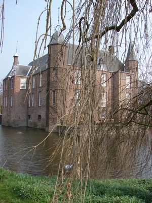
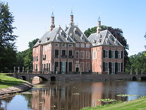
Overijssel
| Castle | Location | Image |
|---|---|---|
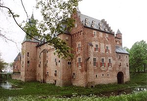
| Huize Almelo | Almelo Almelo Almelo is a municipality and a city in the eastern Netherlands. The main population centres in the town are Aadorp, Almelo, Mariaparochie and Bornerbroek.... , Overijssel Overijssel Overijssel is a province of the Netherlands in the central eastern part of the country. The region has a NUTS classification of NL21. The province's name means "Lands across river IJssel". The capital city of Overijssel is Zwolle and the largest city is Enschede... 52°21′29"N 6°40′18"E |
|
| Rechteren Castle | Dalfsen Dalfsen Dalfsen is a municipality and a town in the Salland region of the Dutch province of Overijssel.The present municipality of Dalfsen was created on 1 January 2001 through the merger of the municipalities of Nieuwleusen and Dalfsen.... , Overijssel Overijssel Overijssel is a province of the Netherlands in the central eastern part of the country. The region has a NUTS classification of NL21. The province's name means "Lands across river IJssel". The capital city of Overijssel is Zwolle and the largest city is Enschede... 52°29′52"N 6°17′20"E |
|
| Waardenborg Castle | Holten Holten Holten is a small village in the municipality of Rijssen-Holten in the Dutch province of Overijssel, with approximately 10,000 inhabitants. Holten is located in an ample-forested area, just south of the Holterberg. This hill, which is about 65m high, is part of the "Sallandse Heuvelrug" National... , Overijssel Overijssel Overijssel is a province of the Netherlands in the central eastern part of the country. The region has a NUTS classification of NL21. The province's name means "Lands across river IJssel". The capital city of Overijssel is Zwolle and the largest city is Enschede... 52°16′53"N 6°25′07"E |
|
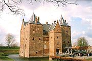
| Twickel Castle | Delden Delden Delden is a city in the Dutch province of Overijssel and, since 2001, in the municipality of Hof van Twente.Although its population is small, it gained city rights in 1333. Castle Twickel is a famous landmark near Delden and the Baron van Heeckeren of Twickel built a watertower in Delden... , Overijssel Overijssel Overijssel is a province of the Netherlands in the central eastern part of the country. The region has a NUTS classification of NL21. The province's name means "Lands across river IJssel". The capital city of Overijssel is Zwolle and the largest city is Enschede... 52°15′59"N 6°42′54"E |
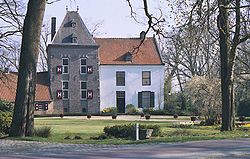
Gelderland
| Castle | Location | Image |
|---|---|---|
| Ammersoyen Castle | Ammerzoden Ammerzoden Ammerzoden is a village on the northern bank of the Maas river in western Gelderland, a Dutch province. The people of the village have strong connections with the people in the province of Noord-Brabant, especially the nearby city of 's-Hertogenbosch... , Gelderland Gelderland Gelderland is the largest province of the Netherlands, located in the central eastern part of the country. The capital city is Arnhem. The two other major cities, Nijmegen and Apeldoorn have more inhabitants. Other major regional centers in Gelderland are Ede, Doetinchem, Zutphen, Tiel, Wijchen,... 51°45′06"N 5°13′45"E |
|
| Batenburg Castle | Batenburg Batenburg Batenburg is a village in the municipality of Wijchen, in the Dutch province of Gelderland. It is located on the Meuse, about 15 km west of Nijmegen... , Gelderland Gelderland Gelderland is the largest province of the Netherlands, located in the central eastern part of the country. The capital city is Arnhem. The two other major cities, Nijmegen and Apeldoorn have more inhabitants. Other major regional centers in Gelderland are Ede, Doetinchem, Zutphen, Tiel, Wijchen,... 51°49′25"N 5°37′52"E |
|
| Bemmel Castle | Bemmel Bemmel Bemmel is a village in Gelderland in the municipality of Lingewaard. It was previously a municipality of its own, but in 2001 it merged with Huissen and Gendt. Bemmel lies between two major cities; Arnhem and Nijmegen, and is thus bordered by the rivers Rhine and Waal. It has a population of... , Gelderland Gelderland Gelderland is the largest province of the Netherlands, located in the central eastern part of the country. The capital city is Arnhem. The two other major cities, Nijmegen and Apeldoorn have more inhabitants. Other major regional centers in Gelderland are Ede, Doetinchem, Zutphen, Tiel, Wijchen,... 51°53′33"N 5°53′44"E |
|
| Bergh Castle Huis Bergh Huis Bergh is a castle in 's-Heerenberg and is one of the largest castles in the Netherlands. It gives its name to the Land van den Bergh and was previously owned by the counts van Bergh.-History:... |
's-Heerenberg 's-Heerenberg s-Heerenberg is a city on the Dutch-German border, in the Province of Gelderland, Netherlands. It is located about 5 km north of the German Emmerich, and about 12 km south of Doetinchem. It received city rights in 1379.... , Gelderland Gelderland Gelderland is the largest province of the Netherlands, located in the central eastern part of the country. The capital city is Arnhem. The two other major cities, Nijmegen and Apeldoorn have more inhabitants. Other major regional centers in Gelderland are Ede, Doetinchem, Zutphen, Tiel, Wijchen,... 51°52′27"N 6°14′27"E |
|
| Biljoen Castle Biljoen Castle Castle Biljoen lies between the Veluwe and the IJssel near Velp. This Noble House from the 16th century was rebuilt by Alexander van Spaen into the present day castle with four equal corner towers.-History:... |
Rheden Rheden Rheden is a municipality and a town in the eastern Netherlands.- Population centres :*Velp *Dieren *Rheden *De Steeg *Ellecom *Spankeren *Laag Soeren -Transportation:... , Gelderland Gelderland Gelderland is the largest province of the Netherlands, located in the central eastern part of the country. The capital city is Arnhem. The two other major cities, Nijmegen and Apeldoorn have more inhabitants. Other major regional centers in Gelderland are Ede, Doetinchem, Zutphen, Tiel, Wijchen,... 51°59′48"N 5°59′33"E |
|
| Blankenborg Castle | Beuningen Beuningen Beuningen is a municipality and a town in the eastern Netherlands close to the city of Nijmegen. The municipality consists of the towns Beuningen, Ewijk, Winssen and Weurt. 1 Mile to the north lays the river the Waal... , Gelderland Gelderland Gelderland is the largest province of the Netherlands, located in the central eastern part of the country. The capital city is Arnhem. The two other major cities, Nijmegen and Apeldoorn have more inhabitants. Other major regional centers in Gelderland are Ede, Doetinchem, Zutphen, Tiel, Wijchen,... 51°51′52"N 5°46′12"E |
|
| Brakel Castle | Brakel Brakel Brakel is a municipality in the Belgian province of East Flanders in the Denderstreek and the Flemish Ardennes. The name is derived from a Carolingian villa Braglo first mentioned in 866 and located in the center of Opbrakel. Since 1970, the municipality has comprised the villages of Nederbrakel,... , Gelderland Gelderland Gelderland is the largest province of the Netherlands, located in the central eastern part of the country. The capital city is Arnhem. The two other major cities, Nijmegen and Apeldoorn have more inhabitants. Other major regional centers in Gelderland are Ede, Doetinchem, Zutphen, Tiel, Wijchen,... 51°49′01"N 5°05′56"E |
|
| Doddendael Castle | Ewijk Ewijk Ewijk is a village in the Dutch province of Gelderland. It is a part of the municipality of Beuningen, and lies about 7 km north of Wijchen.Ewijk was a separate municipality until 1984, when it was merged with Beuningen.... , Gelderland Gelderland Gelderland is the largest province of the Netherlands, located in the central eastern part of the country. The capital city is Arnhem. The two other major cities, Nijmegen and Apeldoorn have more inhabitants. Other major regional centers in Gelderland are Ede, Doetinchem, Zutphen, Tiel, Wijchen,... 51°52′27"N 5°44′51"E |
|
| Doornenburg Castle Doornenburg Castle Castle Doornenburg is a Dutch castle from the 13th century.The castle is located in the eastern part of Gelderland, near the village of Doornenburg. It contains a front-castle and a main castle, which are connected through a small wooden bridge... |
Doornenburg Doornenburg Doornenburg is a village south of Huissen in the municipality of Lingewaard, Gelderland, the Netherlands. It has a population of 2797 .Doornenburg Castle is located near the village.... , Gelderland Gelderland Gelderland is the largest province of the Netherlands, located in the central eastern part of the country. The capital city is Arnhem. The two other major cities, Nijmegen and Apeldoorn have more inhabitants. Other major regional centers in Gelderland are Ede, Doetinchem, Zutphen, Tiel, Wijchen,... 51°53′37"N 5°59′56"E |
|
| Doorwerth Castle Doorwerth Castle Doorwerth Castle is a medieval castle situated on the river Rhine near the city of Arnhem, Netherlands.-History:The original castle, probably wooden, is first mentioned in 1260 when it was besieged and burned to the ground, after which it was rebuilt in stone. In 1280 this second castle was again... |
Doorwerth Doorwerth Doorwerth is a village in the Dutch province of Gelderland. It is located in the municipality of Renkum, about 8 km west of Arnhem.-History:The valley of the Seelbeek has been in residential use since prehistoric times... , Gelderland Gelderland Gelderland is the largest province of the Netherlands, located in the central eastern part of the country. The capital city is Arnhem. The two other major cities, Nijmegen and Apeldoorn have more inhabitants. Other major regional centers in Gelderland are Ede, Doetinchem, Zutphen, Tiel, Wijchen,... 51°58′00"N 5°47′20"E |
 |
| Goudenstein Castle | Haaften Haaften Haaften is a village in the Dutch province of Gelderland. It is a part of the municipality of Neerijnen, and lies about 25 km south of Utrecht.Haaften was a separate municipality between 1818 and 1978, when it was merged with Neerijnen.... , Gelderland Gelderland Gelderland is the largest province of the Netherlands, located in the central eastern part of the country. The capital city is Arnhem. The two other major cities, Nijmegen and Apeldoorn have more inhabitants. Other major regional centers in Gelderland are Ede, Doetinchem, Zutphen, Tiel, Wijchen,... 51°49′00"N 5°13′00"E |
|
| Hackfort Castle | Vorden Vorden Vorden is a former municipality and a town in the eastern Netherlands, about 10 kilometres south-east of Zutphen. On 1 January 2005 the municipality merged with Hummelo en Keppel, Steenderen, Hengelo en Zelhem, to form the new municipality Bronckhorst.... , Gelderland Gelderland Gelderland is the largest province of the Netherlands, located in the central eastern part of the country. The capital city is Arnhem. The two other major cities, Nijmegen and Apeldoorn have more inhabitants. Other major regional centers in Gelderland are Ede, Doetinchem, Zutphen, Tiel, Wijchen,... 52°06′00"N 6°16′37"E |
|
| Hatert Castle | Nijmegen, Gelderland Gelderland Gelderland is the largest province of the Netherlands, located in the central eastern part of the country. The capital city is Arnhem. The two other major cities, Nijmegen and Apeldoorn have more inhabitants. Other major regional centers in Gelderland are Ede, Doetinchem, Zutphen, Tiel, Wijchen,... 51°48′32"N 5°49′09"E |
|
| Hernen Castle | Hernen Hernen Hernen is a village in the Dutch province of Gelderland. It is located in the municipality of Wijchen, about 13 km west of Nijmegen.Hernen was a separate municipality until 1818, when it was merged with Bergharen.-References:... , Gelderland Gelderland Gelderland is the largest province of the Netherlands, located in the central eastern part of the country. The capital city is Arnhem. The two other major cities, Nijmegen and Apeldoorn have more inhabitants. Other major regional centers in Gelderland are Ede, Doetinchem, Zutphen, Tiel, Wijchen,... 51°50′4"N 5°40′35"E |
|
| Jachtslot Sint Hubertus | Otterlo Otterlo Otterlo is a small village in the province of Gelderland in the Netherlands, in or near the Nationaal Park De Hoge Veluwe.... , Gelderland Gelderland Gelderland is the largest province of the Netherlands, located in the central eastern part of the country. The capital city is Arnhem. The two other major cities, Nijmegen and Apeldoorn have more inhabitants. Other major regional centers in Gelderland are Ede, Doetinchem, Zutphen, Tiel, Wijchen,... 52°07′18"N 5°49′58"E |
 |
| De Kelder Castle Hagen Castle |
Doetinchem Doetinchem Doetinchem is a city and municipality in the east of the Netherlands. It is situated along the Oude IJssel river in a part of the province of Gelderland called the Achterhoek . The municipality has 56,700 inhabitants and has an area of 79.66 km²... , Gelderland Gelderland Gelderland is the largest province of the Netherlands, located in the central eastern part of the country. The capital city is Arnhem. The two other major cities, Nijmegen and Apeldoorn have more inhabitants. Other major regional centers in Gelderland are Ede, Doetinchem, Zutphen, Tiel, Wijchen,... 51°59′22"N 6°16′13"E |
|
| Keppel Castle | Laag-Keppel Laag-Keppel Laag-Keppel is a small village with Town privileges between Doetinchem and Doesburg. Situated along the main thoroughfare between these two larger cities, there is heavy traffic moving through at all times.... , Gelderland Gelderland Gelderland is the largest province of the Netherlands, located in the central eastern part of the country. The capital city is Arnhem. The two other major cities, Nijmegen and Apeldoorn have more inhabitants. Other major regional centers in Gelderland are Ede, Doetinchem, Zutphen, Tiel, Wijchen,... 51°59′37"N 6°13′38"E |
|
| Kinkelenburg Castle | Bemmel Bemmel Bemmel is a village in Gelderland in the municipality of Lingewaard. It was previously a municipality of its own, but in 2001 it merged with Huissen and Gendt. Bemmel lies between two major cities; Arnhem and Nijmegen, and is thus bordered by the rivers Rhine and Waal. It has a population of... , Gelderland Gelderland Gelderland is the largest province of the Netherlands, located in the central eastern part of the country. The capital city is Arnhem. The two other major cities, Nijmegen and Apeldoorn have more inhabitants. Other major regional centers in Gelderland are Ede, Doetinchem, Zutphen, Tiel, Wijchen,... 51°53′23"N 5°53′46"E |
|
| Merckenburg Castle | Heukelum Heukelum Heukelum is a town in the Dutch province of Gelderland. It is a part of the municipality of Lingewaal, and lies about 8 km northeast of Gorinchem. It received city rights in 1391.In 2001, the town of Heukelum had 1967 inhabitants... , Gelderland Gelderland Gelderland is the largest province of the Netherlands, located in the central eastern part of the country. The capital city is Arnhem. The two other major cities, Nijmegen and Apeldoorn have more inhabitants. Other major regional centers in Gelderland are Ede, Doetinchem, Zutphen, Tiel, Wijchen,... 51°52′40"N 5°05′24"E |
|
| Slot Loevestein Loevestein Castle Loevestein is a medieval castle built by the knight Dirc Loef van Horne between 1357 and 1397.... |
Poederoijen Poederoijen Poederoijen is a village in the Dutch province of Gelderland. It is a part of the municipality of Zaltbommel, and lies about 9 km southeast of Gorinchem.Poederoijen was a separate municipality until 1955, when it was merged with Brakel.... , Gelderland Gelderland Gelderland is the largest province of the Netherlands, located in the central eastern part of the country. The capital city is Arnhem. The two other major cities, Nijmegen and Apeldoorn have more inhabitants. Other major regional centers in Gelderland are Ede, Doetinchem, Zutphen, Tiel, Wijchen,... 51°48′59"N 5°01′14"E |
 |
| Slot van Malsen Well Castle |
Well Well (Gelderland) Well is a village in the Dutch province of Gelderland. It is a part of the municipality of Maasdriel, and lies about 9 km northwest of 's-Hertogenbosch.... , Gelderland Gelderland Gelderland is the largest province of the Netherlands, located in the central eastern part of the country. The capital city is Arnhem. The two other major cities, Nijmegen and Apeldoorn have more inhabitants. Other major regional centers in Gelderland are Ede, Doetinchem, Zutphen, Tiel, Wijchen,... 51°44′47"N 5°12′24"E |
|
| Middachten Castle | De Steeg, Gelderland Gelderland Gelderland is the largest province of the Netherlands, located in the central eastern part of the country. The capital city is Arnhem. The two other major cities, Nijmegen and Apeldoorn have more inhabitants. Other major regional centers in Gelderland are Ede, Doetinchem, Zutphen, Tiel, Wijchen,... 52°01′09"N 6°04′11"E |
|
| Oude Loo Castle | Apeldoorn Apeldoorn Apeldoorn is a municipality and city in the province of Gelderland, about 60 miles south east of Amsterdam, in the centre of the Netherlands. It is a regional centre and has 155,000 . The municipality of Apeldoorn, including villages like Beekbergen, Loenen and Hoenderloo, has over 155,000... , Gelderland Gelderland Gelderland is the largest province of the Netherlands, located in the central eastern part of the country. The capital city is Arnhem. The two other major cities, Nijmegen and Apeldoorn have more inhabitants. Other major regional centers in Gelderland are Ede, Doetinchem, Zutphen, Tiel, Wijchen,... 52°14′07"N 5°56′32"E |
|
| Nederhemert Castle | Nederhemert Nederhemert Nederhemert is a village in the Dutch province of Gelderland. It is a part of the municipality of Zaltbommel, and lies about 8 km southwest of that city.Nederhemert was a separate municipality until 1955, when it was merged with Kerkwijk.... , Gelderland Gelderland Gelderland is the largest province of the Netherlands, located in the central eastern part of the country. The capital city is Arnhem. The two other major cities, Nijmegen and Apeldoorn have more inhabitants. Other major regional centers in Gelderland are Ede, Doetinchem, Zutphen, Tiel, Wijchen,... 51°45′15"N 5°09′15"E |
|
| Nyenbeek Castle | Voorst Voorst Voorst is a municipality and a town in the eastern Netherlands.- Population centres :* Appen * Bussloo... , Gelderland Gelderland Gelderland is the largest province of the Netherlands, located in the central eastern part of the country. The capital city is Arnhem. The two other major cities, Nijmegen and Apeldoorn have more inhabitants. Other major regional centers in Gelderland are Ede, Doetinchem, Zutphen, Tiel, Wijchen,... 52°11′12"N 6°09′42"E |
|
| Ophemert Castle | Voorst Voorst Voorst is a municipality and a town in the eastern Netherlands.- Population centres :* Appen * Bussloo... , Gelderland Gelderland Gelderland is the largest province of the Netherlands, located in the central eastern part of the country. The capital city is Arnhem. The two other major cities, Nijmegen and Apeldoorn have more inhabitants. Other major regional centers in Gelderland are Ede, Doetinchem, Zutphen, Tiel, Wijchen,... 51°50′53"N 5°23′26"E |
|
| Poelwijk Castle | Gendt Gendt Gendt is a city in Gelderland in the municipality of Lingewaard. It was previously a municipality of its own, but in 2001 it merged with Huissen and Bemmel to form the new municipality Lingewaard. The city is located on the river Waal, about 5 km northeast of the city of Nijmegen. It received... , Gelderland Gelderland Gelderland is the largest province of the Netherlands, located in the central eastern part of the country. The capital city is Arnhem. The two other major cities, Nijmegen and Apeldoorn have more inhabitants. Other major regional centers in Gelderland are Ede, Doetinchem, Zutphen, Tiel, Wijchen,... 51°52′19"N 5°57′55"E |
|
| Rosendael Castle | Rozendaal Rozendaal Rozendaal is a municipality and a town in the eastern Netherlands, in the province of Gelderland.The town is next to Arnhem and Velp.It's known for the Castle of Rozendaal and its bedriegertjes.... , Gelderland Gelderland Gelderland is the largest province of the Netherlands, located in the central eastern part of the country. The capital city is Arnhem. The two other major cities, Nijmegen and Apeldoorn have more inhabitants. Other major regional centers in Gelderland are Ede, Doetinchem, Zutphen, Tiel, Wijchen,... 52°00′34"N 5°57′52"E |
|
| Huis te Ruurlo Huis te Ruurlo Huis te Ruurlo is a Dutch castle in Ruurlo, Gelderland, the Netherlands.-See also:*List of castles in the Netherlands... |
Ruurlo Ruurlo Ruurlo is a former municipality and a town in the eastern part of the Netherlands in the province of Gelderland. It has a population of 8,676 in 2004.... , Gelderland Gelderland Gelderland is the largest province of the Netherlands, located in the central eastern part of the country. The capital city is Arnhem. The two other major cities, Nijmegen and Apeldoorn have more inhabitants. Other major regional centers in Gelderland are Ede, Doetinchem, Zutphen, Tiel, Wijchen,... 52°04′44"N 6°26′42"E |
|
| Ryswyk Castle | Groessen, Gelderland Gelderland Gelderland is the largest province of the Netherlands, located in the central eastern part of the country. The capital city is Arnhem. The two other major cities, Nijmegen and Apeldoorn have more inhabitants. Other major regional centers in Gelderland are Ede, Doetinchem, Zutphen, Tiel, Wijchen,... 51°55′37"N 6°01′59"E |
|
| Slangenburg Castle | Doetinchem Doetinchem Doetinchem is a city and municipality in the east of the Netherlands. It is situated along the Oude IJssel river in a part of the province of Gelderland called the Achterhoek . The municipality has 56,700 inhabitants and has an area of 79.66 km²... , Gelderland Gelderland Gelderland is the largest province of the Netherlands, located in the central eastern part of the country. The capital city is Arnhem. The two other major cities, Nijmegen and Apeldoorn have more inhabitants. Other major regional centers in Gelderland are Ede, Doetinchem, Zutphen, Tiel, Wijchen,... 51°57′38"N 6°21′39"E |
|
| Huis te Vorden | Het Valkhof, Gelderland Gelderland Gelderland is the largest province of the Netherlands, located in the central eastern part of the country. The capital city is Arnhem. The two other major cities, Nijmegen and Apeldoorn have more inhabitants. Other major regional centers in Gelderland are Ede, Doetinchem, Zutphen, Tiel, Wijchen,... 51°50′52"N 5°52′15"E |
|
| Huis te Vorden | Vorden Vorden Vorden is a former municipality and a town in the eastern Netherlands, about 10 kilometres south-east of Zutphen. On 1 January 2005 the municipality merged with Hummelo en Keppel, Steenderen, Hengelo en Zelhem, to form the new municipality Bronckhorst.... , Gelderland Gelderland Gelderland is the largest province of the Netherlands, located in the central eastern part of the country. The capital city is Arnhem. The two other major cities, Nijmegen and Apeldoorn have more inhabitants. Other major regional centers in Gelderland are Ede, Doetinchem, Zutphen, Tiel, Wijchen,... 52°06′05"N 6°19′21"E |
|
| Waardenburg Castle | Waardenburg Waardenburg Waardenburg is a town in the Dutch province of Gelderland. It is a part of the municipality of Neerijnen, and lies about 13 km west of Tiel.Waardenburg was a separate municipality until 1978, when it was merged with Neerijnen.... , Gelderland Gelderland Gelderland is the largest province of the Netherlands, located in the central eastern part of the country. The capital city is Arnhem. The two other major cities, Nijmegen and Apeldoorn have more inhabitants. Other major regional centers in Gelderland are Ede, Doetinchem, Zutphen, Tiel, Wijchen,... 51°49′54"N 5°15′59"E |
|
| Wageningen Castle | Wageningen Wageningen ' is a municipality and a historical town in the central Netherlands, in the province of Gelderland. It is famous for Wageningen University, which specializes in life sciences. The city has 37,414 inhabitants , of which many thousands are students... , Gelderland Gelderland Gelderland is the largest province of the Netherlands, located in the central eastern part of the country. The capital city is Arnhem. The two other major cities, Nijmegen and Apeldoorn have more inhabitants. Other major regional centers in Gelderland are Ede, Doetinchem, Zutphen, Tiel, Wijchen,... 51°57′59"N 5°40′01"E |
|
| Waliën Castle | Winterswijk Winterswijk Winterswijk is a municipality and a town in the eastern Netherlands.Winterswijk is a town with a population of some 30,000 in the Achterhoek which lies in the most eastern part of the province of Gelderland in the Netherlands. It was also known as Winethereswick, Winriswic or Wenterswic... , Gelderland Gelderland Gelderland is the largest province of the Netherlands, located in the central eastern part of the country. The capital city is Arnhem. The two other major cities, Nijmegen and Apeldoorn have more inhabitants. Other major regional centers in Gelderland are Ede, Doetinchem, Zutphen, Tiel, Wijchen,... 51°59′30"N 6°44′06"E |
|
| Wisch Castle Hof Terborg |
Terborg Terborg Terborg is a village in the Dutch province of Gelderland, in the east of the Netherlands. It is located in the municipality of Oude IJsselstreek. The village lies about 7 km southeast of Doetinchem. The population is about 4600 inhabitants.... , Gelderland Gelderland Gelderland is the largest province of the Netherlands, located in the central eastern part of the country. The capital city is Arnhem. The two other major cities, Nijmegen and Apeldoorn have more inhabitants. Other major regional centers in Gelderland are Ede, Doetinchem, Zutphen, Tiel, Wijchen,... 51°55′03"N 6°21′23"E |
 |
| Wijenburg Castle | Echteld, Gelderland Gelderland Gelderland is the largest province of the Netherlands, located in the central eastern part of the country. The capital city is Arnhem. The two other major cities, Nijmegen and Apeldoorn have more inhabitants. Other major regional centers in Gelderland are Ede, Doetinchem, Zutphen, Tiel, Wijchen,... 51°54′34"N 5°30′01"E |
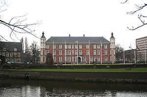
Utrecht
See also: List of manors in Utrecht| Castle | Location | Image |
|---|---|---|
| Amerongen Castle | Amerongen, Utrecht Utrecht (city) Utrecht city and municipality is the capital and most populous city of the Dutch province of Utrecht. It is located in the eastern corner of the Randstad conurbation, and is the fourth largest city of the Netherlands with a population of 312,634 on 1 Jan 2011.Utrecht's ancient city centre features... 51°59′44"N 5°27′31"E |
|
| Beesde Castle Huis Cammingha |
Bunnik Bunnik Bunnik is a municipality and a village in the Netherlands, in the province of Utrecht. The recorded history of the village dates back nearly 2000 years, when the Romans constructed a fort at Fectio with a harbour facing the river Rhine, which marked the border of the Roman Empire... , Utrecht Utrecht (city) Utrecht city and municipality is the capital and most populous city of the Dutch province of Utrecht. It is located in the eastern corner of the Randstad conurbation, and is the fourth largest city of the Netherlands with a population of 312,634 on 1 Jan 2011.Utrecht's ancient city centre features... 52°04′19"N 5°11′46"E |
|
| Huis Beverweert | Werkhoven Werkhoven Werkhoven is a town in the Dutch province of Utrecht. It is a part of the municipality of Bunnik, and lies about 5 km east of Houten.In 2001, the town of Werkhoven had 1528 inhabitants. The built-up area of the town was 0.29 km², and contained 550 residences... , Utrecht Utrecht (city) Utrecht city and municipality is the capital and most populous city of the Dutch province of Utrecht. It is located in the eastern corner of the Randstad conurbation, and is the fourth largest city of the Netherlands with a population of 312,634 on 1 Jan 2011.Utrecht's ancient city centre features... 52°01′55"N 5°15′00"E |
|
| Bolenstein | Maarssen Maarssen Maarssen is a town and former municipality in the Netherlands, in the province of Utrecht, along the river Vecht. It lies in an area called the Vechtstreek.On January 1, 2011 Maarssen merged with Breukelen and Loenen to Stichtse Vecht.... , Utrecht Utrecht (city) Utrecht city and municipality is the capital and most populous city of the Dutch province of Utrecht. It is located in the eastern corner of the Randstad conurbation, and is the fourth largest city of the Netherlands with a population of 312,634 on 1 Jan 2011.Utrecht's ancient city centre features... 52°08′24"N 5°02′11"E |
|
| Huis Doorn Huis Doorn Huis Doorn is a small manor house that lies outside of Doorn, a small town near Utrecht, in the Netherlands. The 15th-century house was rebuilt in the late 18th century in a conservative manner and, in the mid-19th century, a surrounding park was laid out as an English landscape garden... |
Doorn Doorn Doorn is a town in the municipality of Utrechtse Heuvelrug in the central Netherlands, in the province of Utrecht. On 1 January 2008 the town had 10,052 inhabitants.-History:... , Utrecht Utrecht (city) Utrecht city and municipality is the capital and most populous city of the Dutch province of Utrecht. It is located in the eastern corner of the Randstad conurbation, and is the fourth largest city of the Netherlands with a population of 312,634 on 1 Jan 2011.Utrecht's ancient city centre features... 52°01′53"N 5°20′19"E |
|
| Drakensteyn Castle | Lage Vuursche Lage Vuursche Lage Vuursche is a village in the Dutch province of Utrecht. It is a part of the municipality of Baarn, and lies about 5 km west of Soest, in the middle of the forest. Drakestein, the former residence of Queen Beatrix, is situated just east of the village.In 2001, the village of Lage-Vuursche... , Utrecht Utrecht (city) Utrecht city and municipality is the capital and most populous city of the Dutch province of Utrecht. It is located in the eastern corner of the Randstad conurbation, and is the fourth largest city of the Netherlands with a population of 312,634 on 1 Jan 2011.Utrecht's ancient city centre features... 52°10′47"N 5°13′38"E |
 |
| Duurstede Castle Duurstede Castle Castle Duurstede is a medieval castle in Wijk bij Duurstede in the province of Utrecht in the Netherlands.-Origin and development:The castle originated in the 13th century. Around 1270, Zweder I van Zuylen van Abcoude built a freestanding keep on a raised and moated site near the lost city Dorestad... |
Wijk bij Duurstede Wijk bij Duurstede - The city of Wijk bij Duurstede :The city is located on the Rhine. At Wijk bij Duurstede, the Kromme Rijn branches off, and the main branch is called Lek River downstream from Wijk bij Duurstede.... , Utrecht Utrecht (city) Utrecht city and municipality is the capital and most populous city of the Dutch province of Utrecht. It is located in the eastern corner of the Randstad conurbation, and is the fourth largest city of the Netherlands with a population of 312,634 on 1 Jan 2011.Utrecht's ancient city centre features... 51°58′10"N 5°20′36"E |
|
| Den Ham Castle | Vleuten Vleuten Vleuten is a former village in the Dutch province of Utrecht. It is a part of the city of Utrecht, and lies about 6 km west of it. In 2001, it became together with De Meern, a city part of Utrecht called Vleuten-De Meern. Vleuten has a railway station on the line between Utrecht and Woerden.In... , Utrecht Utrecht (city) Utrecht city and municipality is the capital and most populous city of the Dutch province of Utrecht. It is located in the eastern corner of the Randstad conurbation, and is the fourth largest city of the Netherlands with a population of 312,634 on 1 Jan 2011.Utrecht's ancient city centre features... 52°06′20"N 4°59′44"E |
|
| Gunterstein Gunterstein Gunterstein is a castle in Breukelen, on the river Vecht, that was the former home of the rich Dutch widow Magdalena Poulle . She bought the property and associated title after the former castle and stronghold was destroyed by the French in the rampjaar 1672.-History:The castle was built in 1681 on... |
Breukelen Breukelen Breukelen is a town and former municipality in the Netherlands, in the province of Utrecht. It is situated to the north west of Utrecht, along the river Vecht and close to the lakes of the Loosdrechtse Plassen, an area of natural and touristic interest... , Utrecht Utrecht (city) Utrecht city and municipality is the capital and most populous city of the Dutch province of Utrecht. It is located in the eastern corner of the Randstad conurbation, and is the fourth largest city of the Netherlands with a population of 312,634 on 1 Jan 2011.Utrecht's ancient city centre features... 52°10′20"N 5°0′21"E |
|
| Hardenbroek Castle | Driebergen Driebergen Driebergen is a former village in the Dutch province of Utrecht. Later it became a part of the single town of Driebergen-Rijsenburg. And presently it's part of Utrechtse Heuvelrug.... , Utrecht Utrecht (city) Utrecht city and municipality is the capital and most populous city of the Dutch province of Utrecht. It is located in the eastern corner of the Randstad conurbation, and is the fourth largest city of the Netherlands with a population of 312,634 on 1 Jan 2011.Utrecht's ancient city centre features... 52°00′39"N 5°17′01"E |
|
| Harmelen Castle | Harmelen Harmelen Harmelen is a town in the Dutch province of Utrecht. It is a part of the municipality of Woerden, and lies about 6 km east of Woerden.In 2001, the town of Harmelen had 6557 inhabitants... , Utrecht Utrecht (city) Utrecht city and municipality is the capital and most populous city of the Dutch province of Utrecht. It is located in the eastern corner of the Randstad conurbation, and is the fourth largest city of the Netherlands with a population of 312,634 on 1 Jan 2011.Utrecht's ancient city centre features... 52°05′46"N 4°58′03"E |
|
| Hinderstein Castle | Langbroek, Utrecht Utrecht (city) Utrecht city and municipality is the capital and most populous city of the Dutch province of Utrecht. It is located in the eastern corner of the Randstad conurbation, and is the fourth largest city of the Netherlands with a population of 312,634 on 1 Jan 2011.Utrecht's ancient city centre features... 52°00′52"N 5°18′40"E |
|
| Loenersloot Castle | Loenersloot Loenersloot Loenersloot is a village in the Dutch province of Utrecht. It was a part of the former municipality of Loenen. Since 2011 it has made part of the new formed municipality of Stichtse Vecht. It lies about 12 km west of Hilversum. It is located on the Angstel River.In 2001, the village of... , Utrecht Utrecht (city) Utrecht city and municipality is the capital and most populous city of the Dutch province of Utrecht. It is located in the eastern corner of the Randstad conurbation, and is the fourth largest city of the Netherlands with a population of 312,634 on 1 Jan 2011.Utrecht's ancient city centre features... 52°13′46"N 4°59′49"E |
|
| Lunenburg Castle | Langbroek, Utrecht Utrecht (city) Utrecht city and municipality is the capital and most populous city of the Dutch province of Utrecht. It is located in the eastern corner of the Randstad conurbation, and is the fourth largest city of the Netherlands with a population of 312,634 on 1 Jan 2011.Utrecht's ancient city centre features... 52°00′43"N 5°19′12"E |
|
| Moersbergen Castle | Doorn Doorn Doorn is a town in the municipality of Utrechtse Heuvelrug in the central Netherlands, in the province of Utrecht. On 1 January 2008 the town had 10,052 inhabitants.-History:... , Utrecht Utrecht (city) Utrecht city and municipality is the capital and most populous city of the Dutch province of Utrecht. It is located in the eastern corner of the Randstad conurbation, and is the fourth largest city of the Netherlands with a population of 312,634 on 1 Jan 2011.Utrecht's ancient city centre features... 52°01′37"N 5°19′11"E |
|
| Nijenrode Castle | Breukelen Breukelen Breukelen is a town and former municipality in the Netherlands, in the province of Utrecht. It is situated to the north west of Utrecht, along the river Vecht and close to the lakes of the Loosdrechtse Plassen, an area of natural and touristic interest... , Utecht Utecht Utecht is a municipality in the Nordwestmecklenburg district, in Mecklenburg-Vorpommern, Germany.... 52°09′49"N 5°00′33"E |
|
| Sterkenburg Castle | Sterkenburg Sterkenburg Sterkenburg is a former municipality in the Dutch province of Utrecht. It existed between 1818 and 1857, when it was merged with Driebergen.The castle Sterkenburg is located here, about 3 km south of Driebergen. The literal translation of the name is "strong castle".There is also a Dutch... , Utrecht Utrecht (city) Utrecht city and municipality is the capital and most populous city of the Dutch province of Utrecht. It is located in the eastern corner of the Randstad conurbation, and is the fourth largest city of the Netherlands with a population of 312,634 on 1 Jan 2011.Utrecht's ancient city centre features... 52°01′24"N 5°17′01"E |
|
| Vredenburg Castle Vredenburg (castle) Vredenburg or Vredeborch was a 16th-century castle built by Habsburg emperor Charles V in the city of Utrecht in the Netherlands. Some remains of the castle, which stood for only 50 years, are still visible on what is now Vredenburg square in Utrecht.... |
Utrecht (city) Utrecht (city) Utrecht city and municipality is the capital and most populous city of the Dutch province of Utrecht. It is located in the eastern corner of the Randstad conurbation, and is the fourth largest city of the Netherlands with a population of 312,634 on 1 Jan 2011.Utrecht's ancient city centre features... , Utrecht Utrecht (city) Utrecht city and municipality is the capital and most populous city of the Dutch province of Utrecht. It is located in the eastern corner of the Randstad conurbation, and is the fourth largest city of the Netherlands with a population of 312,634 on 1 Jan 2011.Utrecht's ancient city centre features... 52°05′33"N 5°06′50"E |
|
| Woerden Castle | Woerden Woerden Woerden is a municipality and a city in the central Netherlands. Due to its central location between Amsterdam, Rotterdam, The Hague and Utrecht, and the fact that it has excellent rail and road connections to those cities, it is a popular town for commuters who work in those cities.-Population... , Utrecht Utrecht (city) Utrecht city and municipality is the capital and most populous city of the Dutch province of Utrecht. It is located in the eastern corner of the Randstad conurbation, and is the fourth largest city of the Netherlands with a population of 312,634 on 1 Jan 2011.Utrecht's ancient city centre features... 52°05′06"N 4°53′17"E |
|
| Slot Zuylen Slot Zuylen Slot Zuylen is a Dutch castle at the village of Oud-Zuilen just north of the city of Utrecht. It is located at the southern end of the Vechtstreek.-History:... |
Oud-Zuilen Oud-Zuilen Oud-Zuilen is a town in the Dutch province of Utrecht. It is a part of the municipality of Stichtse Vecht, and lies about 4 km northwest of Utrecht. It is in an area called the "Vechtstreek".In 2001, the town of Oud-Zuilen had 224 inhabitants... , Utrecht Utrecht (city) Utrecht city and municipality is the capital and most populous city of the Dutch province of Utrecht. It is located in the eastern corner of the Randstad conurbation, and is the fourth largest city of the Netherlands with a population of 312,634 on 1 Jan 2011.Utrecht's ancient city centre features... 52°04′37"N 5°04′23"E |
 |
North Holland
| Castle | Location | Image |
|---|---|---|
| Slot Assumburg | Heemskerk Heemskerk Heemskerk is a municipality and a town in the Netherlands, in the province of North Holland.-Local government:The municipal council of Heemskerk consists of 25 seats, which are divided as follows:* PvdA - 5 seats* CDA - 5 seats* VVD - 5 seats... , North Holland North Holland North Holland |West Frisian]]: Noard-Holland) is a province situated on the North Sea in the northwest part of the Netherlands. The provincial capital is Haarlem and its largest city is Amsterdam.-Geography:... 52°30′18"N 4°41′07"E |
|
| Brederode Castle Castle Brederode Castle Brederode, also called the Ruïns of Brederode, is located near Santpoort-Zuid.The castle was founded in the second half of the 13th century by William I van Brederode . William was a descendant of the lords van Teylingen, who were related to the counts of Holland... |
Santpoort, North Holland North Holland North Holland |West Frisian]]: Noard-Holland) is a province situated on the North Sea in the northwest part of the Netherlands. The provincial capital is Haarlem and its largest city is Amsterdam.-Geography:... 52°25′31"N 4°37′21"E |
|
| Huis ter Kleef Huis ter Kleef The ruins of the Huis ter Kleef castle are located in the city gardens of Haarlem.-History:The castle is located about halfway between the Castle Brederode and the Haarlem City Hall, which were built respectively in the second half of the 13th century and 1370, and probably dates from that period,... |
Haarlem Haarlem Haarlem is a municipality and a city in the Netherlands. It is the capital of the province of North Holland, the northern half of Holland, which at one time was the most powerful of the seven provinces of the Dutch Republic... , North Holland North Holland North Holland |West Frisian]]: Noard-Holland) is a province situated on the North Sea in the northwest part of the Netherlands. The provincial capital is Haarlem and its largest city is Amsterdam.-Geography:... 52°23′44"N 4°38′13"E |
 |
| Slot Heemstede Slot Heemstede Slot Heemstede is the site of the old castle of Heemstede. The property is situated at the site of the former castle 'Heerlijkheid Heemstede', or 'Huis te Heemstede', at a strategic position on mouth of the Spaarne river on the Haarlem lake .-History:The castle was first built in 1280 by Dirk van... |
Heemstede Heemstede Heemstede is a municipality and a town in the Netherlands, in the province of North Holland.-History :Heemstede formed around the Castle Heemstede that was built on the Spaarne River around 1286. Before 1296, Floris V, Count of Holland, granted Heemstede as a fiefdom to Reinier of Holy... , North Holland North Holland North Holland |West Frisian]]: Noard-Holland) is a province situated on the North Sea in the northwest part of the Netherlands. The provincial capital is Haarlem and its largest city is Amsterdam.-Geography:... 52°20′23"N 4°37′53"E |
 |
| Ilpenstein Castle Ilpenstein Ilpenstein was the name of a ruined castle of the Free and high Lordship of Purmerend, Purmerland and Ilpendam, located in Ilpendam in the north of the city of Amsterdam.-History:... |
Ilpendam Ilpendam Ilpendam is a village in the Dutch province of North Holland. It is a part of the municipality of Waterland, and lies about 4 km south of Purmerend.-History:The man standing highlighted at center on Rembrandts Night Watch painting is Frans Banning Cocq... , North Holland North Holland North Holland |West Frisian]]: Noard-Holland) is a province situated on the North Sea in the northwest part of the Netherlands. The provincial capital is Haarlem and its largest city is Amsterdam.-Geography:... 52°27′52"N 4°57′27"E |
.jpg) |
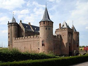
| Muiderslot Muiderslot The Muiderslot is a castle in the Netherlands, located at the mouth of the river Vecht, some 15 kilometers southeast of Amsterdam, in Muiden, where it flows into what used to be the Zuiderzee... |
Muiden Muiden Muiden is a municipality and a town in the Netherlands, in the province of North Holland. It lies at the mouth of the Vecht and is in an area called the Vechtstreek.-Population centres :... , North Holland North Holland North Holland |West Frisian]]: Noard-Holland) is a province situated on the North Sea in the northwest part of the Netherlands. The provincial capital is Haarlem and its largest city is Amsterdam.-Geography:... 52°20′03"N 5°04′17"E |
 |
| Radboud Castle | Medemblik Medemblik Medemblik is a municipality and a town in the Netherlands, in the province of North Holland and the region of West-Frisia.- History :... , North Holland North Holland North Holland |West Frisian]]: Noard-Holland) is a province situated on the North Sea in the northwest part of the Netherlands. The provincial capital is Haarlem and its largest city is Amsterdam.-Geography:... 52°46′21"N 5°06′47"E |
South Holland
| Castle | Location | Image |
|---|---|---|
| Huys Dever Huys Dever The Huys Dever is a small castle in Lisse, Netherlands. It was probably built shortly after 1375 by Reinier Dever or d'Ever, a member of an old noble family from Holland.-History:... |
Lisse Lisse Lisse is a town and municipality in the western Netherlands, in the province of South Holland. The municipality covers an area of 16.11 km² of which 0.41 km² is water. Its population is 21864... , South Holland South Holland South Holland is a province situated on the North Sea in the western part of the Netherlands. The provincial capital is The Hague and its largest city is Rotterdam.South Holland is one of the most densely populated and industrialised areas in the world... 52°14′56"N 4°32′51"E |
|
| Duivenvoorde Castle Kasteel Duivenvoorde Duivenvoorde Castle is a castle in the town of Voorschoten, South Holland, in the Netherlands. It was first mentioned in 1226, making it one of the oldest castles in South Holland.... |
Voorschoten Voorschoten Voorschoten is a village and municipality in the western Netherlands, in the province of South Holland. It is a smaller town in the Randstad, enclosed by the cities of Leiden and The Hague. The municipality covers an area of 11.59 km²... , South Holland South Holland South Holland is a province situated on the North Sea in the western part of the Netherlands. The provincial capital is The Hague and its largest city is Rotterdam.South Holland is one of the most densely populated and industrialised areas in the world... 52°06′41"N 4°25′03"E |
 |
| Burcht van Leiden Burcht van Leiden The burcht van Leiden is an old Shell keep in Leiden constructed in the 11th century. It is located at the spot where two tributaries of the Rhine come together, the Leidse Rijn, and another river, now a canal... |
Leiden, South Holland South Holland South Holland is a province situated on the North Sea in the western part of the Netherlands. The provincial capital is The Hague and its largest city is Rotterdam.South Holland is one of the most densely populated and industrialised areas in the world... 52°09′32"N 4°29′33"E |
|
| Rhoon Castle | Rhoon Rhoon thumb|200px|Castle Rhoonthumb|200pxRhoon is a village that borders the municipality of the city of Rotterdam, South Holland, the Netherlands.According to its history it was established in 1199 and was ruled by the lords of Duiveland... , South Holland South Holland South Holland is a province situated on the North Sea in the western part of the Netherlands. The provincial capital is The Hague and its largest city is Rotterdam.South Holland is one of the most densely populated and industrialised areas in the world... 51°51′37"N 4°25′05"E |
|
| Slot Teylingen Slot Teylingen Slot Teylingen is a Dutch castle in the municipality of Teylingen, in Voorhout, near the border with Sassenheim. It is presumably the family keep of the noble family Van Teylingen, from which the Van Brederode family directly descended from.... |
Voorhout Voorhout thumb|250px|right|Location of Voorhout.Voorhout is a town and former municipality in the western Netherlands, in the province of South Holland. The former municipality covered an area of 12.59 km² of which 0.33 km² is covered by water, and had a population of 14,792 in 2004... , South Holland South Holland South Holland is a province situated on the North Sea in the western part of the Netherlands. The provincial capital is The Hague and its largest city is Rotterdam.South Holland is one of the most densely populated and industrialised areas in the world... 52°13′52"N 4°31′09"E |
 |
North Brabant
| Castle | Location | Image |
|---|---|---|
| Great Castle | Deurne Deurne Deurne may refer to two towns:* Deurne, North Brabant, a municipality in North Brabant * Deurne, Belgium, a district of the city of Antwerp... , North Brabant North Brabant North Brabant , sometimes called Brabant, is a province of the Netherlands, located in the south of the country, bordered by Belgium in the south, the Meuse River in the north, Limburg in the east and Zeeland in the west.- History :... 51°28′11"N 5°48′10"E |
|
| Bouvigne Castle | Breda Breda Breda is a municipality and a city in the southern part of the Netherlands. The name Breda derived from brede Aa and refers to the confluence of the rivers Mark and Aa. As a fortified city, the city was of strategic military and political significance... , North Brabant North Brabant North Brabant , sometimes called Brabant, is a province of the Netherlands, located in the south of the country, bordered by Belgium in the south, the Meuse River in the north, Limburg in the east and Zeeland in the west.- History :... 51°33′45"N 4°47′00"E |
|
| Breda Castle Breda Castle In the 12th century, a fortress was located at Breda. The city of Breda came into existence nearby the fortress. In 1350, the Duke of Brabant sold Breda to Jan II of Polanen . He reinforced the castle with four towers and a channel... |
Breda Breda Breda is a municipality and a city in the southern part of the Netherlands. The name Breda derived from brede Aa and refers to the confluence of the rivers Mark and Aa. As a fortified city, the city was of strategic military and political significance... , North Brabant North Brabant North Brabant , sometimes called Brabant, is a province of the Netherlands, located in the south of the country, bordered by Belgium in the south, the Meuse River in the north, Limburg in the east and Zeeland in the west.- History :... 51°35′17"N 4°46′19"E |
 |
| Croy Castle Croy Castle The castle Croy is currently no longer inhabited but in use as an office. The castle lies in the Dutch province North Brabant, near the village Aarle-Rixtel which is part of the municipality Laarbeek. From 1642 until 1968 Croy belonged to the municipality Stiphout .Since 1795 beer is brewed near... |
Aarle-Rixtel Aarle-Rixtel Aarle-Rixtel is a town in the Dutch municipality of Laarbeek in North Brabant. It lies about 4 km north of Helmond. Since 1997 the castle Croy is part of Aarle-Rixtel.Until 1997, Aarle-Rixtel was a separate municipality.-External links:*... , North Brabant North Brabant North Brabant , sometimes called Brabant, is a province of the Netherlands, located in the south of the country, bordered by Belgium in the south, the Meuse River in the north, Limburg in the east and Zeeland in the west.- History :... 51°30′00"N 5°37′27"E |
|
| Dussen Castle | Werkendam Werkendam Werkendam is a municipality and a town in the southern Netherlands. The municipality contains a large part of the Biesbosch area.- Population centres :*Dussen*Hank*Nieuwendijk*Sleeuwijk*'t Zand*Werkendam- Transport :... , North Brabant North Brabant North Brabant , sometimes called Brabant, is a province of the Netherlands, located in the south of the country, bordered by Belgium in the south, the Meuse River in the north, Limburg in the east and Zeeland in the west.- History :... 51°44′02"N 4°58′10"E |
|
| Dommelrode Castle | Sint-Oedenrode Sint-Oedenrode Sint-Oedenrode is a municipality and a city in the South of the Netherlands.-History of the city of Sint-Oedenrode:First records of the settlement called Rhode date from the year 500. Sint-Oedenrode was a small settlement on an elevated place near the river Dommel... , North Brabant North Brabant North Brabant , sometimes called Brabant, is a province of the Netherlands, located in the south of the country, bordered by Belgium in the south, the Meuse River in the north, Limburg in the east and Zeeland in the west.- History :... 51°33′36"N 5°27′40"E |
|
| Geldrop Castle | Geldrop-Mierlo Geldrop-Mierlo Geldrop-Mierlo is a municipality in the southern Netherlands, in the province of North Brabant. The municipality was created from the two former municipalities of Geldrop and Mierlo.-Villages:... , North Brabant North Brabant North Brabant , sometimes called Brabant, is a province of the Netherlands, located in the south of the country, bordered by Belgium in the south, the Meuse River in the north, Limburg in the east and Zeeland in the west.- History :... 51°25′29"N 5°33′35"E |
|
| Heeswijk Castle | Heeswijk Heeswijk Heeswijk is a Dutch town. It is located in the province of North Brabant, in the south of the Netherlands.Heeswijk was a separate municipality until 1969, when it merged with the adjacent village of Dinther. Since 1 January 1994 it has been part of the larger municipality of Bernheze, which... , North Brabant North Brabant North Brabant , sometimes called Brabant, is a province of the Netherlands, located in the south of the country, bordered by Belgium in the south, the Meuse River in the north, Limburg in the east and Zeeland in the west.- History :... 51°39′21"N 5°26′26"E |
|
| Heeze Castle Heeze Castle Heeze Castle is situated in the Netherlands, south of Eindhoven. It used to be the centre of the seigneury of Heeze, Leende and Zesgehuchten, part of the Duchy of Brabant. In the Middle Ages, it was owned by the de Horne family... Eymerick Castle |
Heeze Heeze Heeze is a town in the Dutch province of North Brabant. It is located in the municipality of Heeze-Leende, about 9 km southeast of Eindhoven.Heeze was a separate municipality until 1997, when it merged with Leende.... , North Brabant North Brabant North Brabant , sometimes called Brabant, is a province of the Netherlands, located in the south of the country, bordered by Belgium in the south, the Meuse River in the north, Limburg in the east and Zeeland in the west.- History :... 51°22′52"N 5°35′15"E |
 |
| Henkeshage Castle | Sint-Oedenrode Sint-Oedenrode Sint-Oedenrode is a municipality and a city in the South of the Netherlands.-History of the city of Sint-Oedenrode:First records of the settlement called Rhode date from the year 500. Sint-Oedenrode was a small settlement on an elevated place near the river Dommel... , North Brabant North Brabant North Brabant , sometimes called Brabant, is a province of the Netherlands, located in the south of the country, bordered by Belgium in the south, the Meuse River in the north, Limburg in the east and Zeeland in the west.- History :... 51°33′32"N 5°27′23"E |
|
| Helmond Castle | Helmond Helmond Helmond is a municipality and a city in the province of North Brabant in the southern Netherlands.- Quarters and Neighbourhoods :*Quarter 11 Inner City**Neighbourhood 0 Centrum**Neighbourhood 2 Leonardus**Neighbourhood 3 Heipoort... , North Brabant North Brabant North Brabant , sometimes called Brabant, is a province of the Netherlands, located in the south of the country, bordered by Belgium in the south, the Meuse River in the north, Limburg in the east and Zeeland in the west.- History :... 51°28′37"N 5°39′10"E |
|
| Maurick Castle | Vught Vught Vught is a municipality and a town in the southern Netherlands. It is a town where lots of commuters live and has recently been named "Best place to live" by the Dutch magazine Elsevier.-Politics:... , North Brabant North Brabant North Brabant , sometimes called Brabant, is a province of the Netherlands, located in the south of the country, bordered by Belgium in the south, the Meuse River in the north, Limburg in the east and Zeeland in the west.- History :... 51°39′31"N 5°18′20"E |
|
| Nemerlaer Castle Nemerlaer Castle Nemerlaer Castle is a 14th century castle, located in Haaren, The Netherlands.The castle is named after the river Nemer and after Laer which means clearing in the forest.... |
Haaren Haaren Haaren is a municipality and a town in the southern Netherlands, in the province of North Brabant.- About Haaren:Haaren is also known as 'The Garden of Brabant' because of the many plantations of trees, plants etc. The municipality of Haaren contains three other villages: Helvoirt, Esch, and... , North Brabant North Brabant North Brabant , sometimes called Brabant, is a province of the Netherlands, located in the south of the country, bordered by Belgium in the south, the Meuse River in the north, Limburg in the east and Zeeland in the west.- History :... 51°35′21"N 5°13′54"E |
|
| Loon op Zand Castle | Loon op Zand Loon op Zand Loon op Zand is a municipality and a village in the southern Netherlands. It has 23.000 residents.- Loon op Zand :Loon op Zand is the oldest village of the municipality. Somewhere around the year 1000, this village was founded in a very wet and swampy area. There was also a lot of drift-sand whose... , North Brabant North Brabant North Brabant , sometimes called Brabant, is a province of the Netherlands, located in the south of the country, bordered by Belgium in the south, the Meuse River in the north, Limburg in the east and Zeeland in the west.- History :... 51°37′28"N 5°04′28"E |
|
| Onsenoort Castle | Nieuwkuijk Nieuwkuijk Nieuwkuijk is a town in the Dutch province of North Brabant. It is located in the municipality of Heusden, about 10 km west of 's-Hertogenbosch.Nieuwkuijk was a separate municipality until 1935, when it became part of Vlijmen.... , North Brabant North Brabant North Brabant , sometimes called Brabant, is a province of the Netherlands, located in the south of the country, bordered by Belgium in the south, the Meuse River in the north, Limburg in the east and Zeeland in the west.- History :... 51°42′07"N 5°11′25"E |
|
| Small Castle | Deurne Deurne Deurne may refer to two towns:* Deurne, North Brabant, a municipality in North Brabant * Deurne, Belgium, a district of the city of Antwerp... , North Brabant North Brabant North Brabant , sometimes called Brabant, is a province of the Netherlands, located in the south of the country, bordered by Belgium in the south, the Meuse River in the north, Limburg in the east and Zeeland in the west.- History :... 51°28′24"N 5°48′15"E |
 |
| Stapelen Castle | Boxtel Boxtel Boxtel is a municipality and a town in the southern Netherlands.This is the origin of the van Boxtel family, which has numerous descendants in North Brabant.... , North Brabant North Brabant North Brabant , sometimes called Brabant, is a province of the Netherlands, located in the south of the country, bordered by Belgium in the south, the Meuse River in the north, Limburg in the east and Zeeland in the west.- History :... 51°34′59"N 5°19′27"E |
|
| Strijen Castle | Oosterhout Oosterhout Oosterhout is a municipality and a city in the South of the Netherlands. At June, 2008, the city population was 54,015.-History:Oosterhout is mentioned for the first time in 1277, although archaeological excavations showed the existence of human settlements in the area in prehistoric times. The... , North Brabant North Brabant North Brabant , sometimes called Brabant, is a province of the Netherlands, located in the south of the country, bordered by Belgium in the south, the Meuse River in the north, Limburg in the east and Zeeland in the west.- History :... 51°39′19"N 4°51′32"E |
|
| Tongelaer Castle | Beers Beers Beers can refer to either:* plural of Beer - an alcoholic beverage.* Beers - a town in the Netherlands part of Cuijk mun.* Beers - another town in the Netherlands... , North Brabant North Brabant North Brabant , sometimes called Brabant, is a province of the Netherlands, located in the south of the country, bordered by Belgium in the south, the Meuse River in the north, Limburg in the east and Zeeland in the west.- History :... 51°42′47"N 5°46′48"E |
|
| Zwijnsbergen Castle | Helvoirt Helvoirt Helvoirt is a village and part of the municipality of Haaren, North Brabant, Netherlands.Helvoirt was a separate municipality until 1996, when it became a part of Haaren.... , North Brabant North Brabant North Brabant , sometimes called Brabant, is a province of the Netherlands, located in the south of the country, bordered by Belgium in the south, the Meuse River in the north, Limburg in the east and Zeeland in the west.- History :... 51°38′32"N 5°13′19"E |
Zeeland
| Castle | Location | Image |
|---|---|---|
| Haamstede Castle | Haamstede Haamstede Haamstede is a town in the Dutch province of Zeeland. It is a part of the municipality of Schouwen-Duiveland.The statistical area "Haamstede", which also can include the surrounding countryside, has a population of around 2460.... , Zeeland Zeeland Zeeland , also called Zealand in English, is the westernmost province of the Netherlands. The province, located in the south-west of the country, consists of a number of islands and a strip bordering Belgium. Its capital is Middelburg. With a population of about 380,000, its area is about... 51°41′51"N 3°44′30"E |
|
| Hellenburg Castle | Baarland Baarland Baarland is a town in the Dutch province of Zeeland. It is a part of the municipality of Borsele, and lies about 21 km east of Middelburg.In 2001, the town of Baarland had 291 inhabitants... , Zeeland Zeeland Zeeland , also called Zealand in English, is the westernmost province of the Netherlands. The province, located in the south-west of the country, consists of a number of islands and a strip bordering Belgium. Its capital is Middelburg. With a population of about 380,000, its area is about... 51°24′32"N 3°52′46"E |
|
| Slot Moermond | Renesse Renesse Renesse is a village in the Dutch province of Zeeland. It is a part of the municipality of Schouwen-Duiveland, and lies about 28 km west of Hellevoetsluis.Renesse is a popular tourist resort with zero-fare bus services in the area .... , Zeeland Zeeland Zeeland , also called Zealand in English, is the westernmost province of the Netherlands. The province, located in the south-west of the country, consists of a number of islands and a strip bordering Belgium. Its capital is Middelburg. With a population of about 380,000, its area is about... 51°44′00"N 3°47′11"E |
|
| Huis te Sabbinge | Oud-Sabbinge, Zeeland Zeeland Zeeland , also called Zealand in English, is the westernmost province of the Netherlands. The province, located in the south-west of the country, consists of a number of islands and a strip bordering Belgium. Its capital is Middelburg. With a population of about 380,000, its area is about... 51°31′56"N 3°47′58"E |
|
| Westhove Castle | Domburg Domburg Domburg is a seaside resort on the North Sea, on the northwest coast of Walcheren in the Dutch province of Zeeland. It is a part of the municipality of Veere, and lies about 11 km northwest of the city of Middelburg, the provincial capital.-Demographics:... , Zeeland Zeeland Zeeland , also called Zealand in English, is the westernmost province of the Netherlands. The province, located in the south-west of the country, consists of a number of islands and a strip bordering Belgium. Its capital is Middelburg. With a population of about 380,000, its area is about... 51°34′10"N 3°31′19"E |
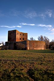
Limburg
| Castle | Location | Image |
|---|---|---|
| Baarlo Castle | Maasbree Maasbree Maasbree is a former municipality and a town in southeastern Netherlands. Until 1818, the municipality was just called "Bree".- History :In the Middle Ages Maasbree and Baarlo belonged to the duchy of Guelders. Around 1702, at the time of the War of the Spanish Succession Maasbree was occupied by... , Limburg Limburg (Netherlands) Limburg is the southernmost of the twelve provinces of the Netherlands. It is located in the southeastern part of the country and bordered by the province of Gelderland to the north, Germany to the east, Belgium to the south and part of the west, andthe Dutch province of North Brabant partly to... 51°19′44"N 6°05′58"E |
|
| Bleijenbeek Castle Kasteel Bleijenbeek The Castle Bleijenbeek is situated in the small hamlet Bleijenbeek in the Dutch province of Limburg.The Castle Bleijenbeek is a ruin since the bombartment by the alies on 21 and 22 february 1945. According to the 19th century historian A.J. van der Aa, the castle is known for the numerous sieges... |
Bleijenbeek Bleijenbeek Bleijenbeek is a small hamlet in the Dutch province of Limburg. It is located in the municipality of Bergen, about 2 km east of Afferden.... , Limburg Limburg (Netherlands) Limburg is the southernmost of the twelve provinces of the Netherlands. It is located in the southeastern part of the country and bordered by the province of Gelderland to the north, Germany to the east, Belgium to the south and part of the west, andthe Dutch province of North Brabant partly to... 51°38′06"N 6°03′05"E |
|
| Genhoes Castle | Oud-Valkenburg Oud-Valkenburg Oud-Valkenburg is a village in the Dutch province of Limburg. It is located in the municipality of Valkenburg aan de Geul, and has about 130 inhabitants.Oud-Valkenburg was a separate municipality until 1940, when it was merged with Valkenburg... , Limburg Limburg (Netherlands) Limburg is the southernmost of the twelve provinces of the Netherlands. It is located in the southeastern part of the country and bordered by the province of Gelderland to the north, Germany to the east, Belgium to the south and part of the west, andthe Dutch province of North Brabant partly to... 50°51′20"N 5°51′22"E |
|
| Hoensbroek Castle Hoensbroek Castle Castle Hoensbroek or Gebrookhoes is one of the largest castles in the Netherlands. It is situated in Hoensbroek, a town in the province of Limburg. This imposing watercastle is known as 'the most lordly stronghold between Rhine and Meuse'... |
Hoensbroek Hoensbroek Hoensbroek is a Dutch town in the municipality of Heerlen. It is situated in the southeast of Limburg, a province in the southeast of the Netherlands. Until 1982, Hoensbroek was a separate municipality.... , Limburg Limburg (Netherlands) Limburg is the southernmost of the twelve provinces of the Netherlands. It is located in the southeastern part of the country and bordered by the province of Gelderland to the north, Germany to the east, Belgium to the south and part of the west, andthe Dutch province of North Brabant partly to... 50°55′01"N 5°55′05"E |
|
| Landsfort Heerlen Landsfort Herle Landsfort Herle was a fortification with moat in, what now is, the centre of Heerlen , it was probably built by the counts van Ahr-Hochstaden . The name Landsfort comes from the fact that the fortification come under the responsibility of the land... |
Heerlen Heerlen Heerlen is a city and a municipality in the southeastern Netherlands. The municipality is the second largest in the province of Limburg. It forms part of Parkstad Limburg, , an agglomeration of about 220,000 inhabitants.After its early Roman beginnings and a rather modest medieval period, Heerlen... , Limburg Limburg (Netherlands) Limburg is the southernmost of the twelve provinces of the Netherlands. It is located in the southeastern part of the country and bordered by the province of Gelderland to the north, Germany to the east, Belgium to the south and part of the west, andthe Dutch province of North Brabant partly to... 50°53′16"N 5°58′49"E |
 |
| Jansgeleen Castle | Spaubeek Spaubeek Spaubeek is a village in the Dutch province of Limburg. It is located in the municipality of Beek, about 3 km south of the town of Geleen.Spaubeek was a separate municipality until 1982, when it was merged with Beek.-Jansgeleen Castle :... , Limburg Limburg (Netherlands) Limburg is the southernmost of the twelve provinces of the Netherlands. It is located in the southeastern part of the country and bordered by the province of Gelderland to the north, Germany to the east, Belgium to the south and part of the west, andthe Dutch province of North Brabant partly to... 50°56′00"N 5°51′00"E |
 |
| Mheer Castle | Mheer Mheer Mheer is a village in the Dutch province of Limburg. It is located in the municipality of Margraten, about 12 km southeast of Maastricht.... , Limburg Limburg (Netherlands) Limburg is the southernmost of the twelve provinces of the Netherlands. It is located in the southeastern part of the country and bordered by the province of Gelderland to the north, Germany to the east, Belgium to the south and part of the west, andthe Dutch province of North Brabant partly to... 50°46′49"N 5°47′27"E |
|
| Rivieren Castle | Voerendaal Voerendaal - Population centres :Barrier, Colmont, Craubeek, Dolberg, Eyserheide, Fromberg, Heek, Hellebeuk, Klimmen, Koulen, Kunrade, Mingersberg, Opscheumer, Overheek, Ransdaal, Retersbeek, Termaar, Termoors, Ubachsberg, Voerendaal, Weustenrade, Winthagen.-History:... , Limburg Limburg (Netherlands) Limburg is the southernmost of the twelve provinces of the Netherlands. It is located in the southeastern part of the country and bordered by the province of Gelderland to the north, Germany to the east, Belgium to the south and part of the west, andthe Dutch province of North Brabant partly to... 50°53′50"N 5°55′28"E |
|
| Schaloen Castle | Oud-Valkenburg Oud-Valkenburg Oud-Valkenburg is a village in the Dutch province of Limburg. It is located in the municipality of Valkenburg aan de Geul, and has about 130 inhabitants.Oud-Valkenburg was a separate municipality until 1940, when it was merged with Valkenburg... , Limburg Limburg (Netherlands) Limburg is the southernmost of the twelve provinces of the Netherlands. It is located in the southeastern part of the country and bordered by the province of Gelderland to the north, Germany to the east, Belgium to the south and part of the west, andthe Dutch province of North Brabant partly to... 50°51′25"N 5°51′03"E |
|
| Valkenburg castle Valkenburg castle -History:In the year 1115, fortifications were erected at the site by Gosewijn I, Lord of Valkenburg. This original wooden keep survived until 1122 when it was destroyed under siege by Henry V, Holy Roman Emperor. The castle was rebuilt in the following centuries but was again destroyed in a siege,... |
Valkenburg aan de Geul Valkenburg aan de Geul Valkenburg aan de Geul is a municipality in the southeastern Netherlands.-History:Siege and conquest were characteristic of the history of Valkenburg. Each event is withheld, followed by subsequent restorations. This most definitely holds for the castle perched atop of a hill in the middle of the... , Limburg Limburg (Netherlands) Limburg is the southernmost of the twelve provinces of the Netherlands. It is located in the southeastern part of the country and bordered by the province of Gelderland to the north, Germany to the east, Belgium to the south and part of the west, andthe Dutch province of North Brabant partly to... 50°51′43"N 5°49′52"E |
|
| Wittem Castle | Wittem Wittem Wittem is a small village in the Dutch province of Limburg. It is located in the municipality of Gulpen-Wittem.Wittem was a separate municipality until 1999, when it merged with Gulpen.-External links: Map of the former municipality, around 1868.... , Limburg Limburg (Netherlands) Limburg is the southernmost of the twelve provinces of the Netherlands. It is located in the southeastern part of the country and bordered by the province of Gelderland to the north, Germany to the east, Belgium to the south and part of the west, andthe Dutch province of North Brabant partly to... 50°48′50"N 5°54′36"E |
See also
- List of castles
- List of stinsen in FrieslandStinsA stins is a former stronghold or villa in the province of Friesland, the Netherlands. Many stinsen carry the name "state."...
- List of manors in Utrecht
External links
- Castles in the Netherlands (in DutchDutch languageDutch is a West Germanic language and the native language of the majority of the population of the Netherlands, Belgium, and Suriname, the three member states of the Dutch Language Union. Most speakers live in the European Union, where it is a first language for about 23 million and a second...
) - Castles and Country seats in Holland and Zeeland
- Castles in Overijssel (in DutchDutch languageDutch is a West Germanic language and the native language of the majority of the population of the Netherlands, Belgium, and Suriname, the three member states of the Dutch Language Union. Most speakers live in the European Union, where it is a first language for about 23 million and a second...
) - Castles in Gelderland (in DutchDutch languageDutch is a West Germanic language and the native language of the majority of the population of the Netherlands, Belgium, and Suriname, the three member states of the Dutch Language Union. Most speakers live in the European Union, where it is a first language for about 23 million and a second...
)