

List of bus routes in Westchester County, New York
Encyclopedia
.jpg)
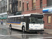
Bee-Line Bus System
The Bee-Line Bus System, branded on the buses in lowercase as the bee-line system, is a bus system serving Westchester County, New York. The system is owned by the County's Department of Public Works and Transportation and operated, on contract , by Yonkers-based Liberty Lines Transit, Inc...
, the bus system for Westchester County
Westchester County, New York
Westchester County is a county located in the U.S. state of New York. Westchester covers an area of and has a population of 949,113 according to the 2010 Census, residing in 45 municipalities...
, operates a network of bus routes throughout Westchester County, serving destinations throughout much of the county and parts of The Bronx
The Bronx
The Bronx is the northernmost of the five boroughs of New York City. It is also known as Bronx County, the last of the 62 counties of New York State to be incorporated...
in New York City
New York City
New York is the most populous city in the United States and the center of the New York Metropolitan Area, one of the most populous metropolitan areas in the world. New York exerts a significant impact upon global commerce, finance, media, art, fashion, research, technology, education, and...
. Even though not used officially by Bee-Line, routes tend to be identified with a "W" prefix (ex: W60), akin to the routing system in New York City. The process is most evident at bus stops in The Bronx. The route system is considered official, as usage by the MTA and New York City government in various media, would suggest. These routes are listed below.
This table gives details for the Bee Line routes. For details on non Bee Line routes see the following articles:
- List of bus routes in the Bronx: Bx16
- List of express and multi-borough bus routes in New York City: BxM3
- Connecticut Transit StamfordConnecticut Transit StamfordConnecticut Transit Stamford is the division of Connecticut Transit for the Stamford, area. In Stamford it provides service on 18 routes around Stamford, Connecticut, with routes centered around downtown Stamford and providing local bus service to Norwalk, White Plains, New York via the I-Bus, and...
: I-BUS
Local
These lines provide local bus transit throughout Westchester County. Routes operating into the Bronx are express service except where noted.Destinations shown are for the full route except for route branching. Some trips may only serve a portion of the route.
| Route | Terminals | Major streets traveled | Notes | |||
|---|---|---|---|---|---|---|
| 1 | 1 (full-time) |
Van Cortlandt Park – 242 St. Broadway ( train) |
↔ | Yonkers Yonkers, New York Yonkers is the fourth most populous city in the state of New York , and the most populous city in Westchester County, with a population of 195,976... 1200 block of Warburton Avenue (just before city line) |
Broadway Warburton Avenue Saw Mill River Road New York State Route 9A New York State Route 9A is a state highway in the vicinity of New York City, New York, United States. Its southern terminus is at the northern end of the Brooklyn–Battery Tunnel in New York City, where it intersects with both Interstate 478 and FDR Drive. The northern terminus of... |
|
| 1C (Weekdays only) |
↔ | Westchester Community College Westchester Community College Westchester Community College is a public, two-year community college in Valhalla, New York, sponsored by Westchester County, New York, and the State University of New York . The college is one of 30 community colleges affiliated with SUNY.... |
Broadway Warburton Avenue Saw Mill River Road New York State Route 9A New York State Route 9A is a state highway in the vicinity of New York City, New York, United States. Its southern terminus is at the northern end of the Brooklyn–Battery Tunnel in New York City, where it intersects with both Interstate 478 and FDR Drive. The northern terminus of... |
|||
| 1T (Weekdays only) |
↔ | Tarrytown Railroad Station Tarrytown (Metro-North station) The Tarrytown Metro-North Railroad station serves residents of Tarrytown, New York and other commuters via the Hudson Line and is one of four express stations on that line south of Croton–Harmon seeing most trains minus peak hour trains to/from Poughkeepsie. Trains leave for New York City every 25... Depot Plaza |
Broadway Warburton Avenue |
|||
| 1W (No Sunday service) |
↔ | White Plains White Plains, New York White Plains is a city and the county seat of Westchester County, New York, United States. It is located in south-central Westchester, about east of the Hudson River and northwest of Long Island Sound... -City Center |
Broadway Warburton Avenue Tarrytown Road New York State Route 119 New York State Route 119 is an east–west state highway in Westchester County, New York, in the United States. The road starts in Tarrytown at an intersection with U.S. Route 9 and comes to an end at a junction with NY 22 in White Plains... |
|||
| 2 | Van Cortlandt Park – 242 St. ( train) |
↔ | South Westchester Executive Park | Broadway Park Avenue |
|
|
| 4 | Bedford Park Blvd. – Lehman College Bedford Park Boulevard ( train) |
↔ | Yonkers-Getty Square Hudson Street |
McLean Avenue Broadway |
||
| 5 | Yonkers-Getty Square Riverdale Avenue |
↔ | Harrison Harrison, New York Harrison is a village and town in Westchester County, New York, United States, located approximately northeast of Manhattan. The population was 27,472 at the 2010 census.-Establishment:... Oakland Avenue and Halstead Avenue |
Nepperhan Avenue Saw Mill River Road New York State Route 9A New York State Route 9A is a state highway in the vicinity of New York City, New York, United States. Its southern terminus is at the northern end of the Brooklyn–Battery Tunnel in New York City, where it intersects with both Interstate 478 and FDR Drive. The northern terminus of... Tarrytown Road North Street New York State Route 127 New York State Route 127 is a long north–south state highway in Westchester County, New York, from the village of Mamaroneck to the city of White Plains, New York.-Route description:... |
|
|
| 6 | 6 | Yonkers Railroad Station Yonkers (Metro-North station) The Yonkers Metro-North Railroad station serves the downtown area of Yonkers, New York via the Hudson Line. It is one of four express stations on that line south of Croton–Harmon. Trains leave for New York City every 25 to 35 minutes on weekdays. It is 14.4 miles from Grand Central Terminal in... Nepperhan Plaza |
↔ | Pleasantville Railroad Station Pleasantville (Metro-North station) The Pleasantville Metro-North Railroad station serves the residents of Pleasantville, New York, via the Harlem Line. Trains leave or arrive approximately every 20 minutes during peak periods, hourly otherwise. It is 30.5 miles from Grand Central Terminal and the average travel time to Grand Central... Bedford Road and Wheeler Avenue |
Broadway Dobbs Ferry Road New York State Route 100B New York State Route 100B is a spur route of NY 100 in Westchester County, New York, in the United States. The route crosses the southern part of the town of Greenburgh, connecting NY 9A to NY 119. It does not directly connect to NY 100; however, it intersects... Columbus Avenue |
|
| 6U (Weekdays only) |
Yonkers Railroad Station Yonkers (Metro-North station) The Yonkers Metro-North Railroad station serves the downtown area of Yonkers, New York via the Hudson Line. It is one of four express stations on that line south of Croton–Harmon. Trains leave for New York City every 25 to 35 minutes on weekdays. It is 14.4 miles from Grand Central Terminal in... Nepperhan Plaza |
↔ | Pleasantville Railroad Station Pleasantville (Metro-North station) The Pleasantville Metro-North Railroad station serves the residents of Pleasantville, New York, via the Harlem Line. Trains leave or arrive approximately every 20 minutes during peak periods, hourly otherwise. It is 30.5 miles from Grand Central Terminal and the average travel time to Grand Central... Bedford Road and Wheeler Avenue |
Broadway Farragut Parkway Dobbs Ferry Road New York State Route 100B New York State Route 100B is a spur route of NY 100 in Westchester County, New York, in the United States. The route crosses the southern part of the town of Greenburgh, connecting NY 9A to NY 119. It does not directly connect to NY 100; however, it intersects... Columbus Avenue |
||
| 7 | Yonkers-Getty Square Riverdale Avenue |
↔ | New Rochelle Transportation Center New Rochelle (Metro-North station) The New Rochelle station serves New Rochelle, New York, via the New Haven Line. Amtrak's Northeast Regional also stops at the station en route to Boston and Washington, DC, serving riders from northern New York City and Southern Westchester who use New Rochelle as a closer alternative to Penn... |
Yonkers Avenue Lincoln Avenue |
|
|
| 8 (No Sunday service) |
Tuckahoe Railroad Station Tuckahoe (Metro-North station) The Tuckahoe Metro-North Railroad station serves the residents of the village of Tuckahoe, New York via the Harlem Line. It is 16 miles from Grand Central Terminal.... Depot Square |
↔ | College of Mt. St. Vincent College of Mount Saint Vincent For the university in Halifax, Nova Scotia, see Mount Saint Vincent University The College of Mount Saint Vincent is a Catholic liberal arts college located in the northeast corner of the Riverdale section of The Bronx, New York, adjacent to the Yonkers border. It is the northernmost location in... Riverdale Avenue and New York City line |
Riverdale Avenue Tuckahoe Road |
|
|
| 9 (Weekdays only) |
Yonkers Railroad Station Nepperhan Plaza |
↔ | South Westchester Executive Park | Palisade Avenue/North Broadway (northbound) Nepperhan Avenue (southbound) |
||
| 12 | White Plains Transcenter White Plains (Metro-North station) The White Plains Metro-North Railroad station serves the residents of White Plains, New York via the Harlem Line. It is 22.3 miles from Grand Central Terminal, and the average travel time varies between 30 and 44 minutes... Lane B |
↔ | Armonk Armonk, New York Armonk is a hamlet and census-designated place located in the town of North Castle in Westchester County, New York. As of the 2010 census, the CDP population was 4,330.... Village Hall |
Westchester Avenue Purchase Street Anderson Hill Road King Street New York State Route 120A New York State Route 120A is a state highway in southern Westchester County, New York, in the United States. It serves as an alternate route to the southern half of NY 120 running along the New York–Connecticut state line. The southern terminus of route is at NY 120 in Harrison. Its... |
|
|
| 13 | 13 | Port Chester Railroad Station Port Chester (Metro-North station) Not to be confused with Portchester railway station in Portchester, Fareham in the UKThe Port Chester Metro-North Railroad station serves Port Chester, New York via the New Haven Line. The station is the last station on the line in New York before crossing into Connecticut... Westchester Avenue |
↔ | Ossining Ossining (village), New York Ossining is a village in Westchester County, New York, United States. The population was 25,060 at the 2010 census. As a village, it is located in the Town of Ossining.-Geography:Ossining borders the eastern shores of the widest part of the Hudson River.... Railroad Station Ossining (Metro-North station) The Ossining Metro-North Railroad station serves residents of Ossining, New York via the Hudson Line and is one of four express stations on that line south of Croton–Harmon seeing most trains minus peak hour trains to/from Poughkeepsie. Trains leave for New York City every 25 to 35 minutes on... and Ferry Terminal |
Westchester Avenue Tarrytown Road/White Plains Road Broadway |
|
| 13B (No Sunday service) |
Port Chester Railroad Station Port Chester (Metro-North station) Not to be confused with Portchester railway station in Portchester, Fareham in the UKThe Port Chester Metro-North Railroad station serves Port Chester, New York via the New Haven Line. The station is the last station on the line in New York before crossing into Connecticut... Westchester Avenue |
↔ | Ossining Railroad Station and Ferry Terminal | Westchester Avenue Tarrytown Road Benedict Avenue Broadway |
||
| 14 | White Plains City Center |
↔ | Cortlandt Town Center | Tarrytown Road Saw Mill River Road Albany Post Road Riverside Avenue Westchester Avenue Washington Street Main Street U.S. Route 6 U.S. Route 6 , also called the Grand Army of the Republic Highway, a name that honors an American Civil War veterans association, is a main route of the U.S. Highway system, running east-northeast from Bishop, California to Provincetown, Massachusetts. Until 1964, it continued south from Bishop to... |
|
|
| 15 (No Sunday service) |
White Plains City Center |
↔ | Peekskill Peekskill, New York Peekskill is a city in Westchester County, New York. It is situated on a bay along the east side of the Hudson River, across from Jones Point.This community was known to be an early American industrial center, primarily for its iron plow and stove products... Police Station |
Knollwood Road New York State Route 100A New York State Route 100A is a long loop route of NY 100 in the town of Greenburgh . It starts in the hamlet of Hartsdale and ends in the community of Grasslands at the boundary between the towns Greenburgh and Mount Pleasant.-Route description:NY 100A splits from NY 100 along... Saw Mill River Road Crompond Road |
|
|
| 16 | Mahopac Mahopac, New York Mahopac, New York, is a hamlet in the Town of Carmel in Putnam County, New York. An exurb of New York City some to the south, Mahopac is located on US Route 6 on the County's southern central border with Westchester County... Village Centre |
↔ | Hudson Valley Hospital Center (except rush hours) |
Route 6 Oregon Road Division Street |
Somers, New York Somers is a town located in northeastern Westchester County, New York, United States. As of the 2010 census, the town had a population of 20,434... . |
|
| Peekskill Railroad Station Peekskill (Metro-North station) The Peekskill Metro-North Railroad station serves residents of Peekskill, New York via the Hudson Line. Trains leave for New York City every hour on weekdays and about every 25 minutes during rush hour. It is from Grand Central Terminal and travel time to Grand Central is approximately one hour... Railroad Avenue |
||||||
| 19 (No Sunday service) |
Ossining Ossining (village), New York Ossining is a village in Westchester County, New York, United States. The population was 25,060 at the 2010 census. As a village, it is located in the Town of Ossining.-Geography:Ossining borders the eastern shores of the widest part of the Hudson River.... Railroad Station Ossining (Metro-North station) The Ossining Metro-North Railroad station serves residents of Ossining, New York via the Hudson Line and is one of four express stations on that line south of Croton–Harmon seeing most trains minus peak hour trains to/from Poughkeepsie. Trains leave for New York City every 25 to 35 minutes on... and Ferry Terminal |
↔ | Katonah Railroad Station Katonah (Metro-North station) The Katonah Metro-North Railroad station serves the residents of the Westchester County village of Katonah, New York, via the Harlem Line. It is 41.2 miles from Grand Central Terminal and the average travel time to Grand Central is one hour, six minutes.This station is located in the Zone 6... Katonah Avenue and Jay Street |
Pleasantville Road Bedford Road New York State Route 117 New York State Route 117 is a 15.57 mile long state highway in Westchester County, New York, United States. The southern terminus of the route is at U.S. Route 9 north of the village of Sleepy Hollow. The northern terminus is at the Saw Mill River Parkway south of Katonah, a hamlet... |
|
|
| 20 | Bedford Park Blvd. – Lehman College Bedford Park Boulevard ( train) |
↔ | White Plains City Center |
Central Park Avenue New York State Route 100 New York State Route 100 is a major north–south state highway in Westchester County, New York, in the United States. It begins parallel to Interstate 87 at a junction with the Cross County Parkway in the city of Yonkers and runs through most of the length of the county via the city of... |
Macy's Macy's is a U.S. chain of mid-to-high range department stores. In addition to its flagship Herald Square location in New York City, the company operates over 800 stores in the United States... . |
|
| 25 | Yonkers Railroad Station Nepperhan Plaza |
↔ | Nereid Avenue – 238 St. Nereid Avenue ( trains) |
Midland Avenue Kimball Avenue |
|
|
| 26 (No Sunday service) |
Bronxville Railroad Station Bronxville (Metro-North station) The Bronxville Metro-North Railroad station serves the residents of the village of Bronxville, New York via the Harlem Line. It is 15.3 miles from Grand Central Terminal.... Palmer Avenue |
↔ | Nereid Avenue – 238 St. Nereid Avenue ( trains) |
Bronx River Road |
|
|
| 30 (No Sunday service) |
Yonkers-Getty Square Riverdale Avenue |
↔ | New Rochelle Transportation Center | Palmer Road Pondfield Road Webster Avenue |
|
|
| 32 (Weekdays only) |
Yonkers Railroad Station Nepperhan Plaza |
→ | Yonkers Railroad Station Nepperhan Plaza |
Rumsey Road (southbound) Hawthorne Avenue (northbound) |
|
|
| 40 | Westchester Medical Center | ↔ | Mount Vernon Mount Vernon, New York Mount Vernon is a city in Westchester County, New York, United States. It lies on the border of the New York City borough of The Bronx.-Overview:... Prospect Plaza |
Hillside Avenue White Plains Road |
|
|
| 42 | New Rochelle Transportation Center | ↔ | 233 Street subway station 233rd Street (IRT White Plains Road Line) 233rd Street is a local station on the IRT White Plains Road Line of the New York City Subway. It is located in the Bronx at the intersection of 233rd Street and White Plains Road. It is served by the 2 train at all times and the 5 train during rush hours in the peak direction.This elevated... East 233 Street ( trains) |
West 1 Street Pelhamdale Avenue |
Sound Shore Medical Center Sound Shore Medical Center is a community-based, teaching hospital affiliated with New York Medical College, located at 16 Guion Place in New Rochelle, New York... in New Rochelle. |
|
| 45 | 45 | Pelham Bay Park Pelham Bay Park (IRT Pelham Line) Pelham Bay Park is the northern terminal station of the IRT Pelham Line of the New York City Subway. Located by Pelham Bay Park, at the intersection of the Bruckner Expressway and Westchester Avenue in the Bronx, it is served by the 6 train at all times except weekdays in the peak direction and... Bruckner Boulevard ( trains) |
↔ | Eastchester Mill Road and White Plains Road |
Pelham Road North Avenue |
|
| 45Q (Rush hours only) |
New Rochelle Main Street and Church Avenue |
↔ AM ---- ↔ PM |
Scarsdale Pine Brook Boulevard and Stratton Road. |
North Avenue Pine Brook Boulevard |
||
| 52 (No Sunday service) |
Bronxville Railroad Station Palmer Avenue |
↔ | Bronx The Bronx The Bronx is the northernmost of the five boroughs of New York City. It is also known as Bronx County, the last of the 62 counties of New York State to be incorporated... Secor Housing |
Gramatan Avenue South Fifth Avenue |
|
|
| 53 (Rush hours only) |
Mount Vernon East Railroad Station North side |
↔ | Mount Vernon High School | East 3 Street Fifth Avenue (Pelham) |
|
|
| 54 (Rush hours only) |
Mount Vernon East Railroad Station North side |
↔ | Mount Vernon Sandford Avenue and Fulton Avenue |
South 11 Avenue Sandford Boulevard |
|
|
| 55 | Cross County Shopping Center Cross County Shopping Center Cross County Shopping Center, also known as Cross County Center is an open-air shopping mall located in Yonkers, New York, United States. Over 100 stores and restaurants are featured in the mall, including anchor stores Macy's, Old Navy and Sears. The mall is managed by Macerich.-History:Cross... Macy's |
↔ | Eastchester – Dyre Ave. Light Street ( trains) |
Terrace Avenue South Columbus Avenue |
||
| 60 | Fordham Fordham, Bronx Fordham is a neighborhood of New York City, United States, located in the West Bronx. The neighborhood is part of Bronx Community Board 5. It is bordered by Fordham Road to the north, Webster Avenue to the east, East 183rd Street to the south, and Jerome Avenue to the west... Fordham Road and Tiebout Avenue |
↔ | White Plains Transcenter Lane B |
Boston Road Palmer Avenue Mamaroneck Avenue |
|
|
| 61 (no Sunday service) |
Fordham Fordham Road and Tiebout Avenue |
↔ | Port Chester Port Chester, New York Port Chester is a village in Westchester County, New York, United States. The village is part of the town of Rye. As of the 2010 census, Port Chester had a population of 28,967... Willett Avenue and Putnam Avenue |
Boston Road Fifth Avenue Halstead Avenue |
|
|
| 63 | 63 (No Sunday service) |
White Plains Transcenter Lane B |
↔ | Scarsdale Railroad Station Scarsdale (Metro-North station) The Scarsdale Metro-North Railroad station serves the residents of Scarsdale, New York via the Harlem Line. It is 19 miles from Grand Central Terminal. Scarsdale is the southernmost station on the two-track section of the Harlem Line; a third track begins to the south... East side |
Old Mamaroneck Road Palmer Avenue Popham Road |
|
| 63C (Weekdays only) |
White Plains Transcenter Lane B |
↔ | Scarsdale Railroad Station Scarsdale (Metro-North station) The Scarsdale Metro-North Railroad station serves the residents of Scarsdale, New York via the Harlem Line. It is 19 miles from Grand Central Terminal. Scarsdale is the southernmost station on the two-track section of the Harlem Line; a third track begins to the south... East side |
Old Mamaroneck Road Crossways Popham Road |
||
| 63G (Weekdays only) |
White Plains Transcenter Lane B |
↔ | Scarsdale Railroad Station Scarsdale (Metro-North station) The Scarsdale Metro-North Railroad station serves the residents of Scarsdale, New York via the Harlem Line. It is 19 miles from Grand Central Terminal. Scarsdale is the southernmost station on the two-track section of the Harlem Line; a third track begins to the south... East side |
Brook Street Harney Road Garth Road Scarsdale Avenue |
||
| 66 (Weekdays only) |
Mercy College Mercy College (New York) Mercy College is a private, non-profit liberal arts college with its main campus in Dobbs Ferry, New York, and satellite locations throughout southeastern New York, including the Bronx, Manhattan, White Plains and Yorktown... |
↔ | New Rochelle Transportation Center | Ashford Avenue Ardsley Road Weaver Street Palmer Avenue |
Dobbs Ferry (Metro-North station) The Dobbs Ferry Metro-North Railroad station serves residents of Dobbs Ferry, New York via the Hudson Line. Trains leave for New York City every 25 to 35 minutes on weekday rush-hour . Trains run hourly during non-peak times, and on weekends and holidays... . |
|
| 76 (No Sunday service except summer) |
Port Chester Kohl's Kohl's Kohl's Corporation is an American department store chain headquartered in the Milwaukee suburb of Menomonee Falls, Wisconsin, operating , 1,089 stores in 49 states. In 1998, it entered the S&P 500 list, and is also listed in the Fortune 500... Plaza |
↔ | Rye Rye (city), New York Rye is a city in Westchester County, New York, United States. It is separate from the town of Rye, which is larger than the city. Rye city, formerly the village of Rye, was part of the town until 1942, when it received its charter as a city, the most recent to be issued in New York... -Milton Point Forest Avenue and Van Wagenen Avenue |
South Regent Street Midland Avenue Milton Road (to Milton Point) Forest Avenue (to Port Chester) Playland Playland (New York) Playland, often called Rye Playland and also known as Playland Amusement Park, is an amusement park located in Rye, New York. Run by Westchester County, it is the only government owned-and-operated amusement park in the United States.-History:... |
|
|
| 78 | Yonkers-Getty Square Broadway |
↔ | Stew Leonard's Stew Leonard's Stew Leonard's is chain of four supermarkets in Connecticut and New York which Ripley's Believe It or Not! deemed "The World's Largest Dairy", with Fortune Magazine listing Stew Leonard's as one of the "100 Best Companies to Work For"."Anyone who comes from Connecticut or thereabouts knows this... |
Tuckahoe Road |
|
|
Express
Routes run during peak hours only unless otherwise indicated. The local bus fare is charged on these routes, and all types of MetroCard are accepted (except for AirTrain MetroCards).| Route | Terminals | Major Streets | Notes | ||
|---|---|---|---|---|---|
| 1X | Van Cortlandt Park – 242 St. Broadway ( train) |
→ AM ---- ← PM |
SUNY WCC Westchester Community College Westchester Community College is a public, two-year community college in Valhalla, New York, sponsored by Westchester County, New York, and the State University of New York . The college is one of 30 community colleges affiliated with SUNY.... & Westchester County Medical Center |
Broadway New York State Thruway |
|
| 3 | Van Cortlandt Park – 242 St. Broadway ( train) |
→ AM ---- ← PM |
Purchase Purchase, New York Purchase, New York is a hamlet of the town of Harrison, in Westchester County. Its ZIP code is 10577. Its name is derived from Harrison's purchase, for Harrison could have as much land as he could ride in one day... MasterCard headquarters |
Broadway Sprain Brook Parkway Westchester Avenue |
|
| 11 | Croton-Harmon Railroad Station Croton-Harmon (Metro-North station) The Croton–Harmon Metro-North Railroad station serves the residents of Croton-on-Hudson, New York via the Hudson Line. It is the main transfer point between the Hudson Line's local and express service, and it is also served by almost all Amtrak trains on the line. Metro-North trains leave for New... |
→ AM ---- ← PM |
White Plains City Center |
Saw Mill River Road Highland Avenue |
Westchester County Center Westchester County Center is a 5,000-seat multi-purpose arena in White Plains, New York. It hosts various local concerts and sporting events for the area.... . |
| 17 | Cortlandt Town Center | → AM ---- ← PM |
White Plains City Center |
Route 9A |
|
| 21 | Bedford Park Blvd.-Lehman College | ↔ AM ---- ↔ PM |
White Plains City Center |
Central Park Avenue New York State Route 100 New York State Route 100 is a major north–south state highway in Westchester County, New York, in the United States. It begins parallel to Interstate 87 at a junction with the Cross County Parkway in the city of Yonkers and runs through most of the length of the county via the city of... |
Cross County Shopping Center Cross County Shopping Center, also known as Cross County Center is an open-air shopping mall located in Yonkers, New York, United States. Over 100 stores and restaurants are featured in the mall, including anchor stores Macy's, Old Navy and Sears. The mall is managed by Macerich.-History:Cross... ) PM and early weekday evenings. Cross County Shopping Center Cross County Shopping Center, also known as Cross County Center is an open-air shopping mall located in Yonkers, New York, United States. Over 100 stores and restaurants are featured in the mall, including anchor stores Macy's, Old Navy and Sears. The mall is managed by Macerich.-History:Cross... . Cross County Shopping Center Cross County Shopping Center, also known as Cross County Center is an open-air shopping mall located in Yonkers, New York, United States. Over 100 stores and restaurants are featured in the mall, including anchor stores Macy's, Old Navy and Sears. The mall is managed by Macerich.-History:Cross... during AM rush hours (both directions) and PM rush hours southbound. |
| 27 | Hawthorne Hawthorne, New York Hawthorne is an unincorporated hamlet and census-designated place located in the town of Mount Pleasant in Westchester County, New York. The population was 4,586 at the 2010 census.-History:... Mid-Westchester Executive Park |
← AM ---- → PM |
White Plains City Center |
Saw Mill River Road |
|
| 41 | Westchester Medical Center | ← AM ---- → PM |
Wakefield – 241 St. ( train) |
Hillside Avenue White Plains Road |
|
| 43 | Westchester Medical Center | ← AM ---- → PM |
Wakefield – 241 St. ( train) |
Sprain Brook Parkway Sprain Brook Parkway The Sprain Brook Parkway is a long north–south parkway in Westchester County, New York. It is one of the newest and most modern parkways in Westchester County, adopting many ideas and improvements developed during decades of statewide highway construction. The southern terminus is at the... White Plains Road |
|
| 62 | Fordham Fordham, Bronx Fordham is a neighborhood of New York City, United States, located in the West Bronx. The neighborhood is part of Bronx Community Board 5. It is bordered by Fordham Road to the north, Webster Avenue to the east, East 183rd Street to the south, and Jerome Avenue to the west... |
→ AM ---- ← PM |
White Plains White Plains (Metro-North station) The White Plains Metro-North Railroad station serves the residents of White Plains, New York via the Harlem Line. It is 22.3 miles from Grand Central Terminal, and the average travel time varies between 30 and 44 minutes... Transcenter |
Boston Road New England Thruway Westchester Avenue |
|
| 77 | Carmel Carmel, New York Carmel is a town located in Putnam County, New York, USA. As of the 2000 census, the town had a total population of 36,465.There are no incorporated villages in the town, although the hamlets of Carmel and Mahopac each have populations sizable enough to be thought of as villages.The Town of Carmel... Carmel Bowl at Putnam Plaza |
→ AM ---- ← PM |
White Plains City Center |
Taconic State Parkway Routes 132 and 6 |
|
Westchester-Manhattan Express
| Route | Terminals | Major streets traveled | Notes | ||
|---|---|---|---|---|---|
| BxM4C | White Plains Central Avenue and Harding Avenue |
→ AM ---- ← PM |
Manhattan Manhattan Manhattan is the oldest and the most densely populated of the five boroughs of New York City. Located primarily on the island of Manhattan at the mouth of the Hudson River, the boundaries of the borough are identical to those of New York County, an original county of the state of New York... Madison Square Madison Square Madison Square is formed by the intersection of Fifth Avenue and Broadway at 23rd Street in the New York City borough of Manhattan. The square was named for James Madison, fourth President of the United States and the principal author of the United States Constitution.The focus of the square is... and 23 Street |
Central Park Avenue Major Deegan Expressway 5 Avenue/Madison Avenue |
|
Commuter
These shuttle routes run between served communities and the indicated railroad station during rush hours only unless otherwise noted.| Route | Terminals (Station served/municipality of origin) |
Major streets traveled | Notes | ||
|---|---|---|---|---|---|
| 10 | Croton-Harmon Railroad Station | ← AM ---- → PM |
Cortlandt Cortlandt, New York Cortlandt is a town in Westchester County, New York, United States. The population was 41,592 at the 2010 census.The Town of Cortlandt is in the northwest part of the county... Town Center |
Crompond Road New York State Route 35 New York State Route 35 is the principal east–west highway in the northern part of Westchester County, New York, carrying average daily volumes of around 16,500 vehicles... Old Yorktown Road New York State Route 132 New York State Route 132 is a long state highway located entirely within the Town of Yorktown in Westchester County, New York. The route acts as a connector between U.S. Route 202 and NY 35 in the south and U.S. Route 6 in the north... |
|
| 18 | Peekskill Railroad Station | ↔ | Cortlandt Crompond Road/Conklin Street |
Crompond Road Main Street |
|
| 31 | Peekskill Railroad Station | → AM ---- ← PM |
Buchanan Buchanan, New York Buchanan is a village located in the town of Cortlandt in Westchester County, New York. The population was 2,230 as of the 2010 census.The Indian Point nuclear power plant is located in Buchanan.-Geography:Buchanan is located at .... Indian Point |
Lower South Street | |
| 34 | Hartsdale Railroad Station Hartsdale (Metro-North station) The Hartsdale Metro-North Railroad station serves the residents of Hartsdale, New York and Scarsdale, New York via the Harlem Line. It is 20.6 miles from Grand Central Terminal, and the average travel time varies between 42 and 48 minutes depending on if a train is local or express. The station... |
↔ | Greenburgh Greenburgh, New York Greenburgh is a town in the western part of Westchester County, New York, United States. The population was 88,400 at the 2010 census. Paul J. Feiner has been the Town Supervisor since 1991.-History:... Old Knollwood Road and Hartsdale Avenue |
Hartsdale Avenue | |
| 38 | Hartsdale Railroad Station | ↔ | Greenburgh Secor Road and Westway |
Hartsdale Avenue Secor Road |
|
| 39 | Hartsdale Railroad Station | ↔ | Ardsley Ardsley, New York Ardsley is a village in Westchester County, New York, United States. It is part of the town of Greenburgh. The village's population was 4,452 at the 2010 census. The current mayor of Ardsley is Jay Leon.... Ardsley Square |
Hartsdale Avenue Heatherdell Road |
|
| 64 | Scarsdale Railroad Station | ↔ | Scarsdale Scarsdale, New York Scarsdale is a coterminous town and village in Westchester County, New York, United States, in the northern suburbs of New York City. The Town of Scarsdale is coextensive with the Village of Scarsdale, but the community has opted to operate solely with a village government, one of several villages... Stratford Road |
Garth Road | |
| 65 | Scarsdale Railroad Station | ↔ | Greenburgh Highland Road and Longview Drive |
Ardsley Road | |
| 66 | Dobbs Ferry Dobbs Ferry (Metro-North station) The Dobbs Ferry Metro-North Railroad station serves residents of Dobbs Ferry, New York via the Hudson Line. Trains leave for New York City every 25 to 35 minutes on weekday rush-hour . Trains run hourly during non-peak times, and on weekends and holidays... |
← AM ---- ↔ PM |
Ardsley Ardsley Square |
Ashford Avenue Ogden Avenue |
|
| 70 | Larchmont Railroad Station Larchmont (Metro-North station) The Larchmont Metro-North Railroad station serves Larchmont, New York, via the New Haven Line. Though mostly served by Stamford-originating locals, Larchmont is also the last stop on some peak hour trains originating at Harrison.... |
→ | Larchmont Larchmont, New York Larchmont is a village in Westchester County, New York. The population was 5,864 at the 2010 census. It is located within the town of Mamaroneck, on the shore of Long Island Sound, northeast of Midtown Manhattan... loop |
Palmer Avenue Fenimore Road Rockland Avenue Rockingstone Avenue |
|
| 71 | Larchmont Railroad Station | ↔ | Larchmont Larchmont, New York Larchmont is a village in Westchester County, New York. The population was 5,864 at the 2010 census. It is located within the town of Mamaroneck, on the shore of Long Island Sound, northeast of Midtown Manhattan... Grove Avenue and Magnolia Avenue |
Larchmont Avenue Beech Avenue |
|
Shuttle Loops
These shuttle loop routes operate rush hours only, and operate from the White Plains Railroad StationWhite Plains (Metro-North station)
The White Plains Metro-North Railroad station serves the residents of White Plains, New York via the Harlem Line. It is 22.3 miles from Grand Central Terminal, and the average travel time varies between 30 and 44 minutes...
during the AM peak hours, and to it in the PM peak hours (except Loop A which operates in both directions to/from White Plains in the mid afternoons and PM rush hours).
| Shuttle Loop | Terminal | Major streets traveled | Notes |
|---|---|---|---|
| Loop A | Platinum Mile 777 Westchester Avenue |
Westchester Avenue |
|
| Loop B | Platinum Mile Westchester Corporate Park |
Westchester Avenue |
|
| Loop C | Rye Ridge Shopping Plaza | Cross-Westchester Expressway |
New York State Route 120 New York State Route 120 is a state highway in southern Westchester County, New York, United States. It begins in the city of Rye at an intersection with U.S. Route 1 and runs for about north to the hamlet of Millwood, where it ends at a junction with NY 100... . |
| Loop D | Platinum Mile Nine West |
Westchester Avenue |
|
| Loop F | Tarrytown Taxter Road |
Cross Westchester Expressway |
|
| Loop H | Armonk IBM IBM International Business Machines Corporation or IBM is an American multinational technology and consulting corporation headquartered in Armonk, New York, United States. IBM manufactures and sells computer hardware and software, and it offers infrastructure, hosting and consulting services in areas... |
Lake Street King Street |
|
Seasonal
These routes provide seasonal service to and from Playland (New York)Playland (New York)
Playland, often called Rye Playland and also known as Playland Amusement Park, is an amusement park located in Rye, New York. Run by Westchester County, it is the only government owned-and-operated amusement park in the United States.-History:...
.
There is no service on Mondays, excluding certain holidays.
| Route | Terminal | Major streets traveled | Notes |
|---|---|---|---|
| 75 (Summers Only) |
Rye Rye (Metro-North station) Rye is a Metro-North commuter rail station that serves Rye, New York via the New Haven Line. During the spring and summer months, the Playland amusement park is accessible from the station via the seasonal 75-Playland route on the Bee-Line Bus System; this service provides a sizeable source of... Railroad Station |
Playland Parkway New England Thruway |
|
| 76 |
Port Chester Kohl's Kohl's Kohl's Corporation is an American department store chain headquartered in the Milwaukee suburb of Menomonee Falls, Wisconsin, operating , 1,089 stores in 49 states. In 1998, it entered the S&P 500 list, and is also listed in the Fortune 500... Plaza |
South Regent Street Midland Avenue Milton Road (to Milton Point) Forest Avenue (to Port Chester) Playland Playland (New York) Playland, often called Rye Playland and also known as Playland Amusement Park, is an amusement park located in Rye, New York. Run by Westchester County, it is the only government owned-and-operated amusement park in the United States.-History:... |
|
| 91 (Summers Only) |
Yonkers Yonkers (Metro-North station) The Yonkers Metro-North Railroad station serves the downtown area of Yonkers, New York via the Hudson Line. It is one of four express stations on that line south of Croton–Harmon. Trains leave for New York City every 25 to 35 minutes on weekdays. It is 14.4 miles from Grand Central Terminal in... Railroad Station |
Yonkers Avenue South Fulton Avenue Sanford Boulevard Pelhamdale Avenue Boston Post Road New England Thruway |
|
Holiday schedule
| Holiday | Service level |
|---|---|
|
Saturday |
|
|
Sunday |
|
|
No service |