

List of Sites of Special Scientific Interest in the West Midlands
Encyclopedia
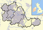
West Midlands (county)
The West Midlands is a metropolitan county in western central England with a 2009 estimated population of 2,638,700. It came into existence as a metropolitan county in 1974 after the passage of the Local Government Act 1972, formed from parts of Staffordshire, Worcestershire and Warwickshire. The...
, England
England
England is a country that is part of the United Kingdom. It shares land borders with Scotland to the north and Wales to the west; the Irish Sea is to the north west, the Celtic Sea to the south west, with the North Sea to the east and the English Channel to the south separating it from continental...
. , of the 23 designated sites, 11 have been designated due to their biological interest, 9 due to their geological interest, and 3 for both. In England, the body responsible for designating SSSIs is Natural England
Natural England
Natural England is the non-departmental public body of the UK government responsible for ensuring that England's natural environment, including its land, flora and fauna, freshwater and marine environments, geology and soils, are protected and improved...
, which chooses sites because of their flora
Plant
Plants are living organisms belonging to the kingdom Plantae. Precise definitions of the kingdom vary, but as the term is used here, plants include familiar organisms such as trees, flowers, herbs, bushes, grasses, vines, ferns, mosses, and green algae. The group is also called green plants or...
, fauna
Fauna
Fauna or faunæ is all of the animal life of any particular region or time. The corresponding term for plants is flora.Zoologists and paleontologists use fauna to refer to a typical collection of animals found in a specific time or place, e.g. the "Sonoran Desert fauna" or the "Burgess shale fauna"...
, geological
Geology
Geology is the science comprising the study of solid Earth, the rocks of which it is composed, and the processes by which it evolves. Geology gives insight into the history of the Earth, as it provides the primary evidence for plate tectonics, the evolutionary history of life, and past climates...
or physiographical features. Natural England took over the role of designating and managing SSSIs from English Nature
English Nature
English Nature was the United Kingdom government agency that promoted the conservation of wildlife, geology and wild places throughout England between 1990 and 2006...
in October 2006 when it was formed from the amalgamation of English Nature, parts of the Countryside Agency
Countryside Agency
The Countryside Agency in England was a statutory body set up in 1999 with the task of improving the quality of the rural environment and the lives of those living in it. The Agency was formed by merging the Countryside Commission and the Rural Development Commission...
and the Rural Development Service
Rural Development Service
The Rural Development Service was formerly part of the UK Government's Department for Environment, Food and Rural Affairs . It ceased to exist on 1 October 2006 following the creation of Natural England.- History :...
. Natural England, like its predecessor, uses the 1974-1996 county system
Metropolitan and non-metropolitan counties of England
Metropolitan and non-metropolitan counties are one of the four levels of subdivisions of England used for the purposes of local government outside Greater London. As originally constituted, the metropolitan and non-metropolitan counties each consisted of multiple districts, had a county council and...
with each area being called an Area of Search
Area of Search
Areas of Search are geographical areas used in the selection of Sites of Special Scientific Interest. In England these are largely based on the 1974–1996 administrative counties...
. In the West Midlands case, the Area of Search matches the county boundary.
The West Midlands is the second largest conurbation, after Greater London
Greater London
Greater London is the top-level administrative division of England covering London. It was created in 1965 and spans the City of London, including Middle Temple and Inner Temple, and the 32 London boroughs. This territory is coterminate with the London Government Office Region and the London...
, with a population of over 2.6 million inhabitants. Consisting of three large cities: Wolverhampton
Wolverhampton
Wolverhampton is a city and metropolitan borough in the West Midlands, England. For Eurostat purposes Walsall and Wolverhampton is a NUTS 3 region and is one of five boroughs or unitary districts that comprise the "West Midlands" NUTS 2 region...
, Birmingham
Birmingham
Birmingham is a city and metropolitan borough in the West Midlands of England. It is the most populous British city outside the capital London, with a population of 1,036,900 , and lies at the heart of the West Midlands conurbation, the second most populous urban area in the United Kingdom with a...
and Coventry
Coventry
Coventry is a city and metropolitan borough in the county of West Midlands in England. Coventry is the 9th largest city in England and the 11th largest in the United Kingdom. It is also the second largest city in the English Midlands, after Birmingham, with a population of 300,848, although...
, the county of West Midlands is also one of the most densely populated area in the United Kingdom
United Kingdom
The United Kingdom of Great Britain and Northern IrelandIn the United Kingdom and Dependencies, other languages have been officially recognised as legitimate autochthonous languages under the European Charter for Regional or Minority Languages...
. The result of this large human population is that every part of the area has been influenced by humans—often negatively—for example, the clearance of woodland to make room for agriculture. The West Midlands is an area of relatively high ground, ranging from around 500 feet (152 m) to 1000 feet (305 m) above sea level, forming the Birmingham Plateau. It is crossed by Britain's main north-south watershed
Water divide
A drainage divide, water divide, divide or watershed is the line separating neighbouring drainage basins...
between the basins of the Rivers Severn
River Severn
The River Severn is the longest river in Great Britain, at about , but the second longest on the British Isles, behind the River Shannon. It rises at an altitude of on Plynlimon, Ceredigion near Llanidloes, Powys, in the Cambrian Mountains of mid Wales...
and Trent
River Trent
The River Trent is one of the major rivers of England. Its source is in Staffordshire on the southern edge of Biddulph Moor. It flows through the Midlands until it joins the River Ouse at Trent Falls to form the Humber Estuary, which empties into the North Sea below Hull and Immingham.The Trent...
. The main habitat types in the area are heathland, woodland
Woodland
Ecologically, a woodland is a low-density forest forming open habitats with plenty of sunlight and limited shade. Woodlands may support an understory of shrubs and herbaceous plants including grasses. Woodland may form a transition to shrubland under drier conditions or during early stages of...
and grassland
Grassland
Grasslands are areas where the vegetation is dominated by grasses and other herbaceous plants . However, sedge and rush families can also be found. Grasslands occur naturally on all continents except Antarctica...
, all of which are found in both urban and rural contexts.
Between the West Midlands conurbation
West Midlands conurbation
The West Midlands conurbation is the name given to the large conurbation that includes the cities of Birmingham and Wolverhampton and the large towns of Dudley, Walsall, West Bromwich, Solihull, Stourbridge, Halesowen in the English West Midlands....
and Coventry
Coventry
Coventry is a city and metropolitan borough in the county of West Midlands in England. Coventry is the 9th largest city in England and the 11th largest in the United Kingdom. It is also the second largest city in the English Midlands, after Birmingham, with a population of 300,848, although...
is a stretch of green belt
Green Belt (UK)
In United Kingdom town planning, the green belt is a policy for controlling urban growth. The idea is for a ring of countryside where urbanisation will be resisted for the foreseeable future, maintaining an area where agriculture, forestry and outdoor leisure can be expected to prevail...
land roughly 15 miles (24 km) across known as the "Meriden Gap
Meriden Gap
The Meriden Gap is a mostly rural area located in the West Midlands between Solihull and Coventry. It serves as a green belt which separates the latter from the large West Midlands conurbation, which includes Birmingham and Wolverhampton. The 'Gap' takes its name from the village central to the...
", which retains a strongly rural character, and is the site of a number of SSSIs including Berkswell Marsh
Berkswell Marsh
Berkswell Marsh is a 7.5 hectare biological site of Special Scientific Interest in the West Midlands. The site was notified in 1991 under the Wildlife and Countryside Act 1981. It is located in the Meriden Gap which is between Birmingham and Coventry.-References:* Natural England. Retrieved on...
. A smaller green belt is located between Birmingham, Walsall and West Bromwich which includes Sutton Park
Sutton Park
Sutton Park, in Sutton Coldfield, Birmingham, England, is one of the largest urban parks in Europe and the largest outside a capital city; it is larger than Richmond Park in London....
in Sutton Coldfield
Sutton Coldfield
Sutton Coldfield is a suburb of Birmingham, in the West Midlands of England. Sutton is located about from central Birmingham but has borders with Erdington and Kingstanding. Sutton is in the northeast of Birmingham, with a population of 105,000 recorded in the 2001 census...
. Sutton Park, an SSSI and National Nature Reserve
National Nature Reserve
For details of National nature reserves in the United Kingdom see:*National Nature Reserves in England*National Nature Reserves in Northern Ireland*National Nature Reserves in Scotland*National Nature Reserves in Wales...
, has an area of 900.1 hectares (2224.2 acres (9 km²)) making it one of the largest urban parks in Europe and the largest European park outside a capital city.
Sites
| Site name | Reason for designation | Area | Grid reference | Year in which notified | Map | ||
|---|---|---|---|---|---|---|---|
| Biological interest | Geological interest | Hectares | Acres | ||||
| Berkswell Marsh Berkswell Marsh Berkswell Marsh is a 7.5 hectare biological site of Special Scientific Interest in the West Midlands. The site was notified in 1991 under the Wildlife and Countryside Act 1981. It is located in the Meriden Gap which is between Birmingham and Coventry.-References:* Natural England. Retrieved on... |
7.5 | 18.5 | 1991 | http://www.natureonthemap.naturalengland.org.uk/map.aspx?map=sssi&feature=1006055,sssi,HYPERLINK,LABEL | |||
| Bickenhill Meadows Bickenhill Meadows Bickenhill Meadows is a 7.2 hectare biological site of Special Scientific Interest in the West Midlands. The site was notified in 1991 under the Wildlife and Countryside Act 1981.-References:* Natural England. Retrieved on 2008-05-28... |
7.2 | 17.8 | & | 1991 | http://www.natureonthemap.naturalengland.org.uk/map.aspx?map=sssi&feature=1002847,sssi,HYPERLINK,LABEL | ||
| Brewin's Canal Section Brewin's Canal Section Brewin's Canal Section is a 1.34 hectare geological site of Special Scientific Interest in the West Midlands. The site was notified in 1990 under the Wildlife and Countryside Act 1981 and is currently managed by the Country Trust.-References:... |
1.34 | 3.3 | 1990 | http://www.natureonthemap.naturalengland.org.uk/map.aspx?map=sssi&feature=1001455,sssi,HYPERLINK,LABEL | |||
| Bromsgrove Road Cutting Bromsgrove Road Cutting Bromsgrove Road Cutting is a 0.2 hectare geological site of Special Scientific Interest in the West Midlands. The site was notified in 1990 under the Wildlife and Countryside Act 1981. It is located on the eastern edge of Halesowen.-References:... |
0.2 | 0.5 | 1990 | http://www.natureonthemap.naturalengland.org.uk/map.aspx?map=sssi&feature=1001404,sssi,HYPERLINK,LABEL | |||
| Clayhanger Clayhanger Marsh Clayhanger Marsh is a 23.8 hectare biological site of Special Scientific Interest in the West Midlands. The site was notified in 1986 under the Wildlife and Countryside Act 1981. It is located to the north of Walsall.-References:... |
23.8 | 58.8 | 1986 | http://www.natureonthemap.naturalengland.org.uk/map.aspx?map=sssi&feature=1003040,sssi,HYPERLINK,LABEL | |||
| Daw End Railway Cutting Daw End Railway Cutting Daw End Railway Cutting is a 8.1 hectare geological site of Special Scientific Interest in the West Midlands. The site was notified in 1986 under the Wildlife and Countryside Act 1981 and is currently managed by the Country Trust.-References:... |
8.1 | 20.9 | 1986 | http://www.natureonthemap.naturalengland.org.uk/map.aspx?map=sssi&feature=1004331,sssi,HYPERLINK,LABEL | |||
| Doulton's Claypit Doulton's Claypit Doulton's Claypit is a 3.3 hectare geological site of Special Scientific Interest in the West Midlands. The site was notified in 1986 under the Wildlife and Countryside Act 1981 and is currently managed by the Country Trust.-References:... |
3.3 | 8.2 | 1986 | http://www.natureonthemap.naturalengland.org.uk/map.aspx?map=sssi&feature=1005684,sssi,HYPERLINK,LABEL | |||
| Edgbaston Pool Edgbaston Pool Edgbaston Pool is a Site of Special Scientific Interest located in Edgbaston, Birmingham, England. It is one of 23 SSSI's in the West Midlands. The site has two distinct units within it. The first is water-related and contains the lake and the input channel of the Chad Brook as well as some land... |
15.6 | 38.5 | 1986 | http://www.natureonthemap.naturalengland.org.uk/map.aspx?map=sssi&feature=1001509,sssi,HYPERLINK,LABEL | |||
| Fens Pools Fens Pools Fens Pools is a 37.6 hectare biological site of Special Scientific Interest in the West Midlands. The site was notified in 1989under the Wildlife and Countryside Act 1981 and is currently managed by the Country Trust.-History:... |
37.6 | 92.9 | 1989 | http://www.natureonthemap.naturalengland.org.uk/map.aspx?map=sssi&feature=1003757,sssi,HYPERLINK,LABEL | |||
| Hay Head Quarry Hay Head Quarry Hay Head Quarry is a 5.8 hectare geological site of Special Scientific Interest in the West Midlands. The site was notified in 1986 under the Wildlife and Countryside Act 1981 and is currently managed by the Country Trust.-References:... |
5.8 | 14.3 | 1986 | http://www.natureonthemap.naturalengland.org.uk/map.aspx?map=sssi&feature=1004352,sssi,HYPERLINK,LABEL | |||
| Herald Way Marsh Herald Way Marsh Herald Way marsh is a 10.6 hectare biological and geological site of Special Scientific Interest in the West Midlands. The site was notified in 1988 under the Wildlife and Countryside Act 1981 and is currently managed by the Country Trust.... |
10.6 | 26.2 | 1988 | http://www.natureonthemap.naturalengland.org.uk/map.aspx?map=sssi&feature=1005052,sssi,HYPERLINK,LABEL | |||
| Illey Pastures Illey Pastures Illey Pastures is a 3.5 hectare biological site of Special Scientific Interest in the West Midlands. The site was notified in 1989 under the Wildlife and Countryside Act 1981. It is close to the village of Illey.-References:... |
3.5 | 8.6 | 1989 | http://www.natureonthemap.naturalengland.org.uk/map.aspx?map=sssi&feature=1002670,sssi,HYPERLINK,LABEL | |||
| Jockey Fields Jockey Fields -References:* English Nature. Retrieved on 2008-05-26... |
18.05 | 44.5 | 1994 | http://www.natureonthemap.naturalengland.org.uk/map.aspx?map=sssi&feature=1007138,sssi,HYPERLINK,LABEL | |||
| Ketley Claypit Ketley Claypit Ketley Claypit is a 13.7 hectare geological site of Special Scientific Interest in the West Midlands. The site was notified in 1990 under the Wildlife and Countryside Act 1981. It is located in Kingswinford.-References:... |
13.7 | 33.9 | 1990 | http://www.natureonthemap.naturalengland.org.uk/map.aspx?map=sssi&feature=1001421,sssi,HYPERLINK,LABEL | |||
| Monkspath Meadow Monkspath Meadow Monkspath Meadow is a 1.2 hectare biological site of Special Scientific Interest in the West Midlands. The site was notified in 1986 under the Wildlife and Countryside Act 1981. It is on the south-eastern edge of Monkspath.-References:... |
1.2 | 3.0 | 1986 | http://www.natureonthemap.naturalengland.org.uk/map.aspx?map=sssi&feature=1001744,sssi,HYPERLINK,LABEL | |||
| River Blythe River Blythe The Blythe is a river in the English Midlands which runs from Warwickshire, through the borough of Solihull and on to Coleshill. It runs along the Meriden Gap in the Midlands Plateau,... |
102.2 | 252.5 | – | 1989 | http://www.natureonthemap.naturalengland.org.uk/map.aspx?map=sssi&feature=1001772,sssi,HYPERLINK,LABEL | ||
| Stubbers Green Bog Stubbers Green Bog Stubbers Green Bog is a 3.0 hectare biological site of Special Scientific Interest in the West Midlands, England. The site was notified in 1986 under the Wildlife and Countryside Act 1981 and is currently managed by the Country Trust.-See also:... |
3.0 | 7.4 | 1986 | http://www.natureonthemap.naturalengland.org.uk/map.aspx?map=sssi&feature=1001541,sssi,HYPERLINK,LABEL | |||
| Sutton Park Sutton Park Sutton Park, in Sutton Coldfield, Birmingham, England, is one of the largest urban parks in Europe and the largest outside a capital city; it is larger than Richmond Park in London.... |
866.1 | 2140.1 | 1987 | http://www.natureonthemap.naturalengland.org.uk/map.aspx?map=sssi&feature=1001574,sssi,HYPERLINK,LABEL | |||
| Swan Pool & The Swag Swan Pool & The Swag Swan Pool & The Swag is a 5.7 hectare biological site of Special Scientific Interest in the West Midlands. The site was notified in 1986 under the Wildlife and Countryside Act 1981 and is currently managed by the Country Trust.-References:... |
5.7 | 14.0 | 1986 | http://www.natureonthemap.naturalengland.org.uk/map.aspx?map=sssi&feature=1000981,sssi,HYPERLINK,LABEL | |||
| Tile Hill Wood Tile Hill Wood Tile Hill Wood is a wood between Hawthorn Lane and Banner Lane in the Tile Hill area of Coventry, England. It has been designated as a Site of Special Scientific Interest and is stewarded by the Coventry and District Natural History and Scientific Society... |
29.4 | 72.6 | 1986 | http://www.natureonthemap.naturalengland.org.uk/map.aspx?map=sssi&feature=1001592,sssi,HYPERLINK,LABEL | |||
| Turner's Hill Turners Hill, West Midlands Turners Hill or Turner's Hill is the highest hill in the West Midlands, England, at 271m above sea level. The hill is situated on the border of Dudley and Rowley Regis, in the Metropolitan Borough of Sandwell , in a rural part of the predominantly industrial Black Country.The hill can be seen from... |
1.5 | 3.7 | 1989 | http://www.natureonthemap.naturalengland.org.uk/map.aspx?map=sssi&feature=1001605,sssi,HYPERLINK,LABEL | |||
| Webster's Claypit Webster's Claypit Webster's Claypit is a 0.3 hectare geological site of Special Scientific Interest in the West Midlands. The site was notified in 1986 under the Wildlife and Countryside Act 1981 and is currently managed by the Country Trust.-References:... |
0.3 | 0.8 | 1986 | http://www.natureonthemap.naturalengland.org.uk/map.aspx?map=sssi&feature=1001438,sssi,HYPERLINK,LABEL | |||
| Wren's Nest Wren's Nest The Wren's Nest is a National Nature Reserve located to the north west of the town centre of Dudley, West Midlands, England. Today, apart from the geological interest, the site is home to a number of species of birds and locally rare flora; the caverns also support large roosting populations of bats... |
34.1 | 84.3 | 1990 | http://www.natureonthemap.naturalengland.org.uk/map.aspx?map=sssi&feature=1004000,sssi,HYPERLINK,LABEL | |||