
List of Registered Historic Places in Chittenden County, Vermont
Encyclopedia

This is intended to be a complete list of the properties and districts on the National Register of Historic Places
National Register of Historic Places
The National Register of Historic Places is the United States government's official list of districts, sites, buildings, structures, and objects deemed worthy of preservation...
in Chittenden County
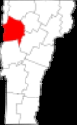
Chittenden County, Vermont
Chittenden County is a county located in the U.S. state of Vermont. As of 2010, the population was 156,545. Its shire town is Burlington. Chittenden is the most populous county in the state, with more than twice as many residents as Vermont's second-most populous county, Rutland.Chittenden County...
, Vermont
Vermont
Vermont is a state in the New England region of the northeastern United States of America. The state ranks 43rd in land area, , and 45th in total area. Its population according to the 2010 census, 630,337, is the second smallest in the country, larger only than Wyoming. It is the only New England...
, United States
United States
The United States of America is a federal constitutional republic comprising fifty states and a federal district...
. Latitude and longitude coordinates are provided for many National Register properties and districts; these locations may be seen together in a Google map.
There are 97 properties and districts listed on the National Register in the county, including 3 National Historic Landmark
National Historic Landmark
A National Historic Landmark is a building, site, structure, object, or district, that is officially recognized by the United States government for its historical significance...
s.
Current listings
| Site name | Image | Date listed | Location | City or Town | Summary | |
|---|---|---|---|---|---|---|
| 1 | Ethan Allen Homestead | Off Van Patten Parkway 44°30′28.91"N 73°13′47.86"W |
Burlington Burlington, Vermont Burlington is the largest city in the U.S. state of Vermont and the shire town of Chittenden County. Burlington lies south of the U.S.-Canadian border and some south of Montreal.... |
|||
| 2 | Martin M. Bates Farmstead | Huntington Rd. north of Huntington 44°21′57"N 72°59′48"W |
Richmond Richmond, Vermont Richmond is a town in Chittenden County, Vermont, United States. The 2000 census revealed a population of 4,090.Local students attend Mount Mansfield Union High School, Camel's Hump Middle School, And Richmond Elementary School. Mount Mansfield Union High is in the neighboring town of Jericho... |
|||
| 3 | Battery Street Historic District | Roughly bounded by Lake Champlain Lake Champlain Lake Champlain is a natural, freshwater lake in North America, located mainly within the borders of the United States but partially situated across the Canada—United States border in the Canadian province of Quebec.The New York portion of the Champlain Valley includes the eastern portions of... and Main, Maple, and St. Pauls Sts. (both sides); also roughly bounded by Brown's Court and King, Adams, and Union Sts. 44°28′29"N 73°13′5"W |
Burlington Burlington, Vermont Burlington is the largest city in the U.S. state of Vermont and the shire town of Chittenden County. Burlington lies south of the U.S.-Canadian border and some south of Montreal.... |
Second set of boundaries represents a boundary increase | ||
| 4 | Wilson Alwyn "Snowflake" Bentley House | Southeast of Jericho on Nashville Rd. 44°27′1"N 72°55′57"W |
Jericho | |||
| 5 | Buell Street-Bradley Street Historic District | 2-71 Bradley St., 24-125 Buell St., 16-75 Orchard Terr., 9-96 S. Union St., 11-87 Hungerford Terr. 44°28′45"N 73°12′31"W |
Burlington Burlington, Vermont Burlington is the largest city in the U.S. state of Vermont and the shire town of Chittenden County. Burlington lies south of the U.S.-Canadian border and some south of Montreal.... |
|||
| 6 | Burlington Bay Horse Ferry | In Burlington Bay, between Lone Rock Point and the Burlington breakwater 44°29′7.2"N 73°14′34.8"W |
Burlington Burlington, Vermont Burlington is the largest city in the U.S. state of Vermont and the shire town of Chittenden County. Burlington lies south of the U.S.-Canadian border and some south of Montreal.... |
Shipwreck of a horse-powered ferry | ||
| 7 | Burlington Breakwater | Burlington Harbor 44°28′32"N 73°13′33"W |
Burlington Burlington, Vermont Burlington is the largest city in the U.S. state of Vermont and the shire town of Chittenden County. Burlington lies south of the U.S.-Canadian border and some south of Montreal.... |
Built to calm the waters of Lake Champlain against Burlington harbor. | ||
| 8 | Burlington Montgomery Ward Building | 52-54 Church St. 44°28′44"N 73°12′46"W |
Burlington Burlington, Vermont Burlington is the largest city in the U.S. state of Vermont and the shire town of Chittenden County. Burlington lies south of the U.S.-Canadian border and some south of Montreal.... |
|||
| 9 | Burlington Traction Company | 662 Riverside Ave. and 321-343 N. Winooski Ave. 44°29′29"N 73°12′22"W |
Burlington Burlington, Vermont Burlington is the largest city in the U.S. state of Vermont and the shire town of Chittenden County. Burlington lies south of the U.S.-Canadian border and some south of Montreal.... |
First housing streetcars, then buses, now several small businesses. | ||
| 10 | Roswell Butler House Roswell Butler House The Roswell Butler House was added to the National Register of Historic Places in 2001 . It is a brick building with a stone foundation located on Carmichael St within the Essex Town Center development., Essex, Vermont.-History:... |
6 Carmichael St. 44°30′34"N 73°5′5"W |
Essex Essex, Vermont Essex is a town in Chittenden County, Vermont, United States. The population was 19,587 at the 2010 census.By population, Essex is the largest town in Vermont, and the second-largest municipality .-Government:... |
|||
| 11 | Carnegie Building of the Fletcher Free Library | College St. and S. Winooski Ave. 44°28′37"N 73°12′39"W |
Burlington Burlington, Vermont Burlington is the largest city in the U.S. state of Vermont and the shire town of Chittenden County. Burlington lies south of the U.S.-Canadian border and some south of Montreal.... |
|||
| 12 | Champlain School | 809 Pine St. 44°27′25"N 73°12′55"W |
Burlington Burlington, Vermont Burlington is the largest city in the U.S. state of Vermont and the shire town of Chittenden County. Burlington lies south of the U.S.-Canadian border and some south of Montreal.... |
Former elementary school, now apartments (with addition in rear) | ||
| 13 | Charlotte Center Historic District | Church Hill and Hinesburg Rds. 44°18′52"N 73°14′23"W |
Charlotte Charlotte, Vermont Charlotte is a town in Chittenden County, Vermont, United States. The town was named for Sofia Charlotte of Mecklenburg-Strelitz, youngest daughter of Duke Charles Louis Frederick of Mecklenburg-Strelitz.The population was 3,569 at the 2000 census.... |
|||
| 14 | Chittenden County Courthouse | 180 Church St. 44°28′2"N 73°12′44"W |
Burlington Burlington, Vermont Burlington is the largest city in the U.S. state of Vermont and the shire town of Chittenden County. Burlington lies south of the U.S.-Canadian border and some south of Montreal.... |
|||
| 15 | Giles Chittenden Farmstead | Governor Chittenden Rd., northeast of Williston village center 44°26′59"N 73°2′43"W |
Williston Williston, Vermont Williston is a town in Chittenden County, Vermont, United States. The population was 8,698 at the 2010 census, an increase of over 1,000 people since the 2000 census... |
|||
| 16 | Martin Chittenden House | West of Jericho on Vermont Route 117 44°27′28"N 73°1′13"W |
Jericho | |||
| 17 | Church Street Historic District | 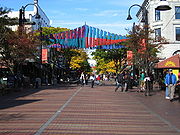 |
Generally the Church St. corridor, along with flanking blocks of Bank, Cherry, College, and Main Sts. 44°28′40"N 73°12′45"W |
Burlington Burlington, Vermont Burlington is the largest city in the U.S. state of Vermont and the shire town of Chittenden County. Burlington lies south of the U.S.-Canadian border and some south of Montreal.... |
||
| 18 | City Hall Park Historic District | Church, College, Main, and St. Paul Sts. 44°28′35"N 73°12′49"W |
Burlington Burlington, Vermont Burlington is the largest city in the U.S. state of Vermont and the shire town of Chittenden County. Burlington lies south of the U.S.-Canadian border and some south of Montreal.... |
|||
| 19 | Downtown Essex Junction Commercial Historic District | 3-17 and 8-12 Main St., 2-28 Railroad Ave., and 2 Railroad St. 44°29′36"N 73°6′35"W |
Essex Junction Essex Junction, Vermont Essex Junction is a village in the town of Essex in Chittenden County, Vermont, United States. The population was 8,591 at the 2000 census. It was incorporated on November 15, 1892.... |
|||
| 20 | Ethan Allen Engine company No. 4 | Church St. 44°28′40"N 73°12′50"W |
Burlington Burlington, Vermont Burlington is the largest city in the U.S. state of Vermont and the shire town of Chittenden County. Burlington lies south of the U.S.-Canadian border and some south of Montreal.... |
|||
| 21 | First Baptist Church First Baptist Church (Burlington, Vermont) First Baptist Church is a historic church at 81 St. Paul Street in Burlington, Vermont.It was built in 1864 and added to the National Register in 2001.-See also:*National Register of Historic Places listings in Chittenden County, Vermont... |
81 St. Paul St. 44°29′3"N 73°13′24"W |
Burlington Burlington, Vermont Burlington is the largest city in the U.S. state of Vermont and the shire town of Chittenden County. Burlington lies south of the U.S.-Canadian border and some south of Montreal.... |
|||
| 22 | First Methodist Church of Burlington First Methodist Church of Burlington First Methodist Church of Burlington is a historic church on S. Winooski Avenue in Burlington, Vermont.It was built in 1869 to a design by Alexander R. Esty and added to the National Register of Historic Places in 1978.... |
S. Winooski Ave. 44°28′33"N 73°12′40"W |
Burlington Burlington, Vermont Burlington is the largest city in the U.S. state of Vermont and the shire town of Chittenden County. Burlington lies south of the U.S.-Canadian border and some south of Montreal.... |
|||
| 23 | Follett House | 63 College St. 44°28′36"N 73°13′4"W |
Burlington Burlington, Vermont Burlington is the largest city in the U.S. state of Vermont and the shire town of Chittenden County. Burlington lies south of the U.S.-Canadian border and some south of Montreal.... |
|||
| 24 | Fort Ethan Allen Historic District | Junction of Vermont Route 15 Vermont Route 15 Vermont Route 15 is an east–west state highway in northern Vermont, United States. Its western terminus is at U.S. Route 2 and U.S. Route 7 in Winooski and its eastern terminus is at US 2 in Danville. It runs for and is known as the Grand Army of the Republic Highway.Its numbering originates from... and Barnes Rd. 44°30′19"N 73°8′56"W |
Colchester Colchester, Vermont Colchester is a town in Chittenden County, Vermont, United States. The population was 17,067 at the 2010 census. It is the fourth-largest municipality and second-largest town in Vermont by population.-Geography:... and Essex Essex, Vermont Essex is a town in Chittenden County, Vermont, United States. The population was 19,587 at the 2010 census.By population, Essex is the largest town in Vermont, and the second-largest municipality .-Government:... |
|||
| 25 | Galusha House | South of Jericho 44°30′9"N 72°59′38"W |
Jericho | |||
| 26 | GENERAL BUTLER (shipwreck) | Burlington Bay 44°28′19"N 73°13′42"W |
Burlington Burlington, Vermont Burlington is the largest city in the U.S. state of Vermont and the shire town of Chittenden County. Burlington lies south of the U.S.-Canadian border and some south of Montreal.... |
|||
| 27 | Grassemount | 411 Main St. 44°28′36"N 73°12′13"W |
Burlington Burlington, Vermont Burlington is the largest city in the U.S. state of Vermont and the shire town of Chittenden County. Burlington lies south of the U.S.-Canadian border and some south of Montreal.... |
|||
| 28 | Gray Rocks | U.S. Route 2 U.S. Route 2 U.S. Route 2 is an east–west U.S. Highway spanning across the northern continental United States. US 2 consists of two segments connected by various roadways in southern Canada... , near its junction with U.S. Route 89 U.S. Route 89 U.S. Route 89 is a north–south United States Highway with two sections, and one former section. The southern section runs for 848 miles from Flagstaff, Arizona, to the southern entrance of Yellowstone National Park... 44°24′5"N 72°58′29"W |
Richmond Richmond, Vermont Richmond is a town in Chittenden County, Vermont, United States. The 2000 census revealed a population of 4,090.Local students attend Mount Mansfield Union High School, Camel's Hump Middle School, And Richmond Elementary School. Mount Mansfield Union High is in the neighboring town of Jericho... |
|||
| 29 | Head of Church Street Historic District | Pearl and Church Sts. 44°28′51"N 73°12′48"W |
Burlington Burlington, Vermont Burlington is the largest city in the U.S. state of Vermont and the shire town of Chittenden County. Burlington lies south of the U.S.-Canadian border and some south of Montreal.... |
|||
| 30 | Holmes Creek Covered Bridge Holmes Creek Covered Bridge The Holmes Creek Covered Bridge, also called the Lakeshore Covered Bridge, is a wooden covered bridge that crosses Holmes Creek in Charlotte, Vermont on Lake Road. It was listed on the National Register of Historic Places in 1974.... |
Northwest of Charlotte over Holmes Creek 44°19′59"N 73°17′40"W |
Charlotte Charlotte, Vermont Charlotte is a town in Chittenden County, Vermont, United States. The town was named for Sofia Charlotte of Mecklenburg-Strelitz, youngest daughter of Duke Charles Louis Frederick of Mecklenburg-Strelitz.The population was 3,569 at the 2000 census.... |
|||
| 31 | House at 44 Front Street | 42-44 Front St. 44°28′59.53"N 73°13′13.29"W |
Burlington Burlington, Vermont Burlington is the largest city in the U.S. state of Vermont and the shire town of Chittenden County. Burlington lies south of the U.S.-Canadian border and some south of Montreal.... |
|||
| 32 | Honey Hollow Camp | 2 mi (3.2 km) south of Vermont Route 2, along Honey Hollow Rd. 44°21′2"N 72°55′6"W |
Bolton Bolton, Vermont Bolton is a town in Chittenden County, Vermont, United States. The population was 971 at the 2000 census.The principal transportation artery of the town is US Route 2, which follows the north side of the Winooski River... |
|||
| 33 | Howard Mortuary Chapel Howard Mortuary Chapel The Howard Mortuary Chapel is a historic mortuary chapel on the grounds of Lakeview Cemetery in Burlington, Vermont.... |
455 North Ave. 44°29′36"N 73°13′49"W |
Burlington Burlington, Vermont Burlington is the largest city in the U.S. state of Vermont and the shire town of Chittenden County. Burlington lies south of the U.S.-Canadian border and some south of Montreal.... |
|||
| 34 | Huntington Lower Village Church | Huntington Lower Village Church 44°19′35"N 72°59′21"W |
Huntington Huntington, Vermont Huntington is a town in Chittenden County, Vermont, United States. The population was 1,861 at the 2000 census.The town was originally called New Huntington but the name was changed to Huntington in 1795... |
|||
| 35 | Jericho Center Historic District | Brown's Trace, Bolger Hill and Varney Rds. 44°28′13"N 72°58′20"W |
Jericho | |||
| 36 | Jericho Village Historic District | Vermont Route 15 Vermont Route 15 Vermont Route 15 is an east–west state highway in northern Vermont, United States. Its western terminus is at U.S. Route 2 and U.S. Route 7 in Winooski and its eastern terminus is at US 2 in Danville. It runs for and is known as the Grand Army of the Republic Highway.Its numbering originates from... , Plains Rd., Mill St., and Old Pump Rd. 44°30′19"N 72°59′45"W |
Jericho | |||
| 37 | Dan Johnson Farmstead | Junction of U.S. Route 2 U.S. Route 2 U.S. Route 2 is an east–west U.S. Highway spanning across the northern continental United States. US 2 consists of two segments connected by various roadways in southern Canada... and Johnson Ln. 44°25′50"N 73°3′22"W |
Williston Williston, Vermont Williston is a town in Chittenden County, Vermont, United States. The population was 8,698 at the 2010 census, an increase of over 1,000 people since the 2000 census... |
|||
| 38 | Jonesville Academy | South of Jonesville at Cochran and Waterbury Rds. 44°22′53"N 72°56′20"W |
Jonesville Jonesville, Vermont Jonesville is an unincorporated community in the town of Richmond in Chittenden County, Vermont, United States.The community is situated at the junction of the Winooski and Huntington rivers in the western slopes of the Green Mountains. A significant portion of Jonesville is fertile farmland... |
|||
| 39 | Martin L. Kelsey House | 43 Elmwood Ave 44°28′52"N 73°12′52"W |
Burlington Burlington, Vermont Burlington is the largest city in the U.S. state of Vermont and the shire town of Chittenden County. Burlington lies south of the U.S.-Canadian border and some south of Montreal.... |
|||
| 40 | LeFarriere House | 171-173 Intervale Ave. 44°29′32.4312"N 73°11′43.9908"W |
Burlington Burlington, Vermont Burlington is the largest city in the U.S. state of Vermont and the shire town of Chittenden County. Burlington lies south of the U.S.-Canadian border and some south of Montreal.... |
|||
| 41 | Lakeside Development | Lakeside, Central, Conger, Wright, and Harrison Aves. 44°27′35"N 73°13′15"W |
Burlington Burlington, Vermont Burlington is the largest city in the U.S. state of Vermont and the shire town of Chittenden County. Burlington lies south of the U.S.-Canadian border and some south of Montreal.... |
|||
| 42 | Main Street-College Street Historic District | Roughly bounded by College, S. Williams and Main Sts., and S. Winooski Ave. 44°28′44"N 73°12′22"W |
Burlington Burlington, Vermont Burlington is the largest city in the U.S. state of Vermont and the shire town of Chittenden County. Burlington lies south of the U.S.-Canadian border and some south of Montreal.... |
|||
| 43 | McNeil Homestead | Lake Champlain off Vermont Route F-5 Vermont Route F-5 Vermont Route F-5 is a town-maintained state highway located in Chittenden County, Vermont, United States. The route is the last remaining F-X designation in Vermont. F-X route designations were previously used for roads leading to ferries across Lake Champlain... 44°18′12"N 73°18′5"W |
Charlotte Charlotte, Vermont Charlotte is a town in Chittenden County, Vermont, United States. The town was named for Sofia Charlotte of Mecklenburg-Strelitz, youngest daughter of Duke Charles Louis Frederick of Mecklenburg-Strelitz.The population was 3,569 at the 2000 census.... |
|||
| 44 | Methodist Episcopal Church of Winooski Methodist Episcopal Church of Winooski Methodist Episcopal Church of Winooski is a historic church at 24 W Allen Street in Winooski, Vermont.It was built in 1918 and added to the National Register of Historic Places in 2001.... |
24 W Allen St. 44°29′28"N 73°11′16"W |
Winooski Winooski, Vermont Winooski is a city in Chittenden County, Vermont, in the United States. Located at the mouth of the Winooski River, as of the 2010 census the city population was 7,267... |
|||
| 45 | Mintzer House | 175-177 Intervale Ave. 44°29′25.71"N 73°12′36.8274"W |
Burlington Burlington, Vermont Burlington is the largest city in the U.S. state of Vermont and the shire town of Chittenden County. Burlington lies south of the U.S.-Canadian border and some south of Montreal.... |
|||
| 46 | Moquin's Bakery | 78 Rose St. 44°29′13"N 73°13′0"W |
Burlington Burlington, Vermont Burlington is the largest city in the U.S. state of Vermont and the shire town of Chittenden County. Burlington lies south of the U.S.-Canadian border and some south of Montreal.... |
|||
| 47 | Moran Municipal Generation Station Moran Municipal Generation Station The Moran Municipal Generation Station was built in 1953 in Burlington, Vermont, in the United States named for Burlington mayor J.E. Moran.. It was a 30-megawatt power plant known for its architecture and innovation. It is now a derelict structure that will be redeveloped to encourage year-round... |
475 Lake St. 44°28′53"N 73°13′24"W |
Burlington Burlington, Vermont Burlington is the largest city in the U.S. state of Vermont and the shire town of Chittenden County. Burlington lies south of the U.S.-Canadian border and some south of Montreal.... |
|||
| 48 | Mount Philo State Park Mount Philo State Park Mount Philo State Park is a state park located in Charlotte, Vermont. The park protects the area around Mount Philo and provides views of Lake Champlain and the Adirondack Mountains to the west. The Green Mountains can be seen to the east and south... |
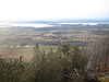 |
5425 Mount Philo Rd. 44°16′40"N 73°12′40"W |
Charlotte Charlotte, Vermont Charlotte is a town in Chittenden County, Vermont, United States. The town was named for Sofia Charlotte of Mecklenburg-Strelitz, youngest daughter of Duke Charles Louis Frederick of Mecklenburg-Strelitz.The population was 3,569 at the 2000 census.... |
||
| 49 | Murray-Isham Farm | 741 Oak Hill Rd. (Town Highway 1) 44°23′34"N 73°5′47"W |
Williston Williston, Vermont Williston is a town in Chittenden County, Vermont, United States. The population was 8,698 at the 2010 census, an increase of over 1,000 people since the 2000 census... |
|||
| 50 | Normand House | 163-165, 165 rear Intervale Ave. 44°29′24.7158"N 73°12′37.677"W |
Burlington Burlington, Vermont Burlington is the largest city in the U.S. state of Vermont and the shire town of Chittenden County. Burlington lies south of the U.S.-Canadian border and some south of Montreal.... |
|||
| 51 | North Street Historic District | Roughly along North St., from North Ave. to N. Winooski Ave. 44°29′3"N 73°13′1"W |
Burlington Burlington, Vermont Burlington is the largest city in the U.S. state of Vermont and the shire town of Chittenden County. Burlington lies south of the U.S.-Canadian border and some south of Montreal.... |
|||
| 52 | O.J. WALKER (shipwreck) | Burlington Bay 44°28′44"N 73°14′27"W |
Burlington Burlington, Vermont Burlington is the largest city in the U.S. state of Vermont and the shire town of Chittenden County. Burlington lies south of the U.S.-Canadian border and some south of Montreal.... |
|||
| 53 | Old Ohavi Zedek Synagogue Old Ohavi Zedek Synagogue Old Ohavi Zedek Synagogue is a historic synagogue building in Burlington, Vermont currently occupied by Congregation Ahavath Gerim.-History:Founded in 1885, Ohavi Zedek is the oldest Jewish congregation in Vermont... |
Archibald and Hyde Sts. 44°29′18"N 73°12′26"W |
Burlington Burlington, Vermont Burlington is the largest city in the U.S. state of Vermont and the shire town of Chittenden County. Burlington lies south of the U.S.-Canadian border and some south of Montreal.... |
|||
| 54 | Old Red Mill and Mill House | Vermont Route 15 Vermont Route 15 Vermont Route 15 is an east–west state highway in northern Vermont, United States. Its western terminus is at U.S. Route 2 and U.S. Route 7 in Winooski and its eastern terminus is at US 2 in Danville. It runs for and is known as the Grand Army of the Republic Highway.Its numbering originates from... 44°30′17"N 73°0′0"W |
Jericho | |||
| 55 | Old Stone House | 73 E. Allen St. 44°29′29.112"N 73°11′0.168"W |
Winooski Winooski, Vermont Winooski is a city in Chittenden County, Vermont, in the United States. Located at the mouth of the Winooski River, as of the 2010 census the city population was 7,267... |
|||
| 56 | Charles R. Palmer House | 201 and 203 N. Willard St. 44°29′21"N 73°12′15"W |
Burlington Burlington, Vermont Burlington is the largest city in the U.S. state of Vermont and the shire town of Chittenden County. Burlington lies south of the U.S.-Canadian border and some south of Montreal.... |
|||
| 57 | Pearl Street Historic District | Roughly 184 to 415 Pearl St., Orchard Terr., and Winooski Ave. 44°28′50"N 73°12′29"W |
Burlington Burlington, Vermont Burlington is the largest city in the U.S. state of Vermont and the shire town of Chittenden County. Burlington lies south of the U.S.-Canadian border and some south of Montreal.... |
|||
| 58 | Cicero Goddard Peck House | 18 Mechanicsville Rd. 44°19′55"N 73°6′36"W |
Hinesburg Hinesburg, Vermont Hinesburg is a town in Chittenden County, Vermont, United States. The town was named for Abel Hine, town clerk. The population was 4,340 at the 2000 census.-Geography:... |
|||
| 59 | PHOENIX (Shipwreck) | Colchester Shoal, Colchester Reef 44°33′11"N 73°19′52"W |
Colchester Colchester, Vermont Colchester is a town in Chittenden County, Vermont, United States. The population was 17,067 at the 2010 census. It is the fourth-largest municipality and second-largest town in Vermont by population.-Geography:... |
|||
| 60 | Porter Screen Company | 110 E. Spring St. 44°19′51"N 73°11′13"W |
Winooski Winooski, Vermont Winooski is a city in Chittenden County, Vermont, in the United States. Located at the mouth of the Winooski River, as of the 2010 census the city population was 7,267... |
|||
| 61 | Preston-Lafreniere Farm | Junction of Duxbury Rd. and Honey Hollow Rd. 44°22′29"N 72°54′33"W |
Bolton Bolton, Vermont Bolton is a town in Chittenden County, Vermont, United States. The population was 971 at the 2000 census.The principal transportation artery of the town is US Route 2, which follows the north side of the Winooski River... |
|||
| 62 | Proctor Maple Research Farm | UVM Rd. 44°31′37"N 72°51′57"W |
Underhill Underhill, Vermont Underhill is a town in Chittenden County, Vermont, United States. The population was 2,980 at the 2000 census.-Geography:According to the United States Census Bureau, the town has a total area of 51.4 mi2 , of which 51.3 mi2 is land and 0.1 mi2 is water.-Education:Underhill... |
|||
| 63 | Quinlan's Covered Bridge Quinlan's Covered Bridge Quinlan's Covered Bridge, also called the Lower Covered Bridge, and Sherman Covered Bridge is a wooden covered bridge that crosses Lewis Creek in Charlotte, Vermont on Monkton Road. It was listed on the National Register of Historic Places in 1974.... |
South of East Charlotte over Lewis Creek 44°16′35"N 73°11′4"W |
East Charlotte | |||
| 64 | Redstone Historic District | S. Prospect St. 44°28′12"N 73°11′54"W |
Burlington Burlington, Vermont Burlington is the largest city in the U.S. state of Vermont and the shire town of Chittenden County. Burlington lies south of the U.S.-Canadian border and some south of Montreal.... |
|||
| 65 | Remington-Williamson Farm | 4282 Main Rd. 44°18′0"N 72°58′14"W |
Huntington Huntington, Vermont Huntington is a town in Chittenden County, Vermont, United States. The population was 1,861 at the 2000 census.The town was originally called New Huntington but the name was changed to Huntington in 1795... |
|||
| 66 | Richmond Congregational Church Richmond Congregational Church Richmond Congregational Church is a historic church at the junction of Bridge and Church Street in Richmond, Vermont.It was built in 1903 and added to the National Register in 2001.... |
Junction of Bridge and Church St. 44°24′14"N 72°59′46"W |
Richmond Richmond, Vermont Richmond is a town in Chittenden County, Vermont, United States. The 2000 census revealed a population of 4,090.Local students attend Mount Mansfield Union High School, Camel's Hump Middle School, And Richmond Elementary School. Mount Mansfield Union High is in the neighboring town of Jericho... |
|||
| 67 | Richmond Underwear Company Building | Millet St. 44°24′23.6"N 72°59′37.6"W |
Richmond Richmond, Vermont Richmond is a town in Chittenden County, Vermont, United States. The 2000 census revealed a population of 4,090.Local students attend Mount Mansfield Union High School, Camel's Hump Middle School, And Richmond Elementary School. Mount Mansfield Union High is in the neighboring town of Jericho... |
|||
| 68 | John B. Robarge Duplex | 58-60 N. Champlain St. 44°29′3"N 73°13′2"W |
Burlington Burlington, Vermont Burlington is the largest city in the U.S. state of Vermont and the shire town of Chittenden County. Burlington lies south of the U.S.-Canadian border and some south of Montreal.... |
|||
| 69 | Daniel Webster Robinson House | 384 and 388 Main St. 44°28′35"N 73°12′15"W |
Burlington Burlington, Vermont Burlington is the largest city in the U.S. state of Vermont and the shire town of Chittenden County. Burlington lies south of the U.S.-Canadian border and some south of Montreal.... |
|||
| 70 | Round Church Round Church Round Church, also known as Old Round Church, built in 1812-1813 in Richmond, Vermont, USA, is a rare, well-preserved example of a sixteen-sided meeting house. It was built to serve as the meeting place for the town as well as five Protestant congregations... |
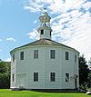 |
Bridge St. and Cochran Rd. 44°23′56"N 72°59′58"W |
Richmond Richmond, Vermont Richmond is a town in Chittenden County, Vermont, United States. The 2000 census revealed a population of 4,090.Local students attend Mount Mansfield Union High School, Camel's Hump Middle School, And Richmond Elementary School. Mount Mansfield Union High is in the neighboring town of Jericho... |
Built in 1812-1813, a rare, well-preserved example of a sixteen-sided meetinghouse | |
| 71 | Lucy Ruggles House | 262 S. Prospect St. 44°28′30"N 73°12′0"W |
Burlington Burlington, Vermont Burlington is the largest city in the U.S. state of Vermont and the shire town of Chittenden County. Burlington lies south of the U.S.-Canadian border and some south of Montreal.... |
|||
| 72 | Saltus Grocery Store | 299-301 N. Winooski Ave. 44°29′18"N 73°12′28"W |
Burlington Burlington, Vermont Burlington is the largest city in the U.S. state of Vermont and the shire town of Chittenden County. Burlington lies south of the U.S.-Canadian border and some south of Montreal.... |
|||
| 73 | Sand Bar State Park | 1215 U.S. Route 2 U.S. Route 2 U.S. Route 2 is an east–west U.S. Highway spanning across the northern continental United States. US 2 consists of two segments connected by various roadways in southern Canada... 44°37′37"N 73°14′27"W |
Milton Milton, Vermont Milton is a town in Chittenden County, Vermont, United States. The population was 10,352 at the 2010 census. According to local legend, the town was named for the English poet John Milton, but the name most likely originated from William FitzWilliam, 4th Earl FitzWilliam, who held the title... |
|||
| 74 | Sequin Covered Bridge Sequin Covered Bridge The Sequin Covered Bridge, also called the Upper Covered Bridge, is a wooden covered bridge that crosses Lewis Creek in Charlotte, Vermont on Roscoe Road. It was listed on the National Register of Historic Places in 1974.... |
Southeast of East Charlotte over Lewis Creek 44°17′20"N 73°9′3"W |
East Charlotte | |||
| 75 | Shelburne Farms Shelburne Farms Shelburne Farms is a nonprofit environmental education center and National Historic Landmark on the shores of Lake Champlain in Shelburne, Vermont. It is also one of the principal concert sites for the Vermont Mozart Festival.... |
Off U.S. Route 7 U.S. Route 7 U.S. Route 7 is a north–south United States highway in western New England that runs for from Norwalk, Connecticut, to Highgate, Vermont. The highway's southern terminus is at Interstate 95 in Norwalk, Connecticut... 44°23′37"N 73°14′53"W |
Shelburne Shelburne, Vermont Shelburne is a town in southwestern Chittenden County, Vermont, United States, along the shores of Lake Champlain. The population was 7,144 at the 2010 census.-History:... |
Created in 1886 by Dr. William Seward Webb William Seward Webb William Seward Webb, M.D. was a businessman, and Inspector General of the Vermont militia with the rank of Colonel. He was a founder and former President of the Sons of the American Revolution.-Biography:... and Eliza Osgood Vanderbilt-Webb as a model agricultural estate. |
||
| 76 | Shelburne Village Historic District | 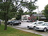 |
Area north and south of the junction of U.S. Route 7 U.S. Route 7 U.S. Route 7 is a north–south United States highway in western New England that runs for from Norwalk, Connecticut, to Highgate, Vermont. The highway's southern terminus is at Interstate 95 in Norwalk, Connecticut... , Harbor Rd. and Falls Rd., including the area south and east of the LaPlatte River and U.S. Route 7 44°22′51"N 73°13′36"W |
Shelburne Shelburne, Vermont Shelburne is a town in southwestern Chittenden County, Vermont, United States, along the shores of Lake Champlain. The population was 7,144 at the 2010 census.-History:... |
||
| 77 | South Union Street Historic District | S. Union St. between Howard and Main 44°28′16"N 73°12′30"W |
Burlington Burlington, Vermont Burlington is the largest city in the U.S. state of Vermont and the shire town of Chittenden County. Burlington lies south of the U.S.-Canadian border and some south of Montreal.... |
|||
| 78 | South Willard Street Historic District | S. Willard St. 44°28′21"N 73°12′23"W |
Burlington Burlington, Vermont Burlington is the largest city in the U.S. state of Vermont and the shire town of Chittenden County. Burlington lies south of the U.S.-Canadian border and some south of Montreal.... |
|||
| 79 | Sutton Farm | 1592 Dorset St. 44.338829°N 73.170662°W |
Shelburne Shelburne, Vermont Shelburne is a town in southwestern Chittenden County, Vermont, United States, along the shores of Lake Champlain. The population was 7,144 at the 2010 census.-History:... |
|||
| 80 | Tavern on Mutton Hill | Church Hill Rd. 44°19′30"N 73°14′15"W |
Charlotte Charlotte, Vermont Charlotte is a town in Chittenden County, Vermont, United States. The town was named for Sofia Charlotte of Mecklenburg-Strelitz, youngest daughter of Duke Charles Louis Frederick of Mecklenburg-Strelitz.The population was 3,569 at the 2000 census.... |
|||
| 81 | TICONDEROGA Ticonderoga (steamboat) The steamboat Ticonderoga is America’s last remaining side-paddle-wheel passenger steamer with a vertical beam engine of the type that provided freight and passenger service on America’s lakes and rivers from the early 19th to the mid-20th centuries... |
.jpg) |
Shelburne Museum 44°22′37"N 73°13′53"W |
Shelburne Shelburne, Vermont Shelburne is a town in southwestern Chittenden County, Vermont, United States, along the shores of Lake Champlain. The population was 7,144 at the 2010 census.-History:... |
220 feet (67.1 m) steamboat built in Shelburne, Vermont in 1906. | |
| 82 | Lee Tracy House | U.S. Route 7 U.S. Route 7 U.S. Route 7 is a north–south United States highway in western New England that runs for from Norwalk, Connecticut, to Highgate, Vermont. The highway's southern terminus is at Interstate 95 in Norwalk, Connecticut... 44°22′54"N 73°13′42"W |
Shelburne Shelburne, Vermont Shelburne is a town in southwestern Chittenden County, Vermont, United States, along the shores of Lake Champlain. The population was 7,144 at the 2010 census.-History:... |
|||
| 83 | U.S. Post Office and Customshouse | Southeastern corner of Main and Church Sts. 44°28′33"N 73°12′44"W |
Burlington Burlington, Vermont Burlington is the largest city in the U.S. state of Vermont and the shire town of Chittenden County. Burlington lies south of the U.S.-Canadian border and some south of Montreal.... |
|||
| 84 | Underhill State Park | 352 Mountain Rd. 44°31′34"N 72°49′58"W |
Underhill Underhill, Vermont Underhill is a town in Chittenden County, Vermont, United States. The population was 2,980 at the 2000 census.-Geography:According to the United States Census Bureau, the town has a total area of 51.4 mi2 , of which 51.3 mi2 is land and 0.1 mi2 is water.-Education:Underhill... |
|||
| 85 | University Green Historic District | University of Vermont University of Vermont The University of Vermont comprises seven undergraduate schools, an honors college, a graduate college, and a college of medicine. The Honors College does not offer its own degrees; students in the Honors College concurrently enroll in one of the university's seven undergraduate colleges or... campus 44°28′39"N 73°12′2"W |
Burlington Burlington, Vermont Burlington is the largest city in the U.S. state of Vermont and the shire town of Chittenden County. Burlington lies south of the U.S.-Canadian border and some south of Montreal.... |
|||
| 86 | Edward Wells House | 61 Summit St. 44°28′28"N 73°12′11"W |
Burlington Burlington, Vermont Burlington is the largest city in the U.S. state of Vermont and the shire town of Chittenden County. Burlington lies south of the U.S.-Canadian border and some south of Montreal.... |
|||
| 87 | Wells-Jackson Carriage House Complex | 192-194 Jackson Court and 370 Maple St. 44°28′30"N 73°12′17"W |
Burlington Burlington, Vermont Burlington is the largest city in the U.S. state of Vermont and the shire town of Chittenden County. Burlington lies south of the U.S.-Canadian border and some south of Montreal.... |
|||
| 88 | Wells-Richardson District | Main, Pine, College, and St. Paul Sts. 44°28′35"N 73°12′54"W |
Burlington Burlington, Vermont Burlington is the largest city in the U.S. state of Vermont and the shire town of Chittenden County. Burlington lies south of the U.S.-Canadian border and some south of Montreal.... |
|||
| 89 | West Milton Bridge | Town Highway 40 over the Lamoille River Lamoille River The Lamoille River is a river which runs through northern Vermont and drains into Lake Champlain. It is about in length, and has a drainage area of around . The river generally flows southwest, and then northwest, from the water divide of the Green Mountains, and is the namesake of Lamoille... 44°37′56"N 73°10′18"W |
Milton Milton, Vermont Milton is a town in Chittenden County, Vermont, United States. The population was 10,352 at the 2010 census. According to local legend, the town was named for the English poet John Milton, but the name most likely originated from William FitzWilliam, 4th Earl FitzWilliam, who held the title... |
|||
| 90 | M. S. Whitcomb Farm | U.S. Route 2 U.S. Route 2 U.S. Route 2 is an east–west U.S. Highway spanning across the northern continental United States. US 2 consists of two segments connected by various roadways in southern Canada... 44°23′29"N 72°56′24"W |
Richmond Richmond, Vermont Richmond is a town in Chittenden County, Vermont, United States. The 2000 census revealed a population of 4,090.Local students attend Mount Mansfield Union High School, Camel's Hump Middle School, And Richmond Elementary School. Mount Mansfield Union High is in the neighboring town of Jericho... |
|||
| 91 | Williston Congregational Church Williston Congregational Church Williston Congregational Church is a historic church in the center of Williston Village on VT 2 in Williston, Vermont.It was built in 1832 and added to the National Register of Historic Places in 1973.... |
Center of Williston Village on Vermont Route 2 44°26′20"N 73°4′23"W |
Williston Williston, Vermont Williston is a town in Chittenden County, Vermont, United States. The population was 8,698 at the 2010 census, an increase of over 1,000 people since the 2000 census... |
|||
| 92 | Williston Village Historic District | U.S. Route 2 U.S. Route 2 U.S. Route 2 is an east–west U.S. Highway spanning across the northern continental United States. US 2 consists of two segments connected by various roadways in southern Canada... ; also U.S. Route 2 over Allen Brook 44°26′16"N 73°4′14"W |
Williston Williston, Vermont Williston is a town in Chittenden County, Vermont, United States. The population was 8,698 at the 2010 census, an increase of over 1,000 people since the 2000 census... |
Allen Brook location represents a boundary increase | ||
| 93 | Winooski Archeological Site | Address Restricted | Winooski Winooski, Vermont Winooski is a city in Chittenden County, Vermont, in the United States. Located at the mouth of the Winooski River, as of the 2010 census the city population was 7,267... |
|||
| 94 | Winooski Block | E. Allen and Main Sts. 44°29′30"N 73°11′11"W |
Winooski Winooski, Vermont Winooski is a city in Chittenden County, Vermont, in the United States. Located at the mouth of the Winooski River, as of the 2010 census the city population was 7,267... |
|||
| 95 | Winooski Falls Mill District | 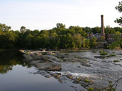 |
Northern bank of the Winooski River Winooski River The Winooski River is a tributary of Lake Champlain, approximately long, in northern Vermont in the United States. Although not Vermont's longest river, it is one of the state's most significant, forming a major valley way from Lake Champlain through the Green Mountains towards the Connecticut... to Center and Canal Sts., southern bank to Bartlet St.; also 485-497 Colchester Ave., 5-21 Mill St., and 8-32 Barrett St.; also 110 W. Canal St. 44°29′20"N 73°11′15"W |
Winooski Winooski, Vermont Winooski is a city in Chittenden County, Vermont, in the United States. Located at the mouth of the Winooski River, as of the 2010 census the city population was 7,267... |
Range of street addresses represents a boundary increase; 110 Canal represents a second boundary increase | |
| 96 | Winooski River Bridge | US Route 2 over the Winooski River Winooski River The Winooski River is a tributary of Lake Champlain, approximately long, in northern Vermont in the United States. Although not Vermont's longest river, it is one of the state's most significant, forming a major valley way from Lake Champlain through the Green Mountains towards the Connecticut... 44°25′24"N 73°1′1"W |
Richmond Richmond, Vermont Richmond is a town in Chittenden County, Vermont, United States. The 2000 census revealed a population of 4,090.Local students attend Mount Mansfield Union High School, Camel's Hump Middle School, And Richmond Elementary School. Mount Mansfield Union High is in the neighboring town of Jericho... |
|||
| 97 | Winterbotham Estate | 163 S. Willard St. 44°28′33"N 73°12′22"W |
Burlington Burlington, Vermont Burlington is the largest city in the U.S. state of Vermont and the shire town of Chittenden County. Burlington lies south of the U.S.-Canadian border and some south of Montreal.... |
See also
- List of National Historic Landmarks in Vermont
- National Register of Historic Places listings in Vermont