

List of Pennsylvania state historical markers in Northumberland County
Encyclopedia
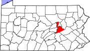
This is intended to be a complete list of the official state historical markers placed in Northumberland County, Pennsylvania
Northumberland County, Pennsylvania
There were 38,835 households out of which 27.30% had children under the age of 18 living with them, 52.40% were married couples living together, 9.60% had a female householder with no husband present, and 34.10% were non-families. 30.20% of all households were made up of individuals and 15.50% had...
by the Pennsylvania Historical and Museum Commission
Pennsylvania Historical and Museum Commission
The Pennsylvania Historical and Museum Commission is the governmental agency of the Commonwealth of Pennsylvania responsible for the collection, conservation and interpretation of Pennsylvania's historic heritage...
(PHMC). The locations of the historical markers, as well as the latitude and longitude coordinates as provided by the PHMC's database, are included below when available. There are 33 historical markers located in Northumberland County.
Historical markers
| Marker title | Image | Date dedicated | Location | Marker type | Topics |
|---|---|---|---|---|---|
| Bloody Spring, The | N. 7th St. extension between Shikellamy Ave. & Memorial Park, Sunbury °N °W |
Roadside | Forts, French & Indian War, Military, Native American | ||
| Bucknell University Bucknell University Bucknell University is a private liberal arts university located alongside the West Branch Susquehanna River in the rolling countryside of Central Pennsylvania in the town of Lewisburg, 30 miles southeast of Williamsport and 60 miles north of Harrisburg. The university consists of the College of... |
Pa. 405 at junction Pa. 45 3 miles S of Milton °N °W |
Roadside | Education, Religion | ||
| Captain John Brady - PLAQUE | PA 405 (E side), .5 mile S of intersection PA 45, Milton °N °W |
Plaque | American Revolution, Exploration, Forts, French & Indian War, Military, Native American | ||
| Col. Matthew Smith | SR 1007 (old Pa. 147) at Warrior Run Church N of McEwensville °N °W |
Roadside | American Revolution, Government & Politics 18th Century, Military | ||
| Danville-Pottsville R.R. | Pa. 147 (Front St.), Sunbury 40.85957°N 76.79837°W |
Roadside | Railroads, Transportation | ||
| First Electric Light | Pa. 147 (Front St.) at Market St., Sunbury 40.862°N 76.79453°W |
Roadside | Business & Industry, Electricity | ||
| Fort Augusta Fort Augusta Fort Augusta was a stronghold in Northumberland County, Pennsylvania, in the upper Susquehanna Valley from the time of the French and Indian War to the close of the American Revolution. The fort was erected by Col... |
n/a | Pa. 147 (Front St.) at site, Sunbury 40.86443°N 76.79595°W |
Roadside | Forts, French & Indian War, Military | |
| Fort Augusta - PLAQUE | PA 14 in Sunbury °N °W |
Plaque | American Revolution, Forts, Military, Native American | ||
| Fort Freeland | SR 1007 (old Pa. 147) near Warrior Run Church N of McEwensville °N °W |
Roadside | American Revolution, Forts, Military, Native American | ||
| Fort Freeland - PLAQUE | SR 1007 (old PA 147), Warrior Run Church N of McEwensville °N °W |
Plaque | American Revolution, Forts, Military, Native American | ||
| Gen. James M. Gavin | West Avenue & Maple Streets, Mt. Carmel 40.79858°N 76.4151°W |
Roadside | Government & Politics 20th Century, Military, Military Post-Civil War | ||
| Great Shamokin Path Great Shamokin Path The Great Shamokin Path was a major Native American trail in the U.S. State of Pennsylvania that ran from the native village of Shamokin along the left bank of the West Branch Susquehanna River north and then west to the Great Island... |
Pa. 405, 3.9 miles S of Milton °N °W |
Roadside | Native American, Paths & Trails, Transportation | ||
| Great Shamokin Path Great Shamokin Path The Great Shamokin Path was a major Native American trail in the U.S. State of Pennsylvania that ran from the native village of Shamokin along the left bank of the West Branch Susquehanna River north and then west to the Great Island... |
8.9 miles N of Milton (Missing) °N °W |
Roadside | Native American, Paths & Trails, Transportation | ||
| James Pollock James Pollock James Pollock was the 13th Governor of the State of Pennsylvania from 1855 to 1858.- Political career :James Pollock graduated from the College of New Jersey at Princeton before setting up a law practice in his home community, in Milton, Pennsylvania... |
Pa. 405, .2 mile N of Milton (Missing) °N °W |
Roadside | Canals, Government & Politics, Government & Politics 19th Century, Governors, Railroads | ||
| Joseph Priestley Joseph Priestley Joseph Priestley, FRS was an 18th-century English theologian, Dissenting clergyman, natural philosopher, chemist, educator, and political theorist who published over 150 works... |
U.S. 11 NE of Northumberland °N °W |
Roadside | Ethnic & Immigration, Medicine & Science, Professions & Vocations | ||
| Joseph Priestley Joseph Priestley Joseph Priestley, FRS was an 18th-century English theologian, Dissenting clergyman, natural philosopher, chemist, educator, and political theorist who published over 150 works... |
Duke St. (PA 147) at 10th St., Northumberland 40.89463°N 76.80997°W |
Roadside | Medicine & Science | ||
| Joseph Priestley House Joseph Priestley House The Joseph Priestley House was the American home of 18th-century British theologian, Dissenting clergyman, natural philosopher , educator, and political theorist Joseph Priestley from 1798 until his death. Located in Northumberland, Pennsylvania, the house, which was designed by Priestley's wife... |
472 Priestley Ave., Northumberland °N °W |
Roadside | Buildings, Ethnic & Immigration, Houses & Homesteads, Medicine & Science, Professions & Vocations | ||
| Lorenzo da Ponte (1749-1838) | Cameron Park, 3rd & Market Sts., Sunbury 40.8617°N 76.79335°W |
Roadside | Music & Theater | ||
| Northumberland County Northumberland County Northumberland County is the name of several counties in Northern America:* in the United States** Northumberland County, Pennsylvania** Northumberland County, Virginia* in Canada** Northumberland County, New Brunswick** Northumberland County, Ontario... |
Courthouse, 2nd & Market Sts., Sunbury 40.862°N 76.79453°W |
City | Government & Politics, Government & Politics 18th Century | ||
| Pennsylvania Canal Pennsylvania Canal Pennsylvania Canal refers generally to a complex system of canals, dams, locks, tow paths, aqueducts, and other infrastructure including, in some cases, railroads in Pennsylvania... |
U.S. 11, Northumberland, Near E end of bridge °N °W |
Roadside | Canals, Navigation, Transportation | ||
| Pennsylvania Canal Pennsylvania Canal Pennsylvania Canal refers generally to a complex system of canals, dams, locks, tow paths, aqueducts, and other infrastructure including, in some cases, railroads in Pennsylvania... |
U.S. 11, 3.5 miles NE of Northumberland °N °W |
Roadside | Canals, Navigation, Transportation | ||
| Shikellamy Shikellamy Shikellamy , also known as Swatana, was an Oneida chief and overseer for the Iroquois confederacy. In his position as chief and overseer, Shikellamy served as a supervisor for the Six Nations, overseeing the Shawnee and Lenape tribes in central Pennsylvania along the Susquehanna River and... |
Front St. (PA 147) between John & Julia Sts., at Fort Augusta site, Sunbury 40.87607°N 76.79212°W |
Roadside | Early Settlement, Native American | ||
| Shikellamy - PLAQUE | PA 147 (Front St.) just N of Fort Augusta site, Sunbury 40.8773°N 76.79012°W |
Plaque | Government & Politics 18th Century, Native American | ||
| Shikellamy's Town | Pa. 405, .5 mile S of Milton °N °W |
Roadside | Early Settlement, Native American | ||
| Sodom School Sodom Schoolhouse Sodom Schoolhouse is a historic octagonal school in West Chillisquaque Township, Northumberland County, Pennsylvania, United States reportedly built about 1812, 1835, or 1836 and used until 1915... |
At property, Pa. 45, 1 mile E of Montandon 40.96587°N 76.82668°W |
Roadside | Buildings, Education | ||
| Sunbury Sunbury, Pennsylvania Sunbury is a city in Northumberland County, Pennsylvania, United States. The city is located on the east bank of the Susquehanna River, just downstream of the confluence of its main and West branches. The population was 9,905 at the 2010 census... |
Route 147/61 (Front St.), at Weis Markets HQ, S end of Sunbury 40.84727°N 76.80257°W |
Roadside | Business & Industry, Cities & Towns, Forts, Government & Politics, Transportation | ||
| Sunbury Sunbury, Pennsylvania Sunbury is a city in Northumberland County, Pennsylvania, United States. The city is located on the east bank of the Susquehanna River, just downstream of the confluence of its main and West branches. The population was 9,905 at the 2010 census... |
Highland St. (PA 61) near Green St., E end of Sunbury °N °W |
City | Business & Industry, Forts, Government & Politics 18th Century, Transportation | ||
| Thompson's Rifle Battalion: Capt. John Lowdon's Company | Front St. (PA 147) between John & Julia Sts., at Hunter Home, Fort Augusta, Sunbury 40.87607°N 76.79212°W |
Roadside | American Revolution, Military | ||
| Tulpehocken Path | SR 3016, east side, N of Klingerstown 40.67054°N 76.70231°W |
Roadside | Native American, Paths & Trails, Transportation | ||
| Tulpehocken Path | Pa. 147, at Wise Rd., N of Herndon 40.72157°N 76.83751°W |
Roadside | Native American, Paths & Trails, Transportation | ||
| Warrior Run Church | SR 1007 (old Pa. 147) at site N of McEwensville °N °W |
Roadside | Buildings, Native American, Religion | ||
| William Maclay William Maclay William Maclay was a politician from Pennsylvania during the eighteenth century.-Biography:Maclay pursued classical studies, and then served as a lieutenant in an expedition to Fort Duquesne in 1758. He went on to serve in other expeditions in the French and Indian Wars. He studied law and was... |
Front St. (PA 147) betw. Market St. and Woodlawn Ave., Sunbury 40.86347°N 76.79633°W |
Roadside | George Washington, Government & Politics, Government & Politics 18th Century | ||
| Wyoming Path | U.S. 11 NE of Northumberland °N °W |
Roadside | Native American, Paths & Trails, Transportation |
See also
- List of Pennsylvania state historical markers
- National Register of Historic Places listings in Northumberland County, PennsylvaniaNational Register of Historic Places listings in Northumberland County, PennsylvaniaThis is a list of the National Register of Historic Places listings in Northumberland County, Pennsylvania.This is intended to be a complete list of the properties and districts on National Register of Historic Places in Northumberland County, Pennsylvania...