
List of MAX Light Rail stations
Encyclopedia
Metropolitan Area Express (MAX) is a light rail
transit system serving the Portland metropolitan area
. The system is operated by TriMet
, a public agency that operates public transit in the Portland area. Serving over 113,000 passengers a day, MAX Light Rail is one of the largest light rail systems in the United States in terms of ridership.
The MAX system currently consists of four lines, each designated by a color. Blue Line
: Hillsboro
– City Center
– Gresham
Green Line
: Clackamas
– City Center – Portland State University
Red Line
: Portland International Airport
– City Center – Beaverton
Yellow Line
: Expo Center
– City Center – Portland State University
MAX Light Rail began service on September 5, 1986 with the opening of the original segment from Downtown Portland
to Gresham
. An extension westward to Beaverton
and Hillsboro
opened in 1998. The resulting 33-mile east-west line has always been operated as a single through route, and it became known as the Blue Line in 2001, after TriMet adopted color designations for its separate light rail routes after the Red Line opened to the airport. The Yellow Line branch to the Expo Center opened in 2004. In 2009, the Green Line opened, serving the Portland Transit Mall
(along with the rerouted Yellow Line) and the new I-205 branch to Clackamas.
The system currently has a total of 85 stations. Fifty-one stations are served by the Blue Line, 28 stations by the Green Line, 29 by the Red Line, and 22 by the Yellow Line, with 38 stations served by two or more lines and 8 by three. All trains connect at Pioneer Courthouse Square
and the Rose Quarter
.
Light rail
Light rail or light rail transit is a form of urban rail public transportation that generally has a lower capacity and lower speed than heavy rail and metro systems, but higher capacity and higher speed than traditional street-running tram systems...
transit system serving the Portland metropolitan area
Portland metropolitan area
The Portland-Vancouver-Hillsboro, OR-WA Metropolitan Statistical Area , also known as the Portland metropolitan area or Greater Portland, is an urban area in the U.S. states of Oregon and Washington centered around the city of Portland, Oregon. The U.S...
. The system is operated by TriMet
TriMet
TriMet, more formally known as the Tri-County Metropolitan Transportation District of Oregon, is a public agency that operates mass transit in a region that spans most of the Portland metropolitan area in the U.S. state of Oregon...
, a public agency that operates public transit in the Portland area. Serving over 113,000 passengers a day, MAX Light Rail is one of the largest light rail systems in the United States in terms of ridership.
The MAX system currently consists of four lines, each designated by a color. Blue Line
MAX Blue Line
The MAX Blue Line is a 33 mile light rail line in the MAX Light Rail system in the Portland metropolitan area in the U.S. state of Oregon. Operated by TriMet, the line runs between Hillsboro and Gresham, via downtown Portland...
: Hillsboro
Hillsboro, Oregon
Hillsboro is the fifth-largest city in the U.S. state of Oregon and is the county seat of Washington County. Lying in the Tualatin Valley on the west side of the Portland metropolitan area, the city is home to many high-technology companies, such as Intel, that compose what has become known as the...
– City Center
Downtown Portland
Downtown Portland, the city center of Portland, Oregon, United States, is located on the west bank of the Willamette River. It is in the northeastern corner of the southwest section of the city and is where most of the city's high-rise buildings are found....
– Gresham
Gresham, Oregon
- Demographics :As of the census of 2000, there were 90,205 people, 33,327 households, and 22,695 families residing in the city. The population density was 4,071.6 people per square mile . There were 35,309 housing units at an average density of 1,593.8 per square mile...
Green Line
MAX Green Line
The MAX Green Line is a light rail route in the MAX Light Rail system in Portland, Oregon, United States, extending to Clackamas, Oregon. Construction began in early 2007, and the line opened on September 12, 2009. The average daily ridership in June 2010 was 19,500 increasing to 23,200 by April...
: Clackamas
Clackamas, Oregon
Clackamas was a census-designated place in Clackamas County, Oregon, United States. The population was 5,177 at the 2000 census. It is a suburb of Portland, Oregon.It is the location of Camp Withycombe, a military base...
– City Center – Portland State University
Portland State University
Portland State University is a public state urban university located in downtown Portland, Oregon, United States. Founded in 1946, it has the largest overall enrollment of any university in the state of Oregon, including undergraduate and graduate students. It is also the only public university in...
Red Line
MAX Red Line
The MAX Red Line is a route in the Metropolitan Area Express light rail system in the Portland, Oregon metropolitan area. It is 25.5 miles long...
: Portland International Airport
Portland International Airport
Portland International Airport is a joint civil-military airport and the largest airport in the U.S. state of Oregon, accounting for 90% of passenger travel and more than 95% of air cargo of the state. It is located within Portland's city limits just south of the Columbia River in Multnomah...
– City Center – Beaverton
Beaverton, Oregon
Beaverton is a city in Washington County, Oregon, United States, seven miles west of Portland in the Tualatin River Valley.As of the 2010 census, the population is 90,267. This makes it the second-largest city in the county and Oregon's sixth-largest city...
Yellow Line
MAX Yellow Line
The MAX Yellow Line is a 5.8-mile route in the Metropolitan Area Express light rail system in Portland, Oregon. The route, which opened May 1, 2004, runs between Portland State University , in downtown Portland, and the Portland Expo Center...
: Expo Center
Portland Metropolitan Exposition Center
The Portland Metropolitan Exposition Center, usually referred to as the Expo Center, is a convention center located in the Kenton neighborhood of Portland, Oregon. Opened in the early 1920s as a livestock exhibition and auction facility, the Expo Center now hosts over 100 events a year, including...
– City Center – Portland State University
MAX Light Rail began service on September 5, 1986 with the opening of the original segment from Downtown Portland
Downtown Portland
Downtown Portland, the city center of Portland, Oregon, United States, is located on the west bank of the Willamette River. It is in the northeastern corner of the southwest section of the city and is where most of the city's high-rise buildings are found....
to Gresham
Gresham, Oregon
- Demographics :As of the census of 2000, there were 90,205 people, 33,327 households, and 22,695 families residing in the city. The population density was 4,071.6 people per square mile . There were 35,309 housing units at an average density of 1,593.8 per square mile...
. An extension westward to Beaverton
Beaverton, Oregon
Beaverton is a city in Washington County, Oregon, United States, seven miles west of Portland in the Tualatin River Valley.As of the 2010 census, the population is 90,267. This makes it the second-largest city in the county and Oregon's sixth-largest city...
and Hillsboro
Hillsboro, Oregon
Hillsboro is the fifth-largest city in the U.S. state of Oregon and is the county seat of Washington County. Lying in the Tualatin Valley on the west side of the Portland metropolitan area, the city is home to many high-technology companies, such as Intel, that compose what has become known as the...
opened in 1998. The resulting 33-mile east-west line has always been operated as a single through route, and it became known as the Blue Line in 2001, after TriMet adopted color designations for its separate light rail routes after the Red Line opened to the airport. The Yellow Line branch to the Expo Center opened in 2004. In 2009, the Green Line opened, serving the Portland Transit Mall
Portland Transit Mall
The Portland Transit Mall is a set of public transit corridors through the center of downtown Portland, Oregon, United States. More specifically, it is a pair of one-way streets—one for northbound traffic, the other for southbound—along which two of the three lanes are restricted to...
(along with the rerouted Yellow Line) and the new I-205 branch to Clackamas.
The system currently has a total of 85 stations. Fifty-one stations are served by the Blue Line, 28 stations by the Green Line, 29 by the Red Line, and 22 by the Yellow Line, with 38 stations served by two or more lines and 8 by three. All trains connect at Pioneer Courthouse Square
Pioneer Courthouse Square
Pioneer Courthouse Square, affectionately known as Portland's living room, is a public space occupying a full 40,000 ft² city block in the center of downtown Portland, Oregon, United States...
and the Rose Quarter
Rose Quarter
The Rose Quarter is a 30 acre sports and entertainment district located in Portland's Lloyd District on the east bank of the Willamette River, just east of downtown. The Rose Quarter is bounded on the west by NE Interstate Avenue, on the north by NE Broadway and NE Weidler Streets, on the...
.
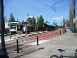
Stations
| † | Terminals |
| < | Westbound/southbound-only stations |
| > | Eastbound/northbound-only stations |
| Station | Line(s) | Fare zone | Year opened | Park and ride? | Image |
|---|---|---|---|---|---|
| Hatfield Government Center† | 3 | 1998 | Yes |  |
|
| Hillsboro Central/Southeast 3rd Avenue Transit Center | 3 | 1998 | No |  |
|
| Tuality Hospital/Southeast 8th Avenue | 3 | 1998 | No | ||
| Washington/Southeast 12th Avenue | 3 | 1998 | No | ||
| Fair Complex/Hillsboro Airport | 3 | 1998 | Yes | 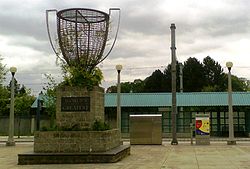 |
|
| Hawthorn Farm | 3 | 1998 | No | 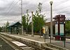 |
|
| Orenco/Northwest 231st Avenue | 3 | 1998 | Yes |  |
|
| Quatama/Northwest 205th Avenue | 3 | 1998 | Yes | 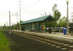 |
|
| Willow Creek/Southwest 185th Avenue Transit Center | 3 | 1998 | Yes |  |
|
| Elmonica/Southwest 170th Avenue | 3 | 1998 | Yes | ||
| Merlo Road/Southwest 158th Avenue | 3 | 1998 | No |  |
|
| Beaverton Creek | 3 | 1998 | Yes | ||
| Millikan Way | 3 | 1998 | Yes |  |
|
| Beaverton Central | 3 | 1998 | No | ||
| Beaverton Transit Center† | 3 | 1998 | No | ||
| Sunset Transit Center | 3 | 1998 | Yes | 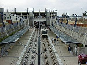 |
|
| Washington Park Washington Park (MAX station) Washington Park is a station in the MAX Light Rail system of TriMet, served by the Blue and Red lines. It is located in Portland, Oregon and is a part of the Robertson Tunnel under Portland's West Hills. It is the fourth station westbound on the Westside MAX alignment... |
1 | 1998 | No |  |
|
| Goose Hollow/SW Jefferson St | 1 | 1998 | No |  |
|
| Kings Hill/Southwest Salmon | 1 | 1997 | No |  |
|
| Jeld-Wen Field Jeld-Wen Field (MAX station) Jeld-Wen Field station is a light rail station on the MAX Blue and Red lines located in the Goose Hollow neighborhood of Portland, Oregon. It is named after the adjacent stadium, Jeld-Wen Field. The station, consisting of separate east and westbound platforms built into city sidewalks between SW... |
1 | 1997 | No | 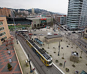 |
|
| Galleria/Southwest 10th Avenue< | Free Rail Zone | 1986 | No | 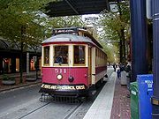 |
|
| Library/Southwest 9th Avenue> | Free Rail Zone | 1986 | No | ||
| Pioneer Square North< | Free Rail Zone | 1986 | No | ||
| Pioneer Square South> | Free Rail Zone | 1986 | No |  |
|
| Mall/Southwest 5th Avenue< | Free Rail Zone | 1990 | No | ||
| Mall/Southwest 4th Avenue> | Free Rail Zone | 1990 | No | 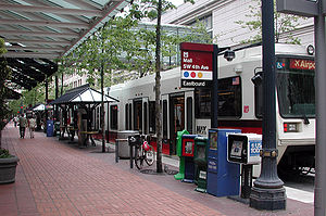 |
|
| Morrison/Southwest 3rd Avenue< | Free Rail Zone | 1986 | No | ||
| Yamhill District> | Free Rail Zone | 1986 | No | 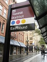 |
|
| Oak Street/Southwest 1st Avenue | Free Rail Zone | 1986 | No | ||
| Skidmore Fountain Skidmore Fountain (MAX station) The Skidmore Fountain station is a light rail station on the MAX Blue and Red lines in Portland, Oregon. It is the sixth stop eastbound on the Eastside MAX. It originally served the Yellow Line from 2004 and 2009 until its relocation to the Portland Transit Mall.The station has side platforms built... |
Free Rail Zone | 1986 | No |  |
|
| Old Town/Chinatown | Free Rail Zone | 1986 | No | ||
| Union Station/Northwest 6th & Hoyt Street Union Station/Northwest 6th & Hoyt Street and Union Station/Northwest 5th & Glisan Street The Union Station/Northwest 6th & Hoyt Street and Union Station/Northwest 5th & Glisan Street stations are light rail stations on the MAX Green and Yellow lines in Portland, Oregon... > |
Free Rail Zone | 2009 | No | ||
| Union Station/Northwest 5th & Glisan Street Union Station/Northwest 6th & Hoyt Street and Union Station/Northwest 5th & Glisan Street The Union Station/Northwest 6th & Hoyt Street and Union Station/Northwest 5th & Glisan Street stations are light rail stations on the MAX Green and Yellow lines in Portland, Oregon... < |
Free Rail Zone | 2009 | No | ||
| Northwest 6th & Davis Street Northwest 6th & Davis Street and Northwest 5th & Couch Street The Northwest 6th & Davis Street and Northwest 5th & Couch Street stations are light rail stations on the MAX Green and Yellow lines in Portland, Oregon. It is the 2nd stop southbound on the Portland Transit Mall extension.... > |
Free Rail Zone | 2009 | No | ||
| Northwest 5th & Couch Street Northwest 6th & Davis Street and Northwest 5th & Couch Street The Northwest 6th & Davis Street and Northwest 5th & Couch Street stations are light rail stations on the MAX Green and Yellow lines in Portland, Oregon. It is the 2nd stop southbound on the Portland Transit Mall extension.... < |
Free Rail Zone | 2009 | No | ||
| Southwest 6th & Pine Street Southwest 6th & Pine Street and Southwest 5th & Oak Street The Southwest 6th & Pine Street and Southwest 5th & Oak Street stations are light rail stations on the MAX Green and Yellow lines in Portland, Oregon. It is the 3rd stop southbound on the Portland Transit Mall extension.... > |
Free Rail Zone | 2009 | No | ||
| Southwest 5th & Oak Street Southwest 6th & Pine Street and Southwest 5th & Oak Street The Southwest 6th & Pine Street and Southwest 5th & Oak Street stations are light rail stations on the MAX Green and Yellow lines in Portland, Oregon. It is the 3rd stop southbound on the Portland Transit Mall extension.... < |
Free Rail Zone | 2009 | No | ||
| Pioneer Courthouse/Southwest 6th Pioneer Courthouse/Southwest 6th and Pioneer Place/Southwest 5th The Pioneer Courthouse/Southwest 6th and Pioneer Place/Southwest 5th stations are light rail stations on the MAX Green and Yellow lines in Portland, Oregon. It is the 4th stop southbound on the Portland Transit Mall extension.... > |
Free Rail Zone | 2009 | No | ||
| Pioneer Place/Southwest 5th Pioneer Courthouse/Southwest 6th and Pioneer Place/Southwest 5th The Pioneer Courthouse/Southwest 6th and Pioneer Place/Southwest 5th stations are light rail stations on the MAX Green and Yellow lines in Portland, Oregon. It is the 4th stop southbound on the Portland Transit Mall extension.... < |
Free Rail Zone | 2009 | No | ||
| Southwest 6th & Madison Street Southwest 6th & Madison Street and City Hall/Southwest 5th & Jefferson Street The Southwest 6th & Madison Street and City Hall/Southwest 5th & Jefferson Street stations are light rail stations on the MAX Green and Yellow lines in Portland, Oregon... > |
Free Rail Zone | 2009 | No | ||
| City Hall/Southwest 5th & Jefferson Street Southwest 6th & Madison Street and City Hall/Southwest 5th & Jefferson Street The Southwest 6th & Madison Street and City Hall/Southwest 5th & Jefferson Street stations are light rail stations on the MAX Green and Yellow lines in Portland, Oregon... < |
Free Rail Zone | 2009 | No | ||
| PSU Urban Center/Southwest 6th & Montgomery Street> | Free Rail Zone | 2009 | No | ||
| PSU Urban Center/Southwest 5th & Mill Street<† | Free Rail Zone | 2009 | No | ||
| Interstate/Rose Quarter | Free Rail Zone | 2004 | No | ||
| Albina/Mississippi | 1 | 2004 | No |  |
|
| Overlook Park | 2 | 2004 | No |  |
|
| North Prescott Street | 2 | 2004 | No | 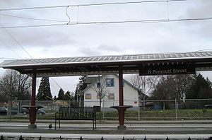 |
|
| North Killingsworth Street | 2 | 2004 | No |  |
|
| North Rosa Parks Way | 2 | 2004 | No | ||
| North Lombard Transit Center | 2 | 2004 | No |  |
|
| Kenton/North Denver Avenue Kenton/North Denver Avenue The Kenton/North Denver Avenue station is a light rail station on the MAX Yellow Line in Portland, Oregon. It is the 8th stop northbound on the Interstate MAX extension.... |
2 | 2004 | No | ||
| Delta Park/Vanport | 2 | 2004 | Yes | 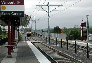 |
|
| Expo Center Expo Center (MAX station) The Expo Center station is a light rail station on the MAX Yellow Line in Portland, Oregon, United States. It is the last stop northbound on the Interstate MAX extension.... † |
2 | 2004 | Yes | 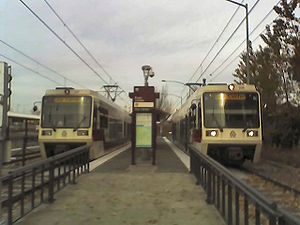 |
|
| Rose Quarter Transit Center | Free Rail Zone | 1986 | No |  |
|
| Convention Center Convention Center (MAX station) The Convention Center station is a light rail station on the MAX Blue, Green and Red lines in Portland, Oregon. It is the ninth stop eastbound on the Eastside MAX.... |
Free Rail Zone | 1990 | No |  |
|
| Northeast 7th Avenue | Free Rail Zone | 1986 | No | ||
| Lloyd Center/Northeast 11th Avenue | Free Rail Zone | 1986 | No |  |
|
| Hollywood/Northeast 42nd Avenue Transit Center | 2 | 1986 | No |  |
|
| Northeast 60th Avenue | 2 | 1986 | No | 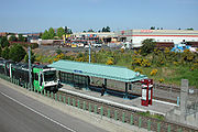 |
|
| Northeast 82nd Avenue | 2 | 1986 | No | 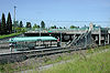 |
|
| Gateway/Northeast 99th Avenue Transit Center | 3 | 1986 | Yes | ||
| Parkrose/Sumner Transit Center | 3 | 2001 | Yes | ||
| Cascades Cascades (MAX station) Cascades is a light rail train station in the MAX Light Rail system. It is served by the Red Line and is located in Portland, Oregon; it is the second stop north on the Airport MAX section. When the line first opened, trains paused here in order to simulate a station stop for timetable purposes,... |
3 | 2007 | No | ||
| Mount Hood Avenue | 3 | 2001 | No | ||
| Portland International Airport† | 3 | 2001 | No | 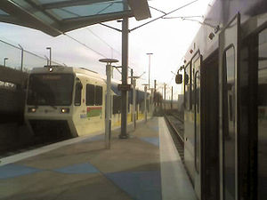 |
|
| Southeast Main Street Southeast Main Street The Southeast Main Street station is a light rail station on the MAX Green Line in Portland, Oregon. It is the first stop southbound on the I-205 MAX branch, following the Green Line's split from the Red and Blue lines at the Gateway Transit Center.... |
3 | 2009 | Yes | ||
| Southeast Division Street Southeast Division Street The Southeast Division Street station is a light rail station on the MAX Green Line in Portland, Oregon. It us the 2nd stop southbound on the I-205 MAX branch.... |
3 | 2009 | No | ||
| Southeast Powell Boulevard Southeast Powell Boulevard The Southeast Powell Boulevard station is a light rail station on the MAX Green Line in Portland, Oregon. It is the 3rd stop southbound on the I-205 MAX branch.... |
3 | 2009 | Yes | ||
| Southeast Holgate Boulevard Southeast Holgate Boulevard Southeast Holgate Boulevard station is a light rail station on the MAX Green Line in Portland, Oregon. It is the 4th stop southbound on the I-205 MAX branch. The station is at the intersection of Interstate 205 and Holgate Boulevard. This station has a center platform, and is surrounded by a... |
3 | 2009 | Yes | 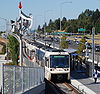 |
|
| Lents Town Center/Southeast Foster Road Lents Town Center/Southeast Foster Road The Lents Town Center/Southeast Foster Road station is a light rail station on the MAX Green Line in Portland, Oregon. It is the 5th stop southbound on the I-205 MAX branch. The station is at the intersection of Interstate 205 and Foster Road. It is located in the Lents neighborhood's town center... |
3 | 2009 | No | ||
| Southeast Flavel Street Southeast Flavel Street The Southeast Flavel Street station is a light rail station on the MAX Green Line in Portland, Oregon. It is the 6th stop southbound on the I-205 MAX branch. The station is located at SE Flavel Street, adjacent below Interstate 205. This station has a center platform.... |
3 | 2009 | No | ||
| Southeast Fuller Road Southeast Fuller Road The Southeast Fuller Road station is a light rail station on TriMet's MAX Green Line in Portland, Oregon, located between SE 82nd Avenue and Interstate 205. It is the 7th stop southbound on the Interstate 205 MAX branch... |
3 | 2009 | Yes | ||
| Clackamas Town Center Transit Center† | 3 | 2009 | Yes | |
|
| East 102nd Avenue | 3 | 1986 | No | 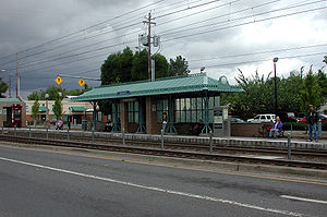 |
|
| East 122nd Avenue | 3 | 1986 | Yes | ||
| East 148th Avenue | 3 | 1986 | No | ||
| East 162nd Avenue | 3 | 1986 | No | ||
| East 172nd Avenue | 3 | 1986 | No | ||
| East 181st Avenue | 3 | 1986 | Yes | ||
| Rockwood/East 188th Avenue | 3 | 1986 | No | ||
| Ruby Junction/East 197th Avenue | 3 | 1986 | No | ||
| Civic Drive | 3 | 2010 | No | ||
| Gresham City Hall | 3 | 1986 | Yes | ||
| Gresham Central Transit Center | 3 | 1986 | Yes | ||
| Cleveland Avenue† | 3 | 1986 | Yes |
Stations under construction
| † | Terminals |
| > | Northbound-only stations |
| < | Southbound-only stations |
| Station | Line(s) | Fare zone | Projected opening | Park and ride? |
|---|---|---|---|---|
| PSU South/Southwest 6th & College Street> | Free Rail Zone | 2011 | No | |
| PSU South/Southwest 5th & Jackson Street<† | Free Rail Zone | 2011 | No |