

Liddesdale
Encyclopedia
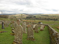
.png)
Liddel Water
Liddel Water is a river running through southern Scotland and northern England, for much of its course forming the border between the two countries, and was formerly one of the boundaries of the Debatable Lands....
, in the County of Roxburgh
Roxburghshire
Roxburghshire or the County of Roxburgh is a registration county of Scotland. It borders Dumfries to the west, Selkirk to the north-west, and Berwick to the north. To the south-east it borders Cumbria and Northumberland in England.It was named after the Royal Burgh of Roxburgh...
, southern Scotland
Scotland
Scotland is a country that is part of the United Kingdom. Occupying the northern third of the island of Great Britain, it shares a border with England to the south and is bounded by the North Sea to the east, the Atlantic Ocean to the north and west, and the North Channel and Irish Sea to the...
, extends in a south-westerly direction from the vicinity of Peel Fell
Peel Fell
Peel Fell is the highest hill in the Kielder Forest region of England, making it the highest hill for several miles in each direction until the Cheviot Hills to the north-east are reached. Because of this, it has enough relative height to make it a Marilyn...
to the River Esk
River Esk, Dumfries and Galloway
The River Esk is a river in Dumfries and Galloway, Scotland, that flows into the Solway Firth. It also flows for a small way through the English county of Cumbria before entering the Solway....
, a distance of 21 miles (33.8 km). The Waverley route
Waverley Line
The Waverley Line is an abandoned double track railway line that ran south from Edinburgh in Scotland through Midlothian and the Scottish Borders to Carlisle in England. It was built by the North British Railway Company; the first section, from Edinburgh to Hawick opened in 1849. The final section,...
of the North British Railway
North British Railway
The North British Railway was a Scottish railway company that was absorbed into the London and North Eastern Railway at the Grouping in 1923.-History:...
runs down the dale, and the Catrail, or Picts' Dyke, crosses its head.
Liddesdale was also an historic district of Scotland, bordering Teviotdale to the east, Annandale
Annandale, Dumfries and Galloway
Annandale is a strath in Dumfries and Galloway, Scotland, named after the River Annan. It runs north-south through the Southern Uplands from Annanhead to Annan on the Solway Firth and in its higher reaches it separates the Moffat hills on the east from the Lowther hills to the west...
to the west and Tweeddale
Tweeddale
Tweeddale is a committee area and lieutenancy area in the Scottish Borders with a population of 17,394 at the latest census in 2001 it is the second smallest of the 5 committee areas in the Borders. It is the traditional name for the area drained by the upper reaches of the River Tweed...
to the north, with the English
England
England is a country that is part of the United Kingdom. It shares land borders with Scotland to the north and Wales to the west; the Irish Sea is to the north west, the Celtic Sea to the south west, with the North Sea to the east and the English Channel to the south separating it from continental...
county of Cumberland
Cumberland
Cumberland is a historic county of North West England, on the border with Scotland, from the 12th century until 1974. It formed an administrative county from 1889 to 1974 and now forms part of Cumbria....
across the border to the south. The area which was in the Sheriffdom
Sheriffdom
A sheriffdom is a judicial district in Scotland.Since 1 January 1975 there have been six sheriffdoms. Previously sheriffdoms were composed of groupings of counties...
of Roxburgh
Roxburgh
Roxburgh , also known as Rosbroch, is a village, civil parish and now-destroyed royal burgh. It was an important trading burgh in High Medieval to early modern Scotland...
and later became part of the County of Roxburgh
Roxburghshire
Roxburghshire or the County of Roxburgh is a registration county of Scotland. It borders Dumfries to the west, Selkirk to the north-west, and Berwick to the north. To the south-east it borders Cumbria and Northumberland in England.It was named after the Royal Burgh of Roxburgh...
, one of the counties of Scotland
Counties of Scotland
The counties of Scotland were the principal local government divisions of Scotland until 1975. Scotland's current lieutenancy areas and registration counties are largely based on them. They are often referred to as historic counties....
. The main reorganisation took place during the Local Government (Scotland) Act 1889
Local Government (Scotland) Act 1889
The Local Government Act 1889 is an Act of the Parliament of the United Kingdom which was passed on 26 August 1889. The main effect of the Act was to establish elected county councils in Scotland...
, this Act established a uniform system of county council
County council
A county council is the elected administrative body governing an area known as a county. This term has slightly different meanings in different countries.-United Kingdom:...
s and town councils in Scotland and restructured many of Scotland’s counties. (See: History of local government in the United Kingdom
History of local government in the United Kingdom
The history of local government in the United Kingdom covers the development of local government in the United Kingdom since its formation in 1707. Each of the four countries of the United Kingdom has a separate system of local government with origins that predate the UK itself...
)
At one period the points of vantage on the river and its affluents were occupied with freebooters' peel tower
Peel tower
Peel towers are small fortified keeps or tower houses, built along the English and Scottish borders in the Scottish Marches and North of England, intended as watch towers where signal fires could be lit by the garrison to warn of approaching danger...
s, but many of them have disappeared and the remainder are in decay. Larriston Tower belonged to the Elliots, Mangerton, now little more than a site, to the Armstrongs
Clan Armstrong
Clan Armstrong is an armigerous clan whose origins lie in Cumberland, south of the frontier between Scotland and England which was officially established in 1237....
and Park to "Little Jock Elliot
Little Jock Elliot
-Synopsis:John Elliot of Park was a famous Scottish border reiver and infamous plunderer and cattle 'lifter' from the powerful Elliot family along the lawless Scottish border with England in the mid 16th Century...
", the outlaw who nearly killed Bothwell
James Hepburn, 4th Earl of Bothwell
James Hepburn, 1st Duke of Orkney , better known by his inherited title as 4th Earl of Bothwell, was hereditary Lord High Admiral of Scotland. He is best known for his association with and subsequent marriage to Mary, Queen of Scots, as her third husband...
in an encounter in 1566. Hollows Tower
Gilnockie Tower
Gilnockie Tower is a 16th-century tower house, located at the hamlet of Hollows, 2.3 km north of Canonbie, in Dumfries and Galloway, south-west Scotland. The tower is situated on the west bank of the River Esk. It was originally known as Hollows Tower...
, Johnnie Armstrong's peel, is in good condition; it is on the A7, about six and a half kilometres south of Langholm
Langholm
Langholm , also known colloquially as the "Muckle Toon", is a burgh in Dumfries and Galloway, Scotland, on the River Esk and the A7 road.- History:...
.
Hermitage Castle
Hermitage Castle is a semi-ruined castle in the border region of Scotland. It is under the care of Historic Scotland. The Castle has a reputation, both from its history and its appearance, as one of the most sinister and atmospheric in Scotland....
, a massive H-shaped fortress of enormous strength, one of the oldest surviving castles in Scotland. It stands on a hill overlooking Hermitage Water
Hermitage Water
The Hermitage Water is a river in Liddesdale, in the Scottish Borders area of Scotland. Among its many feeder burns are Braidley Burn, Dinley Burn, Gorrenberry Burn and Twislehope Burn. The Water flows through the hamlets of Dinley and Gorrenberry, and through the village of Hermitage, and past...
, a tributary of the Liddel. It was built in 1244 by Nicholas de Soulis, and was captured by the English in David II
David II of Scotland
David II was King of Scots from 7 June 1329 until his death.-Early life:...
's reign. It was retaken by Sir William Douglas
William Douglas, Lord of Liddesdale
Sir William Douglas, Lord of Liddesdale was also known as the Knight of Liddesdale and the Flower of Chivalry. He was a Scottish nobleman and soldier active during the Second War of Scottish Independence.-Family:...
, who received a grant of it from the king. In 1492 Archibald Douglas
Archibald Douglas, 5th Earl of Angus
Archibald Douglas, 5th Earl of Angus , was a late medieval Scottish magnate. He became known as "Bell the Cat"...
, 5th Earl of Angus
Earl of Angus
The Mormaer or Earl of Angus was the ruler of the medieval Scottish province of Angus. The title, in the Peerage of Scotland, is currently held by the Duke of Hamilton.-Mormaers:...
, exchanged it for Bothwell Castle
Bothwell Castle
Bothwell Castle is a large medieval castle sited on a high, steep bank, above a bend in the River Clyde, in South Lanarkshire, Scotland. It is located between Uddingston and Bothwell, about south-east of Glasgow. Construction of the castle was begun in the 13th century by the ancestors of Clan...
on the Clyde with Patrick Hepburn, 1st Earl of Bothwell
Patrick Hepburn, 1st Earl of Bothwell
Patrick Hepburn, 1st Earl of Bothwell was Lord High Admiral of Scotland. Under his territorial designation of Sir Patrick Hepburne of Dunsyre, Knt., he was Sheriff of Berwickshire, 15 June 1480...
. It finally passed to the Duke of Buccleuch
Duke of Buccleuch
The title Duke of Buccleuch , formerly also spelt Duke of Buccleugh, was created in the Peerage of Scotland on 20 April 1663 for the Duke of Monmouth, who was the eldest illegitimate son of Charles II of Scotland, England, and Ireland and who had married Anne Scott, 4th Countess of Buccleuch.Anne...
, under whose care further ruin has been arrested. It was here that Sir Alexander Ramsay of Dalhousie
Dalhousie
-Buildings:*Dalhousie Castle, a castle near Bonnyrigg, Scotland, until 2003, was the seat of the Earls of Dalhousie, the chieftains of Clan Ramsay*Dalhousie Obelisk, a monument in Empress Place, Singapore...
was starved to death by Sir William Douglas in 1342, and that James Hepburn, 4th Earl of Bothwell
James Hepburn, 4th Earl of Bothwell
James Hepburn, 1st Duke of Orkney , better known by his inherited title as 4th Earl of Bothwell, was hereditary Lord High Admiral of Scotland. He is best known for his association with and subsequent marriage to Mary, Queen of Scots, as her third husband...
, was visited by Mary, Queen of Scots, after the assault referred to previously.
George MacDonald Fraser said, in his book, 'The Steel Bonnets':
"In Liddesdale, Hermitage stands roofless, like a hollow tree that will not fall. The valley is still suffering from authority: an all-wise government has taken away its railway, thus demonstrating how much progress can mean in real terms in the twentieth century. Even Scope and Wharton never completely immobilised the Liddesdales, but a later generation of civil servants has succeeded beyond the simple capacity of soldiers.
Farther east the Scott Country remains mercifully unspoiled - as yet - by industrial planners who understand neither the country nor its people...."
Now, in the twenty-first century, the Scottish Borders Council Planners have defined this unspoiled area as PREFERRED for windfarm development. The Hermitage setting is threatened by the Infinis proposal for 20 420ft turbines (the height of the Eye in London) on land which has only known sheep, cattle and reivers for centuries. The title for the proposal is Windy Edge Windfarm.
To the east of the castle is Ninestane Rig, a hill 943 ft (287.4 m). high, four miles (6 km) long and one mile (1.6 km) broad. Here it is said that William de Soulis
William de Soulis
William II de Soules , Lord of Liddesdale and Butler of Scotland, was a Scottish Border noble during the Wars of Scottish Independence. William was the elder son of Nicholas II de Soules, Lord of Liddesdale and Butler of Scotland, and a daughter of Alexander Comyn, Earl of Buchan...
, hated for oppression and cruelty, was (in 1320) boiled by his own vassals in a copper cauldron, which was supported on two of the nine stones which composed the "Druidical" circle that gave the ridge its name. Only five of the stones remain.
James Telfer (1802–1862), the writer of ballads, who was born in the parish of Southdean
Southdean
Southdean is a village in the Scottish Borders area of Scotland, on the A6088, by the Rule Water and in the Wauchope Forest area. Other settlements nearby include Abbotrule, Hobkirk, Bedrule, Hallrule, Bonchester Bridge, Denholm and the Swinnie Forest....
, was for several years schoolmaster of Saughtree
Saughtree
Saughtree is a village by the B6357 and the Liddel Water, in Liddesdale, near Newcastleton, in the Scottish Borders area of Scotland.The Dawston Burn is a tributary of the Liddel Water. Saughtree Fell is a hill which rises to 450m...
, near the head of the valley. The castle of the lairds of Liddesdale stood near the junction of Hermitage Water
Hermitage Water
The Hermitage Water is a river in Liddesdale, in the Scottish Borders area of Scotland. Among its many feeder burns are Braidley Burn, Dinley Burn, Gorrenberry Burn and Twislehope Burn. The Water flows through the hamlets of Dinley and Gorrenberry, and through the village of Hermitage, and past...
and the Liddel, and around it grew up the village of Newcastleton
Newcastleton
Newcastleton, or Copshaw Holm is a village in the Scottish Borders, a few miles from the border of Scotland with England. The village is in Liddesdale and is on the Liddel Water, and is the site of Hermitage Castle.-History:...
.