

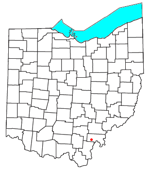
Langsville, Ohio
Encyclopedia
Unincorporated area
In law, an unincorporated area is a region of land that is not a part of any municipality.To "incorporate" in this context means to form a municipal corporation, a city, town, or village with its own government. An unincorporated community is usually not subject to or taxed by a municipal government...
in western Rutland Township
Rutland Township, Meigs County, Ohio
Rutland Township is one of the twelve townships of Meigs County, Ohio, United States. The 2000 census found 2,347 people in the township, 1,946 of whom lived in the unincorporated portions of the township.-Geography:...
, Meigs County
Meigs County, Ohio
Meigs County is a county located in the state of Ohio, United States. As of the 2010 census, the population was 23,770. Its county seat is Pomeroy, and it is named for Return J. Meigs, Jr., the 4th Governor of Ohio.-Geography:...
, Ohio
Ohio
Ohio is a Midwestern state in the United States. The 34th largest state by area in the U.S.,it is the 7th‑most populous with over 11.5 million residents, containing several major American cities and seven metropolitan areas with populations of 500,000 or more.The state's capital is Columbus...
, United States
United States
The United States of America is a federal constitutional republic comprising fifty states and a federal district...
, along Leading Creek
Leading Creek (Ohio)
Leading Creek is a tributary of the Ohio River, long, in southeastern Ohio in the United States. Via the Ohio River, it is part of the watershed of the Mississippi River, draining an area of on the unglaciated portion of the Allegheny Plateau...
. Although it is unincorporated, it has a post office
Post office
A post office is a facility forming part of a postal system for the posting, receipt, sorting, handling, transmission or delivery of mail.Post offices offer mail-related services such as post office boxes, postage and packaging supplies...
, with the ZIP code
ZIP Code
ZIP codes are a system of postal codes used by the United States Postal Service since 1963. The term ZIP, an acronym for Zone Improvement Plan, is properly written in capital letters and was chosen to suggest that the mail travels more efficiently, and therefore more quickly, when senders use the...
of 45741.
Education
Public education in the community of Langsville is provided by the Meigs Local School DistrictMeigs Local School District
The Meigs Local School District is a public school district based in Pomeroy, Ohio, United States.The school district includes all of Rutland Salem, Salisbury, Scipio as well as most of Bedford Township, and a very small portion of Chester Township....
. Campuses serving the community include Meigs Primary School (Grades K-2), Meigs Intermediate School (Grades 3-5), Meigs Middle School (Grades 6-8), and Meigs High School
Meigs High School
Meigs High School is a public high school in Pomeroy, Ohio, United States. It is one of three high schools in the Meigs Local School District. The school mascot is the Marauders.-Athletics:...
(Grades 9-12).