

Kulaura Upazila
Encyclopedia
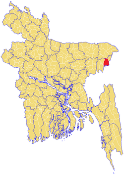
Kulaura is the biggest upazila (subdistricts) of the Moulvibazar district of in north-eastern Bangladesh
. It is bounded by Balaganj and Fenchuganj upazilas of Sylhet
district in the south, Barlekha upazila and Tripura
of India
in the east, Tripura again in the north and Rajnagar
and Kamalganj
upazilas in the west. The total area of this upazila is 495 km2. The average height of this locality from the sea level is about 54 feet. Even though most of the lands are plain, vast areas of its lands are hilly. A small part is very low lying including haors.
Kulaura was upgraded to an Upazila in 1982 and former Minster Air Vice Marshal (Retd.) A.G.Mahmud inaugurated the Upazila head quarters. Mr. Abdul Matin was the first elected Chairman of this Upazila. Late Abdul Jabbar was elected as the Upazila Chairman in the second term. Government suspended the Upazila Parishad in 1991. Present government reformed the upazila system and it has been declared that the election of the office the Chairman will be held very soon. Kulaura has been upgraded in to a Pourashava (municipal town). Mr. Abdul Malik is the present chairman of the pourashava. (For more details click on Pourashava section).
The river Manu
is the principal and biggest river of this Upazila. Other rivers include Bilash, Fanai, Kapua, and Juri etc. The biggest haor
of greater Sylhet, Hakaluki
, belongs to Kulaura Upazila. These rivers and haors are the major sources of pisciculture not only for Kulaura but the whole Bangladesh. The haor beds serves as paddy land during monsoon
and yields a lot of crops mainly boro. Kulaura is also famous for its tea industries. Rubber, orange, pineapple, mango, jack fruit and bamboo are also produced in this upazila.
Apart from haors and rivers the majority of its lands are plain. There are some hilly areas also.
 A few of the companions of the great saint Hazrat Shah Jalal (RA) preached Islam and lived in Kulaura. Their shrines exist there till today as follows:
1) Hazrat Shah Helimuddin Nurnali (RA) – Although His shrine has been taken away by the erosion of Manu river, his dynasty still exists in the villages of Koala of Langla pargana and Hazipur of Kanihati pargana.
2) Hazrat Shah Helimuddin Qureshi (RA)-His holy shrine is located in the bank of the river Kanai.The famous Choudhuris of the village Monsur is believed to be his descendants.
3) Hazrat Hamid Faruqui (RA)-His holy shrine is located in the village Kaukapon of Kanihati union where His descendants are living.
4) Hazrat Syed Nasarullah-Even though there is no trace of His shrine, the Syed family of village Joy pasha of Kulaura is believed to be His descendants.
There is unclear history about many Hindu zaminders and famous Hindu families living in this upazila. However, many legacies of Muslim families are well documented. The family of Syed Amjad Ali Khan of Prithimpasha is not only a featured name in Moulvibazar alone but also the whole of Bangladesh. This family stemmed from the legendary family of Robi Khan. Mr.Ali Amjad khan hosted dignitaries like Shahanahah Reza Pahlavi of Iran, Quaid-e-Azam Muhammad Ali Jinnah, Field Marshal Ayub Khan in his palace in Pritimpasha. This family draws a lot of visitors annually.
In 1960,Kulaura was divided officially into the following 17 unions:
1) Baramchal 2) Bhukshimahal 3) Jaifornagar 4) Joychandi 5) Brahmanbazar 6) Kadipur 7) Kulaura 8) Rauthgaon 9) Tilagaon 10) Hazipur 11) Sharifpur 12) Prithimpasha 13) Komoda 14) Fultola 15) Sagarnal 16) Goalbari 17) Bhatera
Many famous dignitaries of Indian sub-continent visited Kulaura and enriched its fame. They included novel laureate poet Rabindranath Tagore, Quaid-E-Azam Mohammed Ali Jinnah, Sher –e-Bangla AK Fazlul Huq, Liakat Ali Khan, and Pandit Jawarlal Nehru
The lists of the Union Parishads Chairman’s are here as under:
Bangladesh
Bangladesh , officially the People's Republic of Bangladesh is a sovereign state located in South Asia. It is bordered by India on all sides except for a small border with Burma to the far southeast and by the Bay of Bengal to the south...
. It is bounded by Balaganj and Fenchuganj upazilas of Sylhet
Sylhet
Sylhet , is a major city in north-eastern Bangladesh. It is the main city of Sylhet Division and Sylhet District, and was granted metropolitan city status in March 2009. Sylhet is located on the banks of the Surma Valley and is surrounded by the Jaintia, Khasi and Tripura hills...
district in the south, Barlekha upazila and Tripura
Tripura
Tripura is a state in North-East India, with an area of . It is the third smallest state of India, according to area. Tripura is surrounded by Bangladesh on the north, south, and west. The Indian states of Assam and Mizoram lie to the east. The capital is Agartala and the main languages spoken are...
of India
India
India , officially the Republic of India , is a country in South Asia. It is the seventh-largest country by geographical area, the second-most populous country with over 1.2 billion people, and the most populous democracy in the world...
in the east, Tripura again in the north and Rajnagar
Rajnagar
Rajnagar may refer to:Places* Rajnagar Upazila a subdivision in Maulvibazar District, Bangladesh* Rajnagar Bihar, a town in Madhubani District, Bihar, India* Rajnagar, Chhatarpur, a town in Madhya Pradesh, India...
and Kamalganj
Kamalganj
Kamalganj is a town and a nagar panchayat in Farrukhabad district in the Indian state of Uttar Pradesh in India.-Geography:Kamalganj is located at . It has an average elevation of 135 metres .-Demographics:...
upazilas in the west. The total area of this upazila is 495 km2. The average height of this locality from the sea level is about 54 feet. Even though most of the lands are plain, vast areas of its lands are hilly. A small part is very low lying including haors.
Kulaura was upgraded to an Upazila in 1982 and former Minster Air Vice Marshal (Retd.) A.G.Mahmud inaugurated the Upazila head quarters. Mr. Abdul Matin was the first elected Chairman of this Upazila. Late Abdul Jabbar was elected as the Upazila Chairman in the second term. Government suspended the Upazila Parishad in 1991. Present government reformed the upazila system and it has been declared that the election of the office the Chairman will be held very soon. Kulaura has been upgraded in to a Pourashava (municipal town). Mr. Abdul Malik is the present chairman of the pourashava. (For more details click on Pourashava section).
Geography
Kulaura is located at 24.5167°N 92.0333°E. It has 58,883 units of house hold and total area 679.25 square kilometre.The river Manu
Manu River, Tripura
The Manu River rises in the mountains of Tripura . After its initial rapid passage through mountainous terrain it slows and meanders during its course, which includes the Sylhet plains. It joins the Kushiyara River at Manumukh in the Bangladeshi district of Maulvi Bazar.-External links:**...
is the principal and biggest river of this Upazila. Other rivers include Bilash, Fanai, Kapua, and Juri etc. The biggest haor
Haor
A haor is a wetland ecosystem in the north eastern part of Bangladesh which physically is a bowl or saucer shaped shallow depression, also known as a backswamp...
of greater Sylhet, Hakaluki
Hakaluki haor
Hakaluki Haor is a marsh wetland ecological system of Eastern Bangladesh in an area bordering Assam, India. It is one of Bangladesh's largest and one of Asia's larger marsh wetland resources...
, belongs to Kulaura Upazila. These rivers and haors are the major sources of pisciculture not only for Kulaura but the whole Bangladesh. The haor beds serves as paddy land during monsoon
Monsoon
Monsoon is traditionally defined as a seasonal reversing wind accompanied by corresponding changes in precipitation, but is now used to describe seasonal changes in atmospheric circulation and precipitation associated with the asymmetric heating of land and sea...
and yields a lot of crops mainly boro. Kulaura is also famous for its tea industries. Rubber, orange, pineapple, mango, jack fruit and bamboo are also produced in this upazila.
Apart from haors and rivers the majority of its lands are plain. There are some hilly areas also.
History
1) Hazrat Shah Helimuddin Nurnali (RA) – Although His shrine has been taken away by the erosion of Manu river, his dynasty still exists in the villages of Koala of Langla pargana and Hazipur of Kanihati pargana.
2) Hazrat Shah Helimuddin Qureshi (RA)-His holy shrine is located in the bank of the river Kanai.The famous Choudhuris of the village Monsur is believed to be his descendants.
3) Hazrat Hamid Faruqui (RA)-His holy shrine is located in the village Kaukapon of Kanihati union where His descendants are living.
4) Hazrat Syed Nasarullah-Even though there is no trace of His shrine, the Syed family of village Joy pasha of Kulaura is believed to be His descendants.
There is unclear history about many Hindu zaminders and famous Hindu families living in this upazila. However, many legacies of Muslim families are well documented. The family of Syed Amjad Ali Khan of Prithimpasha is not only a featured name in Moulvibazar alone but also the whole of Bangladesh. This family stemmed from the legendary family of Robi Khan. Mr.Ali Amjad khan hosted dignitaries like Shahanahah Reza Pahlavi of Iran, Quaid-e-Azam Muhammad Ali Jinnah, Field Marshal Ayub Khan in his palace in Pritimpasha. This family draws a lot of visitors annually.
In 1960,Kulaura was divided officially into the following 17 unions:
1) Baramchal 2) Bhukshimahal 3) Jaifornagar 4) Joychandi 5) Brahmanbazar 6) Kadipur 7) Kulaura 8) Rauthgaon 9) Tilagaon 10) Hazipur 11) Sharifpur 12) Prithimpasha 13) Komoda 14) Fultola 15) Sagarnal 16) Goalbari 17) Bhatera
Many famous dignitaries of Indian sub-continent visited Kulaura and enriched its fame. They included novel laureate poet Rabindranath Tagore, Quaid-E-Azam Mohammed Ali Jinnah, Sher –e-Bangla AK Fazlul Huq, Liakat Ali Khan, and Pandit Jawarlal Nehru
Demographics
Bangladesh census, Kulaura has a population of 339,673. Males constitute are 51.09% of the population, and females 48.91%. This Upazila's eighteen up population is 171,346. Kulaura has an average literacy rate of 28.8% (7+ years), and the national average of 32.4% literate.Administrative
Kulaura has 17 Unions/Wards, 184 Mauzas/Mahallas, and 486 villages.The lists of the Union Parishads Chairman’s are here as under:
| SL # | NAME OF UNION |
|---|---|
| 1 | BOROMCHAL |
| 2 | BHUKSHIMAIL |
| 3 | JAIFORNAGAR |
| 4 | JOYCHANDI |
| 5 | BRAHMANBAZAR |
| 6 | KADIPUR |
| 7 | KULAURA |
| 8 | RAUTHGAON |
| 9 | TILAGAON |
| 10 | HAJIPUR |
| 11 | SHARIFPUR |
| 12 | PRITHIMPASHA |
| 13 | KARMODA |
| 14 | FULTOLA |
| 15 | SAGARNAL |
| 16 | GOALBARI |
| 17 | BHATERA |