

Ko Phai
Encyclopedia
Eastern Seaboard of Thailand
The Eastern Seaboard of Thailand is an emerging economic region, and plays a key role in Thailand's economy. Its importance lies in the fact that it is Thailand's center for export oriented industries. High value goods, such as Japanese branded automobiles, which are manufactured there and...
Islands of Thailand
Thailand
Thailand , officially the Kingdom of Thailand , formerly known as Siam , is a country located at the centre of the Indochina peninsula and Southeast Asia. It is bordered to the north by Burma and Laos, to the east by Laos and Cambodia, to the south by the Gulf of Thailand and Malaysia, and to the...
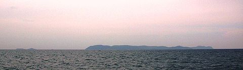
. It is located about 21 km to the west of Pattaya
Pattaya
Pattaya is a city in Thailand, located on the east coast of the Gulf of Thailand, about 165 km southeast of Bangkok located within but not part of Amphoe Bang Lamung in the province of Chonburi....
. It is also mentioned as "Bamboo Island", the meaning of its name in Thai
Thai language
Thai , also known as Central Thai and Siamese, is the national and official language of Thailand and the native language of the Thai people, Thailand's dominant ethnic group. Thai is a member of the Tai group of the Tai–Kadai language family. Historical linguists have been unable to definitively...
, in tourist guides. This island is located at the SE end of the Bay of Bangkok
Bay of Bangkok
The Bay of Bangkok , also known as the Bight of Bangkok, is the northernmost part of the Gulf of Thailand, roughly extending from Hua Hin to the west and Sattahip to the east...
, on the eastern side of the Gulf of Siam. Administratively Ko Phai belongs to the Amphoe Bang Lamung
Amphoe Bang Lamung
Bang Lamung is a district in the southern part of Chonburi Province, Thailand.- History :Mueang Bang Lamung was located in Ban Bang Lamung, Tambon Bang Lamung. The government downgraded Bang Lamung to be a district, with the district office located on the bank of Khlong Nok Yang...
, Chonburi Province
Chonburi Province
Chonburi is a province of Thailand. Neighboring provinces are Chachoengsao, Chanthaburi and Rayong. To the west is the Gulf of Thailand. The eastern seaboard is heavily industrialized and underpinned by shipping, transportation, tourism, and manufacturing industries, and second to only Bangkok...
.
Ko Phai is almost 4 km in length and its maximum width is about 1.5 km. It is a quite craggy wooded island and a great part of its coast is formed by rocky cliffs. The whole island is high, but its highest point is only 150 m and there is not a single peak dominating above the others. There is a light house on the summit of the island.
"Ko Phai" is the name of the island in the Royal Thai General System of Transcription
Royal Thai General System of Transcription
The Royal Thai General System of Transcription is the official system for rendering Thai language words in the Latin alphabet, published by the Royal Institute of Thailand...
. It is also known as "Koh Pai" in the English-based Thai transcription that is now becoming obsolete.
The closest land to the Ko Phai group is Ko Lan
Ko Lan
Ko Lan is one of the Eastern Seaboard islands of Thailand.-Geography:Ko Lan is the largest of the "Near Islands", off south Pattaya. It is located at the SE end of the Bay of Bangkok, on the eastern side of the Gulf of Siam...
, located about 14 km to the east of Ko Phai's eastern shore.
These islands can be reached in about 2 hours by boat from Southern Pattaya harbor. The rental rate depends on the size of the boat and the destination. All these islands are a protected natural area under the supervision of the Royal Thai Navy
Royal Thai Navy
The Royal Thai Navy is the navy of Thailand and part of the Royal Thai Armed Forces, it was established in the late 19th century. Admiral Prince Abhakara Kiartiwongse is "The Father of Royal Thai Navy". Similar to the organizational structure of the United States, the Royal Thai Navy includes the...
. Visitors ought to bring their own food and water and they are not allowed to stay overnight on Mu Ko Phai.
Adjacent islands
Other islands of the group include:- Ko Luam, or Ko Lueam, (เกาะเหลื่อม ) is a high rocky island wooded at the top much like Ko Phai; highest point 135 m. It is located to the NW of the main island. Ko Lueam has a small islet, Ko Lueam Noi, off its eastern coast.
- Ko Man Wichai (เกาะมารวิชัย), 2 km in length and highest point 64 m, Ko Klung Badan (เกาะกรุงบาดาล ), highest point 50 m, and the small islet of Ko Hu Chang (เกาะหูช้าง ), are all located to the south of Ko Phai.
Scuba diving
One of the main attractions of the island group are some well-preserved coral reefs. A World War IIWorld War II
World War II, or the Second World War , was a global conflict lasting from 1939 to 1945, involving most of the world's nations—including all of the great powers—eventually forming two opposing military alliances: the Allies and the Axis...
-vintage ship of the Royal Thai Navy, HTMS Khram (ex USS LSM-469), was sunk 300 m to the east of Ko Phai in January 2003 in order to create an artificial submerged reef. The wreck is located in an area suitable for scuba diving.