Killari
Encyclopedia

India
India , officially the Republic of India , is a country in South Asia. It is the seventh-largest country by geographical area, the second-most populous country with over 1.2 billion people, and the most populous democracy in the world...
at 03:56 local time (UTC + 04:30) on September 30, 1993. The main area affected was the Maharashtra
Maharashtra
Maharashtra is a state located in India. It is the second most populous after Uttar Pradesh and third largest state by area in India...
State in Western India. The earthquake
Earthquake
An earthquake is the result of a sudden release of energy in the Earth's crust that creates seismic waves. The seismicity, seismism or seismic activity of an area refers to the frequency, type and size of earthquakes experienced over a period of time...
primarily affected the districts of Latur
LaTur
La Tur was a Mexican airline that operated from 1988 until 1992 when it was taken over by TAESA.-Company history:Set up in 1988 to help develop the tourist market, La Tur began operations using McDonnell Douglas MD-83 aircraft. One year later, the Airbus A300-600 was introduced for flights to Europe...
and Osmanabad
Osmanabad
Osmanabad is a city and a municipal council in Osmanabad district in the Indian state of Maharashtra.-Geography:The city of Osmanabad is located at . It has an average elevation of 647 metres ....
including Ausa block of Latur and Umerga of Osmanabd. Total 52 villages were demolished.It was an intraplate earthquake
Intraplate earthquake
An intraplate earthquake is an earthquake that occurs in the interior of a tectonic plate, whereas an interplate earthquake is one that occurs at a plate boundary....
. It measured 7.4 on the Richter Scale, and approximately 20,000 people died, whilst another 30,000 were injured. The earthquake's focus was around 12 km deep - relatively shallow causing shock waves to cause more damage.
Because India
India
India , officially the Republic of India , is a country in South Asia. It is the seventh-largest country by geographical area, the second-most populous country with over 1.2 billion people, and the most populous democracy in the world...
does not lie on a plate boundary there was some debate as to what caused the earthquake. One suggestion is the existence of fault webs. The Indian sub-continent crumples as it pushes against Asia
Asia
Asia is the world's largest and most populous continent, located primarily in the eastern and northern hemispheres. It covers 8.7% of the Earth's total surface area and with approximately 3.879 billion people, it hosts 60% of the world's current human population...
and pressure is released. It is possible that this pressure is released along fault lines. Another argument is that reservoir construction along the Terna
Terna
Terňa is a village and municipality in Prešov District in the Prešov Region of eastern Slovakia.-Geography:The municipality lies at an altitude of 383 metres and covers an area of 29.408km². It has a population of about 1090 people....
was responsible for increasing pressure on fault lines.
Relief Efforts:
Several foreign and local donors reacted immediately to the tragedy by sending relief teams and rescue workers. The first convoy of over 120 trucks laden with relief material such as tents, blankets, food and clothing, medical supplies and temporary shelters given by international donors departed from Mumbai at around 10am on October 2, 1993. The Indian Army, State Reserve Police Force, Central Reserve Police Force and other law enforcement agencies had rushed their personnel almost immediately after the quake, assuming there would be a greater number of casualties.
Also among the first to respond were Amateur Radio operators from Mumbai and Hyderabad, who had rushed to Omerga
Omerga
Omerga is a talukas in the Osmanabad district. Its name itself indicates as Uma Marg, after the goddess Tulja Bhavani, who is also called Uma. Hence, at many places Omerga is also written as Umarga. Omerga is represented in Hyderabad mukti sangram.- Overview :Omerga city is a Taluka place in...
, a town near Latur from where all quake hit areas could be accessed by road. The Mumbai-based JNA Wireless Association undertook a special mission. With four-wheel drive vehicles given for the purpose by Mahindra and Mahindra, a group of eight Mumbai based radio hams escorted the supplies convoy from Mumbai to Omerga. Later, these ham radio operators split into four groups and visited scores of ravaged villages, relaying vital information such as possible outbreak of disease, food supply situation and devastation of the area visited to a control station set up in Omerga. During the 10-day field trip, these radio hams successfully assisted disaster mitigation efforts undertaken by the Indian government and private aid agencies.
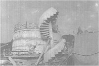
Killari, where the epicenter of the quake is believed to be located, had a large crater, which remains in place to date.

