
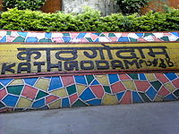
Kathgodam
Encyclopedia
Kathgodam is a town in the Nainital district of Uttarakhand
state of India
. It is part of the twin township of Haldwani
-Kathgodam (हल्द्वानी-काठगोदाम), and is immediately north of Haldwani.
in 1884.
 Today, it is the last station on its Indian Railways
line; from this point, one must travel by automobile to the Kumaon
region of the Himalayan
Mountains. From Kathgodam, mountain roads lead to tourist destinations like Nainital, Bhimtal
, Sattal
, Mukteshwar
, Ranikhet
,Naukuchiyatal and Almora
.
 Kathgodam is located at 29.27°N 79.53°E. It has an average elevation of 554 metres (1,483 feet). It is situated on the banks of the Gaula river
.
Kathgodam is one of the most picturesque locations situated in the Bhabhar
region, the foothills of Kumaon Himalayas.
Kathgodam also leads a way to one of the beautiful ashram called as Hairakhan.
There is a beautiful dam which is built on the Gola River
.
Schools include the Maharishi school, Nirmala Convent High School,St. Theresa School, St. Paul's Senior Secondary School, Naini Valley School and Inspiration School (these arranged in the manner from katghodam to haldwani).
Collage include Kumaun Institute Of Information Technology[KIIT] is located at Nainital road ,Kathgodam: a convenient and prominent area of Kumaun hills on National Highway - 84, 1/2 km from Kathgodam railway station & 4 km from Haldwani.
Uttarakhand
Uttarakhand , formerly Uttaranchal, is a state in the northern part of India. It is often referred to as the Land of Gods due to the many holy Hindu temples and cities found throughout the state, some of which are among Hinduism's most spiritual and auspicious places of pilgrimage and worship...
state of India
India
India , officially the Republic of India , is a country in South Asia. It is the seventh-largest country by geographical area, the second-most populous country with over 1.2 billion people, and the most populous democracy in the world...
. It is part of the twin township of Haldwani
Haldwani
Haldwani is a city, which along with its twin township of Kathgodam forms the Haldwani-Kathgodam municipal board in Nainital District in the Indian state of Uttarakhand....
-Kathgodam (हल्द्वानी-काठगोदाम), and is immediately north of Haldwani.
History
Literally meaning timber depot, Kathgodam was a small village in 1901 with a population of 375, though its importance grew rapidly after the railway line was extended here in late 19th century, after its reach HaldwaniHaldwani
Haldwani is a city, which along with its twin township of Kathgodam forms the Haldwani-Kathgodam municipal board in Nainital District in the Indian state of Uttarakhand....
in 1884.
Indian Railways
Indian Railways , abbreviated as IR , is a departmental undertaking of Government of India, which owns and operates most of India's rail transport. It is overseen by the Ministry of Railways of the Government of India....
line; from this point, one must travel by automobile to the Kumaon
Kumaon Division
For Kumaoni/Kumauni People see Kumauni PeopleKumaon or Kumaun is one of the two regions and administrative divisions of Uttarakhand, a mountainous state of northern India, the other being Garhwal. It includes the districts of Almora, Bageshwar, Champawat, Nainital, Pithoragarh, and Udham Singh Nagar...
region of the Himalayan
Himalayas
The Himalaya Range or Himalaya Mountains Sanskrit: Devanagari: हिमालय, literally "abode of snow"), usually called the Himalayas or Himalaya for short, is a mountain range in Asia, separating the Indian subcontinent from the Tibetan Plateau...
Mountains. From Kathgodam, mountain roads lead to tourist destinations like Nainital, Bhimtal
Bhimtal
Bhimtal Lake is a lake in the town of Bhimtal, Uttarakhand, India. There is an island at the centre of the lake. It is the largest lake in the only real lake district of India...
, Sattal
Sattal
Sattal or Sat Tal is an interconnected group of seven freshwater lakes situated in the Lower Himalayan Range near Bhimtal, a town of the Nainital lake district in Uttarakhand, India...
, Mukteshwar
Mukteshwar
Mukteshwar is a town and tourist destination in the Nainital district of Uttarakhand, India. It sits high in the Kumaon Hills at an altitude of 2286 meters , 51 km from Nainital, 72 km from Haldwani, and 395 km from Delhi....
, Ranikhet
Ranikhet
Ranikhet is a hill station and cantonment town in Almora district in the Indian state of Uttarakhand. It is the home for the Military Hospital, Kumaon Regiment & Naga Regiment and is maintained by the Indian Army....
,Naukuchiyatal and Almora
Almora
Almora is a municipal board, a cantonment town in the Almora district in the state of Uttarakhand, India. Almora was founded in 1568.It is a town bustling with activity and a rich cultural heritage and history. It is considered the cultural heart of the Kumaon region of...
.
Geography
Gaula River (India)
The Gaula River is a river in India. It is approximately 500 kilometers long. It originates in the Sattal lakes of Uttarakhand state, and flows south past Kathgodam, Haldwani, and Shahi, finally joining the Ramganga River about northwest of Bareilly in Uttar Pradesh, Ramganga in turn is a...
.
Kathgodam is one of the most picturesque locations situated in the Bhabhar
Bhabhar
Bhabhar is the region south of the Lower Himalayas and the Siwalik Hills It is the alluvial apron of sediments washed down from the Siwaliks along the northern edge of the Indo-Gangetic Plain.-Etymology:...
region, the foothills of Kumaon Himalayas.
Local Attractions
Situated close to Kathgodam are beautiful temples called 'Sheetla devi' and 'Kalichaud' which attract large numbers of devotees from the surrounding region during festivals.Kathgodam also leads a way to one of the beautiful ashram called as Hairakhan.
There is a beautiful dam which is built on the Gola River
Gola River
Gola is a river originating from Lesser Himalayas majorly a Spring fed River, this river is source of water for Haldwani & Kathgodam, A very beautiful dam exists over this river in Kathgodam....
.
Schools include the Maharishi school, Nirmala Convent High School,St. Theresa School, St. Paul's Senior Secondary School, Naini Valley School and Inspiration School (these arranged in the manner from katghodam to haldwani).
Collage include Kumaun Institute Of Information Technology[KIIT] is located at Nainital road ,Kathgodam: a convenient and prominent area of Kumaun hills on National Highway - 84, 1/2 km from Kathgodam railway station & 4 km from Haldwani.