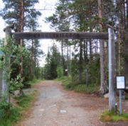
Karhunkierros
Encyclopedia

Hiking
Hiking is an outdoor activity which consists of walking in natural environments, often in mountainous or other scenic terrain. People often hike on hiking trails. It is such a popular activity that there are numerous hiking organizations worldwide. The health benefits of different types of hiking...
trail that stretches from Salla
Salla
Salla is a municipality of Finland, located in Lapland. The municipality has a population of and covers an area of ofwhich is water. The population density is....
to Kuusamo
Kuusamo
Kuusamo is a town and municipality in Finland. It is located in the Oulu province and is part of the Northern Ostrobothnia region. The municipality has a population of and covers an area of of which is water. The population density is ....
in north-eastern Finland
Finland
Finland , officially the Republic of Finland, is a Nordic country situated in the Fennoscandian region of Northern Europe. It is bordered by Sweden in the west, Norway in the north and Russia in the east, while Estonia lies to its south across the Gulf of Finland.Around 5.4 million people reside...
.
The route was first marked in 1955, and has since become the most popular hiking trail in Finland, attracting some 15,000 hikers every year, mainly over the high season lasting from mid-July to late September. The trail is approximately 80 kilometre long, and runs for the most of its length within the Oulanka National Park
Oulanka National Park
Oulanka National Park is a national park in the Northern Ostrobothnia and Lapland regions of Finland, covering . It was established in 1956 and was expanded again in 1982 and 1989, and it borders with Paanajärvi National Park in Russia...
.
Route
The trail has two main starting points. The paths starting at HautajärviHautajärvi
Hautajärvi is a village in southeast Lapland, Finland, near the border with the Republic of Karelia and the Murmansk Oblast of the Russian Federation. Hautajärvi is located in the Salla municipality...
and at Ristikallio converge at Taivalköngäs, from where the trail continues along the Oulanka and Kitka rivers towards Rukatunturi
Rukatunturi
Rukatunturi is a high fell and a ski resort in Kuusamo, Finland. Apart from downhill skiing, there are over 500 km of cross-country skiing tracks. Also snowmobiles can be rented to enjoy some of the area's 600 km of snowmobile routes . Ruka is also the southern end of the Karhunkierros...
fell. Starting from Hautajärvi makes the total length of the trail 80 kilometres, while the Ristikallio variant is some 9 km shorter. The route is marked with orange paint markings in trees and rocks.
It is also perfectly possible to hike the route in the opposite direction, starting from Rukatunturi, but most people prefer the aforementioned ways.
Also of note is the Pieni Karhunkierros, or Little Bear's Ring, a circular day trip trail of 12 km (7.5 mi) that partly shares the route of Karhunkierros proper.
Accommodation
Along the trail there are eight wilderness hutWilderness hut
A wilderness hut is a rent-free, open dwelling place for temporary accommodation, usually located in wilderness areas, national parks and along backpacking routes. As such, the tradition is largely found in Finland, and to some extent in Sweden, Norway, and northern Russia too.The huts can be...
s that are open and free to use for every visitor to spend a night in, plus two day trip huts for shorter breaks. In addition there are several campfire sites
Campsite
A campsite or camping pitch is a place used for overnight stay in the outdoors. In British English a campsite is an area, usually divided into a number of pitches, where people can camp overnight using tents or camper vans or caravans; this British English use of the word is synonymous with the...
and lean-to shelters, and a more fully equipped camping ground. Camping outside the designated areas is not permitted along the trail.

