
Kampong Sungai Teraban
Encyclopedia
Kampong Sungai Teraban is a village (kampong) in Brunei
. It is located in the Belait
district across the mouth of the Belait River from Kuala Belait
and serves as a suburb of the latter. The current village has a population of 941.
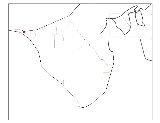
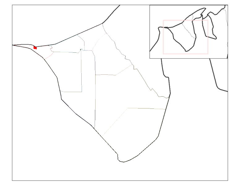 Kampong Sungai Teraban is located on the west bank of the mouth of the Belait River at 114.18ºE longtitude and 4.59ºN latitude. The village is bounded by the South China Sea
to the north, the Belait River to the east, Rasau
to the south with the villages of Kampong Sungai Tiga and the Malaysian border at Sungai Tujoh
to the west.
Kampong Sungai Teraban is one of the kampongs in Mukim Kuala Belait. Due to its proximity to downtown Kuala Belait
, which is immediately across the river from the village, it serves mainly as a residential suburb for the nearby town.
was a small fishing village at the turn of the 20th century. The natives were Belait Malays
who were mainly fishermen. According to local customs, there was a falling out between two groups of the inhabitants and one of those groups moved to the west bank of the mouth of the Belait River to found the current day Kampong Sungai Teraban. Kampong Sungai Teraban was initially known as Kampong Seberang, meaning in Malay 'the village on the opposite bank'. In the 1930s and 1940s, Chinese Hokkien immigrants from the Wee (one of whom was Wee Thian Boo, also known as Ng Tow Woo 1906-1994), Shim, Yeo, and Tan families lived in the village. Their descendants still live in the village today.
Kampong Sungai Teraban gain prominence in the latter half of the 20th century as a point en route to Miri
in Sarawak
, Malaysia. Oil from the Seria field was initially exported to Lutong in Miri via a pipeline running through the village. This was halted after the construction of the Seria Crude Oil Terminal. The pipeline has since been dismantled.
A ferry connected the village to Kuala Belait which was the only route for land vehicles to travel from Bandar Seri Begawan
and other places east of the Belait River overland to Miri for much of the 20th century. The ferry is no longer in operation, due to its declined use since the opening of the Rasau bridge linking Kampong Sungai Duhon
to Rasau.. Since the 1990s, there have been many newcomers to the village.
. The main area for the field is located south of Kampong Sungai Teraban and most of the wells are located there.
The Sungai Teraban Valve Station (STVS) is located near the mouth of the Belait River. It supplies domestic gas and potable water to the village and to the Rasau facilies in the south.
There is a scheduled bus service that runs through the village from the bus station in Kuala Belait
to the immigration post at Sungai Tujoh
(towards Miri
).
A ferry used to connect Kampong Sungai Teraban to Kuala Belait town to the east. The ferry operated from 6am to 6pm and there was a charge of $3 one way for taking the ferry across the river. The ferry is no longer in service.
There are no airports in the village. Commercial travellers would have to travel to either Bandar Seri Begawan or Miri to catch a commercial flight.
Brunei
Brunei , officially the State of Brunei Darussalam or the Nation of Brunei, the Abode of Peace , is a sovereign state located on the north coast of the island of Borneo, in Southeast Asia...
. It is located in the Belait
Belait
Belait can refer to either:* the Belait District of Brunei Darussalam.* Kuala Belait, the administrative town of the Belait District* the Belait River which flows through the Belait District of Brunei Darussalam....
district across the mouth of the Belait River from Kuala Belait
Kuala Belait
This article refers to the town of Kuala Belait. For the mukim of the same name, please refer to Kuala Belait, Belait. For district, please see Belait district.Kuala Belait |Jawi]]: )is a town located in South-West of Brunei...
and serves as a suburb of the latter. The current village has a population of 941.
Location
South China Sea
The South China Sea is a marginal sea that is part of the Pacific Ocean, encompassing an area from the Singapore and Malacca Straits to the Strait of Taiwan of around...
to the north, the Belait River to the east, Rasau
Rasau
Rasau is an area in Brunei. The area contains one of the two oil fields of Brunei, the Rasau Field, and a small village, Kampong Rasau. The village located in the area has a population of 103.-Location:...
to the south with the villages of Kampong Sungai Tiga and the Malaysian border at Sungai Tujoh
Sungai Tujoh
Sungai Tujoh, also abbreviated as Sg. Tujoh, is the westernmost point of Brunei. It is located in the Belait district . The name of the area is derived from two Bruneian Malay words - Sungai, which means river or stream, and Tujoh or the number seven...
to the west.
Kampong Sungai Teraban is one of the kampongs in Mukim Kuala Belait. Due to its proximity to downtown Kuala Belait
Kuala Belait
This article refers to the town of Kuala Belait. For the mukim of the same name, please refer to Kuala Belait, Belait. For district, please see Belait district.Kuala Belait |Jawi]]: )is a town located in South-West of Brunei...
, which is immediately across the river from the village, it serves mainly as a residential suburb for the nearby town.
History
Kuala BelaitKuala Belait
This article refers to the town of Kuala Belait. For the mukim of the same name, please refer to Kuala Belait, Belait. For district, please see Belait district.Kuala Belait |Jawi]]: )is a town located in South-West of Brunei...
was a small fishing village at the turn of the 20th century. The natives were Belait Malays
Malay people
Malays are an ethnic group of Austronesian people predominantly inhabiting the Malay Peninsula, including the southernmost parts of Thailand, the east coast of Sumatra, the coast of Borneo, and the smaller islands which lie between these locations...
who were mainly fishermen. According to local customs, there was a falling out between two groups of the inhabitants and one of those groups moved to the west bank of the mouth of the Belait River to found the current day Kampong Sungai Teraban. Kampong Sungai Teraban was initially known as Kampong Seberang, meaning in Malay 'the village on the opposite bank'. In the 1930s and 1940s, Chinese Hokkien immigrants from the Wee (one of whom was Wee Thian Boo, also known as Ng Tow Woo 1906-1994), Shim, Yeo, and Tan families lived in the village. Their descendants still live in the village today.
Kampong Sungai Teraban gain prominence in the latter half of the 20th century as a point en route to Miri
Miri
Miri is a city in northern Sarawak, Malaysia, on the island of Borneo. It is the second largest city in Sarawak, with a population of about 300,000, and the government administrative centre of Miri District in Miri Division....
in Sarawak
Sarawak
Sarawak is one of two Malaysian states on the island of Borneo. Known as Bumi Kenyalang , Sarawak is situated on the north-west of the island. It is the largest state in Malaysia followed by Sabah, the second largest state located to the North- East.The administrative capital is Kuching, which...
, Malaysia. Oil from the Seria field was initially exported to Lutong in Miri via a pipeline running through the village. This was halted after the construction of the Seria Crude Oil Terminal. The pipeline has since been dismantled.
A ferry connected the village to Kuala Belait which was the only route for land vehicles to travel from Bandar Seri Begawan
Bandar Seri Begawan
Bandar Seri Begawan, with an estimated population 140,000 , is the capital and largest city of the Sultanate of Brunei...
and other places east of the Belait River overland to Miri for much of the 20th century. The ferry is no longer in operation, due to its declined use since the opening of the Rasau bridge linking Kampong Sungai Duhon
Kampong Sungai Duhon
Kampong Sungai Tujoh is a village that is located in the Belait district of Brunei. It is not known if the village was named after the river of Sungai Tujoh or vice versa...
to Rasau.. Since the 1990s, there have been many newcomers to the village.
Oil and gas
Kampong Sungai Teraban is located north of the onshore Rasau fieldRasau
Rasau is an area in Brunei. The area contains one of the two oil fields of Brunei, the Rasau Field, and a small village, Kampong Rasau. The village located in the area has a population of 103.-Location:...
. The main area for the field is located south of Kampong Sungai Teraban and most of the wells are located there.
The Sungai Teraban Valve Station (STVS) is located near the mouth of the Belait River. It supplies domestic gas and potable water to the village and to the Rasau facilies in the south.
Transportation
The main roads linking the ferry crossing towards the Malaysian border (11 kilometers) and towards Rasau bridge are surfaced. Not all the roads in the village are surfaced.There is a scheduled bus service that runs through the village from the bus station in Kuala Belait
Kuala Belait
This article refers to the town of Kuala Belait. For the mukim of the same name, please refer to Kuala Belait, Belait. For district, please see Belait district.Kuala Belait |Jawi]]: )is a town located in South-West of Brunei...
to the immigration post at Sungai Tujoh
Sungai Tujoh
Sungai Tujoh, also abbreviated as Sg. Tujoh, is the westernmost point of Brunei. It is located in the Belait district . The name of the area is derived from two Bruneian Malay words - Sungai, which means river or stream, and Tujoh or the number seven...
(towards Miri
Miri
Miri is a city in northern Sarawak, Malaysia, on the island of Borneo. It is the second largest city in Sarawak, with a population of about 300,000, and the government administrative centre of Miri District in Miri Division....
).
A ferry used to connect Kampong Sungai Teraban to Kuala Belait town to the east. The ferry operated from 6am to 6pm and there was a charge of $3 one way for taking the ferry across the river. The ferry is no longer in service.
There are no airports in the village. Commercial travellers would have to travel to either Bandar Seri Begawan or Miri to catch a commercial flight.