Kamikochi
Encyclopedia


Nagano Prefecture
is a prefecture of Japan located in the Chūbu region of the island of Honshū. The capital is the city of Nagano.- History :Nagano was formerly known as the province of Shinano...
, Japan
Japan
Japan is an island nation in East Asia. Located in the Pacific Ocean, it lies to the east of the Sea of Japan, China, North Korea, South Korea and Russia, stretching from the Sea of Okhotsk in the north to the East China Sea and Taiwan in the south...
, which has been preserved in its natural state. It has been designated as one of Japan's National Cultural Assets. It is sometimes referred to as the "Japanese Yosemite
Yosemite National Park
Yosemite National Park is a United States National Park spanning eastern portions of Tuolumne, Mariposa and Madera counties in east central California, United States. The park covers an area of and reaches across the western slopes of the Sierra Nevada mountain chain...
," although it is considerably smaller than its American counterpart. The highlands reach an altitude of 1500 m (4,921.3 ft). The kanji
Kanji
Kanji are the adopted logographic Chinese characters hanzi that are used in the modern Japanese writing system along with hiragana , katakana , Indo Arabic numerals, and the occasional use of the Latin alphabet...
神垣内 (Kami-ko-uchi) were also used to write "Kamikōchi," but 上高地 (Kami-kō-chi) has become the common way to write the name.
Geography
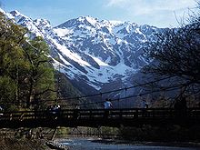
Kamikōchi is located in the Hida MountainsHida Mountains
The , or , is a Japanese mountain range which stretches through Nagano, Toyama and Gifu prefectures. A small portion of the mountains also reach into Niigata Prefecture. William Gowland coined the phrase "Japanese Alps" during his time in Japan, but he was only referring to the Hida Mountains when...
, the northern part of the Japan Alps. Kamikōchi is bordered on its northern end by Mount Hotaka
Mount Hotaka
, also known as Mount Hotakadake, is one of the 100 Famous Japanese Mountains, reaching a height of . It is situated in Japan's Hida Mountains and all its major peaks besides Mount Maehotaka, lie on the border between the cities of Matsumoto, Nagano Prefecture, and Takayama, Gifu Prefecture...
, and on its southern end by Mount Yake
Mount Yake
is an active volcano in the Hida Mountains, lying between Matsumoto, Nagano Prefecture, and Takayama, Gifu Prefecture, Japan. It is one of the 100 Famous Japanese Mountains, reaching at the highest peak.-Geography:...
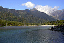
, an active volcano. The Azusa River flows the length of the valley, filling Lake Taishō at the base of Mt. Yake. Lake Taishō received its name because it was formed by the eruption of Mt. Yake in 1915, which was part of the Taishō period
Taisho period
The , or Taishō era, is a period in the history of Japan dating from July 30, 1912 to December 25, 1926, coinciding with the reign of the Taishō Emperor. The health of the new emperor was weak, which prompted the shift in political power from the old oligarchic group of elder statesmen to the Diet...
in Japan.
Kamikōchi is a high mountain valley approximately 16 kilometers in length. The average elevation of the valley floor ranges between roughly 1400 meters above sea level at the south end and roughly 1600 meters at the northern tip.
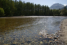
Because of the relatively flat topography, the valley has a number of marshes and ponds, including Takezawa Marsh, Tashiro Pond and Myojin Pond. As the waters are mainly from melted snow runoff or underground aquafers, the water temperature is quite cold, even in the height of summer. The Tokusawa area at the far northern end of the valley served as a grazing area for horses and cattle until 1934, when the area was completely integrated into the park.
History

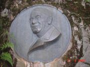
Walter Weston
The Reverend Walter Weston , was an English clergyman, missionary, and mountaineer.-Background and early life:...
, a British missionary, is credited with sparking Japanese interest in mountaineering
Mountaineering
Mountaineering or mountain climbing is the sport, hobby or profession of hiking, skiing, and climbing mountains. While mountaineering began as attempts to reach the highest point of unclimbed mountains it has branched into specialisations that address different aspects of the mountain and consists...
, and also with lobbying to preserve the Kamikōchi area. Japanese novelist Ryunosuke Akutagawa
Ryunosuke Akutagawa
was a Japanese writer active in the Taishō period in Japan. He is regarded as the "Father of the Japanese short story". He committed suicide at age of 35 through an overdose of barbital.-Early life:...
is also credited with a tourism boom when he published his book "Kappa" in 1927.
Nowadays, the facilities include two camping areas, some hotels (western-style and traditional Japanese ryokan), a post office, a tourist information center and some souvenir shops, mainly located between the bus and taxi terminal and Kappa-bashi bridge. As the entire highland is protected as part of the Chūbu-Sangaku National Park
Chubu-Sangaku National Park
is a national park in the Chūbu region, Honshū, Japan. It was established around the Hida Mountains and encompasses parts of Nagano, Gifu, Toyama and Niigata prefectures...
, access is only granted to bus, taxi and local workers' vehicles. The park is officially open from mid-April to mid-November, with peak crowds during the summer school holidays (end of July through the end of August) and when the autumn leaves are at their peak in October.
Surrounding mountains
- Mount HotakaMount Hotaka, also known as Mount Hotakadake, is one of the 100 Famous Japanese Mountains, reaching a height of . It is situated in Japan's Hida Mountains and all its major peaks besides Mount Maehotaka, lie on the border between the cities of Matsumoto, Nagano Prefecture, and Takayama, Gifu Prefecture...
- Mount YariMount Yariis one of the 100 Famous Japanese Mountains. The high peak lies in the southern part of the Hida Mountains of Japan, on the border of Ōmachi and Matsumoto in Nagano Prefecture and Takayama in Gifu Prefecture...
- Mount YakeMount Yakeis an active volcano in the Hida Mountains, lying between Matsumoto, Nagano Prefecture, and Takayama, Gifu Prefecture, Japan. It is one of the 100 Famous Japanese Mountains, reaching at the highest peak.-Geography:...
- Mount Chō
- Mount JōnenMount Jōnenis one of the 100 Famous Japanese Mountains, reaching the height of . It is situated in Japan's Hida Mountains in Nagano Prefecture and in Chūbu-Sangaku National Park. The shape of the mountain looks like the triangle. It can be seen from Azumi Basin.- Outline :...
- Mount Kasumizawa
See also
- List of Special Places of Scenic Beauty, Special Historic Sites and Special Natural Monuments
- Tourism in JapanTourism in JapanTourism in Japan attracted 8.3 million foreign visitors in 2008, slightly more than Singapore and Ireland. Japan has 16 World Heritage Sites, including Himeji Castle and Historic Monuments of Ancient Kyoto . Kyoto receives over 30 million tourists annually...
- Chūbu-Sangaku National ParkChubu-Sangaku National Parkis a national park in the Chūbu region, Honshū, Japan. It was established around the Hida Mountains and encompasses parts of Nagano, Gifu, Toyama and Niigata prefectures...

