

John S. Bibby
Encyclopedia
British Antarctic Survey
The British Antarctic Survey is the United Kingdom's national Antarctic operation and has an active role in Antarctic affairs. BAS is part of the Natural Environment Research Council and has over 400 staff. It operates five research stations, two ships and five aircraft in and around Antarctica....
which undertook four major geological surveys in the James Ross Island
James Ross Island
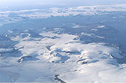
James Ross Island is a large island off the southeast side and near the northeastern extremity of Antarctic Peninsula, from which it is separated by Prince Gustav Channel. Rising to , it is irregularly shaped and extends in a north-south direction. It was charted in October 1903 by the Swedish...
Group in 1958 and 1959. The first survey took 69 days in June–August 1958, and served as a reconnaissance of Bald Head
Bald Head
Bald Head is a bare, ice-free headland southwest of View Point on the south side of Trinity Peninsula. It was probably first seen in 1902–03 by J. Gunnar Andersson's party of the Swedish Antarctic Expedition under Otto Nordenskiöld. The Falkland Islands Dependencies Survey charted it and...
, Botany Bay and the west coast of James Ross Island. The party of three hauled their own sledge but were supported and supplied by dog sledge. In September and October 1958 a further 52-day journey was undertaken, this time by dog sledge (which proved considerably more convenient). On this journey a plane table
Plane table
A plane table is a device used in surveying and related disciplines to provide a solid and level surface on which to make field drawings, charts and maps...
survey on a scale of 1:10,000 was carried out south-west of Brandy Bay
Brandy Bay
Brandy Bay is a bay wide on the northwest coast of James Ross Island, entered west of Bibby Point. It was probably first seen by Otto Nordenskiöld in 1903, and was surveyed by the Falkland Islands Dependencies Survey in 1945...
, and on 1:20,000 over the Hidden Lake
Hidden Lake (Antarctica)
Hidden Lake is a lake, long, lying midway between Lagrelius Point and Cape Obelisk in the west part of James Ross Island. It drains by a small stream into the deep bay south of Lagrelius Point. It was discovered in 1945 by the Falklands Islands Dependencies Survey, who so named it because it is...
and Tumbledown Cliffs
Tumbledown Cliffs
Tumbledown Cliffs is a conspicuous rock cliffs on the west coast of James Ross Island, about 3 nautical miles north of Cape Obelisk. Probably first seen by Dr. Otto Nordenskjold in 1903. Surveyed by Falkland Islands Dependencies Survey in 1945...
area.
During April 1959 a third journey was undertaken using a new overland route via Mondor Glacier
Mondor Glacier
Mondor Glacier is a glacier 3.5 nautical miles long flowing southwest from the head of Depot Glacier into Duse Bay, Trinity Peninsula. This glacier and Depot Glacier together fill the depression between Hope and Duse Bays which marks the northern limit of Tabarin Peninsula...
and Mount Cardinall
Mount Cardinall
Mount Cardinall is a conical mountain, high, lying close southwest of Mount Taylor and overlooking the northeast head of Duse Bay, at the northeast end of the Antarctic Peninsula. It was probably first seen by a party under J. Gunnar Andersson of the Swedish Antarctic Expedition, 1901–04...
to View Point and then to Church Point area. The return journey was over the sea ice. The survey of the peninsula near Camp Hill was completed and a base map on a scale of 1:10,000 was made by plane-table methods.
The last survey, from July to November 1959, took 120 days. Mapping the north-west James Ross Island was completed, the Cretaceous
Cretaceous
The Cretaceous , derived from the Latin "creta" , usually abbreviated K for its German translation Kreide , is a geologic period and system from circa to million years ago. In the geologic timescale, the Cretaceous follows the Jurassic period and is followed by the Paleogene period of the...
outcrops in the south-east of James Ross Island and on Snow Hill Island
Snow Hill Island
Snow Hill Island is an almost completely snowcapped island, long and wide, lying off the east coast of the Antarctic Peninsula. It is separated from James Ross Island to the northeast by Admiralty Sound...
were visited, and the previously unknown fossiliferous sediments
Fossil
Fossils are the preserved remains or traces of animals , plants, and other organisms from the remote past...
at Cape Lamb
Cape Lamb
Cape Lamb is a cape which forms the southwest tip of Vega Island in the James Ross Island group. Discovered by the Swedish Antarctic Expedition, 1901–04, under Otto Nordenskjold. Resighted in 1945 by the Falkland Islands Dependencies Survey , and named after Ivan M...
provided valuable evidence in determining the relationships between ammonite
Ammonite
Ammonite, as a zoological or paleontological term, refers to any member of the Ammonoidea an extinct subclass within the Molluscan class Cephalopoda which are more closely related to living coleoids Ammonite, as a zoological or paleontological term, refers to any member of the Ammonoidea an extinct...
faunas. Plane table maps were constructed of Bald Head (1:10,000) and an area between Lachman Crags
Lachman Crags
Lachman Crags is an escarpment which extends in a north-south direction for about 5 nautical miles , its high point rising to 645 m, standing 3 nautical miles south-southwest of Cape Lachman on James Ross Island. It was surveyed by the Falkland Islands Dependencies Survey in 1945, and named...
and Bibby Point
Bibby Point
Bibby Point is a steep rocky headland with snow slopes falling away inland, at the northeast corner of Brandy Bay, James Ross Island. It was named by the UK Antarctic Place-Names Committee for John S. Bibby, Falkland Islands Dependencies Survey geologist at Hope Bay, 1958–59....
(1:20,000).
Bibby Point
Bibby Point
Bibby Point is a steep rocky headland with snow slopes falling away inland, at the northeast corner of Brandy Bay, James Ross Island. It was named by the UK Antarctic Place-Names Committee for John S. Bibby, Falkland Islands Dependencies Survey geologist at Hope Bay, 1958–59....
, a steep rocky point at the northeast corner of Brandy Bay, was named after John S. Bibby by the United Kingdom Antarctic Place-Names Committee (UK-APC) .
External links
- British Antarctic Survey http://www.antarctica.ac.uk/
- Bibby, J.S., "Some Observations on Sea Level Changes in the James Ross Island Group", British Antarctic Survey Bulletin, No 6, 1965 p. 67-75 http://www.antarctica.ac.uk/documents/bas_bulletins/bulletin06_09.pdf