
Jacumba, California
Encyclopedia
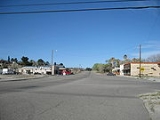
Jacumba is a census-designated place
in the Mountain Empire area of southeastern San Diego County, California
. It was treated as a census-designated place
(CDP) for the first time in the 2010 census, when it had a population of 561. The ZIP code is 91934 and the town lies within area code 619
. The National Geographic Names Database lists its elevation as 2829 feet (862.3 m) above mean sea level (AMSL).
The town is in a valley in the Jacumba Mountains
at an altitude of 2800 feet (853.4 m). The area is dry with an annual average rainfall of 11.8 inches (299.7 mm). It is served by Old Highway 80; Interstate 8 bypasses the town at a distance of two miles (3 km). The town is located in the Pacific time zone (GMT -08:00).
Jacumba is located on the US-Mexico
border. A small settlement exists on the Mexican side, known as La Rumorosa; the unmanned crossing was closed in 1995. The new, enlarged border fence now runs through the area. The United States Border Patrol maintains an increased presence in the area to curtail smuggling and illegal immigration.
According to the United States Census Bureau
, the CDP covers an area of 6.1 square miles (15.9 km²), 99.88% of it land, and 0.12% of it water.
was 91.6 people per square mile (35.4/km²). The racial makeup of Jacumba was 389 (69.3%) White, 4 (0.7%) African American, 15 (2.7%) Native American, 6 (1.1%) Asian, 0 (0.0%) Pacific Islander, 114 (20.3%) from other races
, and 33 (5.9%) from two or more races. Hispanic or Latino of any race were 207 persons (36.9%).
The Census reported that 561 people (100% of the population) lived in households, 0 (0%) lived in non-institutionalized group quarters, and 0 (0%) were institutionalized.
There were 216 households, out of which 66 (30.6%) had children under the age of 18 living in them, 87 (40.3%) were opposite-sex married couples
living together, 29 (13.4%) had a female householder with no husband present, 12 (5.6%) had a male householder with no wife present. There were 21 (9.7%) unmarried opposite-sex partnerships
, and 0 (0%) same-sex married couples or partnerships. 72 households (33.3%) were made up of individuals and 24 (11.1%) had someone living alone who was 65 years of age or older. The average household size was 2.60. There were 128 families
(59.3% of all households); the average family size was 3.38.
The population was spread out with 141 people (25.1%) under the age of 18, 46 people (8.2%) aged 18 to 24, 128 people (22.8%) aged 25 to 44, 167 people (29.8%) aged 45 to 64, and 79 people (14.1%) who were 65 years of age or older. The median age was 39.9 years. For every 100 females there were 101.8 males. For every 100 females age 18 and over, there were 102.9 males.
There were 294 housing units at an average density of 48.0 per square mile (18.5/km²), of which 123 (56.9%) were owner-occupied, and 93 (43.1%) were occupied by renters. The homeowner vacancy rate was 7.4%; the rental vacancy rate was 7.9%. 288 people (51.3% of the population) lived in owner-occupied housing units and 273 people (48.7%) lived in rental housing units.
peoples occupied Jacumba and surrounding areas prior to European incursion. They were probably attracted by the warm Jacumba hot spring (temperature 104 °F), one of many mineral hot springs which occur up and down the Peninsular Ranges
of California. Ranchers occupied the area in the 19th century and were often in conflict with the Indians. About 15 were slain by ranchers for cattle rustling
in the Jacumba Massacre of Feb 27, 1880.
Around the turn of the 20th century, the health and relaxation benefits of natural hot spring
s began to be commercialized. The Jacumba hot spring is prolific and delivered enough water to fill large public baths, the remains of which can still be seen. The water contains sulfur but has a pleasant clean smell. In 1919 rail service connected Jacumba to San Diego. By 1925 the town had a world class hotel, the Hotel Jacumba. In the 1930s, Jacumba had developed into a top destination and had a population of more than 5,000. Many of the foremost movie stars and celebrities of the time regarded Jacumba as a prime destination for relaxation.
Jacumba's role as a prime destination continued through World War II
; however as the southernmost California hot spring, it began to feel competition from more northern ones, including Murrieta
and Palm Springs
. After the new Interstate 8
bypassed Jacumba by two miles, most of the roadside service businesses folded and the community went into economic decline.
The Jacumba Hotel closed and was destroyed in an arson fire in 1983. The ruins stood until 1991. Today, the stub of the massive central fireplace can still be seen. The great public baths closed, the swimming pool was filled in, and the well was capped by its rights-owner.
In the 1980s, the Jacumba Motel was the only hotel facility left in Jacumba. However, the area continues to attract primarily foreign visitors and the motel has acquired rights to the spring and opened a spa.
In 2002 the facility was sold with the intent of renovating it into a timeshare spa type resort. In 2006 it was resold and setup as a bed and breakfast. It is in operation as the Jacumba Hot Springs Hotel, with pool and spas fed with the hot spring mineral water.
The town of Jacumba was home to the artist David Baze.
and about 0.5 mile (0.80467 km) north of the Mexican
border. At 52 degrees off true north, 3.5 miles (5.6 km) distant is the summit known as Squaw Tit (3,880 feet AMSL). At 0.88 miles (1.4 km) on a bearing of 296 degrees off true North lies Jacumba Peak (3,363 ft). Jacumba Airport is one mile (1.6 km) east at 32°37′00"N 116°09′53"W.
Census-designated place
A census-designated place is a concentration of population identified by the United States Census Bureau for statistical purposes. CDPs are delineated for each decennial census as the statistical counterparts of incorporated places such as cities, towns and villages...
in the Mountain Empire area of southeastern San Diego County, California
California
California is a state located on the West Coast of the United States. It is by far the most populous U.S. state, and the third-largest by land area...
. It was treated as a census-designated place
Census-designated place
A census-designated place is a concentration of population identified by the United States Census Bureau for statistical purposes. CDPs are delineated for each decennial census as the statistical counterparts of incorporated places such as cities, towns and villages...
(CDP) for the first time in the 2010 census, when it had a population of 561. The ZIP code is 91934 and the town lies within area code 619
Area code 619
North American area code 619 is a California telephone area code which was split from area code 714 on November 5, 1982. This area code currently covers the southern half of the city of San Diego and its eastern and southern suburbs....
. The National Geographic Names Database lists its elevation as 2829 feet (862.3 m) above mean sea level (AMSL).
Geography
Jacumba is located at (32.617N, 116.188W).The town is in a valley in the Jacumba Mountains
Jacumba Mountains
The Jacumba Mountains are located in southern California near the U.S. border with Mexico. The mountains lie in a northwest-southeasterly direction east of the In-Ko-Pah Mountains, and north of Interstate 8. The range is approximately long, and the mountains are located about four miles northeast...
at an altitude of 2800 feet (853.4 m). The area is dry with an annual average rainfall of 11.8 inches (299.7 mm). It is served by Old Highway 80; Interstate 8 bypasses the town at a distance of two miles (3 km). The town is located in the Pacific time zone (GMT -08:00).
Jacumba is located on the US-Mexico
Mexico
The United Mexican States , commonly known as Mexico , is a federal constitutional republic in North America. It is bordered on the north by the United States; on the south and west by the Pacific Ocean; on the southeast by Guatemala, Belize, and the Caribbean Sea; and on the east by the Gulf of...
border. A small settlement exists on the Mexican side, known as La Rumorosa; the unmanned crossing was closed in 1995. The new, enlarged border fence now runs through the area. The United States Border Patrol maintains an increased presence in the area to curtail smuggling and illegal immigration.
According to the United States Census Bureau
United States Census Bureau
The United States Census Bureau is the government agency that is responsible for the United States Census. It also gathers other national demographic and economic data...
, the CDP covers an area of 6.1 square miles (15.9 km²), 99.88% of it land, and 0.12% of it water.
Demographics
The 2010 United States Census reported that Jacumba had a population of 561. The population densityPopulation density
Population density is a measurement of population per unit area or unit volume. It is frequently applied to living organisms, and particularly to humans...
was 91.6 people per square mile (35.4/km²). The racial makeup of Jacumba was 389 (69.3%) White, 4 (0.7%) African American, 15 (2.7%) Native American, 6 (1.1%) Asian, 0 (0.0%) Pacific Islander, 114 (20.3%) from other races
Race (United States Census)
Race and ethnicity in the United States Census, as defined by the Federal Office of Management and Budget and the United States Census Bureau, are self-identification data items in which residents choose the race or races with which they most closely identify, and indicate whether or not they are...
, and 33 (5.9%) from two or more races. Hispanic or Latino of any race were 207 persons (36.9%).
The Census reported that 561 people (100% of the population) lived in households, 0 (0%) lived in non-institutionalized group quarters, and 0 (0%) were institutionalized.
There were 216 households, out of which 66 (30.6%) had children under the age of 18 living in them, 87 (40.3%) were opposite-sex married couples
Marriage
Marriage is a social union or legal contract between people that creates kinship. It is an institution in which interpersonal relationships, usually intimate and sexual, are acknowledged in a variety of ways, depending on the culture or subculture in which it is found...
living together, 29 (13.4%) had a female householder with no husband present, 12 (5.6%) had a male householder with no wife present. There were 21 (9.7%) unmarried opposite-sex partnerships
POSSLQ
POSSLQ is an abbreviation for "Persons of Opposite Sex Sharing Living Quarters," a term coined in the late 1970s by the United States Census Bureau as part of an effort to more accurately gauge the prevalence of cohabitation in American households....
, and 0 (0%) same-sex married couples or partnerships. 72 households (33.3%) were made up of individuals and 24 (11.1%) had someone living alone who was 65 years of age or older. The average household size was 2.60. There were 128 families
Family (U.S. Census)
A family or family household is defined by the United States Census Bureau for statistical purposes as "a householder and one or more other people related to the householder by birth, marriage, or adoption. They do not include same-sex married couples even if the marriage was performed in a state...
(59.3% of all households); the average family size was 3.38.
The population was spread out with 141 people (25.1%) under the age of 18, 46 people (8.2%) aged 18 to 24, 128 people (22.8%) aged 25 to 44, 167 people (29.8%) aged 45 to 64, and 79 people (14.1%) who were 65 years of age or older. The median age was 39.9 years. For every 100 females there were 101.8 males. For every 100 females age 18 and over, there were 102.9 males.
There were 294 housing units at an average density of 48.0 per square mile (18.5/km²), of which 123 (56.9%) were owner-occupied, and 93 (43.1%) were occupied by renters. The homeowner vacancy rate was 7.4%; the rental vacancy rate was 7.9%. 288 people (51.3% of the population) lived in owner-occupied housing units and 273 people (48.7%) lived in rental housing units.
History
The KumeyaayKumeyaay
The Kumeyaay, also known as Tipai-Ipai, Kamia, or formerly Diegueño, are Native American people of the extreme southwestern United States and northwest Mexico. They live in the states of California in the US and Baja California in Mexico. In Spanish, the name is commonly spelled...
peoples occupied Jacumba and surrounding areas prior to European incursion. They were probably attracted by the warm Jacumba hot spring (temperature 104 °F), one of many mineral hot springs which occur up and down the Peninsular Ranges
Peninsular Ranges
The Peninsular Ranges are a group of mountain ranges, in the Pacific Coast Ranges, which stretch from southern California in the United States to the southern tip of Mexico's Baja California peninsula; they are part of the North American Coast Ranges that run along the Pacific coast from Alaska...
of California. Ranchers occupied the area in the 19th century and were often in conflict with the Indians. About 15 were slain by ranchers for cattle rustling
Cattle raiding
Cattle raiding is the act of stealing cattle.In Australia, such stealing is often referred to as duffing, and the person as a duffer...
in the Jacumba Massacre of Feb 27, 1880.
Around the turn of the 20th century, the health and relaxation benefits of natural hot spring
Hot spring
A hot spring is a spring that is produced by the emergence of geothermally heated groundwater from the Earth's crust. There are geothermal hot springs in many locations all over the crust of the earth.-Definitions:...
s began to be commercialized. The Jacumba hot spring is prolific and delivered enough water to fill large public baths, the remains of which can still be seen. The water contains sulfur but has a pleasant clean smell. In 1919 rail service connected Jacumba to San Diego. By 1925 the town had a world class hotel, the Hotel Jacumba. In the 1930s, Jacumba had developed into a top destination and had a population of more than 5,000. Many of the foremost movie stars and celebrities of the time regarded Jacumba as a prime destination for relaxation.
Jacumba's role as a prime destination continued through World War II
World War II
World War II, or the Second World War , was a global conflict lasting from 1939 to 1945, involving most of the world's nations—including all of the great powers—eventually forming two opposing military alliances: the Allies and the Axis...
; however as the southernmost California hot spring, it began to feel competition from more northern ones, including Murrieta
Murrieta, California
Murrieta has a Mediterranean climate or Dry-Summer Subtropical . Murrieta has plenty of sunshine throughout the year, with an average of 263 sunshine days and 35 days with measurable precipitation annually....
and Palm Springs
Palm Springs, California
Palm Springs is a desert city in Riverside County, California, within the Coachella Valley. It is located approximately 37 miles east of San Bernardino, 111 miles east of Los Angeles and 136 miles northeast of San Diego...
. After the new Interstate 8
Interstate 8
Interstate 8 is an Interstate Highway in the southwestern United States. It runs from the southern edge of Mission Bay at Sunset Cliffs Blvd, in San Diego, California, almost at the Pacific Ocean, to the junction with Interstate 10, just southeast of Casa Grande, Arizona...
bypassed Jacumba by two miles, most of the roadside service businesses folded and the community went into economic decline.
The Jacumba Hotel closed and was destroyed in an arson fire in 1983. The ruins stood until 1991. Today, the stub of the massive central fireplace can still be seen. The great public baths closed, the swimming pool was filled in, and the well was capped by its rights-owner.
In the 1980s, the Jacumba Motel was the only hotel facility left in Jacumba. However, the area continues to attract primarily foreign visitors and the motel has acquired rights to the spring and opened a spa.
In 2002 the facility was sold with the intent of renovating it into a timeshare spa type resort. In 2006 it was resold and setup as a bed and breakfast. It is in operation as the Jacumba Hot Springs Hotel, with pool and spas fed with the hot spring mineral water.
The town of Jacumba was home to the artist David Baze.
Places of interest
- Jacumba Motel and Spa
- DeAnza Springs Resort
- Desert View Tower
- Larry Land Commune location 32.6522999429,-116.120906414 Great place to enjoy the weekend and hang out with local artist just type in the location on your GPS and follow till you reach the bicycle fence and your there. Larry is always up for a visitors just tell them Larry sent ya and smile .
Landmarks
The community is about 1.6 miles (2.6 km) south of Interstate 8Interstate 8
Interstate 8 is an Interstate Highway in the southwestern United States. It runs from the southern edge of Mission Bay at Sunset Cliffs Blvd, in San Diego, California, almost at the Pacific Ocean, to the junction with Interstate 10, just southeast of Casa Grande, Arizona...
and about 0.5 mile (0.80467 km) north of the Mexican
Mexico
The United Mexican States , commonly known as Mexico , is a federal constitutional republic in North America. It is bordered on the north by the United States; on the south and west by the Pacific Ocean; on the southeast by Guatemala, Belize, and the Caribbean Sea; and on the east by the Gulf of...
border. At 52 degrees off true north, 3.5 miles (5.6 km) distant is the summit known as Squaw Tit (3,880 feet AMSL). At 0.88 miles (1.4 km) on a bearing of 296 degrees off true North lies Jacumba Peak (3,363 ft). Jacumba Airport is one mile (1.6 km) east at 32°37′00"N 116°09′53"W.
Sources
- US Geological Survey, National Geographic Names Database
- Jacumba, California, 7.5-minute quadrangle, US Geological Survey, 1997.
- Jacumba OE S, California, 7.5-minute quadrangle, US Geological Survey, 1997.
External links
- Many historical images of Barbara Worth Cafe
- The Jacumba Arts Council
- The Jacumba-Boulevard Revitalization Alliance. Check out www.gosandiegobackcountry.org. A resource for planning day trips or vacations