
Iroquois Point, Hawaii
Encyclopedia
Census-designated place
A census-designated place is a concentration of population identified by the United States Census Bureau for statistical purposes. CDPs are delineated for each decennial census as the statistical counterparts of incorporated places such as cities, towns and villages...
(CDP) in Honolulu County
Honolulu County, Hawaii
The City and County of Honolulu is a consolidated city–county located in the U.S. state of Hawaii. The municipality and county includes both the urban district of Honolulu and the rest of the island of Oahu, as well as several minor outlying islands, including all of the Northwestern Hawaiian...
, Hawaii
Hawaii
Hawaii is the newest of the 50 U.S. states , and is the only U.S. state made up entirely of islands. It is the northernmost island group in Polynesia, occupying most of an archipelago in the central Pacific Ocean, southwest of the continental United States, southeast of Japan, and northeast of...
, United States
United States
The United States of America is a federal constitutional republic comprising fifty states and a federal district...
, on the island of Oahu
Oahu
Oahu or Oahu , known as "The Gathering Place", is the third largest of the Hawaiian Islands and most populous of the islands in the U.S. state of Hawaii. The state capital Honolulu is located on the southeast coast...
near Pearl Harbor
Pearl Harbor
Pearl Harbor, known to Hawaiians as Puuloa, is a lagoon harbor on the island of Oahu, Hawaii, west of Honolulu. Much of the harbor and surrounding lands is a United States Navy deep-water naval base. It is also the headquarters of the U.S. Pacific Fleet...
. "Iroquois Point" refers to the geographic land area that is occupied by the "Waterfront at Pu'uloa" (known as "Iroquois Point Island Club" prior to 2008), a firing range, a Navy Exchange shoppette and gas station, and Iroquois Point Elementary School. Once primarily used as a military housing community, it is now privately operated.
Geography
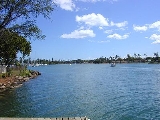
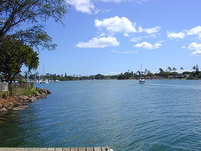
Iroquois Point is located at 21°19'46" North, 157°58'51" West (21.329350, -157.980963). . It is reached from North Road in Ewa Beach by turning onto Iroquois Drive. Alternatively, Iroquois Point Road from Fort Weaver Road in Ewa to West Loch Drive, and West Loch Drive south connecting to the end of North Road just beyond Iroquois Drive.According to the United States Census Bureau
United States Census Bureau
The United States Census Bureau is the government agency that is responsible for the United States Census. It also gathers other national demographic and economic data...
, the CDP has a total area of 0.6 square miles (1.6 km²), of which, 0.5 square miles (1.3 km²) of it is land and 0.1 square mile (0.258998811 km²) of it is water. The total area is 15.62% water.
Demographics
As of the censusCensus
A census is the procedure of systematically acquiring and recording information about the members of a given population. It is a regularly occurring and official count of a particular population. The term is used mostly in connection with national population and housing censuses; other common...
of 2000, there were 2,462 people, 675 households, and 660 families residing in the CDP. The population density
Population density
Population density is a measurement of population per unit area or unit volume. It is frequently applied to living organisms, and particularly to humans...
was 4,585.0 people per square mile (1,760.3/km²). There were 1,035 housing units at an average density of 1,927.5 per square mile (740.0/km²). The racial makeup of the CDP was 76.81% White, 5.56% African American, 1.06% Native American, 4.14% Asian, 0.89% Pacific Islander, 4.10% from other races, and 7.43% from two or more races. 7.88% of the population are Hispanic or Latino of any race.
There were 675 households out of which 83.6% had children under the age of 18 living with them, 95.0% were married couples
Marriage
Marriage is a social union or legal contract between people that creates kinship. It is an institution in which interpersonal relationships, usually intimate and sexual, are acknowledged in a variety of ways, depending on the culture or subculture in which it is found...
living together, 1.9% had a female householder with no husband present, and 2.2% were non-families. 1.9% of all households were made up of individuals and 0.0% had someone living alone who was 65 years of age or older. The average household size was 3.65 and the average family size was 3.68.
In the CDP the population is spread out with 44.5% under the age of 18, 4.8% from 18 to 24, 48.1% from 25 to 44, 2.6% from 45 to 64, and 0.1% who are 65 years of age or older. The median age is 26 years. For every 100 females there are 105.2 males. For every 100 females age 18 and over, there are 100.1 males.
The median income for a household in the CDP is $44,200, and the median income for a family is $44,200. Males have a median income of $33,590 versus $26,458 for females. The per capita income
Per capita income
Per capita income or income per person is a measure of mean income within an economic aggregate, such as a country or city. It is calculated by taking a measure of all sources of income in the aggregate and dividing it by the total population...
for the CDP is $13,257. 1.8% of the population and 2.5% of families are below the poverty line. Out of the total population, 1.7% of those under the age of 18 and 0.0% of those 65 and older are living below the poverty line.
History
The name of Iroquois Point was derived from the name "USS Iroquois" which was held by two U.S. Navy ships. Both ships had history that related to that spot at the entrance to Pearl Harbor. USS Iroquois, a steam sloop of war commissioned in 1850, was outfitted as a hospital ship to provide care to U.S. Sailors aboard vessels anchored in Honolulu Harbor and it is believed that the ship was anchored near the present Iroquois Point site. The second USS Iroquois, a commercial steam tug commissioned in 1898, was assigned to Commander F. Merry as part of his operations at Naval Station, Honolulu.Starting in the summer of 2003 this U.S. Navy property was leased to Hunt Building Co. and Fluor Federal Services LLC—a joint venture now operating as Ford Island Properties—in exchange for in-kind construction and infrastructure repairs on Ford Island
Ford Island
Ford Island is located in the middle of Pearl Harbor, Hawaii. It is connected to the main island by the Ford Island Bridge. Before the bridge was built, Ford Island could only be reached by a ferry boat which ran at hourly intervals for cars and foot passengers. The island houses several naval...
. This unprecedented arrangement was made possible through special legislation passed by Congress in 1999. The Navy gave the developers a 65 year lease of Iroquois Point/Puuloa, a 34 acre (138,000 m²) parcel on Ford Island, and the 6.6 acre (27,000 m²) Hālawa Landing—all underutilized Navy properties. The developers also were allowed to purchase 695 acres (2.8 km²) of housing at Kalaeloa after three years and given outright ownership of the 515 acres (2.1 km²) former Waikele Naval Magazine (Gordon, 2005).
Built in the 1960s, the homes on the north side of Puuloa Lagoon were empty when renovations began in August 2003, with more than 100 tradesmen working on a daily basis, moving block by block through the housing development. Something less than half of the 1,463 homes were upgraded with an initial investment of about $20 million. Beyond that, several million dollars is to be invested for amenities, such as a community center (Gordon, 2005). Iroquois Point housing lies directly under the glideslope of runway 8L of Honolulu International Airport
Honolulu International Airport
Honolulu International Airport is the principal aviation gateway of the City & County of Honolulu and the State of Hawaii and is identified as one of the busiest airports in the United States, with traffic now exceeding 21 million passengers a year and rising.It is located in the Honolulu...
. Neighborhood residents are often witness to large commercial and military jets that land at the airport flying low over the area.