
Indiana State Road 42
Encyclopedia
State Road 42 is an east–west road in Central Indiana. Its western terminus is at State Road 46
in Terre Haute
. Its eastern terminus is at State Road 67
and State Road 144
in Mooresville
.
(I-70). Before leaving Terre Haute SR 42 passes by the Terre Haute International Airport
. The service road to the airport is State Road 342
(SR 342). SR 42 heads east from Terre Haute passing over I-70. SR 42 then has an intersection with State Road 59
. After SR 59, SR 42 still parallels I-70 but the distance between the two routes is greater. SR 42 heads east passing through an intersection with U.S. Route 231. SR 42 heads due east then just south of Eminence
SR 42 turns due north and heads through Eminence. SR 42 turns back east north of Eminence and now SR 42 parallels I-70. SR 42 passes through Crown Center
and then SR 42 enters Monrovia
. in Monrovia SR 42 has an intersection with State Road 39
. SR 42 heads east out of Monrovia, heading towards Mooreville
. In Mooreville SR 42 has intersections with State Road 267
and SR 67/SR 144.
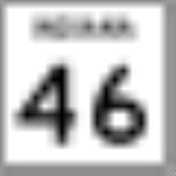
Indiana State Road 46
State Road 46 in the U.S. State of Indiana is an east–west state highway in the southern half of Indiana.-Route description:The western terminus of SR 46 is at U.S. Route 40 in central Vigo County, just east of Terre Haute...
in Terre Haute
Terre Haute, Indiana
Terre Haute is a city and the county seat of Vigo County, Indiana, United States, near the state's western border with Illinois. As of the 2010 census, the city had a total population of 60,785 and its metropolitan area had a population of 170,943. The city is the county seat of Vigo County and...
. Its eastern terminus is at State Road 67
Indiana State Road 67
State Road 67 in the U.S. State of Indiana cuts a diagonal route from southwest to northeast across the state from the north side of Vincennes to Indianapolis to the Ohio state line, where it becomes State Route 29 east of Bryant.-Route description:...
and State Road 144
Indiana State Road 144
State Road 144 in the U.S. State of Indiana is a highway that exists in two short sections south of Indianapolis.-Route description:State Road 144 runs from its northwest end at the southern terminus of Indiana State Road 267 and the eastern terminus of Indiana State Road 42 in Mooresville...
in Mooresville
Mooresville, Indiana
Mooresville is a town in Brown Township, Morgan County, Indiana, in the United States. As of the 2010 census, the town population was 9,326. It was founded in 1824 by Samuel Moore, a Quaker from North Carolina.-Geography:Mooresville is located at ....
.
Route description
From the western terminus with SR 46, SR 42 heads east out of Terre Haute, paralleling Interstate 70Interstate 70 in Indiana
In the U.S. state of Indiana, Interstate 70 travels east–west across the state passing through Indianapolis. Interstate 70 crosses into Indiana near Terre Haute and crosses into Ohio in Richmond. It covers 156.60 miles in Indiana. It parallels U.S...
(I-70). Before leaving Terre Haute SR 42 passes by the Terre Haute International Airport
Terre Haute International Airport
Terre Haute International Airport is a public airport located east of the central business district of Terre Haute, a city in Vigo County, Indiana, United States. It is included in the FAA's National Plan of Integrated Airport Systems for 2011–2015, which categorized it as a general aviation...
. The service road to the airport is State Road 342
Indiana State Road 342
State Road 342 is a north–south road in Vigo County, Indiana. It is less than a half mile long.-Route description:State Road 342 is a spur of State Road 42. It begins at the entrance to the Indiana Air National Guard's 181st Fighter Wing, housed at Terre Haute International Airport, and...
(SR 342). SR 42 heads east from Terre Haute passing over I-70. SR 42 then has an intersection with State Road 59
Indiana State Road 59
State Road 59 is a north–south road in Central Indiana that covers a distance of about through five counties.-Route description:State Road 59 begins at State Road 58 and heads north towards Sandborn. In Sandborn SR 59 has intersection with State Road 67...
. After SR 59, SR 42 still parallels I-70 but the distance between the two routes is greater. SR 42 heads east passing through an intersection with U.S. Route 231. SR 42 heads due east then just south of Eminence
Eminence, Indiana
Eminence is an unincorporated town in Adams Township, Morgan County, Indiana.-Education:Eminence is served by the Eminence School Corporation-Notable natives:...
SR 42 turns due north and heads through Eminence. SR 42 turns back east north of Eminence and now SR 42 parallels I-70. SR 42 passes through Crown Center
Crown Center, Indiana
Crown Center is an unincorporated town in Adams Township, Morgan County, Indiana....
and then SR 42 enters Monrovia
Monrovia, Indiana
Monrovia is a town in Monroe Township, Morgan County, Indiana, United States. The population was 1,063 at the 2010 census.-Geography:Monrovia is located at ....
. in Monrovia SR 42 has an intersection with State Road 39
Indiana State Road 39
State Road 39 in the U.S. State of Indiana is the name of two distinct north–south highways in the state of Indiana.-Southern section:Located in south-central Indiana, the shorter southern section of State Road 39 begins at State Road 56 west of Scottsburg. It runs north and passes through...
. SR 42 heads east out of Monrovia, heading towards Mooreville
Mooresville, Indiana
Mooresville is a town in Brown Township, Morgan County, Indiana, in the United States. As of the 2010 census, the town population was 9,326. It was founded in 1824 by Samuel Moore, a Quaker from North Carolina.-Geography:Mooresville is located at ....
. In Mooreville SR 42 has intersections with State Road 267
Indiana State Road 267
State Road 267 in the U.S. state of Indiana is a north–south route connecting Interstate 65 in Boone County with State Road 42 in Mooresville. It passes through the towns of Brownsburg, Avon, Plainfield, and Mooresville in the counties of Boone, Hendricks, and Morgan.- Route description...
and SR 67/SR 144.