
Indiana State Road 256
Encyclopedia
State Road 256 in the U.S. State
of Indiana
runs mostly through Scott
and Jefferson
counties, with short portions in Jackson
and Washington
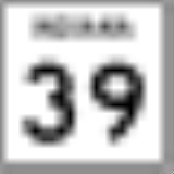
counties. The western terminus is Indiana 39. The eastern terminus is Indiana 56 near Madison
.
. In Austin SR 256 has an interchange
with Interstate 65
and then it has an intersection
with U.S. Route 31. After Austin SR 256 has a intersection with State Road 203
. Then SR 256 enters Jefferson County, where it has an intersection with State Road 3
. Then SR 256 has an intersection with State Road 62
followed by an intersection with State Road 56
.
U.S. state
A U.S. state is any one of the 50 federated states of the United States of America that share sovereignty with the federal government. Because of this shared sovereignty, an American is a citizen both of the federal entity and of his or her state of domicile. Four states use the official title of...
of Indiana
Indiana
Indiana is a US state, admitted to the United States as the 19th on December 11, 1816. It is located in the Midwestern United States and Great Lakes Region. With 6,483,802 residents, the state is ranked 15th in population and 16th in population density. Indiana is ranked 38th in land area and is...
runs mostly through Scott
Scott County, Indiana
As of the census of 2000, there were 22,960 people, 8,832 households, and 6,491 families residing in the county. The population density was 121 people per square mile . There were 9,737 housing units at an average density of 51 per square mile...
and Jefferson
Jefferson County, Indiana
Jefferson County is a county located in the U.S. state of Indiana. As of 2010, the population was 32,428. The county seat is Madison.-History:Jefferson County was formed in 1811...
counties, with short portions in Jackson
Jackson County, Indiana
Jackson County is a county located in the U.S. state of Indiana. As of 2010, the population was 42,376. The county seat is Brownstown.-History:...
and Washington
Washington County, Indiana
Washington County is a county located in the U.S. state of Indiana. As of 2010, the population was 28,262. The county seat is Salem.Washington County is part of the Louisville/Jefferson County, KY–IN Metropolitan Statistical Area.-Early settlers:...
counties. The western terminus is Indiana 39. The eastern terminus is Indiana 56 near Madison
Madison, Indiana
As of the census of 2000, there were 12,004 people, 5,092 households, and 3,085 families residing in the city. The population density was 1,402.9 people per square mile . There were 5,597 housing units at an average density of 654.1 per square mile...
.
Route description
SR 256 heads east from its western terminus toward AustinAustin, Indiana
Austin is a city in Jennings Township, Scott County, Indiana, United States. The population was 4,295 at the 2010 census. Austin became Indiana's newest city on January 1, 2008.-Geography:Austin is located at ....
. In Austin SR 256 has an interchange
Interchange (road)
In the field of road transport, an interchange is a road junction that typically uses grade separation, and one or more ramps, to permit traffic on at least one highway to pass through the junction without directly crossing any other traffic stream. It differs from a standard intersection, at which...
with Interstate 65
Interstate 65 in Indiana
In the U.S. state of Indiana, Interstate 65 traverses the state from south to north. The Indiana portion begins near Louisville, Kentucky and travels north, passing through Columbus, Indianapolis, Lafayette. Interstate 65 terminates near Gary on the Indiana Toll Road. Interstate 65 covers 261.27...
and then it has an intersection
Intersection (road)
An intersection is a road junction where two or more roads either meet or cross at grade . An intersection may be 3-way - a T junction or fork, 4-way - a crossroads, or 5-way or more...
with U.S. Route 31. After Austin SR 256 has a intersection with State Road 203
Indiana State Road 203
State Road 203 is a 14-mile north–south highway in the U.S. state of Indiana that runs mostly in Scott County.-Route description:At the south end, State Road 203 begins just within Clark County at its parent route State Road 3 and passes north through the town of Lexington...
. Then SR 256 enters Jefferson County, where it has an intersection with State Road 3
Indiana State Road 3
State Road 3 in the U.S. State of Indiana is a discontinuous state road running through east central Indiana from near the Michigan state line to near the Ohio River...
. Then SR 256 has an intersection with State Road 62
Indiana State Road 62
State Road 62 in the U.S. State of Indiana is an east–west route that runs from the Illinois state line in the southwest corner of Indiana to the Louisville, Kentucky area, then northeast toward the Cincinnati, Ohio area.-Route description:...
followed by an intersection with State Road 56
Indiana State Road 56
State Road 56 in the U.S. state of Indiana is a route that travels the south central part of the state from west to east.-Route description:...
.