

Independence County, Arkansas
Encyclopedia
Independence County is a county
located in the U.S. state
of Arkansas
. As of 2010, the population was 36,647. The county seat
is Batesville
. Independence County is Arkansas's ninth county, formed on October 20, 1820, from a portion of Lawrence County and named to honor the Declaration of Independence
. It is an alcohol prohibition or dry county
.
The Batesville Micropolitan Statistical Area includes all of Independence County.
of 2000, there were 34,233 people, 13,467 households, and 9,669 families residing in the county. The population density
was 45 people per square mile (17/km²). There were 14,841 housing units at an average density of 19 per square mile (8/km²). The racial makeup of the county was 94.91% White
, 2.04% Black
or African American
, 0.45% Native American
, 0.65% Asian
, 0.03% Pacific Islander
, 0.64% from other races
, and 1.28% from two or more races. 1.53% of the population were Hispanic
or Latino
of any race.
There were 13,467 households out of which 32.10% had children under the age of 18 living with them, 59.00% were married couples
living together, 9.20% had a female householder with no husband present, and 28.20% were non-families. 25.50% of all households were made up of individuals and 11.70% had someone living alone who was 65 years of age or older. The average household size was 2.47 and the average family size was 2.95.
In the county the population was spread out with 24.50% under the age of 18, 9.20% from 18 to 24, 27.70% from 25 to 44, 24.10% from 45 to 64, and 14.50% who were 65 years of age or older. The median age was 38 years. For every 100 females there were 96.30 males. For every 100 females age 18 and over, there were 92.60 males.
The median income for a household in the county was $31,920, and the median income for a family was $38,444. Males had a median income of $27,284 versus $20,086 for females. The per capita income
for the county was $16,163. About 9.90% of families and 13.00% of the population were below the poverty line, including 16.10% of those under age 18 and 14.40% of those age 65 or over.
County (United States)
In the United States, a county is a geographic subdivision of a state , usually assigned some governmental authority. The term "county" is used in 48 of the 50 states; Louisiana is divided into parishes and Alaska into boroughs. Parishes and boroughs are called "county-equivalents" by the U.S...
located in the U.S. state
U.S. state
A U.S. state is any one of the 50 federated states of the United States of America that share sovereignty with the federal government. Because of this shared sovereignty, an American is a citizen both of the federal entity and of his or her state of domicile. Four states use the official title of...
of Arkansas
Arkansas
Arkansas is a state located in the southern region of the United States. Its name is an Algonquian name of the Quapaw Indians. Arkansas shares borders with six states , and its eastern border is largely defined by the Mississippi River...
. As of 2010, the population was 36,647. The county seat
County seat
A county seat is an administrative center, or seat of government, for a county or civil parish. The term is primarily used in the United States....
is Batesville
Batesville, Arkansas
Batesville is the county seat and largest city of Independence County, Arkansas, United States, 80 miles northeast of Little Rock, the state capital. According to 2005 Census Bureau estimates, the population of the city was 9,556...
. Independence County is Arkansas's ninth county, formed on October 20, 1820, from a portion of Lawrence County and named to honor the Declaration of Independence
United States Declaration of Independence
The Declaration of Independence was a statement adopted by the Continental Congress on July 4, 1776, which announced that the thirteen American colonies then at war with Great Britain regarded themselves as independent states, and no longer a part of the British Empire. John Adams put forth a...
. It is an alcohol prohibition or dry county
Dry county
A dry county is a county in the United States whose government forbids the sale of alcoholic beverages. Some prohibit off-premises sale, some prohibit on-premises sale, and some prohibit both. Hundreds of dry counties exist across the United States, almost all of them in the South...
.
The Batesville Micropolitan Statistical Area includes all of Independence County.
Geography
According to the 2000 census, the county has a total area of 771.57 square miles (1,998.4 km²), of which 763.78 square miles (1,978.2 km²) (or 98.99%) is land and 7.79 square miles (20.2 km²) (or 1.01%) is water.List Of Highways
 U.S. Highway 167
 Arkansas Highway 14Arkansas Highway 14Arkansas Highway 14 is a designation for two east–west state highway in Arkansas. The primary route from the original 1926 Arkansas state highway numbering runs from Table Rock Lake east to Interstate 555/U.S. Route 63...
 Arkansas Highway 25
 Arkansas Highway 37
 Arkansas Highway 69Arkansas Highway 69Arkansas Highway 69 is a name representing multiple highways in the state of Arkansas.-Section 1:Highway 69 is a highway that leads from Melbourne to Newport in Arkansas.-Description:...
 Arkansas Highway 69 Business
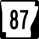 Arkansas Highway 87
 Arkansas Highway 106Arkansas Highway 106Arkansas Highway 106 is a state highway of that runs in Independence County.-Route description:AR 106 begins at AR 69 and runs south to Bethesda. After Bethesda, AR 106 turns east and runs until meeting AR 69 BUS in Batesville, where the route terminates....
 Arkansas Highway 122Arkansas Highway 122Arkansas Highway 122 is an east–west state highway in Independence County, Arkansas. The route of runs from Highway 14 near Oil Trough north and east through Newark to Highway 25 near Cord.-Route description:...
 Arkansas Highway 157Arkansas Highway 157Arkansas Highway 157 is a state highway of in White and Independence Counties.-Route description:AR 157 begins in Judsonia at AR 367. The route runs under US 64/US 167 and continues north until Pleasant Plains. AR 157 meets AR 87 and again crosses US 167 in Pleasant Plains. The route turns east...
 Arkansas Highway 230Arkansas Highway 230-Section 1:Arkansas Highway 230 is a state highway of that runs in Sharp County. A short portion also runs in adjacent Lawrence County. It has no business or spur routes.-Route description:...
 Arkansas Highway 233Arkansas Highway 233Arkansas Highway 233 is a state highway of that runs in Independence County. It has no business or spur routes.-Route description:...
 Arkansas Highway 333Arkansas Highway 333-Section 1:Arkansas Highway 333 is a state highway of in Searcy County.-Route description:The route begins at Searcy County Route 8 and runs north to meet AR 27. Near the Searcy County Airport, AR 333 breaks from AR 27 and runs north. The route then meets US 65/AR 74...
 Arkansas Highway 367
- Arkansas Highway 394Arkansas Highway 394Arkansas Highway 394 is a the name of two state highway in Independence County.-Route description:AR 394 begins at AR 69 in south Batesville. It runs southeast to Magness, where it terminates at AR 69.-Route description:...
Adjacent counties
- Sharp CountySharp County, Arkansas-External links:*...
(north) - Lawrence County (northeast)
- Jackson County (east)
- White CountyWhite County, ArkansasWhite County is a county located in the U.S. state of Arkansas. As of 2010, the population was 77,076. The county seat is Searcy. White County is Arkansas's 31st county, formed on October 23, 1835, from portions of Independence, Jackson, and Pulaski counties and named for Hugh Lawson White, a...
(south) - Cleburne County (southwest)
- Stone County (west)
- Izard County (northwest)
Demographics
As of the censusCensus
A census is the procedure of systematically acquiring and recording information about the members of a given population. It is a regularly occurring and official count of a particular population. The term is used mostly in connection with national population and housing censuses; other common...
of 2000, there were 34,233 people, 13,467 households, and 9,669 families residing in the county. The population density
Population density
Population density is a measurement of population per unit area or unit volume. It is frequently applied to living organisms, and particularly to humans...
was 45 people per square mile (17/km²). There were 14,841 housing units at an average density of 19 per square mile (8/km²). The racial makeup of the county was 94.91% White
Race (United States Census)
Race and ethnicity in the United States Census, as defined by the Federal Office of Management and Budget and the United States Census Bureau, are self-identification data items in which residents choose the race or races with which they most closely identify, and indicate whether or not they are...
, 2.04% Black
Race (United States Census)
Race and ethnicity in the United States Census, as defined by the Federal Office of Management and Budget and the United States Census Bureau, are self-identification data items in which residents choose the race or races with which they most closely identify, and indicate whether or not they are...
or African American
Race (United States Census)
Race and ethnicity in the United States Census, as defined by the Federal Office of Management and Budget and the United States Census Bureau, are self-identification data items in which residents choose the race or races with which they most closely identify, and indicate whether or not they are...
, 0.45% Native American
Race (United States Census)
Race and ethnicity in the United States Census, as defined by the Federal Office of Management and Budget and the United States Census Bureau, are self-identification data items in which residents choose the race or races with which they most closely identify, and indicate whether or not they are...
, 0.65% Asian
Race (United States Census)
Race and ethnicity in the United States Census, as defined by the Federal Office of Management and Budget and the United States Census Bureau, are self-identification data items in which residents choose the race or races with which they most closely identify, and indicate whether or not they are...
, 0.03% Pacific Islander
Race (United States Census)
Race and ethnicity in the United States Census, as defined by the Federal Office of Management and Budget and the United States Census Bureau, are self-identification data items in which residents choose the race or races with which they most closely identify, and indicate whether or not they are...
, 0.64% from other races
Race (United States Census)
Race and ethnicity in the United States Census, as defined by the Federal Office of Management and Budget and the United States Census Bureau, are self-identification data items in which residents choose the race or races with which they most closely identify, and indicate whether or not they are...
, and 1.28% from two or more races. 1.53% of the population were Hispanic
Race (United States Census)
Race and ethnicity in the United States Census, as defined by the Federal Office of Management and Budget and the United States Census Bureau, are self-identification data items in which residents choose the race or races with which they most closely identify, and indicate whether or not they are...
or Latino
Race (United States Census)
Race and ethnicity in the United States Census, as defined by the Federal Office of Management and Budget and the United States Census Bureau, are self-identification data items in which residents choose the race or races with which they most closely identify, and indicate whether or not they are...
of any race.
There were 13,467 households out of which 32.10% had children under the age of 18 living with them, 59.00% were married couples
Marriage
Marriage is a social union or legal contract between people that creates kinship. It is an institution in which interpersonal relationships, usually intimate and sexual, are acknowledged in a variety of ways, depending on the culture or subculture in which it is found...
living together, 9.20% had a female householder with no husband present, and 28.20% were non-families. 25.50% of all households were made up of individuals and 11.70% had someone living alone who was 65 years of age or older. The average household size was 2.47 and the average family size was 2.95.
In the county the population was spread out with 24.50% under the age of 18, 9.20% from 18 to 24, 27.70% from 25 to 44, 24.10% from 45 to 64, and 14.50% who were 65 years of age or older. The median age was 38 years. For every 100 females there were 96.30 males. For every 100 females age 18 and over, there were 92.60 males.
The median income for a household in the county was $31,920, and the median income for a family was $38,444. Males had a median income of $27,284 versus $20,086 for females. The per capita income
Per capita income
Per capita income or income per person is a measure of mean income within an economic aggregate, such as a country or city. It is calculated by taking a measure of all sources of income in the aggregate and dividing it by the total population...
for the county was $16,163. About 9.90% of families and 13.00% of the population were below the poverty line, including 16.10% of those under age 18 and 14.40% of those age 65 or over.
Cities and towns
|
Magness, Arkansas Magness is a town in Independence County, Arkansas, United States. The population was 191 at the 2000 census.-Geography:Magness is located at .... Moorefield, Arkansas Moorefield is a town in Independence County, Arkansas, United States. It was named after Jesse A. Moore who owned the most land in the area of the town at that time... Newark, Arkansas Newark is a city in Independence County, Arkansas, United States. The population was 1,219 at the 2000 census.Local School: Cedar Ridge High, previously Newark High.-Geography:Newark is located at .... |
Oil Trough, Arkansas Oil Trough is a town in Independence County, Arkansas, United States. The population was 218 at the 2000 census. The town is believed to have acquired its name in the early 19th century from a trough used to render bear fat, which was sold to customers in New Orleans... Pleasant Plains, Arkansas Pleasant Plains is a town in Independence County, Arkansas, United States. The population was 267 at the 2000 census.-Geography:Pleasant Plains is located at .... Sulphur Rock, Arkansas Sulphur Rock is a town in Independence County, Arkansas, United States. The population was 421 at the 2000 census.-Geography:Sulphur Rock is located at .... |
Townships
- Ashley
- Barren
- Big Bottom-Wycough-Logan (NewarkNewark, ArkansasNewark is a city in Independence County, Arkansas, United States. The population was 1,219 at the 2000 census.Local School: Cedar Ridge High, previously Newark High.-Geography:Newark is located at ....
) - Black River-Marshell
- Cushman-Union (CushmanCushman, ArkansasCushman is a town in Independence County, Arkansas, United States. The population was 461 at the 2000 census.-Geography:Cushman is located at .According to the United States Census Bureau, the town has a total area of , all land....
) - Departee
- Dota
- Fairview (Pleasant PlainsPleasant Plains, ArkansasPleasant Plains is a town in Independence County, Arkansas, United States. The population was 267 at the 2000 census.-Geography:Pleasant Plains is located at ....
) - Gainsboro
- Greenbrier
- Hill
- Huff
- Jefferson
- Liberty
- McHue
- Magness (MagnessMagness, ArkansasMagness is a town in Independence County, Arkansas, United States. The population was 191 at the 2000 census.-Geography:Magness is located at ....
) - Moorefield (MoorefieldMoorefield, ArkansasMoorefield is a town in Independence County, Arkansas, United States. It was named after Jesse A. Moore who owned the most land in the area of the town at that time...
, part of BatesvilleBatesville, ArkansasBatesville is the county seat and largest city of Independence County, Arkansas, United States, 80 miles northeast of Little Rock, the state capital. According to 2005 Census Bureau estimates, the population of the city was 9,556...
) - Oil Trough (Oil TroughOil Trough, ArkansasOil Trough is a town in Independence County, Arkansas, United States. The population was 218 at the 2000 census. The town is believed to have acquired its name in the early 19th century from a trough used to render bear fat, which was sold to customers in New Orleans...
) - Relief
- Rosie
- Ruddell (most of BatesvilleBatesville, ArkansasBatesville is the county seat and largest city of Independence County, Arkansas, United States, 80 miles northeast of Little Rock, the state capital. According to 2005 Census Bureau estimates, the population of the city was 9,556...
) - Salado
- Washington
- White River (Sulphur RockSulphur Rock, ArkansasSulphur Rock is a town in Independence County, Arkansas, United States. The population was 421 at the 2000 census.-Geography:Sulphur Rock is located at ....
)