
Illinois Route 56
Encyclopedia
Illinois Route 56 is an east–west state road in northern and northeastern Illinois
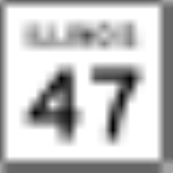
. It runs from the interchange of Illinois Route 47
at U.S. Route 30
in Sugar Grove
east to US 12
/US 20
/US 45
(Mannheim Road) by Bellwood
. This is a distance of 32.52 miles (52.34 km).
(Ronald Reagan Memorial Tollway) for its entire length and merges with it at Illinois Route 31
, making it the only state road to be marked as a toll road. Only Illinois Route 190 and Illinois Route 5
have ever had this distinction. Traveling westbound; after crossing the Fox River
, Illinois 56 travels south along Illinois Route 31
until it joins I88. Illiois 56 runs with the I88 tollway until it exits the tollway just west of Orchard Rd. and terminates in Sugar Grove. (That section is a Freeway).
Route 56 is called Butterfield Road for its entire length east of Illinois Route 25
until it meets its end as Washington Boulevard in Bellwood
. It serves the major cities of Aurora
, Wheaton
, Downers Grove
and Oak Brook
, as well as the College of DuPage
and the Oakbrook Center
, and runs within the Illinois Technology and Research Corridor
. It also forms the southern border of Fermilab
in Batavia
.
Illinois
Illinois is the fifth-most populous state of the United States of America, and is often noted for being a microcosm of the entire country. With Chicago in the northeast, small industrial cities and great agricultural productivity in central and northern Illinois, and natural resources like coal,...
. It runs from the interchange of Illinois Route 47
Illinois Route 47
Illinois Route 47 is a largely rural north–south state highway that runs from the Wisconsin state border at Highway 120 near Hebron, to Illinois Route 10, just south of Interstate 72 near Seymour. This is a distance of . Even though Route 47 is primarily rural, in several suburbs of Chicago,...
at U.S. Route 30
U.S. Route 30
U.S. Route 30 is an east–west main route of the system of United States Numbered Highways, with the highway traveling across the northern tier of the country. It is the third longest U.S. route, after U.S. Route 20 and U.S. Route 6. The western end of the highway is at Astoria, Oregon; the...
in Sugar Grove
Sugar Grove, Illinois
Sugar Grove is a far west suburban Chicago village in Kane County, Illinois, United States. The population was 3,909 at the 2000 census. The population was 6,016 in the 2003 special census. The population was 7,958 in the 2005 special census...
east to US 12
U.S. Route 12
U.S. Route 12 or US 12 is an east–west United States highway, running from Grays Harbor on the Pacific Ocean, in the state of Washington, to downtown Detroit, for almost . As a thoroughfare, it has mostly been supplanted by I-90 and I-94, but remains an important road for local travel.The...
/US 20
U.S. Route 20
U.S. Route 20 is an east–west United States highway. As the "0" in its route number implies, US 20 is a coast-to-coast route. Spanning , it is the longest road in the United States, and the route sparsely parallels Interstate 90...
/US 45
U.S. Route 45
U.S. Route 45 is a north–south United States highway. US 45 is a border-to-border route, from Lake Superior to the Gulf of Mexico. A sign at the highway's northern terminus notes the total distance as ....
(Mannheim Road) by Bellwood
Bellwood, Illinois
Bellwood is a village in Proviso Township, Cook County, Illinois, United States. The population was 20,535 at the 2000 census.There is a railroad station with commuter service to Chicago.-Geography:Bellwood is located at ....
. This is a distance of 32.52 miles (52.34 km).
Route description
Illinois 56 parallels Interstate 88Interstate 88 (west)
Interstate 88 is an intrastate Interstate Highway in the state of Illinois. It runs from an interchange with Interstate 80 near Silvis and Moline to an interchange with Interstates 290 and 294 in Hillside, near Chicago...
(Ronald Reagan Memorial Tollway) for its entire length and merges with it at Illinois Route 31
Illinois Route 31
Illinois Route 31 is a north–south state road in northeastern Illinois, United States. It runs from U.S. Highway 34 in Oswego north to U.S. Highway 12, near the Wisconsin border, just south of Richmond. Illinois 31 is long.- Route description :...
, making it the only state road to be marked as a toll road. Only Illinois Route 190 and Illinois Route 5
Illinois Route 5
Illinois Route 5 is a four-lane road that runs from U.S. Route 67 in Rock Island to the interchange of Interstate 80 and the toll-free portion of Interstate 88, a distance of...
have ever had this distinction. Traveling westbound; after crossing the Fox River
Fox River (Illinois River tributary)
The Fox River is a tributary of the Illinois River in the states of Wisconsin and Illinois in the United States. There are two other "Fox Rivers" in southern Illinois: the Fox River and a smaller "Fox River" that joins the Wabash River near New Harmony, Indiana.-Wisconsin:The Fox River rises near...
, Illinois 56 travels south along Illinois Route 31
Illinois Route 31
Illinois Route 31 is a north–south state road in northeastern Illinois, United States. It runs from U.S. Highway 34 in Oswego north to U.S. Highway 12, near the Wisconsin border, just south of Richmond. Illinois 31 is long.- Route description :...
until it joins I88. Illiois 56 runs with the I88 tollway until it exits the tollway just west of Orchard Rd. and terminates in Sugar Grove. (That section is a Freeway).
Route 56 is called Butterfield Road for its entire length east of Illinois Route 25
Illinois Route 25
Illinois Route 25 is a state road in northeast Illinois. It runs north from U.S. Highway 34 in Oswego to Illinois Route 62 in Algonquin. Illinois 25 is in length.- Route description :...
until it meets its end as Washington Boulevard in Bellwood
Bellwood, Illinois
Bellwood is a village in Proviso Township, Cook County, Illinois, United States. The population was 20,535 at the 2000 census.There is a railroad station with commuter service to Chicago.-Geography:Bellwood is located at ....
. It serves the major cities of Aurora
Aurora, Illinois
Aurora is the second most populous city in the U.S. state of Illinois, and the 112th largest city in the United States. A suburb of Chicago, located west of the Loop, its population in 2010 was 197,899. Originally founded within Kane County, Aurora's city limits have expanded greatly over the past...
, Wheaton
Wheaton, Illinois
Wheaton is an affluent community located in DuPage County, Illinois, approximately west of Chicago and Lake Michigan. Wheaton is the county seat of DuPage County...
, Downers Grove
Downers Grove, Illinois
Downers Grove is a village in Downers Grove and Lisle Townships, DuPage County, Illinois, United States. The population was 48,724 at the 2000 census, with an official estimated population of 49,250 in 2008.-History:...
and Oak Brook
Oak Brook, Illinois
Oak Brook is a village in DuPage and Cook Counties, in Illinois. The population was 8,702 at the 2000 census. A suburb of Chicago, it is the headquarters of McDonald's and Lions Clubs International.-History:...
, as well as the College of DuPage
College of DuPage
College of DuPage, or COD, is a two-year community college in Glen Ellyn, Illinois. The college also owns and operates facilities in the Illinois communities of Addison, Bloomingdale, Carol Stream, Naperville, West Chicago, and Westmont...
and the Oakbrook Center
Oakbrook Center
Oakbrook Center is an upscale super-regional shopping center located near Interstate 88 in Oak Brook, Illinois. It was originally opened in 1962 and has become the largest open-air center in the contiguous United States with over 160 stores and restaurants...
, and runs within the Illinois Technology and Research Corridor
Illinois Technology and Research Corridor
The Illinois Technology and Research Corridor is a region of commerce and industry located along Interstate 88 in the Chicago metropolitan area, primarily in DuPage, Kane, and DeKalb Counties...
. It also forms the southern border of Fermilab
Fermilab
Fermi National Accelerator Laboratory , located just outside Batavia, Illinois, near Chicago, is a US Department of Energy national laboratory specializing in high-energy particle physics...
in Batavia
Batavia, Illinois
Batavia was founded in 1833, and is the oldest city in Kane County, Illinois, with a small portion in DuPage County. During the Industrial Revolution, Batavia became known as ‘The Windmill City’ for being the largest windmill producer of the time...
.
History
SBI Route 56 was the current Illinois 56 from Oak Brook to Bellwood on Butterfield Road. In 1965 it was extended west to Sugar Grove over Illinois Route 55. In 1972, the eastern end was truncated to its current location. The western end of Illinois 56 is part of the old alignment of the old east–west Tollway.Major Junctions
| County | Location | Junction | Notes |
|---|---|---|---|
| Cook Cook County, Illinois Cook County is a county in the U.S. state of Illinois, with its county seat in Chicago. It is the second most populous county in the United States after Los Angeles County. The county has 5,194,675 residents, which is 40.5 percent of all Illinois residents. Cook County's population is larger than... |
Bellwood Bellwood, Illinois Bellwood is a village in Proviso Township, Cook County, Illinois, United States. The population was 20,535 at the 2000 census.There is a railroad station with commuter service to Chicago.-Geography:Bellwood is located at .... |
Eastern Terminus | |
| DuPage DuPage County, Illinois As of the 2010 Census, the population of the county was 916,924, White Americans made up 77.9% of Dupage County's population; non-Hispanic whites represented 70.5% of the population. Black Americans made up 4.6% of the population. Native Americans made up 0.3% of Dupage County's population... |
Elmhurst Elmhurst, Illinois Elmhurst is a suburb of Chicago in DuPage and Cook Counties, Illinois. The population is 46,013 as of the 2008 US Census population estimate.-History:... |
No access to IL 38 eastbound from eastbound 56, or westbound 38 from westbound 56 |
|
| Westbound - No direct access - use IL 38 westbound Eastbound - Only IL 83 northbound is accessible |
|||
| Downers Grove Downers Grove, Illinois Downers Grove is a village in Downers Grove and Lisle Townships, DuPage County, Illinois, United States. The population was 48,724 at the 2000 census, with an official estimated population of 49,250 in 2008.-History:... |
Highland Avenue | ||
| Glen Ellyn Glen Ellyn, Illinois Glen Ellyn is an affluent village in DuPage County, Illinois, United States. As of the 2000 Census, the village population was 26,999.-Geography:... |
|||
| Warrenville Warrenville, Illinois Warrenville is a city in DuPage County, Illinois, United States. The population was 13,363 at the 2000 census. It is a part of the Chicago metropolitan area and the Illinois Technology and Research Corridor.-History:... |
|||
| Kane Kane County, Illinois Kane County is a county located in the U.S. state of Illinois. According to the 2010 census, it has a population of 515,269, which is an increase of 27.5% from 404,119 in 2000. Its county seat is Geneva, and its largest city is Aurora.- Geography :... |
North Aurora North Aurora, Illinois North Aurora is village in Kane County, Illinois, United States. A suburb of Chicago, its population was 15,848 at the 2009 census.In its early history, North Aurora was known as "Schneider's Mill" or "Schneider's Crossing" after John Peter Schneider, a German immigrant who established a mill and... |
||
| East end of concurrency | |||
| east Naperville Naperville, Illinois Naperville is a city in DuPage and Will Counties in Illinois in the United States, voted the second best place to live in the United States by Money Magazine in 2006. As of the 2010 census, the city had a total population of 141,853. It is the fifth largest city in the state, behind Chicago,... , Chicago |
West end of concurrency with IL 31. East end of concurrency with I-88 |
||
| Aurora Aurora, Illinois Aurora is the second most populous city in the U.S. state of Illinois, and the 112th largest city in the United States. A suburb of Chicago, located west of the Loop, its population in 2010 was 197,899. Originally founded within Kane County, Aurora's city limits have expanded greatly over the past... |
Orchard Road | ||
| Sugar Grove Sugar Grove, Illinois Sugar Grove is a far west suburban Chicago village in Kane County, Illinois, United States. The population was 3,909 at the 2000 census. The population was 6,016 in the 2003 special census. The population was 7,958 in the 2005 special census... |
west DeKalb DeKalb, Illinois DeKalb is a city in DeKalb County, Illinois, United States. The population was 43,862 at the 2010 census, up from 39,018 at the 2000 census. The city is named after decorated German war hero Johann De Kalb, who died during the American Revolutionary War.... , Quad Cities Quad Cities The Quad Cities is a group of five cities straddling the Mississippi River on the Iowa–Illinois boundary. These cities, Davenport and Bettendorf and Rock Island, Moline, and East Moline , are the center of the Quad Cities Metropolitan Area, which, as of 2010, had an estimated population of... |
West end of I-88 concurrency | |
| Western Terminus | |||