
Illinois Route 135
Encyclopedia
Illinois Route 135 is an L-shaped state road in western Illinois
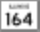
. It runs from Illinois Route 164
west of Monmouth
to Main Street in Alexis
, at the base of the town's water tower. This is a distance of 20.31 miles (32.69 km).
for a few miles north of Little York
, and with U.S. Route 67
for a few miles west of Alexis. Illinois 135 is signed in all four directions, and changes directions at the turnoff from Illinois 94.
to Indiana State Road 154
near Hutsonville
via a bridge over the Wabash River
. This was removed in 1935; the bridge is now unnumbered. In 1937 it was applied on what was Illinois Route 94B, the current routing.
Illinois
Illinois is the fifth-most populous state of the United States of America, and is often noted for being a microcosm of the entire country. With Chicago in the northeast, small industrial cities and great agricultural productivity in central and northern Illinois, and natural resources like coal,...
. It runs from Illinois Route 164
Illinois Route 164
Illinois Route 164 is a state road in rural western Illinois. It runs from U.S. Route 34 in Gladstone to U.S. Route 34 and Illinois Route 41 in Galesburg. This distance is .- Route description :...
west of Monmouth
Monmouth, Illinois
Monmouth is a city in and the county seat of Warren County in the U.S. state of Illinois. It is the home of Monmouth College and contains Monmouth Park, Harmon Park, North Park, Warfield Park, West Park, South Park, Garwood Park, Buster White Park and the Citizens Lake & Campground. It is the host...
to Main Street in Alexis
Alexis, Illinois
Alexis is a village in Mercer and Warren counties in the U.S. state of Illinois. The population was 863 at the 2000 census.The Warren County portion of Alexis is part of the Galesburg Micropolitan Statistical Area, while the Mercer County portion is part of the Davenport–Moline–Rock...
, at the base of the town's water tower. This is a distance of 20.31 miles (32.69 km).
Route description
Illinois 135 is an undivided two-lane surface road for its entire length. It overlaps Illinois Route 94Illinois Route 94
Illinois Route 94 is a north–south state highway in western Illinois. It runs from U.S. Route 24 just east of Camp Point to U.S. Route 67 just south of Oak Grove, just south of the Quad Cities area...
for a few miles north of Little York
Little York, Illinois
Little York is a village in Warren County, Illinois, United States. The population was 269 at the 2000 census. It is part of the Galesburg Micropolitan Statistical Area.-Geography:Little York is located at ....
, and with U.S. Route 67
U.S. Route 67
U.S. Route 67 is a 1,560 mile long north–south U.S. highway in the Central United States. The southern terminus of the route is at the United States-Mexico border in Presidio, Texas, where it continues south as Mexican Federal Highway 16 upon crossing the Rio Grande. The northern...
for a few miles west of Alexis. Illinois 135 is signed in all four directions, and changes directions at the turnoff from Illinois 94.
History
SBI Route 135 originally ran from Illinois Route 1Illinois Route 1
Illinois Route 1 is a state highway in the U.S. state of Illinois. Running parallel to the Indiana border, it is also the longest state road, starting on the south side of Chicago as Halsted Street at the intersection with 95th Street, south to a free ferry crossing to Kentucky at Cave-In-Rock on...
to Indiana State Road 154
Indiana State Road 154
State Road 154, in the U.S. State of Indiana, is a short two-lane east–west highway located in western Sullivan County.-Route description:...
near Hutsonville
Hutsonville, Illinois
Hutsonville is a village in Crawford County, Illinois, United States. The population was 568 at the 2000 census.-Geography:Hutsonville is located at ....
via a bridge over the Wabash River
Wabash River
The Wabash River is a river in the Midwestern United States that flows southwest from northwest Ohio near Fort Recovery across northern Indiana to southern Illinois, where it forms the Illinois-Indiana border before draining into the Ohio River, of which it is the largest northern tributary...
. This was removed in 1935; the bridge is now unnumbered. In 1937 it was applied on what was Illinois Route 94B, the current routing.