
Horam
Encyclopedia
Horam is a village and civil parish in the Wealden
District of East Sussex
, situated three miles (4.8 km) south of Heathfield
. Included in the parish are the settlements of Vines Cross and Burlow.
in 1595. Like many other settlements on the Weald, Horam was involved in the Wealden iron industry
.
The name of Horam was formerly spelled 'Horeham', and this spelling still appears occasionally in public records. The railway station (closed in 1965 under the Beeching Axe
) was originally named 'Horeham Road'. The dialling code for Horam is still listed as 'Horam Road'.
: there are many headwater streams of the River Cuckmere
, carving out valleys, the main one being the Waldron Ghyll (or Gill).
The erstwhile railway line is now the Cuckoo Trail
footpath through the village.
St Mary's School, Horam is a secondary day and residential special school, located at Maynards Green.
Wealden
For the stone, see Wealden GroupWealden is a local government district in East Sussex, England: its name comes from the Weald, the area of high land which occupies the centre of its area.-History:...
District of East Sussex
East Sussex
East Sussex is a county in South East England. It is bordered by the counties of Kent, Surrey and West Sussex, and to the south by the English Channel.-History:...
, situated three miles (4.8 km) south of Heathfield
Heathfield, East Sussex
Heathfield is a small market town, and the principal settlement in the civil parish of Heathfield and Waldron in the Wealden District of East Sussex, within the historic County of Sussex, England.-Location:...
. Included in the parish are the settlements of Vines Cross and Burlow.
History
Vines Cross is named after John Vyne, who was a local vintnerVintner
A vintner is a wine merchant. You pronounce it like this In some modern use, in particular in American English, the term is alsoused as a synonym for winemaker....
in 1595. Like many other settlements on the Weald, Horam was involved in the Wealden iron industry
Wealden iron industry
The Wealden iron industry was located in the Weald of south-eastern England. It was formerly an important industry, producing a large proportion of the bar iron made in England in the 16th century and most British cannon until about 1770. Ironmaking in the Weald used ironstone from various clay...
.
The name of Horam was formerly spelled 'Horeham', and this spelling still appears occasionally in public records. The railway station (closed in 1965 under the Beeching Axe
Beeching Axe
The Beeching Axe or the Beeching Cuts are informal names for the British Government's attempt in the 1960s to reduce the cost of running British Railways, the nationalised railway system in the United Kingdom. The name is that of the main author of The Reshaping of British Railways, Dr Richard...
) was originally named 'Horeham Road'. The dialling code for Horam is still listed as 'Horam Road'.
Geography
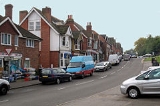
Horam village lies on the A267 Tunbridge Wells–Eastbourne road south of Heathfield. The area is on the slopes of the WealdWeald
The Weald is the name given to an area in South East England situated between the parallel chalk escarpments of the North and the South Downs. It should be regarded as three separate parts: the sandstone "High Weald" in the centre; the clay "Low Weald" periphery; and the Greensand Ridge which...
: there are many headwater streams of the River Cuckmere
River Cuckmere
The River Cuckmere rises near Heathfield in East Sussex, England on the southern slopes of the Weald. The name of the river probably comes from an Old English word meaning fast-flowing, since it descends over 100 m in its initial four miles...
, carving out valleys, the main one being the Waldron Ghyll (or Gill).
Transport
Horam is served by various routes of the Eastbourne Bus Company.The erstwhile railway line is now the Cuckoo Trail
Cuckoo Line
The Cuckoo Line is an informal name for the now defunct railway service which linked Polegate and Eridge in East Sussex, England, from 1880 to 1968. It was nicknamed the Cuckoo Line by drivers, from a tradition observed at the annual fair at Heathfield, a station on the route...
footpath through the village.
Religion
The village is served by the local church, Christ Church found in Horebeech Lane: the last vicar was Revd Mark Redhouse but the church is awaiting a new clergyman. The small church in Vines Cross was dedicated to St James but is no longer in existence.Education
Primary education is provided at Maynards Green Primary School.St Mary's School, Horam is a secondary day and residential special school, located at Maynards Green.