
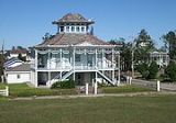
Holy Cross, New Orleans
Encyclopedia
Holy Cross is a neighborhood
of the city of New Orleans
. A subdistrict of the Lower Ninth Ward District Area, its boundaries as defined by the City Planning Commission are: St. Claude Avenue to the north, St. Bernard Parish
to the east, the Mississippi River
to the south and the Industrial Canal
to the west.
, the district has a total area of 0.95 mi2. 0.68 mi2 of which is land and 0.27 mi2 (28.42%) of which is water.
of 2000, there were 5,507 people, 1,982 households, and 1,315 families residing in the neighborhood. The population density
was 8,099 /mi² (3,059 /km²).
New Orleans neighborhoods
In 1980 the New Orleans City Planning Commission divided the city into 13 planning districts and 72 distinct neighborhoods.While most of these assigned boundaries match with traditional local designations, some others differ from common traditional use...
of the city of New Orleans
New Orleans, Louisiana
New Orleans is a major United States port and the largest city and metropolitan area in the state of Louisiana. The New Orleans metropolitan area has a population of 1,235,650 as of 2009, the 46th largest in the USA. The New Orleans – Metairie – Bogalusa combined statistical area has a population...
. A subdistrict of the Lower Ninth Ward District Area, its boundaries as defined by the City Planning Commission are: St. Claude Avenue to the north, St. Bernard Parish
St. Bernard Parish, Louisiana
St. Bernard Parish is a parish located southeast of New Orleans in the U.S. state of Louisiana. The parish seat is Chalmette, the largest city in the parish. As of 2000, its population was 67,229. It has been ranked the fastest-growing county in the United States from 2007 to 2008 by the U.S....
to the east, the Mississippi River
Mississippi River
The Mississippi River is the largest river system in North America. Flowing entirely in the United States, this river rises in western Minnesota and meanders slowly southwards for to the Mississippi River Delta at the Gulf of Mexico. With its many tributaries, the Mississippi's watershed drains...
to the south and the Industrial Canal
Industrial Canal
The Industrial Canal is a 5.5 mile waterway in New Orleans, Louisiana, United States. The waterway's proper name, as used by the U.S. Army Corps of Engineers and on NOAA nautical charts, is Inner Harbor Navigation Canal...
to the west.
Geography
Holy Cross is located at 29°57′30"N 90°01′04"W and has an elevation of 3 foot (0.9144 m). According to the United States Census BureauUnited States Census Bureau
The United States Census Bureau is the government agency that is responsible for the United States Census. It also gathers other national demographic and economic data...
, the district has a total area of 0.95 mi2. 0.68 mi2 of which is land and 0.27 mi2 (28.42%) of which is water.
Adjacent Neighborhoods
- Lower Ninth Ward (north)
- St. Bernard ParishSt. Bernard Parish, LouisianaSt. Bernard Parish is a parish located southeast of New Orleans in the U.S. state of Louisiana. The parish seat is Chalmette, the largest city in the parish. As of 2000, its population was 67,229. It has been ranked the fastest-growing county in the United States from 2007 to 2008 by the U.S....
(east) - Mississippi RiverMississippi RiverThe Mississippi River is the largest river system in North America. Flowing entirely in the United States, this river rises in western Minnesota and meanders slowly southwards for to the Mississippi River Delta at the Gulf of Mexico. With its many tributaries, the Mississippi's watershed drains...
(south) - BywaterBywater, New OrleansBywater is a neighborhood of the city of New Orleans. A subdistrict of the Bywater District Area, its boundaries as defined by the City Planning Commission are: Florida Avenue to the north, the Industrial Canal to the east, the Mississippi River to the south and Franklin Avenue Street to the west...
(west)
Boundaries
The City Planning Commission defines the boundaries of Holy Cross as these streets: St. Claude Avenue, St. Bernard Parish, the Mississippi River and the Industrial Canal.Demographics
As of the censusCensus
A census is the procedure of systematically acquiring and recording information about the members of a given population. It is a regularly occurring and official count of a particular population. The term is used mostly in connection with national population and housing censuses; other common...
of 2000, there were 5,507 people, 1,982 households, and 1,315 families residing in the neighborhood. The population density
Population density
Population density is a measurement of population per unit area or unit volume. It is frequently applied to living organisms, and particularly to humans...
was 8,099 /mi² (3,059 /km²).