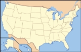
Hells Canyon National Recreation Area
Encyclopedia

National Recreation Area
National Recreation Area is a designation for a protected area in the United States, often centered on large reservoirs and emphasizing water-based recreation for a large number of people. The first National Recreation Area was the Boulder Dam Recreation Area...
located on the borders of the U.S. state
U.S. state
A U.S. state is any one of the 50 federated states of the United States of America that share sovereignty with the federal government. Because of this shared sovereignty, an American is a citizen both of the federal entity and of his or her state of domicile. Four states use the official title of...
s of Oregon
Oregon
Oregon is a state in the Pacific Northwest region of the United States. It is located on the Pacific coast, with Washington to the north, California to the south, Nevada on the southeast and Idaho to the east. The Columbia and Snake rivers delineate much of Oregon's northern and eastern...
and Idaho
Idaho
Idaho is a state in the Rocky Mountain area of the United States. The state's largest city and capital is Boise. Residents are called "Idahoans". Idaho was admitted to the Union on July 3, 1890, as the 43rd state....
. The recreation area was established by U.S. Congress in 1975 to protect the historic and archaeological values of the Hells Canyon
Hells Canyon
Hells Canyon is a wide canyon located along the border of eastern Oregon and western Idaho in the United States. It is North America's deepest river gorge at and part of the Hells Canyon National Recreation Area....
area and the area of the Snake River
Snake River
The Snake is a major river of the greater Pacific Northwest in the United States. At long, it is the largest tributary of the Columbia River, the largest North American river that empties into the Pacific Ocean...
between Hells Canyon Dam
Hells Canyon Dam
Hells Canyon Dam is a concrete gravity dam on the Snake River in Hells Canyon on the Idaho-Oregon border. The dam impounds the Snake River in Hells Canyon Reservoir; its spillway elevation is above sea level....
and the Oregon-Washington border.
Roughly 215000 acres (870.1 km²) of the recreation area are designated the Hells Canyon Wilderness. There are nearly 900 miles (1,448.4 km) of hiking trails in the recreation area. The largest portion of the area lies in eastern Wallowa County, Oregon
Wallowa County, Oregon
Wallowa County is a county located in the U.S. state of Oregon. It is included in the 8 county definition of Eastern Oregon. According to Oregon Geographic Names, the origins of the county's name are uncertain, with the most likely explanation being that it is derived from the Nez Perce term for a...
. Smaller portions lie in southwestern Idaho County, Idaho
Idaho County, Idaho
Idaho County is a county located in the U.S. state of Idaho. As of the 2010 Census the county had a population of 16,267. The county seat is Grangeville...
, northwestern Adams County, Idaho
Adams County, Idaho
Adams County is a rural county located in the state of Idaho. As of the 2010 census the county had a population of 3,976. The county seat and largest city is Council.Adams County was established in 1911 and was named in honor of President John Adams...
, and northeastern Baker County, Oregon
Baker County, Oregon
Baker County is a county located in the U.S. state of Oregon. It is included in the 8 county definition of Eastern Oregon. It is named for Edward Dickinson Baker, a senator from Oregon who was killed at Ball's Bluff, a battle of the Civil War in Virginia in 1861. It was split from the eastern part...
.

