

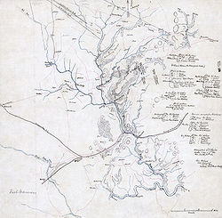
Hachure map
Encyclopedia
Cartographic relief depiction
Terrain or relief is an essential aspect of physical geography, and as such its portrayal presents a central problem in cartography, and more recently GIS and 3D Visualization....
. They show orientation of slope, and by their thickness and overall density they provide a general sense of steepness. Being non-numeric, they are less useful to a scientific survey than contours, but can successfully communicate quite specific shapes of terrain. They are a form of shading
Shading
Shading refers to depicting depth perception in 3D models or illustrations by varying levels of darkness.-Drawing:Shading is a process used in drawing for depicting levels of darkness on paper by applying media more densely or with a darker shade for darker areas, and less densely or with a lighter...
, although different from the one used in shaded maps. Hachure representation of relief was standardized by the Austrian topographer Johann Georg Lehmann in 1799. Hachures may be combined with other ways of representing relief, like shades, the result being a shaded hachure map; an example of such a map is the Dufour Map of Switzerland
Switzerland
Switzerland name of one of the Swiss cantons. ; ; ; or ), in its full name the Swiss Confederation , is a federal republic consisting of 26 cantons, with Bern as the seat of the federal authorities. The country is situated in Western Europe,Or Central Europe depending on the definition....
. Emil von Sydow
Emil von Sydow
Emil von Sydow was a German geographer and cartographer born in Freiberg, Saxony. Early in his career he was a geography instructor at the military academy in Erfurt, and in 1867 became director of statistics and geography to the Prussian General Staff.Emil von Sydow is considered to be the...
designed maps with coloured hachures: green for lowlands and brown for highlands.
Overview
Aspect (geography)
In physical geography, aspect generally refers to the horizontal direction to which a mountain slope faces. For example, a slope on the eastern edge of the Rockies toward the Great Plains is described as having an easterly aspect...
direction). Steeper slopes are represented by thicker, shorter and closer strokes, while gentler slopes are represented by thinner, longer and farther apart strokes. A very gentle slope or a flat area, like the top of a hill, are usually left blank. The hachures are traditionally monocolour, usually black, gray or brown; using two complementary colours for the hachures on a neutral background colour (e.g. black and white lines on gray map colour) would give a shading effect as if the relief were illuminated.
Rules
In representing relief with hachures on a map, six rules are to be followed, according to G.R.P. Lawrence (1979):- The hachures are drawn in the direction of the steepest gradient.
- The hachures are arranged in rows perpendicular to their direction.
- The length and thickness of each stroke represents the drop in height along its direction: a short and thick stroke represents a short and steep slope, while a long and thin stroke represents a long and gentle slope.
- The strokes are spaced at an equal distance inside a row.
- The strokes have the same thickness inside a row.
- If the map is illuminated, strokes are thinner and farther apart on the illuminated side.
The Swiss cartographer Eduard Imhof
Eduard Imhof
Eduard Imhof was a professor of cartography at the Swiss Federal Institute of Technology, Zürich, from 1925 - 1965. His fame, which extends far beyond the Institute of Technology, stems from his relief shading work on school maps and atlases. Between 1922 and 1973 Imhof worked on many school maps...
set 5 similar rules:
- Hachures follow the direction of steepest gradient
- Hachures are arranged in horizontal rows
- Hachure length corresponds to the local horizontal distance between assumed contours of a certain interval
- Hachure width is thicker for steeper slopes
- Hachure density remains constant throughout the map area.
If the illumination is vertical, rule 5 is kept; in the case of oblique illumination, it is dropped. The rules above are to be obeyed for large-scale maps. If the map being drawn is a small-scale map (less than 1:500 000 according to Imhof), rules may be relaxed in order to obtain a more suggestive representation.