
Guarani de Goiás
Encyclopedia
| Guarani de Goiás | |
|---|---|
| State | Goiás Goiás Goiás is a state of Brazil, located in the central part of the country. The name Goiás comes from the name of an indigenous community... |
| Geographical Coordinates: | 13°56′23"S 46°28′38"W |
| Area: | 1,229.1 km² |
| Population: | 4,105(IBGE 2007) |
| Elevation: | 521m |
| Postcode (CEP): | 73910-000 |
| IBGE statistical microregion: | 018 Vão do Paranã |
| Became a city: | 1963 |
| Mayor: | Manoel de Moura Salles |
| Distance to Goiânia Goiânia -Climate:The city has a tropical wet and dry climate with an average temperature of . There's a wet season, from October to April, and a dry one, from May to September. Annual rainfall is around 1,520 mm.... : |
550 km. |
| Website: | n/a |

Town
A town is a human settlement larger than a village but smaller than a city. The size a settlement must be in order to be called a "town" varies considerably in different parts of the world, so that, for example, many American "small towns" seem to British people to be no more than villages, while...
and municipality
Municipality
A municipality is essentially an urban administrative division having corporate status and usually powers of self-government. It can also be used to mean the governing body of a municipality. A municipality is a general-purpose administrative subdivision, as opposed to a special-purpose district...
in eastern Goiás
Goiás
Goiás is a state of Brazil, located in the central part of the country. The name Goiás comes from the name of an indigenous community...
state, Brazil
Brazil
Brazil , officially the Federative Republic of Brazil , is the largest country in South America. It is the world's fifth largest country, both by geographical area and by population with over 192 million people...
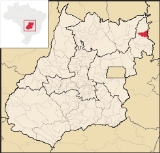
. Guarani is a very poor municipality in the northeast of the state.
Geography
Guarani belongs to the Vão do Paranã statistical microregion. There are municipal boundaries with São DomingosSão Domingos, Goiás
São Domingos is a small town and municipality in northeastern Goiás state, Brazil. It is a large producer of beef cattle but is one of the poorest towns in the state.-Location:...
, Iaciara
Iaciara
Iaciara is a small town and municipality in northeastern Goiás state, Brazil.-Geography:Iaciara is located in Vão do Paranã statistical micro-region, which borders the state of Bahia. The distance to the state capital of Goiânia is 548 kilometers...
, Posse
Posse, Goiás
Posse is a small town and municipality in northeastern Goiás state, Brazil.-Geography:It is located northeast of Brasília, 24 km. from the state boundary with Bahia, on interstate highway BR-020...
, and the state of Bahia
Bahia
Bahia is one of the 26 states of Brazil, and is located in the northeastern part of the country on the Atlantic coast. It is the fourth most populous Brazilian state after São Paulo, Minas Gerais and Rio de Janeiro, and the fifth-largest in size...
Guarani is located south of the Terra Ronca state park (Terra Ronca) and 28 kilometers north of Posse
Posse, Goiás
Posse is a small town and municipality in northeastern Goiás state, Brazil.-Geography:It is located northeast of Brasília, 24 km. from the state boundary with Bahia, on interstate highway BR-020...
. It is 35 kilometers to the important BR-020 highway, which links Brasília
Brasília
Brasília is the capital city of Brazil. The name is commonly spelled Brasilia in English. The city and its District are located in the Central-West region of the country, along a plateau known as Planalto Central. It has a population of about 2,557,000 as of the 2008 IBGE estimate, making it the...
to Salvador. Guarani is crossed by the Frei River, which has one of the most beautiful waterfalls in the region. For a map of the waterfall see Terraronca
The distance to Goiânia
Goiânia
-Climate:The city has a tropical wet and dry climate with an average temperature of . There's a wet season, from October to April, and a dry one, from May to September. Annual rainfall is around 1,520 mm....
is 550 km. Connections are made by taking BR-153 / Anápolis / GO-060 / Alexânia / Planaltina / Formosa / GO-020 / BR-030 / Vila Boa / Alvorada do Norte / GO-108 / Posse.
Demographics
- Population density: 3.34 inhab/km²
- Population in 1980: 3,978
- Population in 2007: 4,105
- Urban population: 1,743
- Rural population: 2,362
- Population growth rate: -1.28%
Economy
The main economic activities are cattle raising, poultry raising, and agriculture (beans, manioc corn, and bananas).There were no hospitals in 2007.
- Industrial units: 1
- Retail commercial units: 30
- Motor vehicles (automobiles and pickup trucks): 146
- Number of inhabitants per motor vehicle: 28
Agricultural data 2006
- Farms: 550
- Total area: 165,143 ha.
- Area of permanent crops: 149 ha.
- Area of perennial crops: 1,713 ha.
- Area of pasture: 106,927 ha.
- Area of woodland and forests: 53,907 ha.
- Persons dependent on farming: 1,750
- Cattle herd: 55,200
- Corn: 450 ha.
- Sugarcane: 80 ha.
- Rice: 450 ha.
- Beans: 60 ha.
- Manioc: 60 ha.
Health and education
Ranking on the Municipal Human Development IndexHuman Development Index
The Human Development Index is a composite statistic used to rank countries by level of "human development" and separate "very high human development", "high human development", "medium human development", and "low human development" countries...
: 0.632
- State ranking: 238 (out of 242 in 2000)
- National ranking: 4,091 (out of 5,507 in 2000)
- Literacy rate: 72.2% (2000)
- Infant mortality rate: 37.81 in 1,000 live births (2000)
- Schools: 12 with 1,429 students
- Hospitals: none in 2007
History
The town was first created as a district of the municipality of São DomingosSão Domingos, Goiás
São Domingos is a small town and municipality in northeastern Goiás state, Brazil. It is a large producer of beef cattle but is one of the poorest towns in the state.-Location:...
with the name of Guarani in 1919. In 1943 the name was changed to Coatiçaba. In 1963 it was dismembered from São Domingos and formed a new municipality with the name Guarani de Goiás.
Notes
Sources of Data
See also
- List of municipalities in Goiás
- Microregions in GoiásMicroregions in GoiásThe state of Goiás is divided into 18 statistical microregions by the Instituto Brasileiro de Geografia e Estatístic . These have no administrative function but are used only for statistics...
- Vão do Paranã MicroregionVão do Paranã MicroregionThe Vão do Paranã is a statistical micro-region created by IBGE in northeastern Goiás state, Brazil.*Population: 102,927 inhabitants *Cities: 12...