
Groß-Umstadt
Encyclopedia
Groß-Umstadt is a town in the district of Darmstadt-Dieburg in the Bundesland (federal state) of Hesse
in Germany
. It is near Darmstadt
and Frankfurt
on the northern border of the Odenwald
and is on the edge of the Frankfurt Rhein-Main Region. The highest point of the town is the Heidelberg (365 m).
The population is about 22,000 residents. About half of these live in Umstadt itself and the remainder in 8 other districts which were combined with Umstadt in the local government reforms in the 1970s:
The last of these includes Frau-Nauses.
The settlement of Civitas Auderiensium was founded at Dieburg in AD 125 in the context of the Roman occupation of the section of the province of Germania Superior
on the right bank of the Rhine. The foundation was followed by an orderly settlement and Romanisation of the district, and a market for agricultural produce was established. The main building of a "villa rustica" has been excavated under the current town church. This villa remained until the collapse of the Alemanni around AD 300. The town's history over the following 450 years until the first documentary evidence of the town is unclear. Alemannic and later Frankish tombs point to a settlement in the area of the town. The siting of the church in the core area of the former villa indicates an uninterrupted settlement, or at least to awareness of the previous settlement.
Konrad IV of Hanau incurred substantial debts in connection with his election as Prince Abbot of Fulda in 1373. He attempted to recoup these debts from the imperial abbey of Fulda after he came to power. Thus in 1374 he mortgaged the castle of Otzberg, the town of Hering and parts of Umstadt to his nephew Ulrich IV for 23,875 florins. Other parts were taken over by the Kurpfalz (the domain of the Electors Palatine), resulting in a condominium. There is physical evidence for this in two castles: the Hanauer Schloss which originated from the first moated castle at the town's NE corner, and the Pfälzer Schloss at the opposite corner. Between these were the mansions of the burghers of the town, including the seat of the Wambolts of Umstadt, which soon eclipsed the castles of both lords of the town.
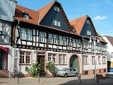
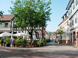
Under this common ownership the town developed until shortly before the Thirty Years War; the still extant town hall was built from 1596.
During the war the town was protected by its strong fortifications, preventing major destruction, but nevertheless there was great suffering, not least during the plague in 1634-36.
The town was briefly occupied and laid waste by a force of 600 dragoons under Marquis of Barbistere in December 1688 during the war of the Palatine succession.
In the election of 1933, 60% of the inhabitants voted for the Nazis, and in 1938 the town's synagogue was desecrated. After WW2 the town's population grew to about 22,500 following several expansions to its boundaries. There is now a substantial Portuguese community.

Hesse
Hesse or Hessia is both a cultural region of Germany and the name of an individual German state.* The cultural region of Hesse includes both the State of Hesse and the area known as Rhenish Hesse in the neighbouring Rhineland-Palatinate state...
in Germany
Germany
Germany , officially the Federal Republic of Germany , is a federal parliamentary republic in Europe. The country consists of 16 states while the capital and largest city is Berlin. Germany covers an area of 357,021 km2 and has a largely temperate seasonal climate...
. It is near Darmstadt
Darmstadt
Darmstadt is a city in the Bundesland of Hesse in Germany, located in the southern part of the Rhine Main Area.The sandy soils in the Darmstadt area, ill-suited for agriculture in times before industrial fertilisation, prevented any larger settlement from developing, until the city became the seat...
and Frankfurt
Frankfurt
Frankfurt am Main , commonly known simply as Frankfurt, is the largest city in the German state of Hesse and the fifth-largest city in Germany, with a 2010 population of 688,249. The urban area had an estimated population of 2,300,000 in 2010...
on the northern border of the Odenwald
Odenwald
The Odenwald is a low mountain range in Hesse, Bavaria and Baden-Württemberg in Germany.- Location :The Odenwald lies between the Upper Rhine Rift Valley with the Bergstraße and the Hessisches Ried in the west, the Main and the Bauland in the east, the Hanau-Seligenstadt Basin – a subbasin of...
and is on the edge of the Frankfurt Rhein-Main Region. The highest point of the town is the Heidelberg (365 m).
The population is about 22,000 residents. About half of these live in Umstadt itself and the remainder in 8 other districts which were combined with Umstadt in the local government reforms in the 1970s:
- Dorndiel
- Heubach
- Kleestadt
- Klein-Umstadt
- Raibach
- Richen
- Semd
- Wiebelsbach
The last of these includes Frau-Nauses.
History
Traces of palaeolithic habitation have been identified outside the town.The settlement of Civitas Auderiensium was founded at Dieburg in AD 125 in the context of the Roman occupation of the section of the province of Germania Superior
Germania Superior
Germania Superior , so called for the reason that it lay upstream of Germania Inferior, was a province of the Roman Empire. It comprised an area of western Switzerland, the French Jura and Alsace regions, and southwestern Germany...
on the right bank of the Rhine. The foundation was followed by an orderly settlement and Romanisation of the district, and a market for agricultural produce was established. The main building of a "villa rustica" has been excavated under the current town church. This villa remained until the collapse of the Alemanni around AD 300. The town's history over the following 450 years until the first documentary evidence of the town is unclear. Alemannic and later Frankish tombs point to a settlement in the area of the town. The siting of the church in the core area of the former villa indicates an uninterrupted settlement, or at least to awareness of the previous settlement.
Early mediaeval period
After the conquest of Alemannic territory by the Franks, they established royal fortifications in order to secure control of the area. One such was undoubtedly established in Umstadt, the center of government of the Umstaedter Mark, which included the current municipalities of Otzberg, Höchst, Breuberg and Schafheim as well as Umstadt itself. At that time Umstadt had the status of a market town as well as a church and the seat of a Count. The first documentary evidence of the district was in 743 under the name of "Autmundisstat", which signified "Autmund's town" (possibly Edmund's). Another possible origin of the name is "ad montes" (near the mountains). In 766 the Fulda monastery acquired the ownership of the Umstaedter Mark, and by 985 it owned three churches, mills and vineyards here.Late mediaeval period
By 1263 or earlier, Umstadt had obtained the status of a town as well as a town wall.Konrad IV of Hanau incurred substantial debts in connection with his election as Prince Abbot of Fulda in 1373. He attempted to recoup these debts from the imperial abbey of Fulda after he came to power. Thus in 1374 he mortgaged the castle of Otzberg, the town of Hering and parts of Umstadt to his nephew Ulrich IV for 23,875 florins. Other parts were taken over by the Kurpfalz (the domain of the Electors Palatine), resulting in a condominium. There is physical evidence for this in two castles: the Hanauer Schloss which originated from the first moated castle at the town's NE corner, and the Pfälzer Schloss at the opposite corner. Between these were the mansions of the burghers of the town, including the seat of the Wambolts of Umstadt, which soon eclipsed the castles of both lords of the town.
Early modern period
In 1504 the town was conquered by Landgrave Wilhelm II of Hesse, who occupied it until the ownership of the town was clarified by the Diet of Worms in 1521. This resulted in another condominium, this time between Hesse and the Palatinate. As compensation Hanau received 12,000 guilders and several nearby villages, viz. Harperthausen, Kleestadt, Langstadt and Schlierbach.Under this common ownership the town developed until shortly before the Thirty Years War; the still extant town hall was built from 1596.
During the war the town was protected by its strong fortifications, preventing major destruction, but nevertheless there was great suffering, not least during the plague in 1634-36.
The town was briefly occupied and laid waste by a force of 600 dragoons under Marquis of Barbistere in December 1688 during the war of the Palatine succession.
19th and 20th centuries
In 1802 the Landgraviate of Hesse-Darmstadt took over the joint dominion of the town, which was the 2nd most important town of the district of Dieburg which was founded at that time. From 1857 the town adopted the name of Gross-Umstadt to distinguish it from Klein-Umstadt and Wenigumstadt. Many factories were established in the town after it obtained a railway connection.In the election of 1933, 60% of the inhabitants voted for the Nazis, and in 1938 the town's synagogue was desecrated. After WW2 the town's population grew to about 22,500 following several expansions to its boundaries. There is now a substantial Portuguese community.
Population Growth
Groß-Umstadt (excluding the 8 other districts)
- 800 - 100
- 985 - 200
- 1604 - 1,000
- 1636 - 424
- 1816 - 2,780
- 1905 - 3,580
- 1945 - 4,500
- 1990 - 9,087
After their inclusion
(December 31)- 1998 - 21,175
- 1999 - 21,338
- 2000 - 21,403
- 2001 - 21,571
- 2002 - 21,620
- 2003 - 21,685
- 2004 - 21,724
- 2005 - 22,600
Culture
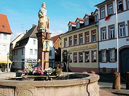
Each year at the weekend after September, 15th there is the "Winzerfest" (a wine festival) which attracts tens of thousands of people.Partner cities
- Saint-PéraySaint-PéraySaint-Péray is a commune in the Ardèche department in the Rhône-Alpes region in southern France.-Population:-See also:* Château de Crussol, located on the territory of the commune.*Communes of the Ardèche department-References:*...
(FranceFranceThe French Republic , The French Republic , The French Republic , (commonly known as France , is a unitary semi-presidential republic in Western Europe with several overseas territories and islands located on other continents and in the Indian, Pacific, and Atlantic oceans. Metropolitan France...
; since 1966) - Santo TirsoSanto TirsoSanto Tirso is a city and municipality located in the north of Porto Metropolitan Area, Porto District, Portugal. In the region, the Ave Valley, there is a large center of textile industry....
(PortugalPortugalPortugal , officially the Portuguese Republic is a country situated in southwestern Europe on the Iberian Peninsula. Portugal is the westernmost country of Europe, and is bordered by the Atlantic Ocean to the West and South and by Spain to the North and East. The Atlantic archipelagos of the...
; since 1988) - DicomanoDicomanoDicomano is a comune in the Province of Florence in the Italian region Tuscany, located about 25 km northeast of Florence.Dicomano borders the following municipalities: Londa, Rufina, San Godenzo, Vicchio.-External links:*...
(ItalyItalyItaly , officially the Italian Republic languages]] under the European Charter for Regional or Minority Languages. In each of these, Italy's official name is as follows:;;;;;;;;), is a unitary parliamentary republic in South-Central Europe. To the north it borders France, Switzerland, Austria and...
; since 2010)