

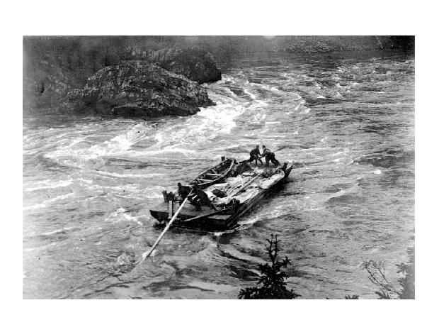
Grand Canyon of the Fraser
Encyclopedia
Fraser River
The Fraser River is the longest river within British Columbia, Canada, rising at Fraser Pass near Mount Robson in the Rocky Mountains and flowing for , into the Strait of Georgia at the city of Vancouver. It is the tenth longest river in Canada...
in north-central British Columbia
British Columbia
British Columbia is the westernmost of Canada's provinces and is known for its natural beauty, as reflected in its Latin motto, Splendor sine occasu . Its name was chosen by Queen Victoria in 1858...
about 30km upstream from the confluence of the Bowron River
Bowron River
The Bowron River, also formerly named the Bear River and Reid Creek, originates in Bowron Lake Provincial Park of east central British Columbia and flows northwest from the outlet of the Bowron Lakes, then northeast, to join the Fraser River...
and about 100km due east of downtown Prince George, British Columbia
Prince George, British Columbia
Prince George, with a population of 71,030 , is the largest city in northern British Columbia, Canada, and is known as "BC's Northern Capital"...
. Just downstream of the canyon, which pierces a rocky ridge, is a stretch of water called Scow Rapids, which was the upper limit of navigation from Prince George
Prince George, British Columbia
Prince George, with a population of 71,030 , is the largest city in northern British Columbia, Canada, and is known as "BC's Northern Capital"...
and where scows had to be used to tow vessels and rafts upstream along the gorge's banks. The canyon is located in Sugarbowl-Grizzly Den Provincial Park and Protected Area
Sugarbowl-Grizzly Den Provincial Park and Protected Area
Sugarbowl-Grizzly Den Provincial Park and Protected Area is a provincial park in British Columbia, Canada.-History:The park was established 2000. In 1973 and 1974, Northwood Pulp and Timber Ltd. built the original trails and cabins . Ministry of Forests maintained the trails and cabins up until...
.
This stretch of the river is not to be confused with the much more impressive Fraser Canyon
Fraser Canyon
The Fraser Canyon is an 84 km landform of the Fraser River where it descends rapidly through narrow rock gorges in the Coast Mountains en route from the Interior Plateau of British Columbia to the Fraser Valley...
, which runs south from the city of Williams Lake
Williams Lake, British Columbia
Williams Lake, is a city in the Central Interior of British Columbia, Canada. Located in the central part of a region known as the Cariboo, it is the largest urban centre between Kamloops and Prince George, with a population of 11,150 in city limits....
to the town of Hope
Hope, British Columbia
Hope is a district municipality located at the confluence of the Fraser and Coquihalla rivers in the province of British Columbia, Canada. Hope is at the eastern end of both the Fraser Valley and the Lower Mainland region, and is at the southern end of the Fraser Canyon...
.