
Goode Township, Franklin County, Illinois
Encyclopedia
Goode Township is one of twelve townships
in Franklin County
, Illinois
, USA
. As of the 2000 census
, its population was 2,855.
, Goode Township covers an area of 28.23 square miles (73.1 km²); of this, 0.11 square mile (0.2848986921 km²) or 0.4 percent is water.
(This list is based on USGS data and may include former settlements.)
Civil township
A civil township is a widely used unit of local government in the United States, subordinate to, and geographic divisions of, a county. Specific responsibilities and the degree of autonomy vary based on each state. Civil townships are distinct from survey townships, but in states that have both,...
in Franklin County
Franklin County, Illinois
Franklin County is a county located in the U.S. state of Illinois. According to the 2010 census, it has a population of 39,561, which is an increase of 1.4% from 39,018 in 2000. Its county seat is Benton.-History:...
, Illinois
Illinois
Illinois is the fifth-most populous state of the United States of America, and is often noted for being a microcosm of the entire country. With Chicago in the northeast, small industrial cities and great agricultural productivity in central and northern Illinois, and natural resources like coal,...
, USA
United States
The United States of America is a federal constitutional republic comprising fifty states and a federal district...
. As of the 2000 census
United States Census, 2000
The Twenty-second United States Census, known as Census 2000 and conducted by the Census Bureau, determined the resident population of the United States on April 1, 2000, to be 281,421,906, an increase of 13.2% over the 248,709,873 persons enumerated during the 1990 Census...
, its population was 2,855.
Geography
According to the United States Census BureauUnited States Census Bureau
The United States Census Bureau is the government agency that is responsible for the United States Census. It also gathers other national demographic and economic data...
, Goode Township covers an area of 28.23 square miles (73.1 km²); of this, 0.11 square mile (0.2848986921 km²) or 0.4 percent is water.
Unincorporated towns
- Meyer
(This list is based on USGS data and may include former settlements.)
Cemeteries
The township contains these four cemeteries: Bear Point, Maple Hill, Mitchell and Youngblood.Major highways
-
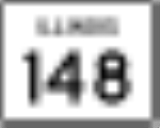
 Illinois Route 148Illinois Route 148Illinois Route 148 is a north–south state road in southern Illinois. It runs from Illinois Route 37 at Pulleys Mill north to the western terminus of Illinois Route 142 and Illinois 37 south of downtown Mount Vernon...
 -
 Illinois Route 154Illinois Route 154Illinois Route 154 is an east–west state road in southern Illinois. It runs from Illinois Route 3 in Red Bud to Illinois Route 37 in Whittington. This is a distance of .- Route description :...
Political districts
- Illinois' 12th congressional districtIllinois' 12th congressional districtThe 12th Congressional District of Illinois has been represented by Democratic Rep. Jerry Costello since 1993.-Voting:-List of representatives:-References:* -External links:**...
- State House District 117
- State Senate District 59