
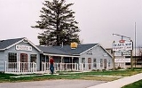
Garden City, Utah
Encyclopedia
Garden City is a town in Rich County
, Utah
, United States
. The population was 562 at the 2010 census. Garden City sits on the shores of Bear Lake
and is a popular summer resort destination town.
.
According to the United States Census Bureau
, the town has a total area of 4.5 square miles (11.7 km²), all of it land.
of 2000, there were 357 people, 131 households, and 99 families residing in the town. The population density
was 79.3 people per square mile (30.6/km²). There were 881 housing units at an average density of 195.6 per square mile (75.6/km²). The racial makeup of the town was 98.32% White, 0.28% Native American, 0.28% from other races
, and 1.12% from two or more races. Hispanic or Latino of any race were 0.84% of the population.
There were 131 households out of which 26.7% had children under the age of 18 living with them, 69.5% were married couples
living together, 4.6% had a female householder with no husband present, and 23.7% were non-families. 19.1% of all households were made up of individuals and 8.4% had someone living alone who was 65 years of age or older. The average household size was 2.69 and the average family size was 3.10.
In the town the population was spread out with 24.9% under the age of 18, 7.8% from 18 to 24, 20.4% from 25 to 44, 24.6% from 45 to 64, and 22.1% who were 65 years of age or older. The median age was 42 years. For every 100 females there were 90.9 males. For every 100 females age 18 and over, there were 92.8 males.
The median income for a household in the town was $40,750, and the median income for a family was $56,250. Males had a median income of $45,833 versus $35,000 for females. The per capita income
for the town was $20,206. About 2.7% of families and 9.6% of the population were below the poverty line, including none of those under age 18 and 12.5% of those age 65 or over.
Rich County, Utah
Rich County is a county located in the U.S. state of Utah. The southern half of Bear Lake and the Bear Lake Valley lie on the northern edge of the county. The Bear River Valley lies in most of the eastern portion of the county. The elevation of these valleys is close to , and the rest of the county...
, Utah
Utah
Utah is a state in the Western United States. It was the 45th state to join the Union, on January 4, 1896. Approximately 80% of Utah's 2,763,885 people live along the Wasatch Front, centering on Salt Lake City. This leaves vast expanses of the state nearly uninhabited, making the population the...
, United States
United States
The United States of America is a federal constitutional republic comprising fifty states and a federal district...
. The population was 562 at the 2010 census. Garden City sits on the shores of Bear Lake
Bear Lake (Idaho-Utah)
Bear Lake is a natural freshwater lake on the Utah-Idaho border in the Western United States. It is the second largest natural freshwater lake in Utah and has been called the "Caribbean of the Rockies" for its unique turquoise-blue color, the result of suspended limestone deposits in the water...
and is a popular summer resort destination town.
History
Garden City was first settled in 1877 and an LDS branch was formed there at that time. Two years later the town had grown into a ward. In 1979, it merged with the neighboring town of PicklevillePickleville, Utah
Pickleville was a small town located near the western shore of Bear Lake, northeast of Salt Lake City, in Rich County, Utah, United States. It is now part of Garden City....
.
Geography
Garden City is located at 41°56′49"N 111°23′37"W (41.933272, -111.405201).According to the United States Census Bureau
United States Census Bureau
The United States Census Bureau is the government agency that is responsible for the United States Census. It also gathers other national demographic and economic data...
, the town has a total area of 4.5 square miles (11.7 km²), all of it land.
Demographics
As of the censusCensus
A census is the procedure of systematically acquiring and recording information about the members of a given population. It is a regularly occurring and official count of a particular population. The term is used mostly in connection with national population and housing censuses; other common...
of 2000, there were 357 people, 131 households, and 99 families residing in the town. The population density
Population density
Population density is a measurement of population per unit area or unit volume. It is frequently applied to living organisms, and particularly to humans...
was 79.3 people per square mile (30.6/km²). There were 881 housing units at an average density of 195.6 per square mile (75.6/km²). The racial makeup of the town was 98.32% White, 0.28% Native American, 0.28% from other races
Race (United States Census)
Race and ethnicity in the United States Census, as defined by the Federal Office of Management and Budget and the United States Census Bureau, are self-identification data items in which residents choose the race or races with which they most closely identify, and indicate whether or not they are...
, and 1.12% from two or more races. Hispanic or Latino of any race were 0.84% of the population.
There were 131 households out of which 26.7% had children under the age of 18 living with them, 69.5% were married couples
Marriage
Marriage is a social union or legal contract between people that creates kinship. It is an institution in which interpersonal relationships, usually intimate and sexual, are acknowledged in a variety of ways, depending on the culture or subculture in which it is found...
living together, 4.6% had a female householder with no husband present, and 23.7% were non-families. 19.1% of all households were made up of individuals and 8.4% had someone living alone who was 65 years of age or older. The average household size was 2.69 and the average family size was 3.10.
In the town the population was spread out with 24.9% under the age of 18, 7.8% from 18 to 24, 20.4% from 25 to 44, 24.6% from 45 to 64, and 22.1% who were 65 years of age or older. The median age was 42 years. For every 100 females there were 90.9 males. For every 100 females age 18 and over, there were 92.8 males.
The median income for a household in the town was $40,750, and the median income for a family was $56,250. Males had a median income of $45,833 versus $35,000 for females. The per capita income
Per capita income
Per capita income or income per person is a measure of mean income within an economic aggregate, such as a country or city. It is calculated by taking a measure of all sources of income in the aggregate and dividing it by the total population...
for the town was $20,206. About 2.7% of families and 9.6% of the population were below the poverty line, including none of those under age 18 and 12.5% of those age 65 or over.
External links
- Garden City, Utah is at coordinates 41°56′45"N 111°23′35"W.
- Official website