
GR 10
Encyclopedia
The GR 10 is a French GR footpath
, or hiking trail, that runs the length of the Pyrenees Mountains
. It roughly parallels the French-Spanish border on the French side. Those attempting the entire trail often choose to walk it from west to east, from Hendaye
on the Bay of Biscay
to Banyuls-sur-Mer
on the Mediterranean Sea
, but it can just as easily be traversed east to west.
involved. The trail covers a distance of 866 kilometres (538.1 mi), with 48000 metres (157,480.3 ft) of ascent.
There are many places to stay along the route that cater to walkers, including hotels, Gîtes d'étape
, and very basic mountain refuges. Camping is only necessary for two or three nights in the Ariège
section. Some walkers walk one section of the trail at a time, completing the route over several visits.
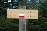
The trail is well marked with red and white painted blazes
. It appears on all regional maps, including on Michelin
roadmaps. The route is within the area shown by the Editions Sud-Ouest Rando éditions range of maps (numbers 1-11) ,which are based on French Institut Géographique National
1:50,000 scale maps. Parts of the route, especially around towns and villages, change from year to year, so walkers do well to carry recent editions of the maps and guides.
A number of sections include alternative routes of a less demanding nature. Some alternatives offer more scenic choices, for example the alternative route from Cauterets
to Luz-Saint-Sauveur
takes in Pont d'Espagne, the Refuge Oulettes de Gaube, the Refuge Baysellance, Gavarnie, Gedre and Pragneres, and offers more spectacular mountain scenery.
Another notable section is near the village of Etsaut
, where the route follows the Chemin de la Mâture
, a track carved into a sheer cliff face. This path was created in the 18th century to facilitate the transport of tree trunks destined to be made into masts for French warships.
There are four very detailed guide books (in French) describing the GR 10. These are published by the Fédération Française de la Randonnée Pédestre (French Hiking Federation). These guide books can be purchased at most large sports stores in the region, and in a few of the largest sports stores in the major cities in France. English guides are also available.
The Spanish GR 11 is a similar route on the Spanish side of the border, while the Haute Randonnée Pyrénéenne
(HRP) follows a generally higher route through the Pyrenees, from mountaintop to mountaintop, frequently crossing the border.
GR footpath
The Grande Randonnée , Grote Routepaden or Lange-afstand-wandelpaden , Grande Rota or Gran Recorrido is a network of long-distance footpaths in Europe, mostly in France, Belgium, the Netherlands and Spain. In France alone, the trails cover approximately 60,000 km...
, or hiking trail, that runs the length of the Pyrenees Mountains
Pyrenees
The Pyrenees is a range of mountains in southwest Europe that forms a natural border between France and Spain...
. It roughly parallels the French-Spanish border on the French side. Those attempting the entire trail often choose to walk it from west to east, from Hendaye
Hendaye
Hendaye is the most south-westerly town and commune in France, lying in the Pyrénées-Atlantiques department and located in the traditional province Lapurdi of the French Basque Country...
on the Bay of Biscay
Bay of Biscay
The Bay of Biscay is a gulf of the northeast Atlantic Ocean located south of the Celtic Sea. It lies along the western coast of France from Brest south to the Spanish border, and the northern coast of Spain west to Cape Ortegal, and is named in English after the province of Biscay, in the Spanish...
to Banyuls-sur-Mer
Banyuls-sur-Mer
Banyuls-sur-Mer is a commune in the Pyrénées-Orientales department in southern France.-Geography:Banyuls-sur-Mer is neighbored by Cerbère, Port-Vendres, Argelès-sur-Mer and Collioure. The region is known for its wines, such as the sweet wine Banyuls. An aquatic museum with aquarium is located in...
on the Mediterranean Sea
Mediterranean Sea
The Mediterranean Sea is a sea connected to the Atlantic Ocean surrounded by the Mediterranean region and almost completely enclosed by land: on the north by Anatolia and Europe, on the south by North Africa, and on the east by the Levant...
, but it can just as easily be traversed east to west.
Description
Hiking the entire route is estimated to take around 52 days for hikers who are in good shape and used to mountain hiking. Some stretches involve a lot of ascending and descending, including a few one-day sections that can climb and then descend 1200 metres (3,937 ft), but the GR 10 is a hiking trail, and there is no actual mountain climbingMountaineering
Mountaineering or mountain climbing is the sport, hobby or profession of hiking, skiing, and climbing mountains. While mountaineering began as attempts to reach the highest point of unclimbed mountains it has branched into specialisations that address different aspects of the mountain and consists...
involved. The trail covers a distance of 866 kilometres (538.1 mi), with 48000 metres (157,480.3 ft) of ascent.
There are many places to stay along the route that cater to walkers, including hotels, Gîtes d'étape
Gîte
"Gîte" is a French term which refers to a specific type of holiday accommodation. A "Gîte" is a holiday home that is available for rent. Gîtes are usually fully furnished and equipped for self-catering...
, and very basic mountain refuges. Camping is only necessary for two or three nights in the Ariège
Ariège
Ariège is a department in southwestern France named after the Ariège River.- History :Ariège is one of the original 83 departments created during the French Revolution on 4 March 1790. It was created from the counties of Foix and Couserans....
section. Some walkers walk one section of the trail at a time, completing the route over several visits.
The trail is well marked with red and white painted blazes
Trail blazing
Trail blazing, or trailblazing, is the practice of marking paths in outdoor recreational areas with blazes, markings that follow each other at certain — though not necessarily exactly defined — distances and mark the direction of the trail...
. It appears on all regional maps, including on Michelin
Michelin
Michelin is a tyre manufacturer based in Clermont-Ferrand in the Auvergne région of France. It is one of the two largest tyre manufacturers in the world along with Bridgestone. In addition to the Michelin brand, it also owns the BFGoodrich, Kleber, Riken, Kormoran and Uniroyal tyre brands...
roadmaps. The route is within the area shown by the Editions Sud-Ouest Rando éditions range of maps (numbers 1-11) ,which are based on French Institut Géographique National
Institut géographique national (France)
This article is about the French Institut Géographique National; for the similar Belgian institution also called Institut Géographique National see Nationaal Geografisch Instituut - Institut Géographique National...
1:50,000 scale maps. Parts of the route, especially around towns and villages, change from year to year, so walkers do well to carry recent editions of the maps and guides.
A number of sections include alternative routes of a less demanding nature. Some alternatives offer more scenic choices, for example the alternative route from Cauterets
Cauterets
Cauterets is a spa town, a ski resort and a commune in the Hautes-Pyrénées department in south-western France.-Geography:Cauterets is located southwest of Lourdes in the beautiful valley of the Gave de Cauterets and borders the Pyrenees National Park....
to Luz-Saint-Sauveur
Luz-Saint-Sauveur
Luz-Saint-Sauveur is a commune in the Hautes-Pyrénées department in south-western France.-References:*...
takes in Pont d'Espagne, the Refuge Oulettes de Gaube, the Refuge Baysellance, Gavarnie, Gedre and Pragneres, and offers more spectacular mountain scenery.
Another notable section is near the village of Etsaut
Etsaut
Etsaut is a commune in the Pyrénées-Atlantiques department in south-western France.-References:*...
, where the route follows the Chemin de la Mâture
Chemin de la Mâture
The Chemin de la Mâture is a path carved into a sheer rock face rising over above the Aspe River valley, in the French Pyrenees mountains. Completed by the engineer Paul-Marie Leroy in 1772, the Chemin de la Mâture was originally created to transport timber from the nearby Pacq forest to be used...
, a track carved into a sheer cliff face. This path was created in the 18th century to facilitate the transport of tree trunks destined to be made into masts for French warships.
There are four very detailed guide books (in French) describing the GR 10. These are published by the Fédération Française de la Randonnée Pédestre (French Hiking Federation). These guide books can be purchased at most large sports stores in the region, and in a few of the largest sports stores in the major cities in France. English guides are also available.
The Spanish GR 11 is a similar route on the Spanish side of the border, while the Haute Randonnée Pyrénéenne
Haute Randonnée Pyrénéenne
The Haute Randonnée Pyrénéenne is a long-distance footpath in the Pyrenees.Like the GR 10 and the GR 11, the path travels the length of the Pyrenees from coast to coast...
(HRP) follows a generally higher route through the Pyrenees, from mountaintop to mountaintop, frequently crossing the border.
Departments crossed
The GR 10 passes through the French departments of:- Pyrénées-AtlantiquesPyrénées-AtlantiquesPyrénées-Atlantiques is a department in the southwest of France which takes its name from the Pyrenees mountains and the Atlantic Ocean.- History :...
- Hautes-PyrénéesHautes-PyrénéesHautes-Pyrénées is a department in southwestern France. It is part of the Midi-Pyrénées region.-History:...
- Haute-GaronneHaute-GaronneHaute-Garonne is a department in the southwest of France named after the Garonne river. Its main city is Toulouse.-History:Haute-Garonne is one of the original 83 departments created during the French Revolution on March 4, 1790. It was created from part of the former province of Languedoc.The...
- AriègeAriègeAriège is a department in southwestern France named after the Ariège River.- History :Ariège is one of the original 83 departments created during the French Revolution on 4 March 1790. It was created from the counties of Foix and Couserans....
- Pyrénées-OrientalesPyrénées-OrientalesPyrénées-Orientales is a department of southern France adjacent to the northern Spanish frontier and the Mediterranean Sea. It also surrounds the tiny Spanish enclave of Llívia, and thus has two distinct borders with Spain.- History :...
Towns, villages and other stopping places
Some commonly used overnight stops with camping or gîte facilities include:- HendayeHendayeHendaye is the most south-westerly town and commune in France, lying in the Pyrénées-Atlantiques department and located in the traditional province Lapurdi of the French Basque Country...
- Olhette
- AinhoaAinhoa, Pyrénées-AtlantiquesAinhoa is a commune in the Pyrénées-Atlantiques department in Aquitaine in south-western France. The village is in the traditional Basque province of Labourd...
- BidarrayBidarrayBidarray is a commune of the Pyrénées-Atlantiques department in south-western France.It is located in the former province of Lower Navarre.-References:* -External links:*...
- Saint-Étienne-de-BaïgorrySaint-Étienne-de-BaïgorrySaint-Étienne-de-Baïgorry is a commune in the Pyrénées-Atlantiques department in south-western France, located at the same time in the former province of Lower Navarre...
- Saint-Jean-Pied-de-PortSaint-Jean-Pied-de-PortSaint-Jean-Pied-de-Port is a commune in the Pyrénées-Atlantiques department in south-western France close to Ostabat in the Pyrenean foothills....
- EsterencubyEstérençubyEstérençuby is a commune in the Pyrénées-Atlantiques department in south-western France.It is located in the former province of Lower Navarre.-External links:*...
- Col Bagargiak
- Logibar (LarrauLarrauLarrau is a commune in the Pyrénées-Atlantiques department in south-western France.It is located in the former province of Soule.-External links:*...
) - Saint-Engrace
- Arette-la-Pierre-Saint-Martin
- LescunLescunThe village of Lescun is a commune in the Pyrénées-Atlantiques department in south-western France.It is at approximately 900m altitude in a grand cirque.Lescun is situated on the GR 10 long-distance footpath traversing the Pyrenees...
- EtsautEtsautEtsaut is a commune in the Pyrénées-Atlantiques department in south-western France.-References:*...
- GabasGabas, Pyrénées-AtlantiquesGabas is a hamlet in the valley of the Gave d'Ossau in the French Pyrenees. It is located where that river is formed by the confluence of two mountain streams, the Gave de Bious and the Gave du Brousset, which flow respectively from the western and eastern sides of the Pic du Midi d'Ossau.The...
- GouretteGouretteGourette is a winter sports resort in the French Pyrenees. It is located in the commune of Eaux-Bonnes in the département of Pyrénées-Atlantiques, on the D918 road which passes through the Col d'Aubisque mountain pass...
- Arrens-MarsousArrens-MarsousArrens-Marsous is a commune in the Hautes-Pyrénées department in south-western France.In the middle of the village, the Maison du Val d'Azun is an information centre and small museum of the area.-References:*...
- CauteretsCauteretsCauterets is a spa town, a ski resort and a commune in the Hautes-Pyrénées department in south-western France.-Geography:Cauterets is located southwest of Lourdes in the beautiful valley of the Gave de Cauterets and borders the Pyrenees National Park....
(and GavarnieGavarnieGavarnie is a commune in the Hautes-Pyrénées department in south-western France.-See also:* Cirque de Gavarnie* Gavarnie Falls*Communes of the Hautes-Pyrénées department-References:*...
and GedreGèdreGèdre is a commune in the Hautes-Pyrénées department in south-western France.-References:*...
via alternative route) - Luz-Saint-SauveurLuz-Saint-SauveurLuz-Saint-Sauveur is a commune in the Hautes-Pyrénées department in south-western France.-References:*...
- BarègesBarègesBarèges is a commune in the Hautes-Pyrénées department in south-western France. It is situated in the valley of the stream Bastan on the former Route nationale 618, the "Route of the Pyrénées."-Economy:...
- Chalet Hotel Lac de L'Oule
- Vielle Aure
- Germ
- Lac d'OoLac d'OôThe Lac d'Oô is an artificial lake in the Pyrenees with an area of 42 hectares located at an altitude of 1507 m in the commune of Oô....
- Bagnères-de-LuchonBagnères-de-LuchonBagnères-de-Luchon , also referred to as Luchon, is a spa town and a commune in the Haute-Garonne department in southwestern France.-Geography:...
- FosFos, Haute-GaronneFos is a commune in the Haute-Garonne department in southwestern France.-Population:-References:*...
- Refuge de l'Etang d'Araing
- Eylie d'en haut
- Cabane de Besset
- Etang d'Ayes
- AunacAunacAunac is a commune in the Charente department in southwestern France.-Population:...
- RouzeRouzeRouze is a commune in the Ariège department in southwestern France.-Population:Inhabitants of Rouze are called Rouzéens....
- St Lizier d'Ustou
- Aulus-les-BainsAulus-les-BainsAulus-les-Bains is a commune in the Ariège department in southwestern France.Situated at the head of the Garbet valley and beneath Guzet Neige ski resort, the village is best known for the thermal springs and spa complex. There are several Belle Époque buildings, some still offering hotel...
- Mounicou
- GoulierGoulierGoulier is a commune in the Ariège department in southwestern France....
- SiguerSiguerSiguer is a commune in the Ariège department in southwestern France.-Population:Inhabitants of Siguer are called Siguerois....
- Refuge de Clarans
- Refuge de Rulhe
- Mérens-les-ValsMérens-les-ValsMérens-les-Vals is a commune in the Ariège department in southwestern France. Its demonym is Mérengois.-Population:- Geography:Mérens-les-Vals, as its name implies, has several valleys. The village is at the confluence of three valleys: Ariège, Nabre and Morgoulliou.The village has a train...
- Refuge des Besines
- Refuge des Bouilloises
- Planes
- Refuge du Ras de la Caranca
- MantetMantetMantet is a commune in the Pyrénées-Orientales department in southern France.-See also:*Communes of the Pyrénées-Orientales departmentThe village of Mantet lies at an altitude of 1550 metres about 200 metres below the Col de Mantet...
- Refuge de Mariailles
- Chalet Hotel des Cortalets
- Mines de Batere
- Moulin de la Palette
- Las Illas
- Chalet de l'Albere
- Banyuls-sur-MerBanyuls-sur-MerBanyuls-sur-Mer is a commune in the Pyrénées-Orientales department in southern France.-Geography:Banyuls-sur-Mer is neighbored by Cerbère, Port-Vendres, Argelès-sur-Mer and Collioure. The region is known for its wines, such as the sweet wine Banyuls. An aquatic museum with aquarium is located in...
Weather
The best time for hiking on the GR 10 is late spring/early summer and late summer/early fall. In the middle of the summer the heat can become a problem, though some of the ski stations on the route open their lifts for summer walkers, providing opportunities for less conscientious hikers to avoid some ascents and descents. In the fall mountain storms become more frequent, making conditions dangerous. In winter most of the GR 10 is impassable due to snow.External links
- www.pyreneeshike.com – Chronicles a full GR 10 hike, including pictures, useful information, and a Google route map.
- Trekking in the Pyrenees – Chronicles a 10 day hike along the GR10, including pictures.
- The Pyrenean Way - A site dedicated to the GR10, here called the "Pyrenean Way"