
Frindsbury Extra
Encyclopedia
Frindsbury Extra is a civil parish
on the Hoo Peninsula
in Kent
, England
. It is conjoined to Strood
to the south west, is bounded by Cliffe and Cliffe Woods
to the north, Hoo
to the east, and the River Medway
to the south.
On 30 September 1894, the Local Government Board
confirmed an order of Kent County Council
, and Frindsbury
civil parish was divided into Frindsbury Intra, and Frindsbury Extra. Intra joined the municipal borough of Rochester, while part of Frindsbury Extra joined Strood Rural District
. The remaining part of Frindsbury Extra joined Rochester in 1934.
It contains the villages of Wainscott, Upnor
and Lower Upnor, and the hamlets of Chattenden
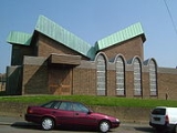
, White Wall and Stone Horse. It does not contain the village of Frindsbury, or All Saints Church and Church Green as they lie in Strood. The former council offices of Strood Rural District
are in Frindsbury Extra.
Civil parish
In England, a civil parish is a territorial designation and, where they are found, the lowest tier of local government below districts and counties...
on the Hoo Peninsula
Hoo Peninsula
The Hoo Peninsula is a peninsula in England separating the estuaries of the rivers Thames and Medway. It is dominated by a line of sand and clay hills, surrounded by an extensive area of marshland composed of alluvial silt. The name Hoo is the Old English word for spur of land.-History:The Romans...
in Kent
Kent
Kent is a county in southeast England, and is one of the home counties. It borders East Sussex, Surrey and Greater London and has a defined boundary with Essex in the middle of the Thames Estuary. The ceremonial county boundaries of Kent include the shire county of Kent and the unitary borough of...
, England
England
England is a country that is part of the United Kingdom. It shares land borders with Scotland to the north and Wales to the west; the Irish Sea is to the north west, the Celtic Sea to the south west, with the North Sea to the east and the English Channel to the south separating it from continental...
. It is conjoined to Strood
Strood
Strood is a town in the unitary authority of Medway in South East England. It is part of the ceremonial county of Kent. It lies on the north west bank of the River Medway at its lowest bridging point, and is part of the Rochester post town....
to the south west, is bounded by Cliffe and Cliffe Woods
Cliffe and Cliffe Woods
Cliffe and Cliffe Woods is a civil parish in the borough of Medway in Kent, England. The parish is located on the Hoo Peninsula and comprises the villages of Cliffe and the suburb, Cliffe Woods....
to the north, Hoo
Hoo
Hoo is used in placenames in the east of England to indicate coastal peninsulas and promontories. It appears in:* Fort Hoo, a fort on an island in the River Medway, Kent* Hoo St Werburgh and Cliffe-at-Hoo on the Hoo Peninsula in Kent* Hoo, Suffolk...
to the east, and the River Medway
River Medway
The River Medway, which is almost entirely in Kent, England, flows for from just inside the West Sussex border to the point where it enters the Thames Estuary....
to the south.
On 30 September 1894, the Local Government Board
Local Government Board
The Local Government Board was a British Government supervisory body overseeing local administration in England and Wales from 1871 to 1919.The LGB was created by the Local Government Board Act 1871 The Local Government Board (LGB) was a British Government supervisory body overseeing local...
confirmed an order of Kent County Council
Kent County Council
Kent County Council is the county council that governs the majority of the county of Kent in England. It provides the upper tier of local government, below which are 12 district councils, and around 300 town and parish councils. The county council has 84 elected councillors...
, and Frindsbury
Frindsbury
Frindsbury is part of the Medway Towns conurbation in Kent, southern England. It lies on the opposite side of the River Medway to Rochester, and at various times in its history has been considered fully or partially part of the City of Rochester. Frindsbury refers to both a parish and a manor....
civil parish was divided into Frindsbury Intra, and Frindsbury Extra. Intra joined the municipal borough of Rochester, while part of Frindsbury Extra joined Strood Rural District
Strood Rural District
Strood Rural District was a rural district in the county of Kent, England.It was subject to boundary reforms in 1934 and 1935.It consisted of the following civil parishes:*Allhallows...
. The remaining part of Frindsbury Extra joined Rochester in 1934.
It contains the villages of Wainscott, Upnor
Upnor
Lower Upnor and Upper Upnor are two small villages in Medway, Kent, England. They are in the parish of Frindsbury Extra on the western bank of the River Medway...
and Lower Upnor, and the hamlets of Chattenden
Chattenden
Chattenden is a small village in Hoo Parish, in Medway in Kent, UK. It lies to the north of the A228 and the village of Wainscott, at the top of Four Elms Hill.Chattenden means 'Forest Settlement' from the elements ceto and ham dun...
, White Wall and Stone Horse. It does not contain the village of Frindsbury, or All Saints Church and Church Green as they lie in Strood. The former council offices of Strood Rural District
Strood Rural District
Strood Rural District was a rural district in the county of Kent, England.It was subject to boundary reforms in 1934 and 1935.It consisted of the following civil parishes:*Allhallows...
are in Frindsbury Extra.