

Frenchs Forest, New South Wales
Encyclopedia
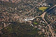
Commercial areas
Schools
- Frenchs Forest Public School (K-6) http://www.frenchsfor-p.schools.nsw.edu.au is on Ann Street; Established 1916.
- The Forest High School (7-12) http://www.theforest-h.schools.nsw.edu.au is on Frenchs Forest Road; Established 1961.
- Mimosa Public SchoolMimosa public schoolMimosa Public School, is a school located in Frenchs Forest Sydney, New South Wales, Australia. It is a co-educational Public school operated by the New South Wales Department of Education and Training with students from years K to 6...
(K-6) http://www.mimosa-p.schools.nsw.edu.au/ is on Mimosa street, Frenchs Forest servicing Davidson; Established 1970. - Davidson High SchoolDavidson High School (New South Wales)Davidson High School, is a school located in Frenchs Forest, Sydney, New South Wales, Australia, on Mimosa Street. It is a co-educational high school operated by the New South Wales Department of Education and Training with students from years 7 to 12...
(7-12) http://www.davidson-h.schools.nsw.edu.au is on Mimosa Street at the western end of Frenchs Forest; Established 1972.
Churches
- Frenchs Forest Catholic Parish
- Frenchs Forest Anglican Church
- Frenchs Forest Uniting Church
- Forest Alliance Church
- Combined Forest Churches
Road
The main Routes through Frenchs Forest include the east-west Warringah Road (State route 29), connecting Roseville in the west with Brookvale in the east; the north-south Forestway, starting at Warringah Road in Frenchs Forest and heading north through Belrose to Terrey Hills (8 km); the north-south Wakehurst Parkway (State route 22), starting at Narrabeen in the northeast, crossing Warringah road in Frenchs Forest, and heading south to Seaforth. Following any of these three major roads lead to the only three road routes off the Warringah peninsula.The intersection of Wakehurst Parkway and Warringah Road was the scene of multiple high speed collisions when these two roads were dirt tracks through the bush. To improve this, a blinking light was suspended above the intersection in the first half of the 20th century to warn motorists of the danger.
Buses
Forest Coach Lines connects Frenchs Forest with Chatswood railway station in the west, Warringah MallWarringah Mall
Warringah Mall is a large indoor/outdoor shopping centre on Sydney's Northern Beaches in the suburb of Brookvale, approximately 15 km from the CBD...
shopping centre at Brookvale
Brookvale, New South Wales
Brookvale is a suburb of northern Sydney, in the state of New South Wales, Australia. Brookvale is located 16 kilometres north-east of the Sydney central business district, in the local government area of Warringah Council and is part of the Northern Beaches region.-History:The first development in...
in the east and Terrey Hills
Terrey Hills, New South Wales
Terrey Hills is a suburb of northern Sydney, in the state of New South Wales, Australia. Terrey Hills is located 25 kilometres north of the Sydney central business district in the local government area of Warringah Council and is part of the Northern Beaches region.Terrey Hills is also considered...
in the north. An express City bus service to Town Hall railway station in the Sydney CBD.
Sydney Buses provides an east-west connection, starting at Manly
Manly, New South Wales
Manly is a suburb of northern Sydney, in the state of New South Wales, Australia. Manly is located 17 kilometres north-east of the Sydney central business district and is the administrative centre of the local government area of Manly Council, in the Northern Beaches region.-History:Manly was named...
via Dee Why
Dee Why, New South Wales
Dee Why is a suburb of northern Sydney, in the state of New South Wales, Australia. Dee Why is located 18 kilometres north-east of the Sydney central business district and is the administrative centre of the local government area of Warringah Council, and along with Brookvale is considered to be...
Beach, through Frenchs Forest then express to Roseville
Roseville, New South Wales
Roseville is a suburb on the Upper North Shore of Sydney in the state of New South Wales, Australia. Roseville is located north-west of the Sydney central business district and sits across the local government areas of Ku-ring-gai and Willoughby...
and Chatswood railway station. The return journey is express from Roseville Bridge
Roseville Bridge
Roseville Bridge crosses Middle Harbour in Sydney, Australia. It is the only crossing besides Spit Bridge.The bridge is 17.4 metres overhead. However, the adjacent Pipe Bridge has only 11 metres...
to Naree Road, Frenchs Forest.
Culture
- Glen Street Theatre
- Frenchs Forest Showground has "off leash" areas for dogs and horse events.
Events
- Forest Funday, is an annual free fair provided by the combined Christian churches of The Forest on ANZAC DayANZAC DayAnzac Day is a national day of remembrance in Australia and New Zealand, commemorated by both countries on 25 April every year to honour the members of the Australian and New Zealand Army Corps who fought at Gallipoli in the Ottoman Empire during World War I. It now more broadly commemorates all...
, 25 April at Frenchs Forest Showground. - Eurofest at Ararat Reserve in mid-September involves all the ethnic clubs in the area.
Clubs
- Lions club
- The Scout HallScouting in New South WalesScouting in New South Wales, a State of Australia, is predominantly represented by the branch of Scouts Australia and Girl Guides NSW & ACT, a member organisation of Girl Guides Australia.-Scouts Australia in New South Wales:...
is at Utyana Place. - Ararat Reserve (named after the Ararat plains of Ancient Armenia) on Bantry Bay Road features a number of ethnic clubs: Dutch, Danish, Swedish, Sokol (Czech/Slovak), Austrian and Armenian.
Sport and recreation
- The Warringah Aquatic Centre features an Olympic indoor heated swimming pool and baseball pitches.
- Lionel Watts Oval provides sports fields for CricketCricketCricket is a bat-and-ball game played between two teams of 11 players on an oval-shaped field, at the centre of which is a rectangular 22-yard long pitch. One team bats, trying to score as many runs as possible while the other team bowls and fields, trying to dismiss the batsmen and thus limit the...
, Australian Rules FootballAustralian rules footballAustralian rules football, officially known as Australian football, also called football, Aussie rules or footy is a sport played between two teams of 22 players on either...
, SoccerFootball (soccer)Association football, more commonly known as football or soccer, is a sport played between two teams of eleven players with a spherical ball...
, Rugby LeagueRugby leagueRugby league football, usually called rugby league, is a full contact sport played by two teams of thirteen players on a rectangular grass field. One of the two codes of rugby football, it originated in England in 1895 by a split from Rugby Football Union over paying players...
and NetballNetballNetball is a ball sport played between two teams of seven players. Its development, derived from early versions of basketball, began in England in the 1890s. By 1960 international playing rules had been standardised for the game, and the International Federation of Netball and Women's Basketball ...
. - A combination cycle/cycle-pedestrian shared/cycle-road path (completed circa 1982) from the corner of Wakehurst Parkway and Frenchs Forest Road, connecting Frenchs Forest with Dee Why. The signposting/painted lines on roads is aged and can be a little difficult to follow.
- The fenced playground for young kids at Lionel Watts Oval (Blackbutts Rd) has a mini-track suitable for toddlers and small kids on tricycles.
- Manly Dam Reserve is adjacent to (southeast of) Frenchs Forest, containing pedestrian/mountain bike bush tracks (map).
Population
In the 2001 Australian Bureau of StatisticsAustralian Bureau of Statistics
The Australian Bureau of Statistics is Australia's national statistical agency. It was created as the Commonwealth Bureau of Census and Statistics on 8 December 1905, when the Census and Statistics Act 1905 was given Royal assent. It had its beginnings in section 51 of the Constitution of Australia...
Census
Census
A census is the procedure of systematically acquiring and recording information about the members of a given population. It is a regularly occurring and official count of a particular population. The term is used mostly in connection with national population and housing censuses; other common...
of Population and Housing, the population of the Frenchs Forest postcode area was 12,435 people, in an area of 9.1 square kilometres. The population was 50.3% females, 49.7% males. 22% of the population was born overseas. The eight strongest religious affiliations in the area were in descending order: Anglican, Catholic
Catholic
The word catholic comes from the Greek phrase , meaning "on the whole," "according to the whole" or "in general", and is a combination of the Greek words meaning "about" and meaning "whole"...
, No religion, Uniting Church, Presbyterian and Reformed, Other Christian, Oriental Christian and Pentecostal.
The three most common forms of dwelling were in decreasing order: separate house (3883), semi-detached
Semi-detached
Semi-detached housing consists of pairs of houses built side by side as units sharing a party wall and usually in such a way that each house's layout is a mirror image of its twin...
, row or terrace house, or townhouse (115) and flat, unit or apartment (36).