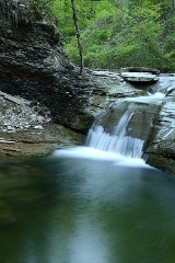
Fourmile Creek
Encyclopedia
Fourmile Creek is an 8 miles (12.9 km) long tributary
of Lake Erie
in Erie County
, Pennsylvania
in the United States
. It has a drainage basin
of 11.93 square miles (30.9 km²) and is a part of the Lake Erie Watershed
.
. It flows through Harborcreek Township through Wintergreen Gorge
and is spanned by the Bayfront Connector
over the Wintergreen Gorge Bridge
. It forms the eastern border of Wesleyville, Pennsylvania
. The creek's mouth opens to Lake Erie about 0.5 mile (0.80467 km) north of Pennsylvania Route 5
at Water Street and 4 miles (6.4 km) east of the city of Erie, Pennsylvania
.
Tributary
A tributary or affluent is a stream or river that flows into a main stem river or a lake. A tributary does not flow directly into a sea or ocean...
of Lake Erie
Lake Erie
Lake Erie is the fourth largest lake of the five Great Lakes in North America, and the tenth largest globally. It is the southernmost, shallowest, and smallest by volume of the Great Lakes and therefore also has the shortest average water residence time. It is bounded on the north by the...
in Erie County
Erie County, Pennsylvania
Erie County is a county located in the U.S. state of Pennsylvania. As of 2010, the population was 280,566. Its county seat is the City of Erie.- Geography :...
, Pennsylvania
Pennsylvania
The Commonwealth of Pennsylvania is a U.S. state that is located in the Northeastern and Mid-Atlantic regions of the United States. The state borders Delaware and Maryland to the south, West Virginia to the southwest, Ohio to the west, New York and Ontario, Canada, to the north, and New Jersey to...
in the United States
United States
The United States of America is a federal constitutional republic comprising fifty states and a federal district...
. It has a drainage basin
Drainage basin
A drainage basin is an extent or an area of land where surface water from rain and melting snow or ice converges to a single point, usually the exit of the basin, where the waters join another waterbody, such as a river, lake, reservoir, estuary, wetland, sea, or ocean...
of 11.93 square miles (30.9 km²) and is a part of the Lake Erie Watershed
Lake Erie Watershed (Pennsylvania)
Lake Erie Watershed is a major drainage catchment in northwestern Pennsylvania, consisting of lands with direct runoff and sub-watersheds with waterways that flow into Lake Erie and Presque Isle Bay from Crawford and Erie counties, as well as from New York...
.
Course
Fourmile Creek starts in Greene TownshipGreene Township, Erie County, Pennsylvania
Greene Township is a township in Erie County, Pennsylvania, United States. The population was 4,706 at the 2010 census.-Geography:According to the United States Census Bureau, the township has a total area of , of which, of it is land and of it is water.-Demographics:As of the census of 2000,...
. It flows through Harborcreek Township through Wintergreen Gorge
Wintergreen Gorge
Wintergreen Gorge is a canyon located in Harborcreek Township, Erie County in the U.S. state of Pennsylvania. The canyon is long and is situated along Fourmile Creek and is also directly next to the campus of Penn State Erie. It is deep at its highest point. Wintergreen Gorge was named for the...
and is spanned by the Bayfront Connector
Bayfront Connector
The Bayfront Connector is a , four-lane expressway that connects Interstate 90 to downtown Erie, Pennsylvania.- Route description :At the intersection of East 12th Street, the Bayfront Parkway becomes the Bayfront Connector and picks up the concurrency with Pennsylvania Route 290...
over the Wintergreen Gorge Bridge
Wintergreen Gorge Bridge
The Wintergreen Gorge Bridge is a , steel, plate girder bridge that carries Pennsylvania Route 290 and the Bayfront Connector over Fourmile Creek and the Wintergreen Gorge in Harborcreek Township, Erie County in the U.S. state of Pennsylvania...
. It forms the eastern border of Wesleyville, Pennsylvania
Wesleyville, Pennsylvania
Wesleyville is a borough in Erie County, Pennsylvania, United States. The population was 3,617 at the 2000 census. It is part of the Erie Metropolitan Statistical Area.-Geography:Wesleyville is located at ....
. The creek's mouth opens to Lake Erie about 0.5 mile (0.80467 km) north of Pennsylvania Route 5
Pennsylvania Route 5
Pennsylvania Route 5 is a westward continuation of New York State Route 5 in Pennsylvania. It runs from North East, Pennsylvania at the New York-Pennsylvania border to near Erie, a total of . The highway is called the Purple Heart Highway and mostly called Lake Road...
at Water Street and 4 miles (6.4 km) east of the city of Erie, Pennsylvania
Erie, Pennsylvania
Erie is a city located in northwestern Pennsylvania in the United States. Named for the lake and the Native American tribe that resided along its southern shore, Erie is the state's fourth-largest city , with a population of 102,000...
.

