

Four Corners, Texas
Encyclopedia
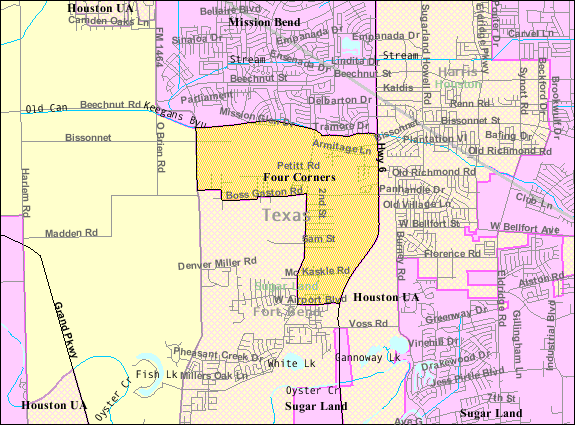
Four Corners is a census-designated place
(CDP) within the extraterritorial jurisdiction
of Houston
in Fort Bend County
, Texas
, United States
. The population was 2,954 at the 2000 census.
 Four Corners is located at 29°40′10"N 95°39′33"W (29.669366, -95.659147).
According to the United States Census Bureau
, the CDP has a total area of 2.8 square miles (7.3 km²), all of it land.
Originally the community was bounded by Boss Gaston, Old Richmond, and Richmond Gaines roads. The census-designated place
as of 2011 includes the crossroads and several new houses west of Texas State Highway 6 and north of West Bellfort Street. Jeannie Kever said that the community, once "isolated," became "something bigger and harder to define, its aging small frame houses and mobile homes engulfed by the omnivorous spoils of growth."
Carmen Martinez, the president of the Fort Bend Freshwater Supply District No. 2 an a Four Corners resident who lived there since 1966, said in a Houston Chronicle
article that at one time residents had to go to Houston or Rosenberg
to get groceries. As of 2011 residents can go to local area stores to shop.
of 2000, there were 2,954 people, 775 households, and 702 families residing in the CDP. The population density
was 1,038.2 people per square mile (400.2/km²). There were 824 housing units at an average density of 289.6/sq mi (111.6/km²). The racial makeup of the CDP was 42.76% White, 18.96% African American, 0.64% Native American, 15.94% Asian, 0.03% Pacific Islander, 18.82% from other races
, and 2.84% from two or more races. Hispanic or Latino of any race were 41.16% of the population.
There were 775 households out of which 57.4% had children under the age of 18 living with them, 74.3% were married couples
living together, 10.2% had a female householder with no husband present, and 9.4% were non-families. 7.2% of all households were made up of individuals and 2.7% had someone living alone who was 65 years of age or older. The average household size was 3.81 and the average family size was 4.02.
In the CDP the population was spread out with 36.7% under the age of 18, 10.0% from 18 to 24, 29.1% from 25 to 44, 19.3% from 45 to 64, and 4.8% who were 65 years of age or older. The median age was 28 years. For every 100 females there were 100.0 males. For every 100 females age 18 and over, there were 97.8 males.
The median income for a household in the CDP was $63,534, and the median income for a family was $65,200. Males had a median income of $34,821 versus $40,272 for females. The per capita income
for the CDP was $19,826. About 12.1% of families and 16.3% of the population were below the poverty line, including 23.4% of those under age 18 and 15.0% of those age 65 or over.
From the 2000 census to the 2010 census, the population increased to 12,382, about four times the population in 2000. As of 2011 90% of the residents are Asian American
s, African-Americans, and Latino Americans. Between the 2000 and 2010 censuses, the number of White American
s increased while the percentage of Whites decreased. Jeannie Kever of the Houston Chronicle
said that "not all of the newcomers identify with the old neighborhood and its inhabitants, even those living just a block away."
Karl Eschbach, a former demographer for the State of Texas, said that many people moved from Houston neighborhoods and communities with distinct racial and socioeconomic identities, like the East End, Sunnyside, and the Third Ward to areas too new to have racial identities. Eschbach explained that "as a large minority middle class started to emerge, Fort Bend was virgin territory that all groups could move to." When explaining why many of the new residents were of minority groups rather than White Americans, Eschbach added that "Many minorities are looking for mixed communities, where whites might feel it’s more optimal to live in a subdivision that’s more homogeneous with their own group"
Kever said that in previous eras "Four Corners has always been a multicultural mashup, its residents united by poverty and an appreciation for life in the slow lane." By 2011 many newer residents were wealthier than the original residents.
s, which provide sewer and water services.
Originally residents of the original section used individual water wells. Several years prior to 2011, residents of the original section formed the Fort Bend Freshwater Supply District No. 2 and built a water system. Residents still use individual septic systems. According to Carmen Martinez, the president of the supply district, work on a sewer system will start at a later point in 2011.
.
Elementary schools serving the Four Corners CDP and within the Four Corners CDP include Arizona Fleming and Holley. Elementary schools outside of the CDP serving sections of Four Corners include Drabek and Oyster Creek. Hodges Bend Middle School, located in the CDP, serves most of Four Corners, while Garcia Middle School, outside of the CDP, serves a small portion of the area. Austin High School, George Bush High School
, and Travis High School
, all outside of the CDP, serve sections of Four Corners.
In previous eras, Four Corners residents attended Dulles High School
in Sugar Land.
Census-designated place
A census-designated place is a concentration of population identified by the United States Census Bureau for statistical purposes. CDPs are delineated for each decennial census as the statistical counterparts of incorporated places such as cities, towns and villages...
(CDP) within the extraterritorial jurisdiction
Extraterritorial jurisdiction
Extraterritorial jurisdiction is the legal ability of a government to exercise authority beyond its normal boundaries.Any authority can, of course, claim ETJ over any external territory they wish...
of Houston
Houston, Texas
Houston is the fourth-largest city in the United States, and the largest city in the state of Texas. According to the 2010 U.S. Census, the city had a population of 2.1 million people within an area of . Houston is the seat of Harris County and the economic center of , which is the ...
in Fort Bend County
Fort Bend County, Texas
Fort Bend County is a county located along the Gulf Coast region in the U.S. state of Texas within the Houston–Sugar Land–Baytown metropolitan area. In 2000 its population was 354,452, while the 2010 U.S...
, Texas
Texas
Texas is the second largest U.S. state by both area and population, and the largest state by area in the contiguous United States.The name, based on the Caddo word "Tejas" meaning "friends" or "allies", was applied by the Spanish to the Caddo themselves and to the region of their settlement in...
, United States
United States
The United States of America is a federal constitutional republic comprising fifty states and a federal district...
. The population was 2,954 at the 2000 census.
History
Four Corners began as a community of extended families. By 2011 it became a rapidly suburbanizing area.Geography
According to the United States Census Bureau
United States Census Bureau
The United States Census Bureau is the government agency that is responsible for the United States Census. It also gathers other national demographic and economic data...
, the CDP has a total area of 2.8 square miles (7.3 km²), all of it land.
Originally the community was bounded by Boss Gaston, Old Richmond, and Richmond Gaines roads. The census-designated place
Census-designated place
A census-designated place is a concentration of population identified by the United States Census Bureau for statistical purposes. CDPs are delineated for each decennial census as the statistical counterparts of incorporated places such as cities, towns and villages...
as of 2011 includes the crossroads and several new houses west of Texas State Highway 6 and north of West Bellfort Street. Jeannie Kever said that the community, once "isolated," became "something bigger and harder to define, its aging small frame houses and mobile homes engulfed by the omnivorous spoils of growth."
Carmen Martinez, the president of the Fort Bend Freshwater Supply District No. 2 an a Four Corners resident who lived there since 1966, said in a Houston Chronicle
Houston Chronicle
The Houston Chronicle is the largest daily newspaper in Texas, USA, headquartered in the Houston Chronicle Building in Downtown Houston. , it is the ninth-largest newspaper by circulation in the United States...
article that at one time residents had to go to Houston or Rosenberg
Rosenberg
- Places :* Rosenberg, Baden, a municipality in the district of Neckar-Odenwald, Baden-Württemberg, Germany* Rosenberg , a municipality in the district of Ostalbkreis, Baden-Württemberg, Germany...
to get groceries. As of 2011 residents can go to local area stores to shop.
Demographics
As of the censusCensus
A census is the procedure of systematically acquiring and recording information about the members of a given population. It is a regularly occurring and official count of a particular population. The term is used mostly in connection with national population and housing censuses; other common...
of 2000, there were 2,954 people, 775 households, and 702 families residing in the CDP. The population density
Population density
Population density is a measurement of population per unit area or unit volume. It is frequently applied to living organisms, and particularly to humans...
was 1,038.2 people per square mile (400.2/km²). There were 824 housing units at an average density of 289.6/sq mi (111.6/km²). The racial makeup of the CDP was 42.76% White, 18.96% African American, 0.64% Native American, 15.94% Asian, 0.03% Pacific Islander, 18.82% from other races
Race (United States Census)
Race and ethnicity in the United States Census, as defined by the Federal Office of Management and Budget and the United States Census Bureau, are self-identification data items in which residents choose the race or races with which they most closely identify, and indicate whether or not they are...
, and 2.84% from two or more races. Hispanic or Latino of any race were 41.16% of the population.
There were 775 households out of which 57.4% had children under the age of 18 living with them, 74.3% were married couples
Marriage
Marriage is a social union or legal contract between people that creates kinship. It is an institution in which interpersonal relationships, usually intimate and sexual, are acknowledged in a variety of ways, depending on the culture or subculture in which it is found...
living together, 10.2% had a female householder with no husband present, and 9.4% were non-families. 7.2% of all households were made up of individuals and 2.7% had someone living alone who was 65 years of age or older. The average household size was 3.81 and the average family size was 4.02.
In the CDP the population was spread out with 36.7% under the age of 18, 10.0% from 18 to 24, 29.1% from 25 to 44, 19.3% from 45 to 64, and 4.8% who were 65 years of age or older. The median age was 28 years. For every 100 females there were 100.0 males. For every 100 females age 18 and over, there were 97.8 males.
The median income for a household in the CDP was $63,534, and the median income for a family was $65,200. Males had a median income of $34,821 versus $40,272 for females. The per capita income
Per capita income
Per capita income or income per person is a measure of mean income within an economic aggregate, such as a country or city. It is calculated by taking a measure of all sources of income in the aggregate and dividing it by the total population...
for the CDP was $19,826. About 12.1% of families and 16.3% of the population were below the poverty line, including 23.4% of those under age 18 and 15.0% of those age 65 or over.
From the 2000 census to the 2010 census, the population increased to 12,382, about four times the population in 2000. As of 2011 90% of the residents are Asian American
Asian American
Asian Americans are Americans of Asian descent. The U.S. Census Bureau definition of Asians as "Asian” refers to a person having origins in any of the original peoples of the Far East, Southeast Asia, or the Indian subcontinent, including, for example, Cambodia, China, India, Indonesia, Japan,...
s, African-Americans, and Latino Americans. Between the 2000 and 2010 censuses, the number of White American
White American
White Americans are people of the United States who are considered or consider themselves White. The United States Census Bureau defines White people as those "having origins in any of the original peoples of Europe, the Middle East, or North Africa...
s increased while the percentage of Whites decreased. Jeannie Kever of the Houston Chronicle
Houston Chronicle
The Houston Chronicle is the largest daily newspaper in Texas, USA, headquartered in the Houston Chronicle Building in Downtown Houston. , it is the ninth-largest newspaper by circulation in the United States...
said that "not all of the newcomers identify with the old neighborhood and its inhabitants, even those living just a block away."
Karl Eschbach, a former demographer for the State of Texas, said that many people moved from Houston neighborhoods and communities with distinct racial and socioeconomic identities, like the East End, Sunnyside, and the Third Ward to areas too new to have racial identities. Eschbach explained that "as a large minority middle class started to emerge, Fort Bend was virgin territory that all groups could move to." When explaining why many of the new residents were of minority groups rather than White Americans, Eschbach added that "Many minorities are looking for mixed communities, where whites might feel it’s more optimal to live in a subdivision that’s more homogeneous with their own group"
Kever said that in previous eras "Four Corners has always been a multicultural mashup, its residents united by poverty and an appreciation for life in the slow lane." By 2011 many newer residents were wealthier than the original residents.
Government and infrastructure
As of 2011 the original section of Four Corners is serviced by a water system of the Fort Bend Freshwater Supply District No. 2 and individual septic systems. Newer areas have municipal utility districtMunicipal Utility District
A Municipal Utility District is a special-purpose district or other governmental jurisdiction that provides public utilities to the residents of that district...
s, which provide sewer and water services.
Originally residents of the original section used individual water wells. Several years prior to 2011, residents of the original section formed the Fort Bend Freshwater Supply District No. 2 and built a water system. Residents still use individual septic systems. According to Carmen Martinez, the president of the supply district, work on a sewer system will start at a later point in 2011.
Education
Four Corners is within the Fort Bend Independent School DistrictFort Bend Independent School District
The Fort Bend Independent School District, also known as Fort Bend ISD or FBISD, is a school district system in the U.S. state of Texas based in the city of Sugar Land....
.
Elementary schools serving the Four Corners CDP and within the Four Corners CDP include Arizona Fleming and Holley. Elementary schools outside of the CDP serving sections of Four Corners include Drabek and Oyster Creek. Hodges Bend Middle School, located in the CDP, serves most of Four Corners, while Garcia Middle School, outside of the CDP, serves a small portion of the area. Austin High School, George Bush High School
George Bush High School
George Bush High School is a fully accredited public high school located in unincorporated Fort Bend County, Texas, serving students in grades 9-12. The school is a part of the Fort Bend Independent School District and serves several areas of unincorporated Fort Bend County, including Mission Bend...
, and Travis High School
Travis High School (Fort Bend County, Texas)
William B. Travis High School is a public high school located on Harlem Road, southwest of the intersection of Harlem Road and State Highway 99 in Pecan Grove, unincorporated Fort Bend County, Texas, United States....
, all outside of the CDP, serve sections of Four Corners.
In previous eras, Four Corners residents attended Dulles High School
Dulles High School (Sugar Land, Texas)
John Foster Dulles High School is a high school in Sugar Land, Texas. It was the first site purchase and new build, in the 1950s, of the newly formed Fort Bend Independent School District, which held its first graduation in 1960. The first class to graduate from Dulles itself was 1962...
in Sugar Land.