
Fort Churchill and Sand Springs Toll Road
Encyclopedia
Fort Churchill and Sand Springs Toll Road was opened in 1866.
A segment of the toll road
within Churchill County
, Nevada
is listed on the National Register of Historic Places
on November 24, 1974. This segment allowed a team of 18 mules to pull three heavily laden freight wagons across a mountain. One end of the road was located at Fort Churchill.
Running between Dayton and the former Sand Springs Pony Express Station along US 50 east of Fallon
, the route provided a reliable supply route from the Comstock
, Carson City
and California
to the Reese River Mining District centered in Austin
.
A segment of the toll road
Toll road
A toll road is a privately or publicly built road for which a driver pays a toll for use. Structures for which tolls are charged include toll bridges and toll tunnels. Non-toll roads are financed using other sources of revenue, most typically fuel tax or general tax funds...
within Churchill County
Churchill County, Nevada
Churchill County is a county located in the western U.S. state of Nevada. As of the 2000 census, the population was 23,982. As of July 1, 2007, the population of Churchill County was estimated at 27,190. The county, named after Mexican-American War hero brevet Brigadier General Sylvester Churchill,...
, Nevada
Nevada
Nevada is a state in the western, mountain west, and southwestern regions of the United States. With an area of and a population of about 2.7 million, it is the 7th-largest and 35th-most populous state. Over two-thirds of Nevada's people live in the Las Vegas metropolitan area, which contains its...
is listed on the National Register of Historic Places
National Register of Historic Places
The National Register of Historic Places is the United States government's official list of districts, sites, buildings, structures, and objects deemed worthy of preservation...
on November 24, 1974. This segment allowed a team of 18 mules to pull three heavily laden freight wagons across a mountain. One end of the road was located at Fort Churchill.
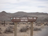
Running between Dayton and the former Sand Springs Pony Express Station along US 50 east of Fallon
Fallon, Nevada
-Demographics:As of the census of 2000, there were 7,536 people, 3,004 households, and 1,877 families residing in the city. The population density was 2,474.1 people per square mile . There were 3,336 housing units at an average density of 1,095.2 per square mile...
, the route provided a reliable supply route from the Comstock
Comstock Lode
The Comstock Lode was the first major U.S. discovery of silver ore, located under what is now Virginia City, Nevada, on the eastern slope of Mount Davidson, a peak in the Virginia Range. After the discovery was made public in 1859, prospectors rushed to the area and scrambled to stake their claims...
, Carson City
Carson City, Nevada
The Consolidated Municipality of Carson City is the capital of the state of Nevada. The words Consolidated Municipality refer to a series of changes in 1969 which abolished Ormsby County and merged all the settlements contained within its borders into Carson City. Since that time Carson City has...
and California
California
California is a state located on the West Coast of the United States. It is by far the most populous U.S. state, and the third-largest by land area...
to the Reese River Mining District centered in Austin
Austin, Nevada
Austin is a small, unincorporated community located in Lander County, Nevada, in the United States. As of 2004, its population is approximately 340. It is located on the western slopes of the Toiyabe Range at an elevation of . U.S...
.