Fort Cascades
Encyclopedia

United States Army
The United States Army is the main branch of the United States Armed Forces responsible for land-based military operations. It is the largest and oldest established branch of the U.S. military, and is one of seven U.S. uniformed services...
fort constructed in 1855 to protect the portage
Portage
Portage or portaging refers to the practice of carrying watercraft or cargo over land to avoid river obstacles, or between two bodies of water. A place where this carrying occurs is also called a portage; a person doing the carrying is called a porter.The English word portage is derived from the...
road around the final section of the Cascades Rapids
Cascades Rapids
The Cascades Rapids were an area of rapids along North America's Columbia River, between the U.S. states of Washington and Oregon. Through a stretch approximately wide, the river dropped about in .-Boat portage:Boat travelers were forced to either portage boats and supplies or pull boats up with...
, known as the "lower cascades." It was built on the Washington side of the Columbia River
Columbia River
The Columbia River is the largest river in the Pacific Northwest region of North America. The river rises in the Rocky Mountains of British Columbia, Canada, flows northwest and then south into the U.S. state of Washington, then turns west to form most of the border between Washington and the state...
, between the present site of North Bonneville
North Bonneville, Washington
North Bonneville is a city in Skamania County, Washington, United States. The population was 593 at the 2000 census and 956 at the 2010 census.-Geography:North Bonneville is located at ....
and the Bonneville Dam
Bonneville Dam
Bonneville Lock and Dam consists of several run-of-the-river dam structures that together complete a span of the Columbia River between the U.S. states of Oregon and Washington at River Mile 146.1. The dam is located east of Portland, Oregon, in the Columbia River Gorge. The primary functions of...
.
It was burned in 1856, then rebuilt, but abandoned in 1861. A small community, Cascades, formed around the fort, but the largest flood of the Columbia River in recorded history passed over both the townsite and the fort site in 1894.http://columbiariverimages.com/Regions/Places/flood_of_1894.html
In 1867, decades before the disastrous floods, famed photographer Carleton Eugene Watkins arrived on the scene. Watkins took a commission from the Oregon Steam Ship Navigation Company to document areas of the Columbia River, with "Cascades" featuring prominently in his Pacific Coast stereoviews collection.http://www.carletonwatkins.org/about_watkins.htm Approximately 50 Watkins stereoscopic images of the Cascades area are known to exist, ranging from serials 1250-1302.http://www.carletonwatkins.org/list-page12.htm Labeled "Upper Cascades," "Cascades" and "Lower Cascades," these photographs feature river view landscapes as well as images of the town and fort blockhouse
Blockhouse
In military science, a blockhouse is a small, isolated fort in the form of a single building. It serves as a defensive strong point against any enemy that does not possess siege equipment or, in modern times, artillery...
s. Aside from capturing beautiful scenery, Watkins documents saw mills, as well as train and riverboat traffic vital to the local economy at that time. A few of the images provide a glimpse of salmon fishing before the rapids were submerged by the construction of the Bonneville Dam
Bonneville Dam
Bonneville Lock and Dam consists of several run-of-the-river dam structures that together complete a span of the Columbia River between the U.S. states of Oregon and Washington at River Mile 146.1. The dam is located east of Portland, Oregon, in the Columbia River Gorge. The primary functions of...
. Although his negatives were destroyed in the great 1906 San Francisco earthquake
1906 San Francisco earthquake
The San Francisco earthquake of 1906 was a major earthquake that struck San Francisco, California, and the coast of Northern California at 5:12 a.m. on Wednesday, April 18, 1906. The most widely accepted estimate for the magnitude of the earthquake is a moment magnitude of 7.9; however, other...
, many of his printed images can be found scattered throughout museums and private collections around the world.http://www.carletonwatkins.org/about_watkins.htm
Fort Cascades is now on the National Register of Historic Places
National Register of Historic Places
The National Register of Historic Places is the United States government's official list of districts, sites, buildings, structures, and objects deemed worthy of preservation...
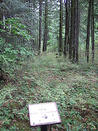
. There is a self-guided tour through what remains of the fort and the townsite. The trail the tour follows is approximately 1.5 miles (2.4 km) long. There is also a replica of a rock covered with petroglyph
Petroglyph
Petroglyphs are pictogram and logogram images created by removing part of a rock surface by incising, picking, carving, and abrading. Outside North America, scholars often use terms such as "carving", "engraving", or other descriptions of the technique to refer to such images...
s that was originally located at the site but has since been moved to Stevenson, Washington
Stevenson, Washington
Stevenson is a town in Skamania County, Washington, United States. The population was 1,465 at the 2010 census, a 22% increase over 2000. It is the county seat of Skamania County and home to the Skamania County Court House and Sheriff's Office...
.
Fort Cascades is one of several forts built to protect the portage around the Cascade Rapids. Others are Fort Raines
Fort Raines
Fort Raines was a United States Army blockhouse built in October 1855 to protect the portage road around the Cascades Rapids. It is located on the Washington side of the Columbia River, west of the Bridge of the Gods, at the "middle cascades." It was abandoned by 1857...
and Fort Lugenbeel.

