
Fochriw
Encyclopedia
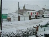
Fochriw is a village
located in Caerphilly County Borough, Wales
. It was well known for its neighbouring collieries, which employed nearly the entire local population in the early 20th century. It lies within the historic county boundaries of Glamorgan
. The village appears as the backdrop on the BBC Wales
sitcom High Hopes
credits.
’ requirement for coal
, which was converted into coke, an essential ingredient in the production of iron
.
Over a period of about 130 years, the landscape changed from rural
to industrial
, and back to rural, as it is today. However, the latter changes did not take place until relatively recently when nearly all the remnants of the coal mining
industry were removed from around the village. The memories of the industrial landmarks, or eyesores, that remained following the closure of the Fochriw and South Tunnel collieries are only retained by those of a certain age, and the younger generation no longer have the “experience” of living in a community which is centred around coal
.
coal mining village that developed from its rural existence by the need for iron
and coal during the 19th century. It is located on the north-east flank of Mynydd Fochriw at the head of the Bargoed Fach (now called the Darran
) valley, approximately 5 miles (8 km) north of Bargoed
, and 5 miles (8 km) south east of Merthyr Tydfil
. The village straddles two ancient hamlets in the parish
of Gelligaer, these being the Ysgwyddgwyn and Brithdir hamlets, the dividing line being the brook (Bargoed Fach) which flows in the bottom of the valley. The boundaries of these hamlets were walked by a number of parishioners of the parish on 24th day of May, 1750, and a document detailing the boundaries of each hamlet, namely Keven, Hengode, Garthgynyd, Ysgwyddgwyn, and Brithdecr (Brithdir) was produced, extracts of same are reproduced below.
It has also been known as Boch Rhiw Carn, Ffochreiw, Fochrhiw, Vochriw, Vochrhiw, and, currently, Fochriw. The interpretation of the name from an my original Fochriw family was Foch Y Rhiw Pentwyn Mawr which translates in English to : the cheek of the slope of the head hill (Pentwyn Mountain). This seems to describe the village's actual location.
 The first school in the area was a National School at Pentwyn. It was opened in 1856 by the Gellygaer Charities which were left to the parish by Edward Lewis of Gilfach Bargoed in 1715.
The new infant school
was opened in July 1910 and was attended for instruction by the scholars for the first time on the first Monday of September 1910. In April 1911 a half acre
of land adjacent to the existing school was bought for £20. It was not until September 1912 that a letter was written to the building committee of the County Council recommending that a new school be built.
On 1 April 1971 both Infants and Junior schools combined under one Head Teacher to become Fochriw Primary School. A Nursery was opened at Plantation Terrace in 1973.
Village
A village is a clustered human settlement or community, larger than a hamlet with the population ranging from a few hundred to a few thousand , Though often located in rural areas, the term urban village is also applied to certain urban neighbourhoods, such as the West Village in Manhattan, New...
located in Caerphilly County Borough, Wales
Wales
Wales is a country that is part of the United Kingdom and the island of Great Britain, bordered by England to its east and the Atlantic Ocean and Irish Sea to its west. It has a population of three million, and a total area of 20,779 km²...
. It was well known for its neighbouring collieries, which employed nearly the entire local population in the early 20th century. It lies within the historic county boundaries of Glamorgan
Glamorgan
Glamorgan or Glamorganshire is one of the thirteen historic counties and a former administrative county of Wales. It was originally an early medieval kingdom of varying boundaries known as Glywysing until taken over by the Normans as a lordship. Glamorgan is latterly represented by the three...
. The village appears as the backdrop on the BBC Wales
BBC Wales
BBC Cymru Wales is a division of the British Broadcasting Corporation for Wales. Based at Broadcasting House in the Llandaff area of Cardiff, it directly employs over 1200 people, and produces a broad range of television, radio and online services in both the Welsh and English languages.Outside...
sitcom High Hopes
High Hopes (TV series)
High Hopes is a sitcom made in Wales, produced and directed by Gareth Gwenlan for BBC Wales and is set in a fictional area of the South Wales Valleys called Cwm-Pen-Ôl...
credits.
History
Fochriw’s growth was germinated to a lesser extent by the Rhymney Iron Company’s requirement for ironstone, and to a greater extent by the Dowlais IronworksDowlais Ironworks
The Dowlais Ironworks was a major ironworks and steelworks located at Dowlais near Merthyr Tydfil, in Wales. Founded in the 18th century, it operated until the end of the 20th, at one time in the 19th century being the largest steel producer in the UK...
’ requirement for coal
Coal
Coal is a combustible black or brownish-black sedimentary rock usually occurring in rock strata in layers or veins called coal beds or coal seams. The harder forms, such as anthracite coal, can be regarded as metamorphic rock because of later exposure to elevated temperature and pressure...
, which was converted into coke, an essential ingredient in the production of iron
Iron
Iron is a chemical element with the symbol Fe and atomic number 26. It is a metal in the first transition series. It is the most common element forming the planet Earth as a whole, forming much of Earth's outer and inner core. It is the fourth most common element in the Earth's crust...
.
Over a period of about 130 years, the landscape changed from rural
Rural
Rural areas or the country or countryside are areas that are not urbanized, though when large areas are described, country towns and smaller cities will be included. They have a low population density, and typically much of the land is devoted to agriculture...
to industrial
Industry
Industry refers to the production of an economic good or service within an economy.-Industrial sectors:There are four key industrial economic sectors: the primary sector, largely raw material extraction industries such as mining and farming; the secondary sector, involving refining, construction,...
, and back to rural, as it is today. However, the latter changes did not take place until relatively recently when nearly all the remnants of the coal mining
Coal mining
The goal of coal mining is to obtain coal from the ground. Coal is valued for its energy content, and since the 1880s has been widely used to generate electricity. Steel and cement industries use coal as a fuel for extraction of iron from iron ore and for cement production. In the United States,...
industry were removed from around the village. The memories of the industrial landmarks, or eyesores, that remained following the closure of the Fochriw and South Tunnel collieries are only retained by those of a certain age, and the younger generation no longer have the “experience” of living in a community which is centred around coal
Coal
Coal is a combustible black or brownish-black sedimentary rock usually occurring in rock strata in layers or veins called coal beds or coal seams. The harder forms, such as anthracite coal, can be regarded as metamorphic rock because of later exposure to elevated temperature and pressure...
.
Location
Fochriw is a typical South Wales ValleysSouth Wales Valleys
The South Wales Valleys are a number of industrialised valleys in South Wales, stretching from eastern Carmarthenshire in the west to western Monmouthshire in the east and from the Heads of the Valleys in the north to the lower-lying, pastoral country of the Vale of Glamorgan and the coastal plain...
coal mining village that developed from its rural existence by the need for iron
Iron
Iron is a chemical element with the symbol Fe and atomic number 26. It is a metal in the first transition series. It is the most common element forming the planet Earth as a whole, forming much of Earth's outer and inner core. It is the fourth most common element in the Earth's crust...
and coal during the 19th century. It is located on the north-east flank of Mynydd Fochriw at the head of the Bargoed Fach (now called the Darran
Darran Valley
Darran Valley is a community in the County Borough of Caerphilly, Wales. The Darran Valley consists of the valley of the Bargod Rhymni and contains the villages of Deri, Pentwyn and Fochriw. These settlements grew around the Industrial Age to serve the collieries of Fochriw, Pencarreg and Groesfaen...
) valley, approximately 5 miles (8 km) north of Bargoed
Bargoed
Bargoed is a town in the Rhymney Valley, Wales, one of the South Wales Valleys. It lies on the Rhymney River in the county borough of Caerphilly and straddles ancient boundary of Glamorgan and Monmouthshire. 'Greater Bargoed', as defined by the local authority Caerphilly County Borough Council,...
, and 5 miles (8 km) south east of Merthyr Tydfil
Merthyr Tydfil
Merthyr Tydfil is a town in Wales, with a population of about 30,000. Although once the largest town in Wales, it is now ranked as the 15th largest urban area in Wales. It also gives its name to a county borough, which has a population of around 55,000. It is located in the historic county of...
. The village straddles two ancient hamlets in the parish
Parish
A parish is a territorial unit historically under the pastoral care and clerical jurisdiction of one parish priest, who might be assisted in his pastoral duties by a curate or curates - also priests but not the parish priest - from a more or less central parish church with its associated organization...
of Gelligaer, these being the Ysgwyddgwyn and Brithdir hamlets, the dividing line being the brook (Bargoed Fach) which flows in the bottom of the valley. The boundaries of these hamlets were walked by a number of parishioners of the parish on 24th day of May, 1750, and a document detailing the boundaries of each hamlet, namely Keven, Hengode, Garthgynyd, Ysgwyddgwyn, and Brithdecr (Brithdir) was produced, extracts of same are reproduced below.
Origin of the name
It was identified as Brohru Carn in the 12th century, and a reference to Fforch y Rhiw is made in the book Parish of Gelligaer by T.V. Davies, in the section dealing with Roman History and the route of Heol Adam. It states that “The holding called Fforch y Rhiw is mentioned in several Gelligaer leases of the 17th century. The name probably arises from a number of old tracks in the Brithdir Hamlet which tend to converge near Fochriw”.It has also been known as Boch Rhiw Carn, Ffochreiw, Fochrhiw, Vochriw, Vochrhiw, and, currently, Fochriw. The interpretation of the name from an my original Fochriw family was Foch Y Rhiw Pentwyn Mawr which translates in English to : the cheek of the slope of the head hill (Pentwyn Mountain). This seems to describe the village's actual location.
Education
The new infant school
Infant school
An Infant school is a term used primarily in the United Kingdom for school for children between the ages of four and seven years. It is usually a small school serving a particular locality....
was opened in July 1910 and was attended for instruction by the scholars for the first time on the first Monday of September 1910. In April 1911 a half acre
Acre
The acre is a unit of area in a number of different systems, including the imperial and U.S. customary systems. The most commonly used acres today are the international acre and, in the United States, the survey acre. The most common use of the acre is to measure tracts of land.The acre is related...
of land adjacent to the existing school was bought for £20. It was not until September 1912 that a letter was written to the building committee of the County Council recommending that a new school be built.
On 1 April 1971 both Infants and Junior schools combined under one Head Teacher to become Fochriw Primary School. A Nursery was opened at Plantation Terrace in 1973.