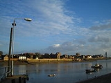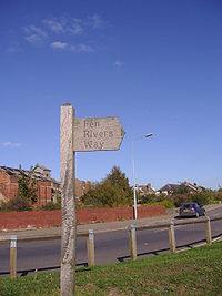
Fen Rivers Way
Encyclopedia

Cambridge
The city of Cambridge is a university town and the administrative centre of the county of Cambridgeshire, England. It lies in East Anglia about north of London. Cambridge is at the heart of the high-technology centre known as Silicon Fen – a play on Silicon Valley and the fens surrounding the...
and the town of King's Lynn
King's Lynn
King's Lynn is a sea port and market town in the ceremonial county of Norfolk in the East of England. It is situated north of London and west of Norwich. The population of the town is 42,800....
in West Norfolk. It follows the course of many rivers that drain slowly across the fenland
Fenland
Fenland is a local government district in Cambridgeshire, England. Its council is based in March, and covers the neighbouring market towns of Chatteris, Whittlesey, and Wisbech, often called the "capital of the fens"...
landscape into the Wash
The Wash
The Wash is the square-mouthed bay and estuary on the northwest margin of East Anglia on the east coast of England, where Norfolk meets Lincolnshire. It is among the largest estuaries in the United Kingdom...
. It provides a small part of European Long Distance Path E2
European walking route E2
The E2 European long distance path or E2 path is a 4850km long-distance footpath that runs from Galway in Ireland to France's Mediterranean coast, via Scotland, England, Netherlands, Belgium, Luxembourg and France...
which goes from Nice
Nice
Nice is the fifth most populous city in France, after Paris, Marseille, Lyon and Toulouse, with a population of 348,721 within its administrative limits on a land area of . The urban area of Nice extends beyond the administrative city limits with a population of more than 955,000 on an area of...
to Galway
Galway
Galway or City of Galway is a city in County Galway, Republic of Ireland. It is the sixth largest and the fastest-growing city in Ireland. It is also the third largest city within the Republic and the only city in the Province of Connacht. Located on the west coast of Ireland, it sits on the...
.
Description
The FenlandFenland
Fenland is a local government district in Cambridgeshire, England. Its council is based in March, and covers the neighbouring market towns of Chatteris, Whittlesey, and Wisbech, often called the "capital of the fens"...
landscape is a man made environment constructed over many centuries. This fertile land is dominated by agriculture
Agriculture
Agriculture is the cultivation of animals, plants, fungi and other life forms for food, fiber, and other products used to sustain life. Agriculture was the key implement in the rise of sedentary human civilization, whereby farming of domesticated species created food surpluses that nurtured the...
and is dissected by dykes
Ditch
A ditch is usually defined as a small to moderate depression created to channel water.In Anglo-Saxon, the word dïc already existed and was pronounced 'deek' in northern England and 'deetch' in the south. The origins of the word lie in digging a trench and forming the upcast soil into a bank...
, draining ditches, rivers and embankments. Walkers cannot fail to be impressed by the Fenlands vast open landscape and vast skies that give the Fens
The Fens
The Fens, also known as the , are a naturally marshy region in eastern England. Most of the fens were drained several centuries ago, resulting in a flat, damp, low-lying agricultural region....
their unique character. The walk along this footpath is rich in both history and wildlife. The Fen Rivers Way is ideal for a two-day trip, with camp sites or bed and breakfast stays en route. Also, there is excellent public transport for the return journey.
The route
Starting from CambridgeCambridge
The city of Cambridge is a university town and the administrative centre of the county of Cambridgeshire, England. It lies in East Anglia about north of London. Cambridge is at the heart of the high-technology centre known as Silicon Fen – a play on Silicon Valley and the fens surrounding the...
the route follows the River Cam
River Cam
The River Cam is a tributary of the River Great Ouse in the east of England. The two rivers join to the south of Ely at Pope's Corner. The Great Ouse connects the Cam to England's canal system and to the North Sea at King's Lynn...
with its banks and pastures fringed with weeping willow
Willow
Willows, sallows, and osiers form the genus Salix, around 400 species of deciduous trees and shrubs, found primarily on moist soils in cold and temperate regions of the Northern Hemisphere...
trees and out into the fens. The Cam Washes have been designated a Site of Special Scientific Interest
Site of Special Scientific Interest
A Site of Special Scientific Interest is a conservation designation denoting a protected area in the United Kingdom. SSSIs are the basic building block of site-based nature conservation legislation and most other legal nature/geological conservation designations in Great Britain are based upon...
because of their rare and special habitats and wildlife. Within this SSSI, Otter
Otter
The Otters are twelve species of semi-aquatic mammals which feed on fish and shellfish, and also other invertebrates, amphibians, birds and small mammals....
s Lutra lutra can sometimes be seen. Approximately 17 miles North East of Cambridge is Wicken Fen
Wicken Fen
Wicken Fen is a wetland nature reserve situated near the village of Wicken, Cambridgeshire, England.It is one of Britain's oldest nature reserves, and was the first reserve acquired by the National Trust, in 1899. The reserve includes fenland, farmland, marsh, and reedbeds...
National Nature Reserve, where walkers will pass through the remains of a fascinating fragment of a Fenland wilderness of former times. Wicken Fen was the first Nature Reserve to be owned by the National Trust
National Trust for Places of Historic Interest or Natural Beauty
The National Trust for Places of Historic Interest or Natural Beauty, usually known as the National Trust, is a conservation organisation in England, Wales and Northern Ireland...
and has been in their care since 1899. Wicken Fen is a haven for birds, plants, insects and mammals. It can be explored by the traditional wide droves and lush green paths, including a boardwalk nature trail, giving access to several hides. Next walkers approach the city of Ely
Ely, Cambridgeshire
Ely is a cathedral city in Cambridgeshire, England, 14 miles north-northeast of Cambridge and about by road from London. It is built on a Lower Greensand island, which at a maximum elevation of is the highest land in the Fens...
. Ely's magnificent cathedral
Ely Cathedral
Ely Cathedral is the principal church of the Diocese of Ely, in Cambridgeshire, England, and is the seat of the Bishop of Ely and a suffragan bishop, the Bishop of Huntingdon...
and ancient city dominate the skyline for miles around. At Ely the River Cam joins the River Great Ouse
River Great Ouse
The Great Ouse is a river in the east of England. At long, it is the fourth-longest river in the United Kingdom. The river has been important for navigation, and for draining the low-lying region through which it flows. Its course has been modified several times, with the first recorded being in...
. The walk now enters the county of Norfolk
Norfolk
Norfolk is a low-lying county in the East of England. It has borders with Lincolnshire to the west, Cambridgeshire to the west and southwest and Suffolk to the south. Its northern and eastern boundaries are the North Sea coast and to the north-west the county is bordered by The Wash. The county...
.
The many tributaries to the Great Ouse are now contained by massive flood banks and from these banks wonderful panoramic views of the surrounding countryside can be seen. Denver
Denver, Norfolk
Denver is a village and civil parish in the English county of Norfolk. It is located on the River Great Ouse, 1 mile south of the small town of Downham Market, 14 miles south of the larger town of King's Lynn, and 37 miles west of the city of Norwich.The civil parish has an area of...
Sluice, being at the confluence of five watercourses, was first built across the river in 1651 as a focus of the flood defence system that protects the low lying Fens although it had to be rebuilt after bursting in 1713. Since Roman
Roman Empire
The Roman Empire was the post-Republican period of the ancient Roman civilization, characterised by an autocratic form of government and large territorial holdings in Europe and around the Mediterranean....
times, man had battled to keep the water at bay, but it was not until the 17th century that systematic drainage commenced. Dutch engineers, notably Cornelius Vermuyden
Cornelius Vermuyden
Sir Cornelius Wasterdyk Vermuyden was a Dutch engineer who introduced Dutch reclamation methods to Britain, and made the first important attempts to drain The Fens of East Anglia.-Life:...
, were commissioned to undertake grand schemes which still form the basis of the modern drainage system. Nearby Denver Windmill is a fully restored 19th century windmill, and lies on the path of the Roman Fen Causeway. The Ouse Washes are an internationally significant environment. Flooded in winter, they attract thousands of migrating wildfowl. From Denver the river is tidal, bringing with it subtle changes in scenery and habitat. Close by is the Relief Channel, the final link in the drainage system, completed in 1964. The two waterways meet at King's Lynn
King's Lynn
King's Lynn is a sea port and market town in the ceremonial county of Norfolk in the East of England. It is situated north of London and west of Norwich. The population of the town is 42,800....
, the historic port on the edge of the Wash
The Wash
The Wash is the square-mouthed bay and estuary on the northwest margin of East Anglia on the east coast of England, where Norfolk meets Lincolnshire. It is among the largest estuaries in the United Kingdom...
where the footpath ends.
Further walks
There are four smaller circular walks along the Fen Rivers way.- Wicken Fen Walk
- baits Bite Walk
- Fenland Village Walk
- The Cutters Walk

