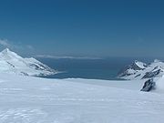
False Bay, Livingston Island
Encyclopedia

Barnard Point
Barnard Point is a headland which marks the southeast side of the entrance to False Bay on the south side of Livingston Island in the South Shetland Islands, Antarctica. This point was known to sealers as early as 1822. The name was applied about a century later, probably after Mount Barnard ...
and Miers Bluff
Miers Bluff
Miers Bluff is the point forming the southwest extremity of Hurd Peninsula, the southeast side of the entrance to South Bay and the northwest side of the entrance to False Bay in the South Shetland Islands, Antarctica....
on the south side of Livingston Island, in the South Shetland Islands
South Shetland Islands
The South Shetland Islands are a group of Antarctic islands, lying about north of the Antarctic Peninsula, with a total area of . By the Antarctic Treaty of 1959, the Islands' sovereignty is neither recognized nor disputed by the signatories and they are free for use by any signatory for...
, Antarctica. It was probably first entered and charted by Capt. Nathaniel Palmer
Nathaniel Palmer
Nathaniel Brown Palmer was an American seal hunter, explorer, sailing captain, and ship designer. He was born in Stonington, Connecticut.-Sealing career and Antarctic exploration:...
in November 1820, and was likely named because of the possibility in thick weather of confusion between this feature and nearby South Bay
South Bay, Livingston Island
South Bay is a wide bay indenting for the south coast of Livingston Island in the South Shetland Islands, Antarctica. The bay is lying northwest of False Bay and east of Walker Bay, and is entered between Hannah Point and Miers Bluff....
, where Johnsons Dock
Johnsons Dock
Johnsons Dock is a sheltered 500 m wide cove indenting for 900 m the southeast coast of South Bay, Livingston Island in the South Shetland Islands, Antarctica. Entered north of Ballester Point. Surmounted by Charrúa Ridge on the northeast...
was frequented by the early sealers.
Map
- L.L. Ivanov. Antarctica: Livingston Island and Greenwich, Robert, Snow and Smith Islands. Scale 1:120000 topographic map. Troyan: Manfred Wörner Foundation, 2009.

