
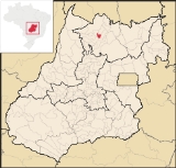
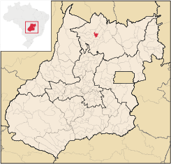
Estrela do Norte, Goiás
Encyclopedia
| Estrela do Norte | |
|---|---|
| State | Goiás Goiás Goiás is a state of Brazil, located in the central part of the country. The name Goiás comes from the name of an indigenous community... |
| Area: | 302 km² |
| Population: | 3,174(IBGE 2007) |
| Urban population: | 2,774 |
| Population density: | |
| Population growth rate: | -0.92.% 1996/2007 |
| Elevation: | 453 m above sea level |
| Postcode (CEP): | 76485-000 |
| Became a city: | 1958 |
| Mayor: | Geraldo Nicolau Filho |
| Distance to Goiânia Goiânia -Climate:The city has a tropical wet and dry climate with an average temperature of . There's a wet season, from October to April, and a dry one, from May to September. Annual rainfall is around 1,520 mm.... : |
365 km. |
| IBGE statistical microregion: | Porangatu Microregion Porangatu Microregion The Porangatu Microregion is a statistical region created by IBGE in north-central Goiás state, Brazil. The most important city is Porangatu... |
| Website: | none |
Town
A town is a human settlement larger than a village but smaller than a city. The size a settlement must be in order to be called a "town" varies considerably in different parts of the world, so that, for example, many American "small towns" seem to British people to be no more than villages, while...
and municipality
Municipality
A municipality is essentially an urban administrative division having corporate status and usually powers of self-government. It can also be used to mean the governing body of a municipality. A municipality is a general-purpose administrative subdivision, as opposed to a special-purpose district...
in north Goiás
Goiás
Goiás is a state of Brazil, located in the central part of the country. The name Goiás comes from the name of an indigenous community...
state, Brazil
Brazil
Brazil , officially the Federative Republic of Brazil , is the largest country in South America. It is the world's fifth largest country, both by geographical area and by population with over 192 million people...
. The population was 3,174 (2007) and the total area was 302.7 km²
Estrela do Norte is a small municipality surrounded by the following municipalities:
- north: MutunópolisMutunópolisMutunópolis is a small town and municipality in north Goiás state, Brazil.-Location:Mutunópolis is located in the extreme north of the state, 38 km south of the important regional center of Porangatu...
and Santa Tereza de GoiásSanta Tereza de GoiásSanta Tereza de Goias is a small town and municipality in north Goiás state, Brazil. Santa Tereza de Goiás is often spelled ""Santa Teresa de Goiás"".-Location:Santa Tereza is located in the extreme north of the state 35 km. south of Porangatu... - south: Mara RosaMara RosaMara Rosa is a small town and municipality in north-central Goiás state, Brazil.-Location:Mara Rosa is located 356 kilometers north of Goiânia in the Porangatu Microregion. It is 11 kilometers east of the Belém-Brasília highway, between the basins of the Araguaia River and the Tocantins River...
- east: AmaralinaAmaralinaAmaralina is a small town and municipality in north Goiás state, Brazil.-Location:*Distance from Goiânia: 485 km.*Highway access from Goiânia: GO-080 / Nerópolis / BR-153 / Jaraguá / GO-080 / Goianésia / Barro Alto / GO-342 / Uruaçu / Campinorte / GO-329.Amaralina is surrounded by the...
- west: FormosoFormosoFormoso is a small town and municipality in north Goiás state, Brazil. The population was 5,241 in a total area of 844 km².Highway connections from Goiânia are made by GO-080 / Nerópolis / São Francisco de Goiás / BR-153 / Jaraguá / GO-080 / Goianésia / Barro Alto / GO-342 / BR-080 / BR-153 /...
The distance to Goiânia
Goiânia
-Climate:The city has a tropical wet and dry climate with an average temperature of . There's a wet season, from October to April, and a dry one, from May to September. Annual rainfall is around 1,520 mm....
is 365 km. Highway connections are made by GO-080 / Nerópolis
Nerópolis
Nerópolis is a small city and municipality in central Goiás state, Brazil.-Location:The municipality is part of the metropolitan region of Goiânia, which is 42 kilometers to the west. It is nationally known as the city of garlic and sweets...
/ São Francisco de Goiás
São Francisco de Goiás
São Francisco de Goiás is a small town and municipality in central Goiás state, Brazil.Municipal boundaries:*North: Jaraguá*South: Petrolina de Goiás*East: Pirenópolis*West: Jesúpolis and Jaraguá...
/ BR-153 / Jaraguá / GO-080 / Goianésia
Goianésia
Goianésia is a municipality in the state of Goiás, Brazil. It is a large producer of sugarcane for production of alcohol used as a source of fuel.-Location:...
/ Barro Alto
Barro Alto
Barro Alto is a small town and municipality in northern Goiás state, Brazil, famous for its nickel mine and production of rubber. The population was 6,446 in 2007 and the total area of the municipality was 1,231.8 km².-Location:...
/ BR-080 / GO-342 / Uruaçu
Uruaçu
Uruaçu is a small city and municipality in north Goiás state, Brazil.-Geography:Uruaçu is located north of Anápolis and Goiânia on the important interstate highway BR-153, which links Brasília to Belém. It is 269 km. from Goiânia and 244 km. from Brasília...
/ Campinorte
Campinorte
Campinorte is a small city and municipality in north-central Goiás state, Brazil. The population was 9,697 in a total area of 1,068 km².-Location:...
/ GO-241.
The economy is based on cattle raising and agriculture, especially corn, rice, and soybeans. In 2007 there was one dairy, no banks, and 39 retail units. There were 205 automobiles.
- Cattle: 22,800 head
In 2006 there were 185 farms with 1,125 hectares planted. There were 20,000 hectares of pasture. Approximately 500 persons were employed in farming. There was modest production of rice, corn, and soybeans.
Data are from IBGE
The literacy rate was 81.1% (2000) and the infant mortality rate was 16.72 in 1,000 live births. There were 05 schools with 1,090 students and one hospital with 17 beds.
Estrela do Norte occupies a middle level position on the Municipal Human Development Index
Human Development Index
The Human Development Index is a composite statistic used to rank countries by level of "human development" and separate "very high human development", "high human development", "medium human development", and "low human development" countries...
with a score of 0.746, 87 out of 242 municipalities in the state in 2000.