
Ellenbogen
Encyclopedia
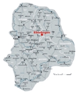
The Ellenbogen is a 814-metre high extinct volcano
in the Thuringia
n Rhön in the district of Landkreis Schmalkalden-Meiningen, Thuringia
, Germany
.
 The Ellenbogen rises between the villages of Oberweid
, Frankenheim and Reichenhausen in the Rhön Biosphere Reserve, and belongs to the municipality of Oberweid
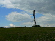
. As with most of the Rhön Mountains its summit is more of a gently curving plateau. Near its highest point are the dwellings of Eisenacher Haus and Thüringer Rhönhaus. From the hill summit there is a good view over the Hohe Rhön ("High Rhön"), the Milseburg
and the Wasserkuppe
, the latter being the highest mountain in the range. One and a half kilometres south of the Ellenbogen the Ellenbogen Plateau climbs to a small rise that is 2 metres higher than the official summit. This rise is the 815.5 m high Schnitzersberg, which is the highest mountain in the Thuringian Rhön. In spite of that some maps give the height of the Ellenbogen as 816 metres as well.
Volcano
2. Bedrock3. Conduit 4. Base5. Sill6. Dike7. Layers of ash emitted by the volcano8. Flank| 9. Layers of lava emitted by the volcano10. Throat11. Parasitic cone12. Lava flow13. Vent14. Crater15...
in the Thuringia
Thuringia
The Free State of Thuringia is a state of Germany, located in the central part of the country.It has an area of and 2.29 million inhabitants, making it the sixth smallest by area and the fifth smallest by population of Germany's sixteen states....
n Rhön in the district of Landkreis Schmalkalden-Meiningen, Thuringia
Thuringia
The Free State of Thuringia is a state of Germany, located in the central part of the country.It has an area of and 2.29 million inhabitants, making it the sixth smallest by area and the fifth smallest by population of Germany's sixteen states....
, Germany
Germany
Germany , officially the Federal Republic of Germany , is a federal parliamentary republic in Europe. The country consists of 16 states while the capital and largest city is Berlin. Germany covers an area of 357,021 km2 and has a largely temperate seasonal climate...
.
Location
Oberweid
Oberweid is a municipality in the district Schmalkalden-Meiningen, in Thuringia, Germany....
, Frankenheim and Reichenhausen in the Rhön Biosphere Reserve, and belongs to the municipality of Oberweid
Oberweid
Oberweid is a municipality in the district Schmalkalden-Meiningen, in Thuringia, Germany....
. As with most of the Rhön Mountains its summit is more of a gently curving plateau. Near its highest point are the dwellings of Eisenacher Haus and Thüringer Rhönhaus. From the hill summit there is a good view over the Hohe Rhön ("High Rhön"), the Milseburg
Milseburg
The Milseburg is an extinct volcano and the second highest mountain of the Rhön Mountains in Hesse, Germany. The mountain is located eastwards of Fulda, near the villages of Kleinsassen and Danzwiesen...
and the Wasserkuppe
Wasserkuppe
The Wasserkuppe is a high plateau , the highest peak in the Rhön Mountains within the German state of Hessen. Between the first and second World Wars, during the era of the so-called Golden Age of Aviation, great advances in sailplane development were made there.Remark: The German wording takes its...
, the latter being the highest mountain in the range. One and a half kilometres south of the Ellenbogen the Ellenbogen Plateau climbs to a small rise that is 2 metres higher than the official summit. This rise is the 815.5 m high Schnitzersberg, which is the highest mountain in the Thuringian Rhön. In spite of that some maps give the height of the Ellenbogen as 816 metres as well.
Sources
- Rhönklub e.V. (Hg.), Durch die Rhön, 2001, Verlag Parzeller Fulda, ISBN 3-7900-0327-1, S. 102 ff
- Rhönklub e.V. (Hg.), Schneiders Rhönführer, 2005, Verlag Parzeller Fulda, ISBN 3-7900-0365-4, S. 273