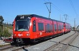
El Cajon Transit Center
Encyclopedia
El Cajon Transit Center is a San Diego Trolley
station in El Cajon
, California
served by the Green Line
and the Orange Line
. The next station north is Arnele Avenue
and the next station south is Amaya Drive
. The stop is a major commuter center for the large suburb, allowing individuals to switch buses or rail lines, use park and ride services, or board regional Greyhound Buses.
32°47′34"N 116°58′34"W
San Diego Trolley
The San Diego Trolley is a light rail system operating in the metropolitan area of San Diego. The operator, San Diego Trolley, Inc. , is a subsidiary of the San Diego Metropolitan Transit System ...
station in El Cajon
El Cajon, California
-History:El Cajon is located on the Rancho El Cajon Mexican land grant made in 1845 to María Antonia Estudillo, wife of Miguel Pedrorena. In 1876 Amaziah Lord Knox , a New Englander who had recently moved to California, established a hotel there to serve the growing number of people traveling...
, California
California
California is a state located on the West Coast of the United States. It is by far the most populous U.S. state, and the third-largest by land area...
served by the Green Line
Green Line (MTS)
The Green Line is one of three primary and five overall light rail lines operated by the San Diego Trolley, an operating division of the San Diego Metropolitan Transit System...
and the Orange Line
Orange Line (MTS)
The Orange Line is one of three primary and five overall light rail lines operated by the San Diego Trolley, an operating division of the San Diego Metropolitan Transit System...
. The next station north is Arnele Avenue
Arnele Avenue (San Diego Trolley station)
Arnele Avenue is a San Diego Trolley station served by the Green Line and the Orange Line. The next station north is Gillespie Field, and the next station south is El Cajon Transit Center. The stop serves as a minor park and ride for the surrounding residential community and also allows for access...
and the next station south is Amaya Drive
Amaya Drive (San Diego Trolley station)
Amaya Drive is a San Diego Trolley station served by the Green Line and the Orange Line. It serves mainly as a park and ride stop for the surrounding community. The next station north is El Cajon Transit Center and the next station south is Grossmont Transit Center....
. The stop is a major commuter center for the large suburb, allowing individuals to switch buses or rail lines, use park and ride services, or board regional Greyhound Buses.
32°47′34"N 116°58′34"W

