
Division No. 13, Saskatchewan
Encyclopedia
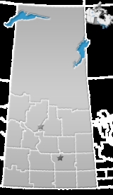
Division No. 13, Saskatchewan, Canada
, is one of the eighteen census divisions within the province, as defined by Statistics Canada
. It is located in the western part of the province, bordering Alberta
. The most populous community in this division is Kindersley
.
According to the 2006 census
, 22,342 people lived in this division. It has a land area of 17,255.30 km² (6,662.31 sq mi).
Canada
Canada is a North American country consisting of ten provinces and three territories. Located in the northern part of the continent, it extends from the Atlantic Ocean in the east to the Pacific Ocean in the west, and northward into the Arctic Ocean...
, is one of the eighteen census divisions within the province, as defined by Statistics Canada
Statistics Canada
Statistics Canada is the Canadian federal government agency commissioned with producing statistics to help better understand Canada, its population, resources, economy, society, and culture. Its headquarters is in Ottawa....
. It is located in the western part of the province, bordering Alberta
Alberta
Alberta is a province of Canada. It had an estimated population of 3.7 million in 2010 making it the most populous of Canada's three prairie provinces...
. The most populous community in this division is Kindersley
Kindersley, Saskatchewan
Kindersley is a town in west central Saskatchewan, Canada, located at Section 10, Township 29, Range 23, West of the 3rd Meridian, along highway 7, a primary highway linking Calgary, Alberta and Saskatoon, Saskatchewan...
.
According to the 2006 census
Statistics Canada
Statistics Canada is the Canadian federal government agency commissioned with producing statistics to help better understand Canada, its population, resources, economy, society, and culture. Its headquarters is in Ottawa....
, 22,342 people lived in this division. It has a land area of 17,255.30 km² (6,662.31 sq mi).
List of Rural Municipalities in Division No. 13
| RM No. 290 Kindersley No. 290, Saskatchewan Kindersley No. 290 is a rural municipality in the Canadian province of Saskatchewan, located in the western part of the province in SARM Division No... Kindersley |
| RM No. 292 Milton No. 292, Saskatchewan Milton No. 292, Saskatchewan was first organised as a Local Improvement District named Wirral Improvement District in 1905. Rural Municipality of Milton No. 292 was established on December 11, 1911. It is a rural municipality in west-central Saskatchewan, Canada on the Alberta - Saskatchewan... Milton |
| RM No. 319 Winslow No. 319, Saskatchewan Winslow No. 319 is a rural municipality in the Canadian province of Saskatchewan.It is also located in the Census division No. 13.-Statistics:According to the Canada 2001 Census:*Population: 343*Dwellings: 148*Area : 798.07... Winslow |
| RM No. 320 Oakdale No. 320, Saskatchewan The Rural Municipality of Oakdale No. 320, Saskatchewan was established on December 11, 1911. It is located in west-central Saskatchewan, Canada near the Alberta - Saskatchewan border. Oakdale No... Oakdale |
| RM No. 321 Prairiedale No. 321, Saskatchewan Prairiedale No. 321 was established on December 13, 1909. It is a rural municipality in west-central Saskatchewan, Canada near the Alberta - Saskatchewan border. Prairiedale No... Prairiedale |
| RM No. 322 Antelope Park No. 322, Saskatchewan Antelope Park No. 322 is a rural municipality in the Canadian province of Saskatchewan, located in the Census Division 13. The municipality was established on December 11, 1911 in west-central Saskatchewan, Canada on the Alberta - Saskatchewan border. Antelope Park No... Antelope Park |
| RM No. 349 Grandview No. 349, Saskatchewan Grandview No. 349 is a rural municipality in the Canadian province of Saskatchewan, located in the Census Division 13. The seat of the municipality is located in the Hamlet of Kelfield.-Demographics:... Grandview |
| RM No. 350 Mariposa No. 350, Saskatchewan Mariposa is rural municipality no. 350 in the Canadian province of Saskatchewan. Its 225 residents are mainly located in the unincorporated settlement of Kerrobert, postal code S0L 1R0. The village of Tramping Lake also lies within the geographical borders of Mariposa No. 350, but is not... Mariposa |
| RM No. 351 Progress No. 351, Saskatchewan Progress No. 351 is a rural municipality in the Canadian province of Saskatchewan. The municipality is located in the Census Division 13 which is a part of SARM Division 6. The seat of the municipality is located in the Town of Luseland.-Demographics:... Progress |
| RM No. 352 Heart's Hill No. 352, Saskatchewan Heart's Hill No. 352, Saskatchewan was incorporated November 15, 1910. It is a rural municipality in west-central Saskatchewan, Canada on the Alberta - Saskatchewan border. Heart's Hill No. 352 operates from Box 458, Luseland, SK S0L 2A0. Heart's Hill No. 352 encompasses the placename of Cactus... Heart's Hill |
| RM No. 379 Reford No. 379, Saskatchewan Reford No. 379 is a rural municipality in the Canadian province of Saskatchewan. The municipality is located in the Census Division 13 which is a part of SARM Division 6. The seat of the municipality is located in the Town of Wilkie.-Demographics:... Reford |
| RM No. 380 Tramping Lake No. 380, Saskatchewan Tramping Lake No. 380 is a rural municipality in the Canadian province of Saskatchewan, located in the Census Division 13. The seat of the municipality is located in the Town of Scott.-Demographics:... Tramping Lake |
| RM No. 381 Grass Lake No. 381, Saskatchewan Grass Lake No. 381 is a rural municipality in the Canadian province of Saskatchewan, located in the Census Division 13. The seat of the municipality is located in the Town of Reward.-Demographics:... Grass Lake |
| RM No. 382 Eye Hill No. 382, Saskatchewan Eye Hill No. 382, Saskatchewan was established on December 12, 1910. It is a rural municipality in west-central Saskatchewan, Canada near the Alberta - Saskatchewan border. Eye Hill No... Eye Hill |
| RM No. 409 Buffalo No. 409, Saskatchewan Buffalo No. 409 is a rural municipality in the Canadian province of Saskatchewan, located in the Census Division 13. The seat of the municipality is located in the Town of Wilkie.-Demographics:... Buffalo |
| RM No. 410 Round Valley No. 410, Saskatchewan Round Valley No. 410 is a rural municipality in the Canadian province of Saskatchewan, located in the Census Division 13 apart of SARM Division 6. The seat of the municipality is located in the Town of Unity.-Demographics:... Round Valley |
| RM No. 411 Senlac No. 411, Saskatchewan Senlac No. 411, Saskatchewan was incorporated January 1, 1913. It is a rural municipality in west-central Saskatchewan, Canada on the Alberta - Saskatchewan border. Senlac No... Senlac |
| RM No. 439 Cut Knife No. 439, Saskatchewan Cut Knife No. 439 is a rural municipality in the Canadian province of Saskatchewan, located in the Census Division 13. The seat of the municipality is located in the Town of Cut Knife.-Demographics:... Cut Knife |
| RM No. 440 Hillsdale No. 440, Saskatchewan Hillsdale No. 440 is a rural municipality in the Canadian province of Saskatchewan, located in the Census Division 13.-Demographics:In 2006, the rural municipality had a population of 530 in 173 dwellings, a -6.4% decrease from 2001... Hillsdale |
| RM No. 442 Manitou Lake No. 442, Saskatchewan The Rural Municipality of Manitou Lake No. 442 is a rural municipality in the Canadian province of Saskatchewan in north western Division 6. The population of this R.M is 590 people. Manitou Lake is named for the Algonquian word meaning “mysterious being.” It covers 13.3 km2, with an average... Manitou Lake |
List of Indian Reserves
- Indian Reserve --Little Pine 116
- Indian Reserve --Poundmaker 114
Major communities
- Cut KnifeCut Knife, SaskatchewanCut Knife is a town located on Highway 40, northwest of Saskatoon. It is home of the world's largest tomahawk, located in the Tomahawk Park next to the Clayton McLain Memorial Museum...
- KerrobertKerrobert, SaskatchewanKerrobert is a town in west central Saskatchewan. Incorporated in 1910, its 2007 population was 1,011. This quaint small town is home of the Kerrobert Tigers. The town is known for its large water tower, clearly visible from 15 kilometres away....
- KindersleyKindersley, SaskatchewanKindersley is a town in west central Saskatchewan, Canada, located at Section 10, Township 29, Range 23, West of the 3rd Meridian, along highway 7, a primary highway linking Calgary, Alberta and Saskatoon, Saskatchewan...
- LuselandLuseland, SaskatchewanLuseland, Saskatchewan is a small town in the west central region of the province. Its population as of the 2006 Canadian Census is 571, down 5% from the 2001 Census.-Geography:...
- Macklin
- UnityUnity, Saskatchewan-Area statistics:*Lat 52°26′ N*Long 109°10′00″ W*Dominion Land Survey Section 18, Township 40, Range 22, West of the 3rd Meridian*Time zone UTC−6-Location:-See also:*List of towns in Saskatchewan...
- WilkieWilkie, SaskatchewanWilkie is a town in Saskatchewan, Canada located at Section 5, Township 40, Range 19, west of the 3rd Meridian .On February 2, 1907, the first post office was established with the name Glenlogan at Section 4, Township 40, Range 19, west of the 3rd Meridian. The post office changed names on October...