
Delaware Route 20
Encyclopedia
Delaware Route 20 is an east–west highway in Sussex County
, Delaware
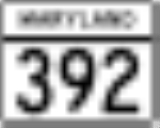
. Its western terminus is the Maryland
state line just west of Seaford where it continues as Maryland Route 392
. Its eastern terminus is Delaware Route 54 west of Fenwick Island. The route passes through the towns of Seaford, Millsboro
, and Dagsboro
. DE 20 was originally created by 1936 to run from the Maryland border east to US 113 in Millsboro. By 1970, it was realigned to bypass Seaford. The route was extended east to DE 1 in Fenwick Island
by 1994; however, the eastern terminus was cut back to DE 54 in 2005 to avoid the concurrency with that route.
, where it widens from a two-lane road to a five-lane highway. At the intersection with Front Street, the road becomes the Norman A. Eskridge Highway and it continues east toward U.S. Route 13
.
Delaware Route 20 then turns south for a concurrency with US 13, passing over the Nanticoke River
. Near Blades
, DE 20 turns east on Concord Road. It heads southeast on Concord Road to Hardscrabble
, where it intersects U.S. Route 9
and the name changes to Hardscrabble Road. It heads east on Hardscrabble Road, passing through countryside, to an intersection with U.S. Route 113
north of Millsboro
.
DE 20 then makes a right turn onto US 113 and heads southeast toward Millsboro. It passes through the town on the four-lane, divided Dupont Boulevard along with US 113, intersecting Delaware Route 24
and Delaware Route 30
. South of Millsboro, DE 20 splits from US 113 by heading to the southeast on Dagsboro Road. DE 20 follows Dagsboro Road into the town of Dagsboro
, where it becomes Main Street. It intersects Delaware Route 26
(Clayton Street), and it joins with DE 20, continuing south on Main Street. The two routes then turn east onto Vines Creek Road and DE 20 splits from DE 26 by heading to the southeast on Armory Road.
DE 20 heads southeast to Omar
, where the name changes to Pyle Center Road. It then heads to Roxana
, where it intersects Delaware Route 17
and it becomes Zion Church Road. It continues southeast and eventually meets Delaware Route 54, where it ends.
by 1994, following its current alignment between Millsboro and DE 54 before overlapping with DE 54 (Lighthouse Road) for the easternmost portion of the route. In 2005, DE 20 was removed from the DE 54 concurrency after it determined unnecessary for there to be two route numbers for that stretch of road.
.
{| class=wikitable
!Location
!Mile
!Road
!Notes
|-
| Reliance
|0.00
|
|Maryland state line, western terminus
|-
|Seaford
|6.34
|
|West end of US 13 overlap
|-
|Blades
|7.18
|
|East end of US 13 overlap
|-
|Hardscrabble
|13.69
|
|
|-
|rowspan=3|Millsboro
|23.46
|
|West end of US 113 overlap
|-
|25.52
|
|
|-
|27.11
|
|East end of US 113 overlap
|-
|rowspan=2|Dagsboro
|29.37
|
|West end of DE 26 overlap
|-
|30.11
|
|East end of DE 26 overlap
|-
|Roxana
|
|
|
|-
|
|
|
|
|-
|Fenwick Island
|39.00
|
|Eastern terminus
|-
Sussex County, Delaware
Sussex County is a county located in the southern part of the U.S. state of Delaware. As of 2010 the population was 197,145, an increase of 25.9% over the previous decade. The county seat is Georgetown. The Seaford Micropolitan Statistical Area includes all of Sussex County.Sussex County is...
, Delaware
Delaware
Delaware is a U.S. state located on the Atlantic Coast in the Mid-Atlantic region of the United States. It is bordered to the south and west by Maryland, and to the north by Pennsylvania...
. Its western terminus is the Maryland
Maryland
Maryland is a U.S. state located in the Mid Atlantic region of the United States, bordering Virginia, West Virginia, and the District of Columbia to its south and west; Pennsylvania to its north; and Delaware to its east...
state line just west of Seaford where it continues as Maryland Route 392
Maryland Route 392
Maryland Route 392 is a state highway in the U.S. state of Maryland. The state highway runs from MD 16 in East New Market east to the Delaware state line in Reliance, where the highway continues east as Delaware Route 20 . MD 392 connects East New Market with Hurlock as well as Seaford,...
. Its eastern terminus is Delaware Route 54 west of Fenwick Island. The route passes through the towns of Seaford, Millsboro
Millsboro, Delaware
As of the census of 2000, there were 2,360 people, 1,045 households, and 619 families residing in the town. The population density was 1,367.9 people per square mile . There were 1,153 housing units at an average density of 668.3 per square mile...
, and Dagsboro
Dagsboro, Delaware
As of the census of 2000, there were 519 people, 226 households, and 141 families residing in the town. The population density was 409.5 people per square mile . There were 248 housing units at an average density of 195.7 per square mile . The racial makeup of the town was 92.29% White, 6.36%...
. DE 20 was originally created by 1936 to run from the Maryland border east to US 113 in Millsboro. By 1970, it was realigned to bypass Seaford. The route was extended east to DE 1 in Fenwick Island
Fenwick Island, Delaware
As of the census of 2000, there were 342 people, 178 households, and 126 families residing in the town. The population density was 994.5 people per square mile . There were 666 housing units at an average density of 1,936.7 per square mile . The racial makeup of the town was 99.42% White, and 0.58%...
by 1994; however, the eastern terminus was cut back to DE 54 in 2005 to avoid the concurrency with that route.
Route description
Delaware Route 20 heads east from the Maryland border on the Stein Highway. It heads east through countryside toward the city of SeafordSeaford, Delaware
Seaford is a city located along the Nanticoke River in Sussex County, Delaware. According to the 2010 Census Bureau figures, the population of the city is 6,928, an increase of 3.4% from the 2000 census...
, where it widens from a two-lane road to a five-lane highway. At the intersection with Front Street, the road becomes the Norman A. Eskridge Highway and it continues east toward U.S. Route 13
U.S. Route 13
U.S. Route 13 is a north–south U.S. highway established in 1926 that runs for from Interstate 95 just north of Fayetteville, North Carolina to the northeastern suburbs of Philadelphia, Pennsylvania, in Morrisville. In all, it traverses five states in the Atlantic coastal plain region,...
.
Delaware Route 20 then turns south for a concurrency with US 13, passing over the Nanticoke River
Nanticoke River
The Nanticoke River is a major tributary of the Chesapeake Bay on the Delmarva Peninsula. It rises in southern Kent County, Delaware, flows through Sussex County, Delaware, and forms the boundary between Dorchester County, Maryland and Wicomico County, Maryland. The river course proceeds southwest...
. Near Blades
Blades, Delaware
Blades is a town in Sussex County, Delaware, United States. As of the 2010 census, the town population was 1,241, a 29.8% increase over the previous decade...
, DE 20 turns east on Concord Road. It heads southeast on Concord Road to Hardscrabble
Hardscrabble, Delaware
Hardscrabble is an unincorporated community in Sussex County, Delaware, United States. Hardscrabble is located on Delaware Route 20 between Seaford and Millsboro....
, where it intersects U.S. Route 9
U.S. Route 9
U.S. Route 9 is a north–south United States highway in the states of Delaware, New Jersey, and New York in the United States. It is one of only two U.S. highways with a ferry connection ; the other being US 10. US 9 is signed east–west in Delaware and north–south on the rest of...
and the name changes to Hardscrabble Road. It heads east on Hardscrabble Road, passing through countryside, to an intersection with U.S. Route 113
U.S. Route 113
U.S. Route 113 is a spur of US 13 in the U.S. states of Maryland and Delaware. The U.S. Highway runs from US 13 in Pocomoke City, Maryland north to Delaware Route 1 in Milford, Delaware...
north of Millsboro
Millsboro, Delaware
As of the census of 2000, there were 2,360 people, 1,045 households, and 619 families residing in the town. The population density was 1,367.9 people per square mile . There were 1,153 housing units at an average density of 668.3 per square mile...
.
DE 20 then makes a right turn onto US 113 and heads southeast toward Millsboro. It passes through the town on the four-lane, divided Dupont Boulevard along with US 113, intersecting Delaware Route 24
Delaware Route 24
Delaware Route 24 is a state highway located in Sussex County, Delaware. The route runs east from Maryland Route 348 at the Maryland border east of Sharptown, Maryland to an intersection with Delaware Route 1 in Midway, between Lewes and Rehoboth Beach. Along the way, DE 24 passes through Laurel,...
and Delaware Route 30
Delaware Route 30
Delaware Route 30 is a state highway in Sussex County, Delaware. The route runs from an intersection with Bi-State Boulevard a short distance west of U.S. Route 13 between Laurel and Delmar to Delaware Route 1 Business southeast of Milford in the area of Lincoln City and Cedar Creek. The road runs...
. South of Millsboro, DE 20 splits from US 113 by heading to the southeast on Dagsboro Road. DE 20 follows Dagsboro Road into the town of Dagsboro
Dagsboro, Delaware
As of the census of 2000, there were 519 people, 226 households, and 141 families residing in the town. The population density was 409.5 people per square mile . There were 248 housing units at an average density of 195.7 per square mile . The racial makeup of the town was 92.29% White, 6.36%...
, where it becomes Main Street. It intersects Delaware Route 26
Delaware Route 26
Delaware Route 26 is a state highway in Sussex County, Delaware. The route's western terminus is at an intersection with Maryland Route 353 and Delaware/Maryland Route 54 at the Maryland border south of Gumboro and its eastern terminus is at a dead end on the Atlantic Ocean in Bethany Beach, even...
(Clayton Street), and it joins with DE 20, continuing south on Main Street. The two routes then turn east onto Vines Creek Road and DE 20 splits from DE 26 by heading to the southeast on Armory Road.
DE 20 heads southeast to Omar
Omar, Delaware
Omar is an unincorporated community in Sussex County, Delaware, United States, located at the crossroads of Delaware Route 20 and Sussex County Road 54 and between the towns of Dagsboro and Roxana....
, where the name changes to Pyle Center Road. It then heads to Roxana
Roxana, Delaware
Roxana, Delaware is an unincorporated community in Sussex County. It is roughly centered around the intersections of Delaware Route 20 and Delaware Route 17. It is part of the Seaford, Delaware Micropolitan Statistical Area. There are many residential neighborhoods in this rapidly growing...
, where it intersects Delaware Route 17
Delaware Route 17
Delaware Route 17 is a state highway located in Sussex County, Delaware. The route runs in a northeast-southwest direction between DE 54 in Selbyville and Delaware Route 26 west of Millville, crossing Delaware Route 20 in Roxana. It is called Bethany Street within Selbyville and Roxana Road for the...
and it becomes Zion Church Road. It continues southeast and eventually meets Delaware Route 54, where it ends.
History
What would become DE 20 was originally an unimproved county road in 1920, with the portion between Seaford and Concord under contract as a state highway. By 1924, the road was completed as a state highway from the Maryland border east to Concord. The portion of road between Concord and Hardscrabble was proposed as a state highway by 1925. By 1931, the state highway was extended from Concord to Hardscrabble. A portion of what would become DE 20 west of Millsboro was completed as a state highway by 1932. When Delaware assigned numbers to its state highways by 1936, DE 20 was designated to run from the Maryland border in Reliance east to US 113 in Millsboro, following its current alignment to Seaford before heading south along what was then US 13 (Front Street) to Blades, where it turned east and picked up its current alignment to Millsboro. By 1970, the Norman Eskridge Highway was built between Front Street and US 13 in Seaford, and DE 20 was moved to its current alignment bypassing Seaford and Blades to the north and northeast along the Norman Eskridge Highway and US 13. The route was extended to DE 1 in Fenwick IslandFenwick Island, Delaware
As of the census of 2000, there were 342 people, 178 households, and 126 families residing in the town. The population density was 994.5 people per square mile . There were 666 housing units at an average density of 1,936.7 per square mile . The racial makeup of the town was 99.42% White, and 0.58%...
by 1994, following its current alignment between Millsboro and DE 54 before overlapping with DE 54 (Lighthouse Road) for the easternmost portion of the route. In 2005, DE 20 was removed from the DE 54 concurrency after it determined unnecessary for there to be two route numbers for that stretch of road.
Major intersections
The entire route is in Sussex CountySussex County, Delaware
Sussex County is a county located in the southern part of the U.S. state of Delaware. As of 2010 the population was 197,145, an increase of 25.9% over the previous decade. The county seat is Georgetown. The Seaford Micropolitan Statistical Area includes all of Sussex County.Sussex County is...
.
{| class=wikitable
!Location
!Mile
!Road
!Notes
|-
| Reliance
|0.00
|
|Maryland state line, western terminus
|-
|Seaford
Seaford, Delaware
Seaford is a city located along the Nanticoke River in Sussex County, Delaware. According to the 2010 Census Bureau figures, the population of the city is 6,928, an increase of 3.4% from the 2000 census...
|6.34
|
|West end of US 13 overlap
|-
|Blades
Blades, Delaware
Blades is a town in Sussex County, Delaware, United States. As of the 2010 census, the town population was 1,241, a 29.8% increase over the previous decade...
|7.18
|
|East end of US 13 overlap
|-
|Hardscrabble
Hardscrabble, Delaware
Hardscrabble is an unincorporated community in Sussex County, Delaware, United States. Hardscrabble is located on Delaware Route 20 between Seaford and Millsboro....
|13.69
|
|
|-
|rowspan=3|Millsboro
Millsboro, Delaware
As of the census of 2000, there were 2,360 people, 1,045 households, and 619 families residing in the town. The population density was 1,367.9 people per square mile . There were 1,153 housing units at an average density of 668.3 per square mile...
|23.46
|
|West end of US 113 overlap
|-
|25.52
|
|
|-
|27.11
|
|East end of US 113 overlap
|-
|rowspan=2|Dagsboro
Dagsboro, Delaware
As of the census of 2000, there were 519 people, 226 households, and 141 families residing in the town. The population density was 409.5 people per square mile . There were 248 housing units at an average density of 195.7 per square mile . The racial makeup of the town was 92.29% White, 6.36%...
|29.37
|
|West end of DE 26 overlap
|-
|30.11
|
|East end of DE 26 overlap
|-
|Roxana
Roxana, Delaware
Roxana, Delaware is an unincorporated community in Sussex County. It is roughly centered around the intersections of Delaware Route 20 and Delaware Route 17. It is part of the Seaford, Delaware Micropolitan Statistical Area. There are many residential neighborhoods in this rapidly growing...
|
|
|
|-
|
|
|
|
|-
|Fenwick Island
Fenwick Island, Delaware
As of the census of 2000, there were 342 people, 178 households, and 126 families residing in the town. The population density was 994.5 people per square mile . There were 666 housing units at an average density of 1,936.7 per square mile . The racial makeup of the town was 99.42% White, and 0.58%...
|39.00
|
|Eastern terminus
|-