

Cuyuna Range
Encyclopedia
Mesabi Range
The Mesabi Iron Range is a vast deposit of iron ore and the largest of four major iron ranges in the region collectively known as the Iron Range of Minnesota. Discovered in 1866, it is the chief deposit of iron ore in the United States. The deposit is located in northeast Minnesota, largely in...
, largely within Crow Wing County, Minnesota
Crow Wing County, Minnesota
Crow Wing County is a county located in the U.S. state of Minnesota. As of 2010, the population was 62,500. Its county seat is Brainerd.-Geography:...
. It lies along a line between Brainerd
Brainerd, Minnesota
Brainerd is a city in Crow Wing County, Minnesota, United States. The population was 13,590 at the 2010 census. It is the county seat of Crow Wing County and one of the largest cities in Central Minnesota...
and Aitkin
Aitkin, Minnesota
As of the census of 2000, there were 1,984 people, 892 households, and 434 families residing in the city. The population density was 1,150.3 people per square mile . There were 969 housing units at an average density of 561.8 per square mile...
, although those communities are not mining
Mining
Mining is the extraction of valuable minerals or other geological materials from the earth, from an ore body, vein or seam. The term also includes the removal of soil. Materials recovered by mining include base metals, precious metals, iron, uranium, coal, diamonds, limestone, oil shale, rock...
towns.
The range was discovered by Cuyler Adams, a surveyor who discovered traces of magnetic ore in 1895 while doing land surveys. The word "Cuyuna" was coined by Adams' wife, who combined the first three letters of Cuyler's name with "Una", the name of their dog.
Mining started on the range in 1911. The ore was located deep underground, as in the Vermilion Range
Vermilion Range (Minnesota)
The Vermilion Range exists between Tower and Ely, Minnesota, and contains significant deposits of iron ore. The Vermilion, along with the Mesabi and Cuyuna Ranges, constitute the Iron Ranges of northern Minnesota which were deposited in the Animikie Group...
, so most of the mines were developed underground or in very deep pits. In addition to the iron, the ore was rich in manganese
Manganese
Manganese is a chemical element, designated by the symbol Mn. It has the atomic number 25. It is found as a free element in nature , and in many minerals...
, which was useful during World War I
World War I
World War I , which was predominantly called the World War or the Great War from its occurrence until 1939, and the First World War or World War I thereafter, was a major war centred in Europe that began on 28 July 1914 and lasted until 11 November 1918...
when other sources were not available.
At the height of the mining, the Cuyuna Range was the location of the worst mining disaster in Minnesota, the Milford Mine disaster. On February 5, 1924, a new tunnel was blasted too close to nearby Foley Lake, and water rushed in, killing 41 miners.
Mining on the range continued until 1984. Also like the Vermilion Range, mining slowed as it became more economical to extract taconite
Taconite
Taconite is a variety of iron formation, an iron-bearing sedimentary rock, in which the iron minerals are interlayered with quartz, chert, or carbonate...
deposits from the Mesabi Range
Mesabi Range
The Mesabi Iron Range is a vast deposit of iron ore and the largest of four major iron ranges in the region collectively known as the Iron Range of Minnesota. Discovered in 1866, it is the chief deposit of iron ore in the United States. The deposit is located in northeast Minnesota, largely in...
, which were closer to the surface. Additionally, the surface mines were safer than the mines deep underground.
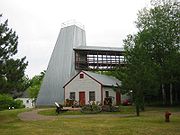
Cuyuna Country State Recreation Area
Cuyuna Country State Recreation Area
Cuyuna Country State Recreation Area is a state park unit of Minnesota, USA, being developed to rehabilitate a portion of the Cuyuna Range where mining pits and piles of waste rock were left behind after decades of open-pit mining for iron ore...
now occupies portions of the range where mining pits and rock deposit stockpiles were left behind by the miners. The Cuyuna Lakes Trail is also located near the former mines.
Communities
- Cuyuna, MinnesotaCuyuna, MinnesotaAs of the census of 2000, there were 231 people, 90 households, and 64 families residing in the city. The population density was 70.6 people per square mile . There were 113 housing units at an average density of 34.5 per square mile . The racial makeup of the city was 98.70% White, 0.87%...
- Crosby, MinnesotaCrosby, MinnesotaAs of the census of 2000, there were 2,299 people, 989 households, and 554 families residing in the city. The population density was 755.0 people per square mile . There were 1,081 housing units at an average density of 355.0 per square mile...
- Ironton, MinnesotaIronton, MinnesotaAs of the census of 2000, there were 498 people, 231 households, and 130 families residing in the city. The population density was 333.2 people per square mile . There were 263 housing units at an average density of 176.0 per square mile . The racial makeup of the city was 99.40% White, 0.40%...
- Trommald, MinnesotaTrommald, MinnesotaAs of the census of 2000, there were 125 people, 47 households, and 28 families residing in the village. The population density was 33.8 people per square mile . There were 52 housing units at an average density of 14.0 per square mile . The racial makeup of the village was 97.60% White, 0.80%...
- Riverton, MinnesotaRiverton, MinnesotaAs of the census of 2000, there were 115 people, 51 households, and 29 families residing in the city. The population density was 146.5 people per square mile . There were 61 housing units at an average density of 77.7 per square mile . The racial makeup of the city was 99.13% White and 0.87% Native...
- Manganese, MinnesotaManganese, MinnesotaManganese was a small village in Minnesota, United States. Located in Wolford Township in Crow Wing County, Manganese lies roughly north of Trommald, Minnesota. Just off of County Road 34, it is perhaps best identified by its location between Coles Lake and Flynn Lake...